03/11/2020-09/11/2020
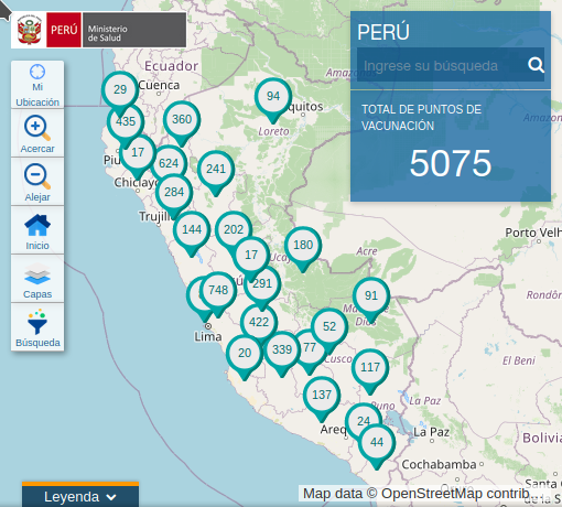
Peruvian vaccination bases on an OSM map. 1 | © Ministerio de Salud, Perú | map data © OpenStreetMap contributors |
About us
- Since issue #537 we have been publishing in the Polish language. We are very happy to welcome our new colleagues and hope that this service in Poland will inspire even more people to contribute to OpenStreetMap when they can read our news in their native language. Witamy, polska drużyno. 😉
Mapping
- Pascal Neis has just updated his ‘Unmapped Places‘ using OSM data from 30 October 2020.
- Christina Ludwig, Sascha Fendrich and Alexander Zipf report about their study on ‘Regional variations of context‐based association rules in OpenStreetMap’. This study investigates the variability of association rules extracted from OSM across different geographic regions and their dependence on different context variables, such as the number of OSM mappers.
- The Spanish Red Cross is organising an online Mapathon
 on Thursday 19 November from 17:00 to 19:00, to help people in Burundi vulnerable to natural disasters, armed conflict and epidemics.
 - OSM Ireland now offers a Tasking Manager that organises the simultaneous mapping of buildings close to each other, by multiple mappers, by assigning the mappers different squares to work on. Another possibility is to start your own projects anywhere in the world.
- PoliMappers report on their effort to introduce new and interested people to the world of geospatial collaborative projects in the Politecnico di Milano campus of Piacenza.
- Brian M. Sperlongano (ZeLonewolf) announced that his proposal
boundary=special_economic_zone, to tag an area in which the business and trade laws are different from the rest of the country or state, is now open for voting until 24 November. - With the outbreak of COVID-19 in March 2020 the German speaking Telegram group started voting on and publishing a weekly mapping focus. Along with the German version, they recently made available an English version of their wiki page to inspire more people to contribute to the weekly changing mapping challenges.
amenity=car_sharingis the current ‘Weekly Focus’. Please enter your own ideas in the ‘Focus Idea Depot’ and vote on them in the Telegram group ‘OSM de‘.
 on Thursday 19 November from 17:00 to 19:00, to help people in Burundi vulnerable to natural disasters, armed conflict and epidemics.
Community
- YouthMappers has appointed a new cohort of regional ambassadors for 2020–2021.
- You can now read the answers to questions from the AskMeAnything thread on Reddit with some of the OSM Foundation Board members.
OpenStreetMap Foundation
- Jonathan Beliën, one of the OSMF Microgrant Program recipients, has submitted his final report for the Road Completion Project. The project focused on software for conflating open data road networks against OpenStreetMap roads in Belgium. The code is open and can be used to achieve similar results anywhere in the world.
Local chapter news
- Due to the lockdown in place since late October, OSM Ireland has come up with a schedule for November to make focused progress on the osmIRL_buildings project. Each day, there is a different town or group of towns to be mapped using the HOT OSM task manager.
- mapeadora reported > in her blog about the official opening of the YouthMappers chapter at the Universidad Autónoma del Estado de México (UAEM), Faculty of Geography, on the Campus Toluca.

Events
- Code The City’s 21st hack event invites everyone to use mapping, software, open data, or programming tools on Saturday 28 November and Sunday 29 November to create, update, digitise and modernise maps of our locales. The event will take place online and coding is, despite the name, only a small part of what is planned – take a look at the agenda here.
- The OSM Geography Awareness Week is taking place from 15 to 21 November. ‘OSMGeoWeek’ is a week when teachers, students, community groups, organisations, and map lovers around the world can join together to celebrate geography and OpenStreetMap. Consider planning a mapathon, a webinar to show off your latest project, a career panel to talk about how your organisation uses OSM, or a workshop to teach others what you know. Follow #osmgeoweek, and share your experiences using the #osmgeoweek hashtag. When editing in OpenStreetMap add the #osmgeoweek2020 hashtag to your changesets to be included in the metrics. Add your event, or find one, at osmgeoweek.org!
- State of the Map Japan 2020 and FOSS4G Japan 2020 were jointly held on 7 and 8 November. The summary of tweets and each video are now online (SotMJ , FOSS4G ).
- Following the success of the mapping party held in September, the Chair of Urban Structure and Transport Planning of the Technical University in Munich is organising another mapping party to be held on 18 November at 18:15.
 and
and Humanitarian OSM
- The HOT Disaster Services Team offers an update on the disaster responses the team is currently supporting or preparing to support around the world, as well as detailing ways the community can help.
- Ramani Huria has been training students in Dar es Salaam and equipping them with industrial and technical skills for the 21st century while generating vital high-precision, low-cost data for flood prediction and preparedness. Through the students’ work, Ramani Huria has mapped more than 10,000 flood data points in eight weeks.
- Crowd2Map, which was created in 2015 by Janet Chapman, has enabled volunteers to map almost five million buildings in Tanzania. This made it possible for welfare workers to locate and save 3000 girls from female genital mutilation and bring them to safe houses, where they can also receive education.
Maps
- [1] The Peruvian Ministry of Health has published > its vaccination data points on an OSM base map.
Open Data
- terrestris shows us several different possibilities for visualising the SRTM-30 elevation model.
- The European Data Portal has 2259 (and counting) open datasets for Romania.
Software
- Jochen Topf gave an overview of the first ten years of Taginfo, a service developed and maintained by himself, and describes some of the recently added features.
- Trufi Association has created a new multi-modal bike app. It has information about the cycling road network, the public transport network, at what times bicycles can be carried on it, and how busy the vehicles are, enabling the app to propose combination routes that no other routing engine can. Maps and POIs are based on OpenStreetMap and the routing is based on OpenTripPlanner. The app can be adapted for use in any city.
- The MIERUNE Inc experimentally released > an address and facility search service ‘MIERUNE Search‘ . This service focuses on geo services. OSM is used > for some data, such as POIs.
- Dongha Hwang (LuxuryCoop) has created a Taginfo instance for South Korea.
- Hartmut (maposmatic) added some new ‘OpenOrienteeringStyles’ to ‘OpenOrienteeringMap‘, the easy Street-O map creation tool. You can quickly and easily set a map, add controls, and create a print-ready, high quality vector PDF. If you have any comments, leave them at the end.
- Researchers from the Federal University of Paraná (UFPR), the University of Maryland (UMD), and the University of Florida published a free e-book on QGIS in October. QGIS is a free and open-source cross-platform desktop geographic information system that supports viewing, editing, and analysing geospatial data. The book is intended for both students and professionals.
 in October. QGIS is a free and open-source cross-platform desktop geographic information system that supports viewing, editing, and analysing geospatial data. The book is intended for both students and professionals.
Releases
- Walter Nordmann (wambacher) has started rebuilding the OSM Software Watchlist (a list of the current release status of OSM software products).
- Marcus Wolschon announced the highlights of the Vespucci 15.1 Beta, released on 28 October.
Did you know …
- … the osm-in-realtime website by James Westman?
- … Taginfo now has a chronology tab? You can use it to see how often a tag has been used in the past.
- … that Geofabrik is hosting Taginfo instances for each country (plus some regions) and continent, even Antarctica?
Other “geo” things
- I Hate Coordinate Systems! has a very informative overview of common questions and pitfalls encountered when working with coordinate systems.
- Topi Tjukanov started the #30DayMapChallenge, a daily social mapping project for every day of November 2020.
- Hoefler&Co has compiled a cartography font collection, with 70 fonts recommended for maps and inspired by mapmaking.
- Udo Urban, from the German Research Centre for Artificial Intelligence (DFKI), presented > the project ‘TreeSatAI – Artificial Intelligence with Earth Observation and Multi-Source Geodata’.
- Mike Darracott reported about Yorkshire Wildlife’s use of MGISS cloud technology to map and help protect habitats.
 >
> Upcoming Events
| Where | What | When | Country |
|---|---|---|---|
| Online | 2020 Pista ng Mapa | 2020-11-13-2020-11-27 |  |
| Cologne Bonn Airport | 133. Bonner OSM-Stammtisch (Online) | 2020-11-17 |  |
| Berlin | OSM-Verkehrswende #17 (Online) | 2020-11-17 | |
| Lyon | Rencontre mensuelle (virtuelle) | 2020-11-17 |  |
| Cologne | Köln Stammtisch ONLINE | 2020-11-18 | |
| Munich | TUM Mapping Party | 2020-11-18 | |
| Online | Missing Maps Mapathon Bratislava #10 | 2020-11-19 |  |
| Online | FOSS4G SotM Oceania 2020 | 2020-11-20 |  |
| Bremen | Bremer Mappertreffen (Online) | 2020-11-23 | |
| Derby | Derby pub meetup | 2020-11-24 |  |
| Salt Lake City / Virtual | OpenStreetMap Utah Map Night | 2020-11-24 |  |
| Düsseldorf | Düsseldorfer OSM-Stammtisch [1] | 2020-11-25 | |
| London | Missing Maps London Mapathon | 2020-12-01 | |
| Stuttgart | Stuttgarter Stammtisch (online) | 2020-12-02 | |
| Taipei | OSM x Wikidata #23 | 2020-12-07 |  |
| Michigan | Michigan Online Meetup | 2020-12-07 | |
Note: If you like to see your event here, please put it into the calendar. Only data which is there, will appear in weeklyOSM. Please check your event in our public calendar preview and correct it, where appropriate.
This weeklyOSM was produced by Elizabete, Climate_Ben, MatthiasMatthias, Nordpfeil, PierZen, Polyglot, Rogehm, Sammyhawkrad, TheSwavu, derFred, k_zoar, richter_fn.