08/08/2017-14/08/2017
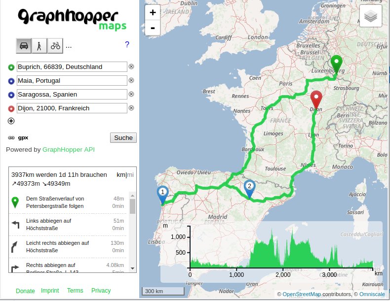
GraphHopper’s new flexible routing is at least 15 times faster 1 | © OpenStreetMap contributors, ODbL, © GraphHopper, © Omniscale
About us
- We are always looking for people to help us improve our newsletter so it can get out faster, have more depth and coverage, and generally improve it for our readers, like you. Please join our team by contacting us now, its fun! 😉
Mapping
- Christoph Hormann blogged about social engineering in OpenStreetMap and how it might be used to influence the course of the project. Mapping for the rendered is also analysed.
- Daniel Koć wrote a proposal for waterways classification following last week’s river rendering debate and requests comments. Mark Wagner seems to think this is not the way to go in OpenStreetMap.
- Miguel Sevilla Callejo (msevilla00) from Zaragoza, Spain, is currently in Wales. He noticed an inconsistent use of English and Welsh in OpenStreetMap. His email resulted in a readable, long-lasting and controversial discussion on the Talk-GB mailing list (threads in July and August) and comments in an OSM changeset. Nearly the same problem in Switzerland – read the following article. 😉
- An official of the Swiss Park Network has requested, via Michael Spreng, that the area be displayed as “Schweizerischer Nationalpark” (German) rather than “Parc Naziunal Svizzer” (Romansch) on OSM. The rationale is that the park is better known by the former name. The ensuing discussion touches on several issues about names in bilingual areas.
- Marc Zoutendijk asks
 on the forum if over 10,000 different
 building=*tag keys are really needed. - The Mapbox team joined the celebration of the XIII anniversary of OpenStreetMap improving the Peru map, where they added a total of 1199 streets, 1022 buildings, points of interest, lakes, rivers, among others.
 on the forum if over 10,000 different
 Community
- Daniel Koć requested comments to the text rendering changes planned for osm-carto.
- mmd wrote about a nice prototype demonstrating the power of the
around:filter in Overpass API to show how you can download OSM data along a GPX track.
Imports
- On the Imports mailing list, Äijälä Tero proposed an import of the Finnish “National Registry of Social and Health care Providers” as POIs.
Events
- Andreas Bürki has a hackathon in mind for DINAcon in Bern, Switzerland.
- The 5th UK OpenData Camp will be held in Belfast on the weekend of 21st and 22nd October. The last two batches of tickets will be released on 9th and 21st of September.
- The SotM 2017 takes place at this weekend in Japan. Travellers get valuable information in the wiki. Laura Barroso, weeklyOSM correspondent in Cuba, has provided – as last year in Brussels – an app with the program.
 a
a Humanitarian OSM
- Everything you need to know about this year’s HOT Summit in Ottawa on September 14-15 can be found here.
- Nirab Pudasaini draws attention to the flood disaster in Nepal. He asks for help in four affected areas. Biratnagar, Inaruwa, Tandi Bazaar – Manahari and Harikul.
- HOT presented the 2016 annual report. Beautiful pictures, impressive figures.
- Melanie Eckle announced the partnership with HOT in GIScience news blog.
- John Whelan put a validation tool on the wish list, after he had to correct 264 buildings that were mapped as
Yess=Building. - Students of Portmarnock Community School from Dublin have won the first prize for their mapping activities in Lesotho at the “SAGE World Cup for social innovators“.
Maps
- Jason Baker presented 13 different OSM-based projects on the occasion of the 13th anniversary of OpenStreetMap.
- Arun (PlaneMad) published a comparison of how different map data editors visually represent turn restrictions for mappers.
Open Data
- Yuri Astrakhan announced that the OSM and Wikidata SPARQL service was updated and listed the changes.
- OpenDataSoft created a map of the open data portals around the world.
Software
- [1] Peter Karich reported a substantial speed up in routing in GraphHopper with the new “landmark” algorithm.
Releases
Mapcat launched a mobile version to celebrate the 13th anniversary of OSM.
| Software | Version | Release date | Changes |
|---|---|---|---|
| guide4you | 2.2.3 | 2017-08-08 | No infos. |
| JOSM | 12545 | 2017-08-15 | Added Java 9 compatibility. Please read Changelog for more infos. |
| Komoot Android * | 9.3 | 2017-08-13 | No infos. |
| Komoot iOS * | 9.3 | 2017-08-14 | Added iPad support, horizontal format, more map details and height indicator. |
| Kurviger Free * | 1.1.7-2 | 2017-08-14 | No infos. |
| Leaflet | 1.2.0 | 2017-08-08 | Please read changelog. |
| Locus Map Free * | 3.25.1 | 2017-08-10 | Man changes, please read changelog. |
| Mapbox Navigation SDK iOS | 0.6.1 | 2017-08-15 | No infos. |
| Mapillary iOS * | 4.8.1 | 2017-08-15 | Added low power mode and bug fixes. |
| Maps.me Android * | 7.4.5 | 2017-08-11 | Updated map data, bug fixes. |
| Maps.me iOS * | 7.4.5 | 2017-08-10 | Updated map data, bug fixes. |
| Mapzen Lost | 3.0.3 | 2017-08-14 | Bug fixes. |
| Naviki Android * | 3.63 | 2017-08-08 | Revised synchronization of ways, improved layout, new map layer and bug fixes. |
| OpenLayers | 4.3.1 | 2017-08-14 | Bug fixes. |
| PostgreSQL | 9.6.4 | 2017-08-10 | Man changes, please read changelog. |
Provided by the OSM Software Watchlist. Timestamp: 2017-08-15 12:58:09+02 UTC
(*) unfree software. See: freesoftware.
Did you know …
- … the functions of Field Papers?
- … the drone innovation of two Afghan brothers to scan an area, detect and destroy anti-personal mines?
 of two Afghan brothers to scan an area, detect and destroy anti-personal mines?
OSM in the media
- MIT researchers Christopher Barrington-Leigh and Adam Millard-Ball have published (full text-PDF) an analysis of the completeness of road networks on OSM across the globe. They use techniques which do not rely on comparison datasets which are therefore applicable to all countries. For OSM data in early 2016 they estimate the road network to be 81% complete, and in May 2017, 86%.
Other “geo” things
- Well, if you don’t know Mercator, then you have to publish a correction. 😉
- The city administration of Chicago wants to map the “underground labyrinth” of the pipes and lines in the course of the development of its smart city plan.
- Galileo reported on the first GPS signal received on the 40th anniversary of the Global Positioning System.
- Refill collects fountains or shops where you can replenish your water bottle for free and presents them on an OSM-based map. It has its own app.
- Will White from Mapbox blogged about the new support for full offline navigation embedded in cars.
- New Scientist reported that “ships fooled in GPS spoofing attack suggest Russian cyberweapon”.
- Markus Reuter reported on Netzpolitik.org on the rapid growth of video surveillance in public spaces. It also shows how you can help with OSM to complete the world map of surveillance by Max Kamba.
Upcoming Events
| Where | What | When | Country |
|---|---|---|---|
| Boston | FOSS4G 2017 | 2017-08-14-2017-08-19 |  |
| Aizu-wakamatsu Shi | State of the Map 2017 (international conference) | 2017-08-18-2017-08-20 |  |
| Buenos Aires | Mapatón 13° aniversario de OpenStreetMap en IGN | 2017-08-19 |  |
| Santiago, Chile | 13° Aniversario de OpenStreetMap | 2017-08-19 |  |
| Sankt Augustin | FrOSCon with OSGeo & OSM Track | 2017-08-19-2017-08-20 |  |
| Derby | Derby Pub Meetup | 2017-08-22 |  |
| Lübeck | Lübecker Stammtisch | 2017-08-24 | |
| Bremen | Bremer Mappertreffen | 2017-08-28 | |
| Taipei | OpenStreetMap Taipei Meetup, MozSpace | 2017-08-28 |  |
| Graz | Stammtisch Graz | 2017-08-28 |  |
| Viersen | OSM Stammtisch Viersen | 2017-08-29 | |
| Dusseldorf | Stammtisch Düsseldorf | 2017-08-30 | |
| Freital | Elbe-Labe-Meeting 2017 | 2017-09-01-2017-09-03 | |
| Rennes | Atelier Wikidata et OSM | 2017-09-02 |  |
| Patan | State of the Map Asia 2017 | 2017-09-23-2017-09-24 |  |
| Boulder, Colorado | State of the Map U.S. 2017 | 2017-10-19-2017-10-22 | |
| Brussels | FOSS4G Belgium 2017 | 2017-10-26 |  |
| Lima | State of the Map LatAm 2017 | 2017-11-29-2017-12-02 |  |
| Bonn | FOSSGIS 2018 | 2018-03-21-2018-03-24 | |
Note: If you like to see your event here, please put it into the calendar. Only data which is there, will appear in weeklyOSM. Please check your event in our public calendar preview and correct it, where appropriate.
This weeklyOSM was produced by Nakaner, PierZen, Polyglot, Rogehm, SK53, Spec80, YoViajo, derFred, doktorpixel14, jcoupey, jinalfoflia.