12/05/2020-18/05/2020
Tracking changes on magOSM 1 | © Magellium, OpenLayers | map data © OpenStreetMap contributors
Mapping
- Mapillary images have been used by the Ukrainian community to map over a thousand speed bumps in Kiev.
- muramoto tweeted screenshots of two tools. Street-level POI Viewer displays POIs from OSM and Wikipedia over Mapillary images. He also pointed to another tool that allows the calculation of angles and distances, also based on Mapillary and an OSM basemap. You can use the two values to determine heights with the online calculator provided. The project files are available on GitHub.
- Pascal Neis drew attention to the high share of paid mappers. He specifically mentioned India, where 8 of the top 10 mappers are working for Facebook.
- Ty S wants to mark areas that have dangerous dogs and has created a proposal for
dog_warning=*. - User SteveA wanted to use
boundary=administrativefor a range of local government entities in Connecticut. This led to long and involved discussions on both the talk-us and tagging mailing lists as to what qualifies as an administrative boundary. - Bob Gambrel asked on the talk-us list for advice about mapping snowmobile trails.
- NetWormKido invites
 (automatic translation) everyone to join his initiative on drawing roads to villages in the Privolzhskiy Federal District of Russia, which are currently not connected in OSM to the rest of the world. Task on MapRoulette.
 - User b-unicycling is interested in field names in Ireland. As part of a local archaeological society activity in Kilkenny they have been collecting field names using Field Papers. They have also published a umap showing all existing places in Ireland where the names of individual fields have been added to OSM.
 (automatic
 Community
- fr1 (a user from Russia) conducted (automatic translation) an experiment. He simultaneously recorded GPS tracks with a regular smartphone and with one of the new generation which uses a two-frequency GPS receiver.
- The podcast Nodes and Ways published its 3rd episode. This episode features Ciarán Staunton, who is speaking about mapping in Ireland, particularly the #osmIRL_buildings campaign.
- The COVID-19 pandemic has forced humanity to take a pause in its activities. The Côte d’Azur University, in collaboration with CartONG, invites (automatic translation) the inhabitants of the planet to add to a map of natural phenomena and solidarity actions that have arisen in this period. Contributors are asked to remember the best too. The project Open map of the global pause was born. Add a photo to it!
- Rovastar pointed out that daily mapper numbers reached a new peak of 6999 on 12 May. The 7000 barrier was broken two days later for another record high of 7209.
- Sergey Astahov reflected (automatic translation), in his diary on GPS receivers, on the movement of lithospheric plates and how this affects OSM.
- OSM Kosova, in collaboration with FLOSSK, posted on Facebook about a series of virtual workshops held during the past two months about OpenStreetMap and Wikidata with local high school students. They were introduced to the projects and taught how to edit them properly.
- Valeriy Trubin continues his series of interviews with OSMers. This time he spoke with Dmitry Lebedev (automatic translation) about using OSM for research and Darafei Praliaskouski (automatic translation) about the work of the OSM Foundation.
 (automatic
 OpenStreetMap Foundation
- Christoph Hormann (imagico) provided a statistical overview of applications for the OSMF microgrants programme.
Events
- This year’s AGIT, an Austrian yearly conference and trade fair about geoinformation, will take place (automatic translation) virtually from 6 to 10 July 2020. It is still to be decided if OSM and OSGeo will be featured.
- The Transatlantic Council of Boy Scouts of America organised a five-day Virtual Mapathon Challenge, allowing Sea Scouts to complete community service requirements by completing tasks on the HOT Tasking Manager.
- Geomob events organised by OpenCage and Mappery have so far taken place in London, Munich and Barcelona. Since COVID-19 the talks, which always have a geographical background, have taken place on the Internet. Commercial and non-commercial, open and closed source speakers report on their work. The next online conference will take place on 10 June. All are welcome to attend, but places are limited to 100 people, on a first-come, first-served basis. Details of how to sign up, and other news, can be found in the monthly newsletter forthcoming in early June.
 (automatic
 Maps
- Julien Minet introduced OpenArdenneMap a cartoCSS style optimised for several scales of topographic maps. The style is available on github.
- Jochen Topf’s recent release of the osm2pgsql flex backend has been discussed generally by Adrien Pavie, and very specifically by Styxman, who is interested in rendering bus routes.
- The University of Heidelberg has stopped operating its tile server Mapsurfer.NET due to organisational difficulties.
switch2OSM
- The tourist portal of the Republic of Mordovia (region in Russia) uses OSM as a basemap. Unfortunately, the site does not attribute OSM properly.
- A team of Russian urbanists has started a public GIS project on analysing public transport routes. So far in Moscow (automatic translation) only, but OSM is the basis of their project. At the moment they are also raising (automatic translation) funds for further development of the project.
Software
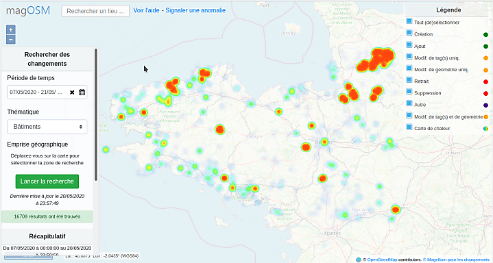
- [1] The French company Magellium announced (automatic translation) on talk-fr a new ‘Tracking changes’ web portal for the magOSM project. About twenty themes are available, covering metropolitan France for the past 30 days. On the database side it uses PGSQL triggers on osm2pgsql tables to detect and store changes before analysing them. The source code is published under a free licence.
- We have written earlier about the open source program OpenDroneMap that can be used to assemble orthophotomaps. This article (automatic translation) explains how to make the app work.
Programming
- In a blogpost Mikel Maron, Lead Mapbox Community team, co-founder of HOT and OSMF board member, published an interview with the Tasking Manager’s lead developer, Felix Delattre, on technical details and other background information of the new version of HOT’s widely used tool.
- In March, Paul Norman reported to the QGIS developers that a particular feature (XYZ tile backgrounds) consumes far more slippy map tiles than necessary. QGIS now represents 5% of all tile requests on the main OSM servers. QGIS developer elpaso has filed a pull request with a fix which should be included in the imminent release of QGIS 3.14. The fix also provides backport patches for two earlier versions: 3.10 and 3.12.
- OpenMapTiles provided an update on recent developments (with the slightly misleading title of ‘The Future of OpenMapTiles Project’) with their software stack. A significant change is moving away from using MapnikVT to a native PostGIS function, ST_AsMVT, which both simplifies the stack and improves performance. They now also run continuous integration tests on the tile output after each code change is integrated.
Releases
- Translators from Latin America produced a Spanish version of ‘Mapping routes‘, Trufi Association documentation on how to map informal bus routes.
- HeiGIT, the Heidelberg University’s GIScience Research Group, announced the release of version 1.0 of its API for the history analysis platform for OpenStreetMap called ohsome. The ohsome project aims to make OSM data from the full history of edits more easily accessible.
- Trail Router, a service which helps users to find new running routes, improved its feature to avoid hills. A blog post details changes that have been made to improve the sensitivity of the option to avoid hills, and a new feature to avoid hills when getting multiple suggestions.
- Martijn van Exel has fixed his map OSM Then And Now, which compares OSM in early October 2007 with today.
Did you know …
- … how to map permanent orienteering course markers? A Twitter conversation between Gregory Marler and Ollie O’Brien, orienteer and maintainer of OpenOrienteering Map, provides some useful hints.
OSM in the media
- The online newspaper New Indian Express reports on how over a thousand volunteer students have been adding to OpenStreetMap through the Mapathon Keralam initiative of the Kerala State IT Mission.
Other “geo” things
- In the small village of Quiliano (northern Italy) local police had to install (automatic translation) road signs to warn truckers not to follow route instructions from Google Maps, because trucks often get stuck or cause traffic congestion in narrower streets.
- Freedom of information requests have revealed the official terminology for many parts of bus stops in London. Tim Dunn summarises the key points visually on Twitter.
- Peter Rushforth informed us about the re-opened call for positions or presentations for the W3C – OGC online workshop on standardising maps. The event is planned for the week from 21 September to 2 October 2020 and will be held in a format that allows global participation.
- The website IanVisits features an article about a map of London street trees. The TreeTalk map helps you to answer the question ‘What kind of tree is that?’ It is not obvious from the map, but the data comes from the Greater London Datastore which published open data on street trees back in 2016.
- The Guardian interviewed the Slovakian graphic designer Martin Vargic, who has created nice fictional maps including among others: ‘Britannia Under the Waves‘, ‘Map of Literature‘, ‘Map of Festivals‘, and ‘Map of Common Foods‘.
- The Guardian presents five of the best online map apps.
- Ride with gps announced that Garmin developed Varia to create a safer cycling environment. Varia is a first-of-its-kind rearview bike radar and smart bike light system that warns cyclists of vehicles approaching from behind, while also alerting approaching vehicles of a cyclist ahead. Ride with gps users now have the ability to connect these Garmin units with their Ride with GPS mobile apps.
- Russian mobile operator Beeline has launched (automatic translation) a geoplatform ‘Save the bees‘ . With this platform they want to introduce landowners and bee keepers to each other so they can exchange information. This would help to prevent the death of bees from chemicals used in fields.
- More than three thousand new petrol (gas) stations were added (automatic translation) to Yandex.Zapravki, a service which allows you to pay for your fuel without leaving your car.
 (automatic
 Upcoming Events
| Where | What | When | Country |
|---|---|---|---|
| Düsseldorf | Düsseldorfer OSM-Stammtisch | 2020-05-27 |  |
| Biella | Incontro mensile | 2020-05-30 |  |
| London | Missing Maps ONLINE London Mapathon | 2020-06-02 |  |
| Stuttgart | Stuttgarter Stammtisch | 2020-06-03 | |
| Arlon | Atelier ouvert OpenStreetMap | 2020-06-03 |  |
| Rennes | Réunion mensuelle | 2020-06-08 |  |
| Taipei | OSM x Wikidata #17 | 2020-06-08 |  |
| Lyon | Rencontre mensuelle | 2020-06-09 | |
| Munich | Münchner Treffen | 2020-06-11 | |
| Zurich | 117. OSM Meetup Zurich | 2020-06-11 |  |
| Berlin | 144. Berlin-Brandenburg Stammtisch | 2020-06-12 | |
| Cape Town | HOT Summit | 2020-07-01-2020-07-02 |  |
| Kandy | 2020 State of the Map Asia | 2020-10-31-2020-11-01 | Sri Lanka |
Note: If you like to see your event here, please put it into the calendar. Only data which is there, will appear in weeklyOSM. Please check your event in our public calendar preview and correct it, where appropriate.
This weeklyOSM was produced by AnisKoutsi, NunoMASAzevedo, PierZen, Polyglot, Rogehm, SK53, Silka123, SunCobalt, TheSwavu, YoViajo, derFred.