27/11/2025-03/12/2025
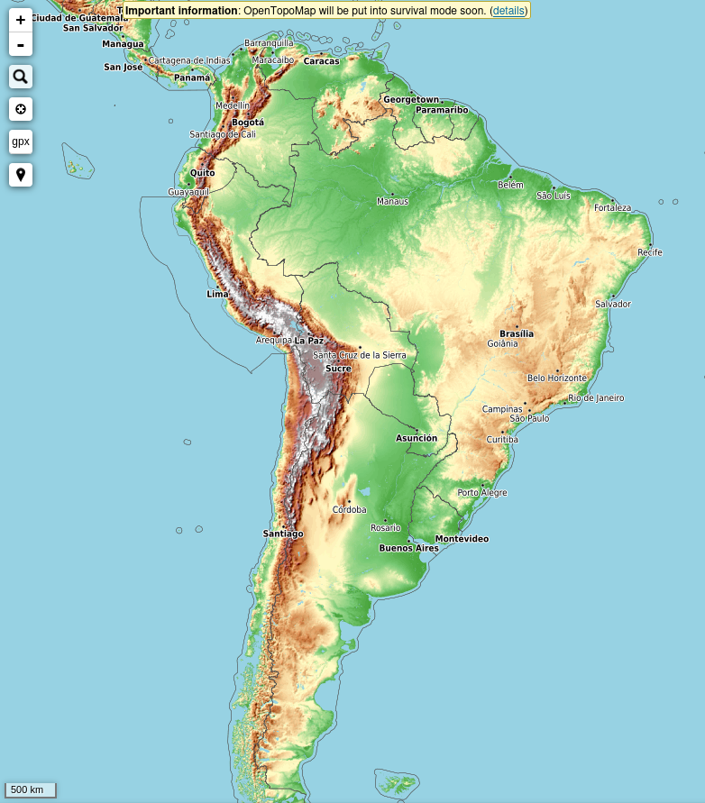
[1] OpenTopoMap pedindo apoio | © OpenTopoMap | dados do mapa © by OpenStreetMap Contributors
Campanhas de mapeamento
- Mateusz Konieczny propôs uma edição de bot para corrigir tags
paved=*esurface=*conflitantes. - confusedbuffalo propôs
 > estender a edição automática existente de números de telefone para incluir o Reino Unido, removendo a pontuação extra e adicionando o código do país. Os mapeadores estão convidados a discutir o assunto no tópico do fórum e a entrar em contato se acharem que essa edição também seria útil e aceita em seu país.
 >
> 
Comunidade
- Aselnigu completou > todos os 30 temas diários no recente #30DayMapChallenge 2025.
- O B-unicycling explica como mapear os blocos de montagem (plataformas elevadas usadas para ajudar os cavaleiros a montar cavalos e carruagens), argumentando que eles devem ser marcados como
amenity=mounting_block. - Dzertanoj explica > um fluxo de trabalho para contribuir com trilhas GNSS-RTK de alta precisão obtidas de estações de referência não WGS84 para o OpenStreetMap. O RTK (Real Time Kinematic) é um método de posicionamento em nível centimétrico que usa uma estação de base fixa para corrigir erros nos sinais padrão do Sistema Global de Navegação por Satélite. Algumas dessas estações base operam em sistemas de referência de coordenadas (CRS) localmente específicos, em vez do sistema WGS84 usado pelo OpenStreetMap. Esse fluxo de trabalho converte esse CRS enquanto preserva os metadados adicionais, garantindo que os dados de rastreamento GPS resultantes permaneçam precisos e confiáveis.
- Koreller explicou o processo de mapeamento da Cho Island.
- Martijn Van Exel descreveu os desafios complexos envolvidos na classificação de pontos de interesse nos dados do OpenStreetMap.
- SomeoneElse usou o Taginfo para compilar uma lista das tags mais usadas do OpenStreetMap.
Importações
- Mateusz Konieczny propôs uma importação global de tags de sites para a IKEA, usando dados produzidos pelos raspadores da Web All the Places > .
Fundação OpenStreetMap
- A equipe de operações do OpenStreetMap tem uma oferta especial para empresas de IA: por uma modesta doação > ao projeto OpenStreetMap, a empresa doadora receberá um link direto para download dos dados do OSM em um formato compatível com máquinas.
Pesquisas com OSM
- A HeiGIT > apresenta o ohsomeDB > , o sucessor do OpenStreetMap History Database (OSHDB), que oferece uma base mais rápida e flexível para a análise de dados do OpenStreetMap (OSM). A API atual do ohsome está planejada para ser encerrada após o SOTM 2026, e suas consultas e scripts antigos deixarão de funcionar, no máximo, até agosto de 2026, o que lhe dará tempo suficiente para adaptar seus fluxos de trabalho.
Mapas
- OSM Pyrénées-Orientales publicou no Mastodon, sobre o uMap criado por LySioS, que oferece uma visão geral dos nomes das rotatórias localizadas na região dos Pirineus Orientais, extraídos do OpenStreetMap. Os dados podem ser obtidos em formato .CSV.
OSM em ação
- O Mapping Diversity é um projeto coordenado pela OBC Transeuropa para a European Data Journalism Network (Rede Europeia de Jornalismo de Dados), que analisa os nomes das ruas em 32 grandes cidades europeias e compara quantos são dedicados a mulheres e homens, visualizando-os em um mapa. Ele faz isso combinando a lista de ruas criada pelo OpenStreetMap com o identificador Wikidata das entidades às quais elas são dedicadas.
Dados abertos
- Xiao Xiang Zhu, et al, desenvolveram > o GlobalBuildingAtlas, um conjunto de dados acessível ao público que fornece cobertura global de pegadas de edifícios, alturas e modelos de edifícios 3D LOD1 (baixo detalhamento). O conjunto de dados é derivado de dados de satélite do PlanetScope, usando redes de regularização treinadas em anotações do OpenStreetMap filtradas manualmente.
Programas
- [1] Há um aviso dos desenvolvedores do OpenTopoMap de que ele será descontinuado em breve, após 14 anos de serviço. Há uma intenção de criar blocos vetoriais, mas não há um cronograma. Se quiser apoiar o projeto, a equipe o convida a entrar em contato.
- A Julcnx desenvolveu uma extensão de navegador que permite que os dados do Strava Heatmap sejam visualizados diretamente no editor iD do OpenStreetMap.
Programação
- Martijn van Exel descreve > o fluxo de trabalho de extração-transformação-carregamento (ETL) para dados do OpenStreetMap, demonstrando o uso do osm2pgsql e do osmium para processar e gerenciar o conjunto de dados.
- GanderPL fez experimentos com chatbots de IA para acelerar a marcação de objetos e combinar melhor as tags com suas finalidades. Sua principal ferramenta é um servidor MCP que fornece o esquema de marcação do OpenStreetMap para assistentes de IA – ele permite a validação de tags, consulta de valores, pesquisa predefinida e sugestões de aprimoramento. Inicialmente, a IA produziu alucinações e tags incompatíveis, mas depois de converter os dados do esquema de marcação de id em uma ferramenta MCP dedicada, os erros caíram significativamente, embora a GanderPL continue refinando o processo.
Você sabia que…
- … há um perfil do Mastodon que mostra as alterações recentes feitas no MapComplete? E ele inclui belas fotos sobre uma variedade de temas.
- … o SPOT é um serviço de geolocalização assistido por IA desenvolvido > pela Deutsche Welle Innovation e que funciona com avisos de linguagem natural e dados OSM. Ele não requer habilidades de codificação e se baseia na precisão do turbo de viaduto.
Outros assuntos “geo”
- Daniel DiDonato, 18 anos, usou um software de mapeamento gratuito em casa para redesenhar os distritos eleitorais do Alabama, e um juiz federal adotou posteriormente sua proposta para corrigir as violações dos direitos de voto, tornando-o o mapa atualmente em vigor > de acordo com a lei estadual.
- Rtnf explica > como acessar dados recentes de imagens de satélite Sentinel para examinar o impacto do ciclone Senyar > , que causou inundações catastróficas e deslizamentos de terra em Sumatra no final de novembro de 2025. Foram registradas pelo menos 867 mortes, mais de 2.600 feridos e 521 pessoas desaparecidas na Indonésia, todas nas províncias de Sumatra do Norte, Sumatra Ocidental e Aceh.
- Jonathan Kemper, da Photographix Magazine, relatou > que o satélite Sentinel-1D entregou com sucesso suas primeiras imagens de radar de alta resolução apenas 50 horas após o lançamento. O sistema de radar do satélite é capaz de mapear a superfície da Terra em qualquer condição climática ou de iluminação. O Sentinel-1D entra em serviço como substituto do Sentinel-1A, que operou em órbita por quase onze anos.
- James Killick, da Map Happenings, destacou a > Bee Maps, uma empresa que desenvolveu uma câmera com IA montada no painel, > chamada "Bee", para coletar dados de mapas. A unidade combina uma câmera primária, sensores de profundidade estéreo, GPS de alta precisão e LTE integrado para uploads de dados em tempo real. A empresa oferece acesso ao dispositivo por meio de assinaturas a partir de US$ 19 por mês, enquanto os motoristas podem ganhar criptomoedas > coletando dados de mapeamento na estrada.
 >
> Próximos eventos
| País | Onde | Local do evento | O que? | Data |
|---|---|---|---|---|
| UN Mappers #ValidationFriday Mappy Hour | 2025-12-05 | |||
 | Olomouc | SotM CZ+SK 2025 | 2025-12-05 | |
 | 大阪市 | 大阪大学中之島センター | State of the Map Japan 2025 | 2025-12-06 |
 | Paris | Carrefour Numérique² de la Cité des Sciences | PSL XXL | 2025-12-06 – 2025-12-07 |
 | Biella | Sala Riunioni 2, CTV Centro Territoriale per il Vo | Incontro dei mapper di Biellese, Vercellese e Canavese | 2025-12-06 |
 | Braunschweig | Stratum0 | Braunschweiger Mappertreffen im Stratum0 Hackerspace | 2025-12-06 |
| Kiel | Toppoint e.V. | Kieler Radinfrastruktur mappen | 2025-12-07 |
 | नई दिल्ली | Jitsi Meet (online) | OSM India – Monthly Online Mapathon | 2025-12-07 |
| Missing Maps : Mapathon en ligne – CartONG [fr] | 2025-12-08 | |||
| Grenoble | La Turbine | Atelier de décembre 2025 du groupe local de Grenoble | 2025-12-08 |
 | 臺北市 | MozSpace Taipei | OpenStreetMap x Wikidata Taipei #83 | 2025-12-08 |
 | Salt Lake City | Woodbine Food Hall | OSM Utah Monthly Map Night | 2025-12-09 |
| Hamburg | Voraussichtlich: "Variable", Karolinenstraße 23 | Hamburger Mappertreffen | 2025-12-09 |
| iD Community Chat | 2025-12-10 | |||
 | Amsterdam | TomTom Amsterdam | Missing Maps/Maptime Amsterdam In-Person Mapathon | 2025-12-10 |
 | Žilina | GLOBESY s.r.o. | Missing Maps mapathon Žilina #20 | 2025-12-11 |
| München | WikiMUC | Münchner OSM-Treffen | 2025-12-11 |
| Online | OpenStreetMap Midwest Meetup | 2025-12-11 | |
 | Zürich | Bitwäscherei Zürich | 182. OSM-Stammtisch Zürich | 2025-12-12 |
 | Zaragoza | Etopia | GeoCamp – State of the Map España 2025 | 2025-12-13 |
 | MAP Mercator museum | OpenStreetMap Belgium at the MAP-Mercator museum | 2025-12-13 | |
| Jalpaiguri | Thana More | 10th OpenStreetMap West Bengal Mapping Party | 2025-12-13 |
 | København | Cafe Bevar’s | OSMmapperCPH | 2025-12-14 |
| Missing Maps London: (Online) Mid-Month Mapathon [eng] | 2025-12-16 | |||
| Lyon | Tubà | Réunion du groupe local de Lyon | 2025-12-16 |
| Bonn | Dotty’s | 195. OSM-Stammtisch Bonn | 2025-12-16 |
 | City of Westminster | Monkey Puzzle pub | London xmas pub meet-up | 2025-12-16 |
| Online | Lüneburger Mappertreffen | 2025-12-16 | |
| Düsseldorf | Online bei https://meet.jit.si/OSM-DUS-2025 | Düsseldorfer OpenStreetMap-Treffen (online) | 2025-12-17 |
| Karlsruhe | Chiang Mai | Stammtisch Karlsruhe | 2025-12-17 |
 | Stainach-Pürgg | Online | 19. Österreichischer OSM-Stammtisch (online) | 2025-12-18 |
| UN Mappers Mappy Hour | 2025-12-19 | |||
| Potsdam | Luisenplatz, Potsdamer Weihnachtsmarkt | Potsdamer Mappertreffen | 2025-12-19 |
| MAP Mercator museum | OpenStreetMap Belgium at the MAP-Mercator museum | 2025-12-20 | |
| Missing Maps : Mapathon en ligne – CartONG [fr] | 2025-12-22 |
Nota: Quer ver seu evento publicado aqui? Então adicione-o no OSM Kalender calendário. Apenas os dados que forem inseridos lá aparecerão no weeklyOSM.
Este semanárioOSM foi produzido por MatthiasMatthias, Paloma Moreira, Raquel Dezidério Souto, Thayná Assis Vianna, derFred, Amanda Silva.