weeklyOSM 301
19/04/2016-25/04/2016
Mapping
Martin Weilandt asks at Talk-Transit mailing-list about how to handle bus stops that have no name.
Marek Kleciak worked along with user Cetus on the JOSM plugin CAD Tools. This plugin will be soon available again with advanced features.
User Sibo Dolem asks in the German Forum about missing information in the wiki to help map building basements and stairways using 3D tagging.
Mapbox’s mappers share techniques for fast mapping like usage of gaming mice (shortcuts) and multiple JOSM windows at the same time to speed up their mapping (to avoid waiting until an upload is finished).
Community
There are crowdfunding efforts from OSM community in Benin to acquire a 275 km² high resolution satellite imagery for Cotonou in Western Africa. The campaign will end on the May 1st, and only a few Euros are still needed to reach the required amount.
Following their blog post about their mapping efforts with OpenStreetMap, Indie Manufacturing has written an articles about the best practices to be followed while mapping in OpenStreetMap.
OpenCage Data Blog talks to Simon Poole about OSM in Switzerland.
Pratik Yadav describes the Open Peer review process at Mapbox, where the new QA system for OSM data edits is accessible for anyone to participate.
Stijn Rombauts is the Belgian mapper of the month.
Imports
- Nakaner suggests a mechanical edit removing
lcn=yesandrcn=yesin the state of Lower Saxony (Germany), if they have been imported from an official map in 2014. See also the discussions at German forum and Talk-de mailing list. (Forum automatic translation)
OpenStreetMap Foundation
OSMF is looking for a part-time “administrative assistant”. As having staff in the OSMF is a highly emotional topic, the idea of hiring is not considered a good thing by everyone.
The draft of the Articles of Associations (AoA) of OpenStreetMap UK can be commented on at Google Docs.
Events
Rory McCann suggests giving a talk about Townlands.ie on the State of the Map in Brussels on the Talk-ie mailing-list. Which talk will you give?
You can apply for a scholarship to join the SotM 2016 in Brussels, the deadline is Sunday May 21, 2016.
Humanitarian OSM
Update earthquake in Ecuador
In an article from the gaurdian, Nama Budhathoki writes about the way mapping technology can revolutionize disaster response.
NOSOLOSIG reported that the “Military Geographic Institute of Ecuador” Instituto Geográfico Militar de Ecuador (IGM) - the main institution in Ecuador to provide geographical data - is working together with HOT.
Mhairi O’Hara and Tyler Radford report about day 7 of HOT efforts after earthquake in Ecuador.
Read about the recent reports concerning the earthquake projects HOT blog.
Taylor Dobbs reports about the work of a group of 28 humanitarian volunteers to help relief efforts.
Some media reports about HOT and OSM mapping in Ecuador:
- Escuala de Datos: Recursos para mapeo abierto por Ecuador (automatic translation)
- The NewYorker: Creating a Map to Navigate the Post-Earthquake Landscape in Ecuador
- eltiempo, Ecuador: Un mapa para entregar ayuda (automatic translation)
- El País: Cómo ayudar a Ecuador después del terremoto (automatic translation)
- El Mundo: Así ayudan a salvar vidas los anónimos de internet (automatic translation)
Coming Home: a benefit concert to support Ecuador/Japan earthquake relief. Proceeds from this concert will be donated to the Humanitarian OpenStreetMap team. Date: May 1, Time: 3pm - 5pm (Location).
Maps
Citee Fashion offers OSM based map images of your favourite city printed on t-shirts.
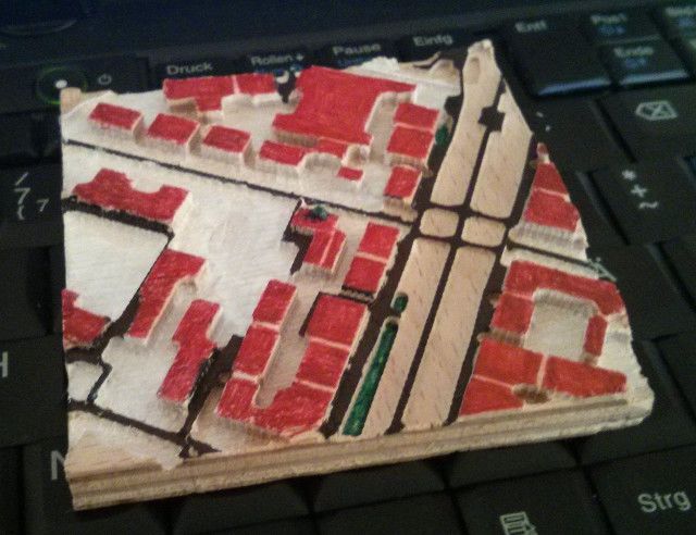
Tactile OpenStreetMap created a tactile map offered by TOUCH MAPPER. More informations on GitHub.
switch2OSM
Andy Mabbett wrote about Birdtrack on the Talk-GB: “Birdtrack is an online citizen science website, operated by the British Trust for Ornithology (BTO) on behalf of a partnership of the BTO, the RSPB, BirdWatch Ireland, the Scottish Ornithologists’ Club and the Welsh Ornithological Society”. Birdtrack switched to OSM.
Rihards Gailums wants to “create a working prototype of cloud based service” Drivenet Maps. He describes here that this prototype is necessary for autonomous driving projects.
Mobify, a Mapbox reseller, which develops store location maps thinks that it has bought an “enterprise subscription” from Mapbox and therefore does not have to attribute OpenStreetMap as data source (i.e. a violation of OSM license). The map of CricketWireless also lacks the OSM attribution. Mapbox had been criticized about this in the past too. The missing attribution in Pieology’s map has been discovered and reported on the Talk-us mailing-list on 13th April and has been corrected in the meanwhile. Mikel Maron from Mapbox replied back on this thread stating that “OpenStreetMap attribution is always required – Mapbox enterprise users can elect to remove only the Mapbox attribution. We here at Mapbox are on this.”
Open Data
Wikipedia initiated a photo contest “Wiki Loves Earth“. The aim is to collect photos from natural monuments and nature reserves. The contest starts on May 1st.
Gluon announces a new JavaFX component named Gluon Maps for map display.
Programming
- Jochen Topf reports about a new feature in the Osmium tool which can be used to store the actual latitude/longitude values of nodes that are element of a way in a more efficient way and as raw OSM data. Those are optimized for speed when reading.
Releases
- | Software | Version | Release Date | Comment | | — | — | — | — | | MapFactor Navigator Free | 2.1.97 | 2016-04-13 | Bugs fixed, better alternate route calculation and more | | SQLite | 3.12.2 | 2016-04-18 | Some bugs fixed | | OSM Buildings | 2.4.2 | 2016-04-20 | Updates for CI automation | | OsmAnd for iOS | 1.2.3 | 2016-04-21 | Bug s fixed | | Mapillary for Android | 1.8.5 | 2016-04-22 | Mapbox sdk upgrade for in-camera map | | OSRM Backend | 5.0 | 2016-04-22 | Many API changes and some fixes | | iD | 1.9.3 | 2016-04-25 | - |
Did you know …
… the weather map of OpenSeaMap?
… the tool Places!? … to find geospatial patterns in place names, based on a previous work of Moritz Stefaner and realised with OSM data. You find the sources of Places! on GitHub.
Other “geo” things
23 wonderful historical maps of 23 European cities. (automatic translation)
The David Rumsey Map Collection (which we already reported about) now offers to 67,000 historic high resolution maps for download. This short video explains how to use the Georeferrencer, a tool that shows the historic map simultaneously side by side (more or less like map compare) with a recent OSM map.
CartoDB and Mapzen have announced a technology and commercialization partnership.
The GIScience Research Group at Heidelberg University is offering a position as senior researcher or Postdoc (100%, TVL) in Geoinformatics with a specializion in quality analysis, mining, improvement and integration of data from VGI data sources such as OSM or Social Media.
Vox.com writes about the expected billion outlay for map data, which probably belongs to companies like Google etc. to enable self-propelled vehicles.
Tagesspiegel.de offers an interesting website for visualizing differences in aerial photography of Berlin from recent days and those of 1928.
Geographers at the Friedrich-Alexander University Nuremberg/Erlangen investigate in a project about the democratization of cartography based on OSM and WikiMapia in Israel and Palestine. (automatic translation)
Upcoming Events
| Donde? | Que? | Quando? | País |
|---|---|---|---|
| Rennes | Rencontres à Rennes | 25/04/2016 |  |
| Seattle | OSM Seattle Ecuador Mapathon Seattle | 27/04/2016 |  |
| Barcelona | Mapathon MSF/Missing Maps Barcelona | 27/04/2016 |  |
| Metro Manila | Mapping Party: UP Village Quezon City | 30/04/2016 |  |
| Berlin | Hack Weekend | 30/04/2016-01/05/2016 |  |
| Trentino | Ala @ library 20:30 | 02/05/2016 |  |
| Liguria | Genova @ Zenzero, via Torti 20:30 with ALID | 02/05/2016 | |
| London | Missing maps mapathon at the Welcome Trust | 03/05/2016 |  |
| Manila Metro Manila | Mapping Party with #MapPHL, Quiapo | 07/05/2016 | |
| Bogotá | Mapping party - Bogota: Usaquén | 07/05/2016 |  |
| Lyon | Rencontre mensuelle mappeurs | 10/05/2016 | |
| Trentino | Besenello @ library 14:00. With support of Portobeseno and the Besenello Municipality | 14/05/2016 | |
| Kyoto | 京都世界遺産マッピングパーティ:第13回 特別編 延暦寺(西塔、横川)(再) | 14/05/2016 |  |
| Clermont-Ferrand | ‘’’State of the Map France 2016’’' | 20/05/2016-22/05/2016 | |
| Rapperswil | 7. Micro Mapping Party | 20/05/2016 |  |
| Milano | ‘’’State of the Map Italy 2016’’' | 20/05/2016-22/05/2016 | |
| Brno | ‘’’State of the Map CZ+SK 2016’’' | 21/05/2016 |  |
| Rapperswil | ‘’’Swiss PG Day 2016’’' | 24/06/2016 | |
| Salzburg | FOSSGIS 2016 | 04/07/2016-06/07/2016 |  |
| Salzburg | AGIT 2016 | 06/07/2016-08/07/2016 | |
| Seattle | State of The Map US 2016 | 23/07/2016-25/07/2016 | |
| Tokyo | State of The Map Japan 2016 | 06/08/2016 | |
| Bonn | ‘’’FOSS4G 2016 Code Sprint’’' | 20/08/2016-22/08/2016 | |
| Bonn | ‘’’Workshops at FOSS4G 2016’’' | 22/08/2016-23/08/2016 | |
| Derby | Derby | 23/08/2016 | |
| Bonn | ‘’’FOSS4G 2016’’' | 24/08/2016-26/08/2016 | |
| Bonn | ‘’’FOSS4G 2016 Code Sprint Part II’’' | 27/08/2016-28/08/2016 | |
| Brussels | ‘’’State of the Map 2016’’' | 23/09/2016-26/09/2016 |  |
| Metro Manila | ‘’’State of the Map Asia’’' | 01/10/2016-02/10/2016 | |
This weeklyOSM was produced by Nakaner, Peda, rogehm, derFred, escada, jinalfoflia, mgehling, stephan75, widedangel.
We welcome link suggestions for the next issue via this form and look forward to your contributions.
Leave a reply