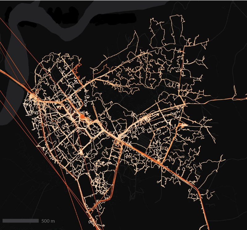
Kartitotp shows in her blogpost that the community together with the Mapbox team in Ayacucho took a great step forward to make the 150,000-inhabitant city in the Peruvian Andes, the best mapped city in Latin America. 20 bus routes from 22 public transport companies are now available in OSM.
Martin Koppenhöfer raises once again the question why monuments up until today are not clearly distinguished by the two proposed subkeys.
Community
Hartmut Holzgraef’s MapOSMatic fork has experienced a variety of innovations and additions and is now even usable worldwide with its variety of styles and overlays.
Simon Poole published his annual analysis of OSM contributors for the year 2016 including the raw data to play with. In a comment, Pascal Neis adds two more statistics which show the number of active contributors per country for this year and for the project’s history.
Mappa Mercia reports about how their quarterly project this time, threatens the national security!
User yasunari blogged about running a mapping party(automatic translation) for the first time in a new city, in this case Tokyo, what to do and what not to do. The subject of the party was to map all 77 historical points in Tetsugaku-dō Park.
Pascal Neis has published a country-specific mapper ranking for December 2016. In another tweet he shows newcomers with their used editor.
Events
Fatouma Harber and Aboul Hassane Cisse, hosted from 7th-9th January 2017 in collaboration with the OSM community of Mali a CartoCamp (mapping party) in Tombouctou.
Ulf Treger, in his lecture on maps on the 33C3, takes a look back at the historical development of maps and map projections to date and their geopolitical background.
Selene Yang published in a diary of photos from the SotM Latam, 2016 that happened in São Paulo, Brazil.
The State of the Map Africa Working Group has starting a logo contest.
Humanitarian OSM
In an OSM diary entry, “everyone_sinks_starco” complained about a HOT mapathon in Indonesia. It turned out to be a very effective rant, because various members of HOT Indonesia posted comments to explain what had happened (if you don’t understand Bahasa Indonesia you’ll need to copy and paste the second half of the comments into an online translation tool). To this, user Iyan the Project Manager of Humanitarian OpenStreetMap Team Indonesia clarified and explained about the project.
That mapathons can be done well, too, is shown by the Red Cross: After training local mappers, 7000 villages in Liberia, Guinea and Sierra Leone are mapped and GPS traces of 70,000 km of roads & paths are collected by those new volunteers.
The blog globalinnovationexchange.org has a very upbeat post published on the topic: Fighting Ebola with Information.
Maps
J. Budissin is seeking a volunteer who would setup and operate a Sorbian map as the former admin is not willing to do so anymore. Preferably people from Lusatia and the surroundings can volunteer.
switch2OSM
The Chilean tax administration uses OSM maps. (Via osmCL)
Open Data
Martin Isenburg reports on rapidlasso.com that now there is open and free LiDAR data in Germany. First, North Rhine-Westphalia and then Thuringia have opened their geoportals for free download of geospatial data at the beginning of 2017. We are full of hope, Martin says, that other federal states will follow their lead. It would simply not make any sense to try to sell this kind of data, as it was shown in England recently.
Software
Robot8A tries to convince Telegram developer to use OSM instead of Google Maps. Interesting discussion follows.
Programming
Adrien Pavie shows his JS library Pic4Carto which allows to embed geolocated pictures into a website. Right now it supports Flickr, Mapillary and Wikimedia Commons.
Karlos shows the newest changes of OSM go, e.g. built-in 3D-models of benches or windturbines and first impressions from the London tube.
… Franz-Benjamin Mocnik’s visualizations on OpenStreetMap changeset and wiki tags?
… TorFlow? It shows the traffic between the individual nodes of Tor in real time.
OSM in the media
The MVV, the local traffic company of Munich, will soon launch (automatic translation) a new service based on OpenStreetMap to show arrivals and delays of local trains. The MVV notes that OpenStreetMap data is not only free but also more current than data from HERE.
Federal Agency for Civic Education published an article how OpenStreetMap could be used for educational purposes in a public school. (automatic translation)
The Herald, in Zimbabwe writes about the importance of collaborative mapping initiatives, such a Missing Maps to help build resilience and better humanitarian response.
Other “geo” things
Examples of using OpenStreetMap data and Mapzen tools in news companies.
The QuickMapServices (we reported earlier) now contains more than 555 services.
Mashable presents jeans from Spinali Design that helps to navigate. We hope for the sake of your safety that only OpenStreetMap data is being used.


Leave a reply