There is a discussion on the OpenStreetMap Forum about Bing rolling out new aerial imagery for Darmstadt, Germany.
A question by wolfbert about grouping buildings and terrain of castles leads(automatic translation) to an amusing discussion. The results are on the wiki.
Levente Juhász writes in the Mapillary Blog on how to map hiking routes in OpenStreetMap and Mapillary.
Micah Cochran invites comments on his modified proposal concerning improvements to toilet tagging.
On the talk-fr mailing list, Florian Lainez suggests using the upcoming French presidential election as a good opportunity to map electoral billboards. A wiki page has been set up and questions are raised on polling stations tagging.
A question is raised on the tagging mailing list about restaurants that allow customers to bring in their own alcoholic drinks.
Some mappers wonder why thoroughly mapped amenities like schools, churches and other buildings do not show up as expected. This was discussed(automatic translation) in detail on the German forum, and on the Tagging mailing list.
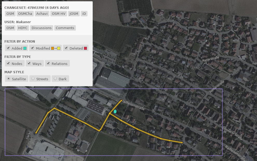
Manohar Erikipati (manoharuss) writes about OpenStreetMap Changeset Analyzer (OSMCHA) and how to use it to review recent changes in your area using filters.
Mapbox Cities is a mentorship program for cities. For research projects on public sector open datasets and OpenStreetMap, Mapbox wants to learn about the local government datasets that are most interesting for you to import, the pain points that you face while interacting with government open data stakeholders, and more on your experience with local government contacts. If you are interested in answering these questions, please take up the survey for OpenStreetMap Contributors and there is one for local government officials too.
Mikel Maron publishes his notes on the Local Chapter Congress that took place during SotM 2016.
Joost Schouppe publishes his analysis of the most frequently used OpenStreetMap editors.
Tyumen Oblast is small region in Western Siberia. The evolution of local mappers in this region is analyzed by user mavl in his blog.
Imports
Ivan Garcia wants to import borders in Indonesia on behalf of HOT.
User ff5722 suggests in his user diary to import the treecover2010 dataset by USGS outside of Europe. Vincent de Phily, Christoph Hormann and SK53 explain in their comments what the issues of this dataset are and why it should not be imported.
OpenStreetMap Foundation
OSM UK has officially applied for Local Chapter. Paul Norman asks for comments on the British request.
Events
The call for papers of FrOSCon conference (Free and Open Source Conference) in Siegburg, Germany is open (and will close on 23. May). FOSSGIS e.V., the German de-facto local OSM organisation, cooperates (automatic translation) with the organizers for GIS and OSM related topics.
Humanitarian OSM
The HOT board was renewed. Meet the members. Melanie Eckle from HeiGIT / GIScience Research Group Heidelberg was elected along with Ahasanul Hoque and Pete Masters.
‘The Conversation’ discusses the role of social media in the improvement of human life, and also addresses the ‘Missing Maps’ project.
A new Missing Maps Hosting Tool helps mapathon organizers register the event and contact other volunteers.
The HOT Mapathons in Belgium were not as successful as hoped, judging by the statistics on continued participation. However, Joost Schouppe writes that they were more successful in other aspects - they have united the community and recruited volunteers while organizing SotM (2016) last autumn.
Maps
OpenStreetMap Carto released version 3.2.0, and landuse=farm will no longer be displayed.
Michael Spreng presents the Swiss map of CHFreeWiFi which is based on OSM. The WeeklyOSM editors do not issue any political opinion.
Open Data
ChristianSW points out that this year Wiki Loves Earth will take place in May. It is an annual photo competition for nature conservation and natural phenomena. Images can be uploaded to Wiki Commons.
The twitter account openOV claims that the timetable data of the integrated transport authority of Aachen, Germany, is public domain.
Software
[1] Geohacker writes about preparing accurate history and caching OpenStreetMap changesets.
Programming
User pathmapper asks on GitHub what will happen with Maputnik in the future because Lukas Martinelli joined Mapbox. Lukas responds that he is looking for a new maintainer.


Leave a reply