Marc Gemis (Escada) explains the workflow he follows when he surveys an area to map on OpenStreetMap.
Christoph Hormann provides new satellite images for mapping on his website imagico.de. The pictures show the North Sea in Germany, Denmark and the Netherlands, the Petschorasee coast in the North of Russia, part of the Arctic coastline and islands in the North Atlantic.
Michael Tsang asks for votes for his proposalbus_bay=left/right/both. Michael also extends the voting for through_service and asks for increased participation.
A discussion about how to map a mill channel/trench started both in the German forum(automatic translation) and the Tagging mailing list at about the same time. waterway=leat is called the water providing alternative for the existing tags waterway=ditch, drain and canalis proposed. The German forum prefers waterway=ditch, so far.
surface=cobblestone was discussed on the German forum(automatic translation), after wiki fiddling changed the original intent of the tag over the years. Do we all have to start retagging what we know colloquially as cobblestone to surface=sett? Or do we make the definitions in the wiki the way they started out?
Élisée Reclus (@reclus23) tweets that “In #Ruhrgebiet the cycle path signposts in #OpenStreetMap soon have(automatic translation) to be changed / supplemented”. He also points out that new signposts might also be rescue points tagged highway=emergency_access_point or emergency=access_point.
Community
Whoever currently scrapes the JOSM server is kindly, but urgently asked to stop it.
OpenStreetMap Foundation
On the recent OSMF Board meeting on 18th April a possible directive was discussed on how to deal with commercially organized edits in a largely non-public item of the agenda. This led to a turmoil prior to the meeting. A theme in the public part was also a possible change of the e-mail provider for osmfoundation.org (Gmail) to a self hosted solution.
“OSMUK Chapter has opened a dialogue at senior level with Highways England about access to their data and they have indicated they are open to releasing data to us”, says Brian Prangle at Talk-GB. He lists a number of features to add to the initial request of data. Your comments are welcome.
Events
On May 10th, a Missing Maps Mapathon will take place in Lyon, France.
The tickets for SotM Africa from July 8th to 10th in Kampala, Uganda, can be purchased here.
On September 14-15, the HOT Summit will take place in Ottawa, Canada.
Humanitarian OSM
OpenGovAsia reported in detail and clearly about the HOT activities and disaster management in Indonesia. The “pioneer work” by HOT even in very remote areas is highlighted in particular.
HOT reports on the projects being supported by the “Microgrants Program 2017”.
Maps
On the Talk mailing list, you can read a discussion about how the important landmarks of cell towers are perceived differently and only pylons are rendered by the map style openstreetmap-carto.
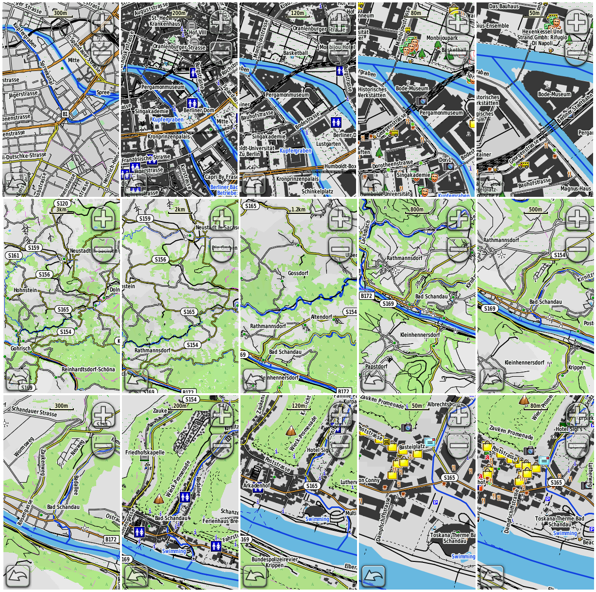
[1] BBBike extract service now also delivers maps with the OpenTopoMap style for Garmin devices.
switch2OSM
The Verkehrsverbund Rhein-Neckar uses OSM data on its website (automatic translation) since the end of March. So far, start and destination maps, and line trajectories are available. They are already workingon an interactive map.(automatic translation)
Software
Bryan Housel requests your help to translate the next version of iD. He also gives some details on the upcoming 2.2 release.
Programming
Mapbox released their Node.js binding for or-tools as open source. Although the code is thought to use the Mapbox APIs, first users confirmed that it also works directly with OSRM and OpenStreetMap data.
R0bst3r thought about how to use OpenStreetMap in his car. He found (automatic translation) a simple way to mirror the smartphone display on his Mazda radio. User michalfabik refers to a discussion on the same topic on reddit.
Releases
| Software|Version|Release date|Comment|
| —— | ———– |—-|—-|
|OpenStreetMap Carto Style|3.2.0|2017-04-17|Many changes, please read release info.|
|Naviki iOS *|3.58|2017-04-18|New cycling map, bug fixes.|
|Mapbox GL JS|v0.36|2017-04-19|One new feature, five bugs fixed and three development workflow improvements.|
|OsMo iOS|1.6|2017-04-19|Improved application stability. View group members, points of interest, tracks on OpenStreetMap.|
|Komoot Android *|var|2017-04-21|No Infos.|
|OSRM Backend|5.7.0|2017-04-21|Many changes, please read release info.|
|QGIS|2.18.7|2017-04-21|No infos.|
|MapContrib|1.7.9|2017-04-24|Some smaller changes.|
|Mapillary Android *|3.51|2017-04-24|Auto break sequences after 600 photos, fix timestamp and upload issues.|
|Naviki Android *|3.58.2|2017-04-24|Added language instructions for additional languages.|
… the livemap24? It shows public transport vehicles, either where they should be based on GTFS timetables, or where they actually are if the public transport operator provides an API with live positions.
OSM in the media
The French newspaper “Le Monde” reports (automatic translation) about the Jungle Bus (automatic translation) project whose aim is to build tools to ease contributions and use for public transport data on OSM. The app has been previously mentioned as Bus Contributor.
Other “geo” things
Mapzen expands the Who’s On First Neighbourhoods post, presenting the work-flow, sources and a status report.


Leave a reply