weeklyOSM 366
18/07/2017-24/07/2017
Mapping
Martijn van Exel writes on the Telenav blog a little bit about MapRoulette. He feels that the page with the most popular and newest challenges is not particularly easy to use. He asks for input to improve the way to find challenges of interest for contributors.
Pander proposed some improvements to the beautified JOSM presets for
natural=treein the tagging mailing list. See also discussion on the related Vespucci github issue..Stuart Reynolds asks on Talk-gb mailing list whether “St” in names should be abbreviated or not.
Vivek Bansal, of Santa Clara Valley Transportation Authority, wants to set up a US Tasking Manager task for adding
sidewalk=*tags across the entire Santa Clara County, California.Mapillary invites participation in a mapathon to improve street-level photo coverage in Medellin. The mapathon runs until August 3rd.
Mapillary draws attention to the US Summer Bus Mapathon and publishes a tutorial on “How to Map Bus Routes and Infrastructure on OpenStreetMap”.
The ‘Mapper of the Month’ chosen by OpenStreetMap Belgium is Jamie Nadeau aka LogicalViolinist from Canada.
Community
OpenStreetMap awards are back. It’s time for you to vote and support not just one but multiple nominees. This time’s procedure involves Approval Voting. Learn more about this in the blog post.
Mapmeld reasons and writes about translating OpenStreetMap into Divehi, the local language of the Maldives.
Imports
It looks like Robin Paulson has discovered an import of buildings with no documentation (Auckland, NZ).
Sam Libby works on a new feature for the iD editor to ease the import of “authoritative” (his wording) data from ArcGIS REST into OpenStreetMap without the need to use JOSM. Several OSM contributors have already commented on his issue.
OpenStreetMap Foundation
- On July 18, an executive board meeting of the OSMF took place. Various topics were discussed, among others like “Microgrants”, and the corporate editing policy. OSM France was recognized as regional chapter (the contract is in the OSMF wiki). The log was still not online at the time.
Events
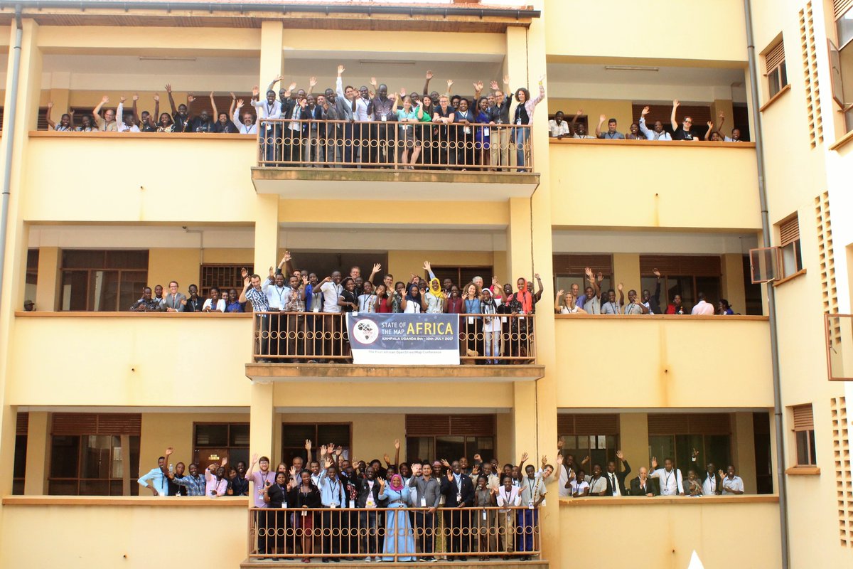
- The first SotM Africa was held between 8th and 10th July, you can read reports by Map Zambia and Janet Chapman sharing their experience at the conference.
Humanitarian OSM
- An invitation on the Talk mailing list to a Community Webinar about the improvement of mapping residential areas initiates some criticism about the way that
landuse=residentialis used in some HOT mapping projects. Christoph Hormann explains why from his point of view you cannot use the same assumptions as used in Europe in regions where most people work in the primary sector (agriculture).
Maps
Wondering how to get an OSM-based map onto a Garmin device without external storage? This diary entry by robbieonsea contains detailed instructions.
OpenMapTiles developed a map which shows the names of places in different languages.
Mapbox presents “Whaam!” a map style inspired by the pop art movement, in particular, the work of Andy Warhol, James Rosenquist and Roy Lichtenstein. True eye candy!
Open Data
Dmitrij Kožuch is planning an open landuse map for Africa based on available data sources. The main source probably will be OSM.
The Guardian and GiGL have worked together to produce an open data set (currently only available through GiGL’s dropbox) of privately-owned public spaces (squares, plazas, parks etc) for Greater London.
Software
- The Overpass API instance of FOSSGIS e.V. (overpass-api.de) had problems following a power outage. Metadata queries (
out meta;) did not work. The problem is now fixed.
Programming
Mapbox is looking for a “data science lead” for its office in Bangalore.
Aaron Ng writes a blog post titled: “How I built it: Visualizing Foursquare check-ins with Mapbox + ARKit”
User kepta is working on the integration of the Imagery Offset Database into iD. JOSM users can already use a plugin.
User n42k reports about his ongoing work on the 3D Model Repository as part of Google Summer of Code 2017.
Releases
Walter Nordmann published emergency map 2.8. Main new feature is clustering for fire hydrants and rescue points.
| Software|Version|Release date|Comment| | —— | ———– |—-|—-| |Jungle Bus|1.2.4|2017-07-20|No infos.| |Komoot Android *|9.3|2017-07-18|No infos.| |Magic Earth *|7.1.17.29|2017-07-19|Many changes, please read release info.| |Mapbox GL JS|v0.39.0|2017-07-21|Many changes, please read release info.| |Maps.me Android *|7.4|2017-07-20|Improved routing, recent map data.| |Maps.me iOS *|7.4|2017-07-20|Improved routing, recent map data.| |OSRM Backend|5.9.0|2017-07-19|Many changes, please read release info.| |OSM Contributor|3.0.9|2017-07-20|Bugs fixed.| |QGIS|2.18.11|2017-07-21|No infos.| |Simple GIS Client *|9.2|2017-07-18|VMany changes, please read release info.| |VTM|0.8.0|2017-07-19|Many changes, please read release info.|
Provided by the OSM Software Watchlist. Timestamp: 2017-07-22 21:29:55+02 UTC
(*) unfree software. See: freesoftware.
Did you know …
… there are coasters with OSM map print available on the Net? Including yellow cast for “vintage” look, however still without attribution.
… Mike Bostocks command-line cartography - part 1 and part 2?
… the website blogs.openstreetmap.org where you can follow several OSM-related blogs?
… the open source project Plan4all? The umbrella organization offers open data for use in research, development, and innovation. OpenStreetMap plays an important role.
Other “geo” things
The Fondazione Bruno Kessler and the University of Trento, Italy are looking for candidates for a PhD scholarship. The research topic is on the quality of OpenStreetMap.
Mapbox’s new plugin for Android SDK enables you to display 3D buildings and show a user’s current location. These are simple features that you can add to your mobile app with a few lines of code.
Upcoming Events
| Where | What | When | Country |
|---|---|---|---|
| Seattle | Complete The Map Challenge, Mapillary image mapping | 2017-06-23-2017-07-31 |  |
| Itami | 【西国街道#08】オープンデータソンin伊丹「有岡城惣構」 | 2017-07-29 |  |
| Tokyo | 東京!街歩かない!マッピングバーティ2 | 2017-07-29 | |
| Managua | Editathon with iD | 2017-07-29 |  |
| Taipei | OpenStreetMap Taipei Meetup, MozSpace | 2017-07-31 |  |
| Rostock | Rostocker Treffen | 2017-08-01 |  |
| Stuttgart | Stuttgarter Stammtisch | 2017-08-02 | |
| Dresden | Stammtisch Dresden | 2017-08-03 | |
| Brisbane | Nundah Mapping Party | 2017-08-04 |  |
| Amagasaki | 地図好きに送るオープンストリートマップの使い方 in みんなのサマーセミナー2017 | 2017-08-05 | |
| Taipei | COSCUP OpenStreetMap Track, National Taiwan University Social Science College | 2017-08-05 | |
| Kusatsu | 真夏のマッピングパーティ in 草津 | 2017-08-06 | |
| Berlin | 110. Berlin-Brandenburg Stammtisch | 2017-08-11 | |
| Passau | Mappertreffen | 2017-08-14 | |
| Boston | FOSS4G 2017 | 2017-08-14-2017-08-19 | |
| Aizu-wakamatsu Shi | State of the Map 2017 (international conference) | 2017-08-18-2017-08-20 | |
| Patan | State of the Map Asia 2017 | 2017-09-23-2017-09-24 |  |
| Colorado | Boulder]] | State of the Map U.S. 2017, [[Boulder | 2017-10-19-2017-10-22 |
| Buenos Aires | FOSS4G+State of the Map Argentina 2017 | 2017-10-23-2017-10-28 |  |
| Brussels | FOSS4G Belgium 2017 | 2017-10-26 |  |
| Lima | State of the Map LatAm 2017 | 2017-11-29-2017-12-02 |  |
| Bonn | FOSSGIS 2018 | 2018-03-21-2018-03-24 | |
This weeklyOSM was produced by Nakaner, Peda, PierZen, Polyglot, rogehm, SK53, SomeoneElse, Spec80, YoViajo, derFred, doktorpixel14, jinalfoflia.
We welcome link suggestions for the next issue via this form and look forward to your contributions.
Leave a reply