The discussion on Facebook’s RapiD continues on Twitter and the talk mailing list. For anyone seriously interested in the values of OSM the latter thread is recommended as it highlights many of the pros and cons. The controversy has been noticed by the MapRoom blog as well.
The proposal for connectivity relations has been approved. Help is sought to translate the wiki page into other languages.
Tomas Straupis asked the tagging list if in a hierarchy of highway types for motorcars would track or service come first? As you would expect, there was a wide range of opinions.
Community
Roland Olbricht introduced (automatic translation) us to the user manual for the Overpass API. Although the manual is still a work in progress, the important chapters “Introduction”, “Spatial Data Selection”, and “Finding Objects” are ready for use. Roland welcomes feedback which you can give to him directly, on the mailing list, or on the GitHub issue tracker.
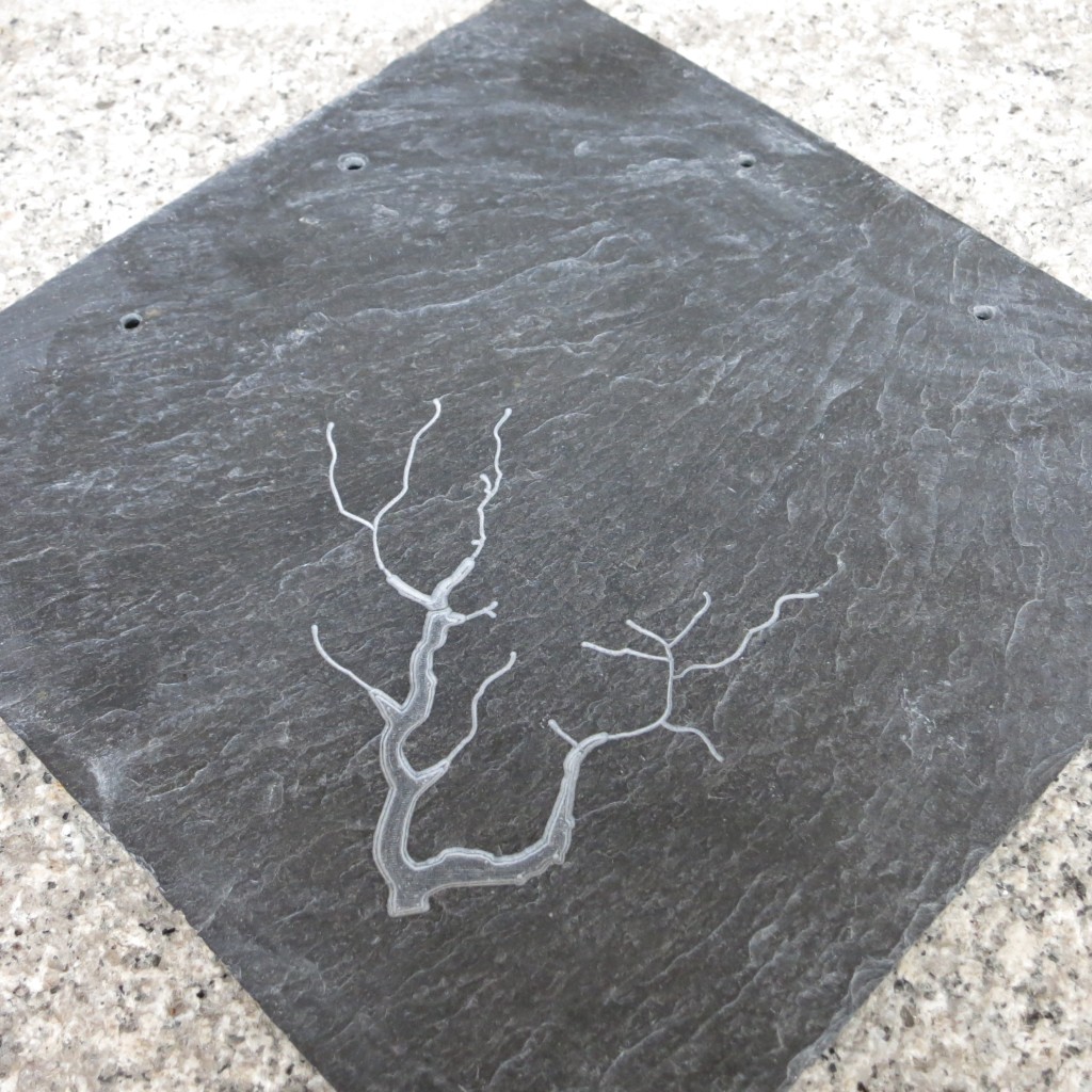
Harald Hartmann wrote a guide on how (automatic translation) to carve a map on a slate. He outlines how to take data from OpenStreetMap and convert it to a format that can be used to program a CNC mill; which then inscribes the slate.
Cepesko opened a very lively discussion on the existence, or not, of a Bavarian Spessart Nature Park. (automatic translation)
Ilya Zverev is once again organising the election for the OSM Awards 2019. He announced that voting has started.
Events
GeoForAll are holding a meeting on Wednesday 28 August 2019 from 18:00 to 19:30 (Bucharest time) at FOSS4G 2019 where ideas for the future will be discussed and planned. The meeting will be similar to the FOSS4G 2018 GeoForAll meeting and aims to bring together colleagues from around the world to plan ideas for expanding open principles in science and education.
Humanitarian OSM
Felix Delattre presented an update on recent work being to improve the HOT Tasking Manager. A user experience survey was carried out in February and March to better understand how users used the software and how users were spending time within the software. Based on the results of the survey HOT plans to better integrate the Tasking Manager with iD in order to improve the experience for mappers and provide user instructions in one tool. This will allow mappers to report back from a task directly from inside the integrated iD editor. Integration also opens the way to dynamically populate the iD editor with tagging presets and specific validation rules depending on the map features that are requested by humanitarian organisations in each of the different projects.
switch2OSM
The Spanish airline Air Europa uses OSM for display on its flights and also informs passengers where the data comes from. ;-). Julio Costa Zambelli adds on Twitter that Flightpath3D is the supplier of in-flight map apps for fifty plus airlines.
Raúl Pérez, from Spain, tweeted that he has achieved integration of the OpenStreetMap basemap with “The Event Calendar” WordPress plugin, and published (translation) a blog on how he did it. So far, no one has given any feedback about this solution and if it works.
Nuno Caldeira complained, in an ironic way, that neither Mapbox nor Facebook follow the attribution rules for OpenStreetMap.
Takayuki Ishino drew attention to a discussion taking place in the Japanese mapping community about proposed changes to the listof data sources suitable for using in OpenStreetMap. The main point at issue is whether we are allowed to use official websites that provide primary information or not. The answer would appear to be a matter of how many items you can copy before a website becomes protected by database rights. (automatic translation)
Programming
Jason Manoloudis gave us an update on the progress made on implementing 3D Traffic sign rendering capabilities for OSM2World, a converter that generates 3D models of the world from OpenStreetMap data. The completion of the traffic sign catalogues task brings a long-desirable feature in OSM2World: being able to define and configure materials solely through the configuration file, without the need for them to exist in Materials.java.
Wikidata, Wikimedia’s project to create a store of structured knowledge, has the potential to improve the calculation of importance scores in Nominatim. For instance, where real-world items have identical names, the ability to differentiate between OSM locations using properties not covered by OSM could help with returning more relevant geocoding results.
tchaddad, who is working on a Google Summer of Code project, gives an introduction to Wikidata and how entries are stored and extracted using the Eiffel Tower as an example. How Wikidata could be used to assist Nominatim is described.
Releases
OsmAnd has released a new version of their OsmAnd Tracker app. The Tracker app allows users to share their location via Telegram. The new version has live track which shows real-time tracks of your contacts on an OsmAnd map.
Did you know …
… the various ref tags on public transport stops? ref typically gets the reference number of the local operator while ref:IFOPT is a (in continental Europe) international unique identifier. If the different platforms (in a bus, tram, metro or train station) have numbers or letters to mark them, this can be tagged as local_ref.
… how to tag how visible a path is on the ground? The tag for this is trail_visibility. This property is independent of the other properties of the path like width, smoothness, surface - a way on a salt lake may be like a paved way, wide, smooth, but also hard to see.
…the LightningMaps? In real time, thunderstorms flash on an OSM-based map.
… the Regional Directorate of the Environment, a service of the Regional Government of the Azores, in Portugal, provides the website On My Island, where all citizens can report environmental occurrences (pollution, abandoned waste, noise, endangered fauna and flora, …). The geolocation of occurrences is carried out using OSM data and with due attribution.
Other “geo” things
Azavea has released an online comparison of the building footprints in the Microsoft Bing dataset with those in OpenStreetMap.
Mapbox is taking the price offensive by offering email support with guaranteed response times for $50 per month. Paul Ramsey comments on Twitter that Mapbox is burning money to increase its market share. There is some more speculation around this topic.
In 1969, two companies opened their doors and began their journey toward developing some of the most effective technologies used today. Intergraph, now Hexagon (but began operations as M&S Computing), and Environmental Systems Research Institute, now Esri, were launched in that year. Directions Magazine has a two-part article by Joe Francica in which he tells us the story of the development of commercial GIS over the periods 1969-1994 and 1994-2019 from his perspective.
Deep and machine learning are becoming more popular in the field of map making. Benjamin Herfort reports on work undertaken to combine crowdsourced data from MapSwipe, with data derived from deep learning applied to satellite imagery and OpenStreetMap data, to delineate human settlement areas. The combined method produced maps that were more accurate than the crowdsourced only version but reduced the volunteer efforts needed by at least 80 percentage points for all study sites.
In March this year at Addis Ababa, Ethiopia, the Australian government joined The Leona M. and Harry B. Helmsley Charitable Trust to announce a funding scheme to establish a Data Cube for Africa reports Space in Africa. The Data Cube, developed by Geoscience Australia, is a cloud-based, open-source platform for processing and analysing earth observations.
The Polish company TatukGIS is now providing their own hosted OSM (world map) web tile server as a free service for use with their software. The map tiles are available as four different styles: standard with native language name labeling, standard with English name labeling, hillshade with native language name labeling, and hillshade with English name labeling.
The German city of Wuppertal’s hanging train, or Schwebebahn, which had been shut down for almost nine months has reopened. With a 24-hour ticket for €7.10 you can once again take an airy flight on the back of a “steely dragon” along the Wupper River.
Upcoming Events
Where
What
When
Country
Stuttgart
Stuttgarter Stammtisch
2019-08-07
San José
Code for San José Summer Mixer [1]
2019-08-08
Cottbus
134. Brandenburg-Berlin Stammtisch
2019-08-09
Fortaleza
15th Birthday in Fortaleza-CE
2019-08-09
Salt Lake City
15th Birthday Salt Lake City Mapping Party
2019-08-10
Taipei
OSM x Wikidata #7
2019-08-12
Bordeaux
Réunion mensuelle
2019-08-12
Salt Lake City
OSM Utah 15th Birthday Drinks
2019-08-13
Zurich
OSM Stammtisch Zurich
2019-08-13
Hamburg
Hamburger Mappertreffen
2019-08-13
Munich
Münchner Stammtisch
2019-08-14
Wuppertal
OSM-Treffen Wuppertaler Stammtisch im Hutmacher 18 Uhr


Leave a reply