Stolpersteine (literally “stumbling blocks”) are small brass-plated cubes laid, around Europe, in front of the last-known residences or workplaces of those who were driven out or murdered by the Nazis. Reclus asked (automatic translation) if the 8700 Stolpersteine with a Wikidata entry are linked to OpenStreetMap.
Hauke Stieler has made (automatic translation) a map of objects tagged shop=yes in Germany. Rendering of shop=yes was dropped in OpenStreetMap Carto v4.22.0.
amilopowers’s proposal to tag the possibility of withdraw cash in a shop or amenity can now be voted on.
Klumbumbus proposestraffic_calming=dynamic_bump for the new type of dynamic traffic calming, whose impact depends on the driver’s speed, and asks for your opinion.
The OSM Operations Team announced that anonymous users will shortly be no longer able to comment on notes. The reasons and more background information can be found in a GitHub issue, which was opened 2 years ago.
Samuel Darkwah Manu, founder of the Kwame Nkrumah University of Science and Technology YouthMappers and a member of the OSM Ghana community, shares his experience participating in the Open Cities Accra project.
For the upcoming 2019 OSMF Board Elections Kate Chapman announced that Mikel Maron will be up for re-election and Frederik Ramm, as well as Kate Chapman, will be stepping down and not be re-running.
Events
The State of the Map is looming. In less than 2 weeks the annual OSM event, with many interesting events, will start in Heidelberg, Germany. The State of the Map will take place from 21st to 23rd September and follows directly after the HOT Summit at the same place.
Lukas and Fabian, from HeiGIT, presented a 90 minute lab about analysing OpenStreetMap data history with the ohsome platform at the FOSS4G 2019 conference in Bucharest. The teaching material and code has been made available as linked snippets in the GIScience HD Gitlab.
Humanitarian OSM
HOT reports about the work on setting up an effective solid waste collection system with Open Source Tools in Dar es Salaam.
Maps
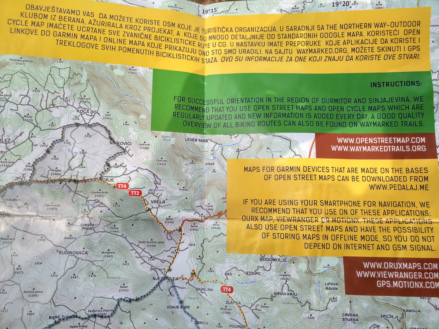
[1] The tourism organisation of the Durmitor National Park in Žabljak, Montenegro, recommends the use of OSM on their mountain bike maps and also on their homepage with the wording “For successful orientation in the region of Durmitor and Sinjajevina, we recommend that you use OpenStreetMap and Open Cycle Maps which are regularly updated and new information is added every day”.
Open Data
The German federal state Saxony has released (automatic translation) aerial images, digital topographic maps, elevation and landscape models, and cadastre data to the public. Unfortunately the new data is licensed with a CC-BY-like licence and, hence, not compatible with our requirements. However, orthophotos and a public map with roads, road names, building footprints and house numbers were already and will continue to be available to OSM mappers.
The CCC is hosting a video, from the Free and Open Source Software for Geospatial (FOSS4G) event in Bucharest, about how to use OSM and Wikidata together with data science tools and Python.
Programming
tchaddad explains, in his user diary, how Wikidata queries using SPARQL and the API work, and how Wikidata could be used to improve Nominatim.
Releases
Paul Norman informed us about an update to Carto, OSM’s main map style. The minor improvements include bug fixes, performance and code cleanup, as well as some optical changes such as retail colour fill on malls, and the rendering of historic=citywalls the same as barrier=city_wall.
Sarah Hoffmann announced a new release of osm2pgsql. The new version (1.0.0) drops support for old-style multipolygons and has received major functionality improvements.
Did you know …
… Matt Mikus answered the question of whether Minnesota has more shoreline than California, Hawaii and Florida, combined. With the help of OSM data he found that the answer is yes if you include rivers and streams in your calculation.
… about the ski resort CopenHill in the Danish capital Copenhagen? It was built, as a globally unique project, on the green roof of a waste incineration plant to give Danes an opportunity to spend their ski holidays in their own country. In OSM it looks like this.
OSM in the media
The Austrian newspaper Der Standardwrotean article about China’s practice of distorting its maps. While Russia ended its efforts to falsify roads, rivers and even city quarters at the end of the 80s, in light of upcoming satellite imagery based maps, China continues its own efforts for unknown reasons. A map law, with 68 paragraphs, requires that only approved maps are allowed to be published, with “correct” borders of course. Only 14 Chinese companies have a licence to produce and publish maps. The distortion is assumed to range between 50 and 700 metres and can be seen when comparing a satellite image on Google maps with the road map layer. The article mentions OSM as an alternative with “controversial legality”.
Other “geo” things
On Day 3 of Pista ng Mapa, Leigh deployed her DJI Phantom 4 to survey the event venue and its surrounding community. Leigh uploaded all of the drone-derived data into OpenAerialMap, including the elevation models. Maning Sambale demonstrates how to use QGIS to extract the heights from the derived DSM/DTM and to use them for visualising building polygons from OpenSteetMap.
The Africa Geospatial Data and Internet Conference 2019 will be held in Accra, Ghana from 22nd to 24th October. The conference aims to bring people together in discussions on public policy issues relating to geospatial and open data, ICTs and the Internet in Africa.
For more than 30 years WGS84 has acted as a “pivot” datum through which one datum can be transformed into another. Michael Giudici explains how, in a world that demands sub-metre accuracy, the WGS84 pivot has outlived its usefulness. The “GDAL Coordinate System Barn Raising” is currently working on improving GDAL, PROJ, and libgeotiff so they can handle time-dependent coordinate reference systems and accurately transform between datums.


Leave a reply