weeklyOSM 610
22/03/2022-28/03/2022
Mapping campaigns
- OSM Ireland’s building mapping campaign reached a significant milestone as reported by Amanda McCann.
Mapping
FasterTracker ponders > the lack of a clear and immediate definition of the use of the
networkkey in the context of the public transport, taking the example of the AML > , the Lisbon metropolitan area.Minh Nguyen blogged about oddities of township boundaries in Ohio (and as both Minh and commenters point out, it is not just Ohio).
muchichka pointed out > that providing information about the movement and deployment of military forces and relevant international aid is forbidden according to a recent amendment of the Ukrainian Criminal Code. The diary post title indicates that in muchichka’s interpretation this extends to any mapping of military facilities.
The following proposals are waiting for your comments:
- Standardising the tagging of
manufacturer:*=*andmodel:*=*of artificial elements. - Introducing
quiet_hours=*to facilitate people looking for autism-friendly opening hours. - Clarifying the diference between
surveillance:type=guardandoffice=security. - Adding loading dock details like
dock:height=*,door:height=*ordoor:width=*.
- Standardising the tagging of
Community
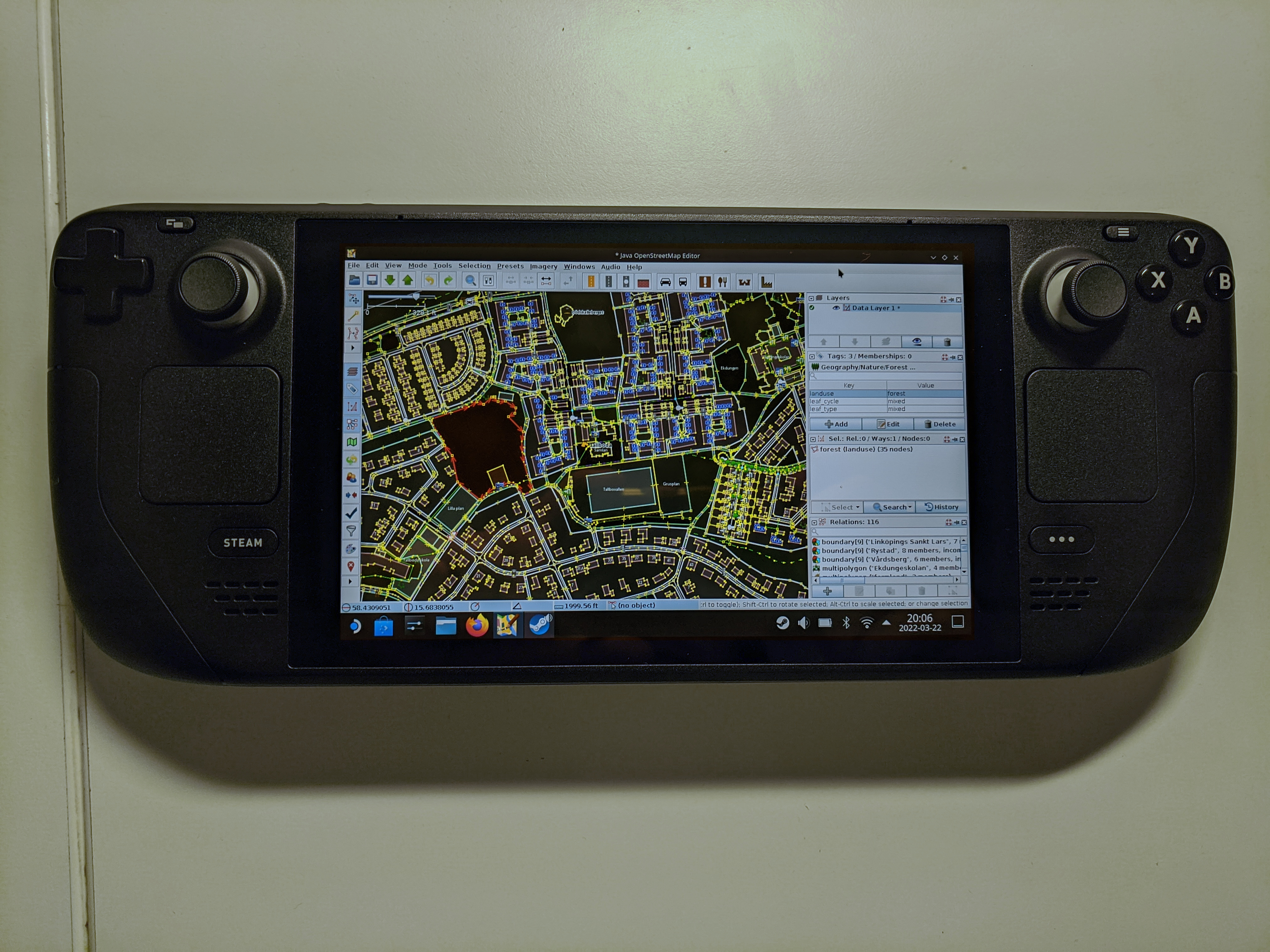
[1] @riiga#7118, on the OSM World Discord, showed JOSM running on their Steam Deck Game Console: ‘No matter the device, no matter the place: mapping first, and with JOSM of course’. Original post (Discord login required.)
Based on the OSM Community Index, Who Maps Where (WMW) allows one to search for a mapper with local knowledge anywhere in the world. If you’re okay with your area of local knowledge being shown on the map, the project’s README on GitHub describes how that works.
qeef shared his view that communication within the HOT Tasking Manager is wrong because it duplicates OSM functionality.

OpenStreetMap Foundation
- Guillaume Rischard noted, on Twitter, a blog post from Fastly about how the OpenStreetMap Operations team is using the Fastly (CDN) to ‘provide updates in near real-time’.
Education
- unen’s latest diary entry continued his reflections on the discussions at his weekly help desk sessions for the HOT Open Mapping Hub Asia-Pacific. He invited people to provide contact details to be informed of future discussion agendas. Issues from recent weeks included accessing older versions of OSM data, and participants’ problems with remote control issues of JOSM.
Maps
- Marcus Marcos Dione was dissatisfied with the appearance of hill shading in areas of Northern Europe. In his blog he explained how this is a result of the way hill shading is calculated using OSGeo tools.
switch2OSM
- PlayzinhoAgro wrote, in his blog, about adding public service points to address gender-based violence in Brazil. Volunteer lawyers and psychologists providing assistance are shown > on a map.
Open Data
- ITDP has published a recording of the webinar ‘Why Open Data Matters for Cycling’, available on the Trufi Association website.
Software
A new version of Organic Maps has been released for iOS and Android. Map data was updated and Wikipedia articles were added. As usual, the release also includes small bugfixes for routing, styles, and translations.
Anthon Khorev has released ‘osm-note-viewer’, an alternative to
https://www.openstreetmap.org/user/username/notes, where one can have an overview of notes related to a user both as a list and on a map.
Releases
- GNU/Linux.ch reported > on the new version of StreetComplete. The intuitive usability, even for OSM newbies, is highlighted.
Did you know …
… the text-based OpenStreetMap editor Level0?
… that actively contributing to OpenStreetMap can qualify you for free map updates in the OsmAnd app? You can find more information in the OSM editing plugin’s settings.
… OSM Smart Menu, the browser extension for Firefox and Google Chrome? The extension can help easily access different maps and a lot of tools to analyse OSM data. One click and you switch to:
and many others, depending on your configuration.
- … how to map turn restrictions, such as no u-turn and no left turn?
Other “geo” things
@Pixel_Dailies (a Twitter account) challenges pixel artists with a new theme everyday. On Monday the theme was bird’s eye view and most of the participants’ entries, which can be found through #BirdsEyeView, feature some kind of aerial map.
Valentin Socha tweeted screen captures from 1993 France weather reports, where weekly forecasts were shown on a cut-out map with a letter for each day.
Upcoming Events
| Where | What | Online | When | Country |
|---|---|---|---|---|
| Tucson | State of the Map US  | 2022-04-01 - 2022-04-03 |  | |
| Burgos | Evento OpenStreetMap Burgos (Spain) 2022  | 2022-04-01 - 2022-04-03 |  | |
| Região Geográfica Imediata de Teófilo Otoni | Mapathona na Cidade Nanuque - MG -Brasil - Edifícios, Estradas, Pontos de Interesses e Área Verde  | 2022-04-02 - 2022-04-03 |  | |
| Bogotá Distrito Capital - Municipio | Notathon en OpenStreetMap - resolvamos notas de Latinoamérica  | 2022-04-02 |  | |
| Ciudad de Guatemala | Segundo mapatón YouthMappers en Guatemala (remoto)  | 2022-04-02 - 2022-04-03 |  | |
| Open Mapping Hub Asia Pacific OSM Help Desk  | 2022-04-04 | |||
| OSMF Engineering Working Group meeting  | 2022-04-04 | |||
| Bologna | Open Data Pax  | 2022-04-04 |  | |
| Stuttgart | Stuttgarter Stammtisch  | 2022-04-05 |  | |
| Greater London | Missing Maps London Mapathon  | 2022-04-05 |  | |
| Berlin | OSM-Verkehrswende #34 (Online)  | ✓ | 2022-04-05 | |
| Open Mapping Hub Asia Pacific OSM Help Desk  | 2022-04-06 | |||
| Tasking Manager Collective Meet Up - Option 1  | 2022-04-06 | |||
| Tasking Manager Collective Meet Up - Option 2  | 2022-04-06 | |||
| Heidelberg | Heidelberg Int’l. Weeks Against Racism: Humanitarian Cartography and OpenStreetMap  | 2022-04-06 | | |
| Berlin | 166. Berlin-Brandenburg OpenStreetMap Stammtisch  | ✓ | 2022-04-08 | |
| OSM Africa April Mapathon: Map Kenya  | 2022-04-09 | |||
| Open Mapping Hub Asia Pacific OSM Help Desk  | 2022-04-11 | |||
| 臺北市 | OpenStreetMap x Wikidata Taipei #39  | 2022-04-11 |  | |
| Washington | MappingDC Mappy Hour  | 2022-04-13 | | |
| San Jose | South Bay Map Night  | ✓ | 2022-04-13 | |
| 20095 | Hamburger Mappertreffen  | 2022-04-12 | | |
| Open Mapping Hub Asia Pacific OSM Help Desk  | 2022-04-13 | |||
| Michigan | Michigan Meetup  | ✓ | 2022-04-14 | |
| OSM Utah Monthly Meetup  | 2022-04-14 | |||
| Open Mapping Hub Asia Pacific OSM Help Desk  | 2022-04-18 | |||
| 150. Treffen des OSM-Stammtisches Bonn  | 2022-04-19 | |||
| City of Nottingham | OSM East Midlands/Nottingham meetup (online)  | ✓ | 2022-04-19 | |
| Lüneburg | Lüneburger Mappertreffen (online)  | 2022-04-19 | | |
| Open Mapping Hub Asia Pacific OSM Help Desk  | 2022-04-20 | |||
| Dublin | Irish Virtual Map and Chat  | ✓ | 2022-04-21 |  |
This weeklyOSM was produced by Lejun, Nordpfeil, PierZen, SK53, Sammyhawkrad, Strubbl, Andrew Davidson, UNGSC_Alessia13, alesarrett, derFred.
We welcome link suggestions for the next issue via this form and look forward to your contributions.
Leave a reply