weeklyOSM 802
27/11/2025-03/12/2025
Mapping campaigns
Mateusz Konieczny is proposing a mechanical edit to fix conflicting
paved=*andsurface=*tags.confusedbuffalo is proposing to extend the existing automated edit of phone numbers to include the United Kingdom, removing extra punctuation and adding the country code. Mappers are invited to discuss this in the OSM Community forum thread and to get in touch if they think such an edit would also be useful and accepted in their country.
Community
Aselnigu has completed all 30 daily themes in the recent #30DayMapChallenge.
Anne-Karoline Distel explained how to map mounting blocks (raised platforms used to help riders mount horses and carriages), arguing that they should be tagged as
amenity=mounting_block.Dzertanoj explained a workflow for contributing high-precision GNSS-RTK tracks obtained from non-WGS84 referenced stations to OpenStreetMap. RTK (Real Time Kinematic) is a centimetre-level positioning method that uses a fixed base station to correct errors in standard Global Navigation Satellite System signals. These base stations operate in coordinate reference systems (CRS) other than the WGS84 system used by OpenStreetMap. This workflow converts that CRS while preserving the additional metadata, ensuring the resulting track data remains precise and reliable.
Koreller explained the process they used in mapping Cho Island.
Martijn Van Exel outlined the intricate challenges involved in classifying points of interest within OpenStreetMap data.
Andy Townsend has been using taginfo to find things that may be missing from the high zoom levels on his map style.
Imports
- Mateusz Konieczny is proposing a global import of website tags for IKEA, using data produced by the All the Places web scrapers.
OpenStreetMap Foundation
- The OpenStreetMap Ops Team has a special offer for AI companies: for a modest donation to the OpenStreetMap project, the donor company will receive a direct download link to OSM data in a machine-friendly format.
OSM research
- HeiGIT is introducing ohsomeDB, the successor to the OpenStreetMap History Database, which offers a faster, more flexible foundation for analysing OpenStreetMap data. The current ohsome API is planned to be shut down after the State of the Map 2026, and your old queries and scripts will stop working by August 2026 at the latest, giving you sufficient time to adapt your workflows.
Maps
- OSM Pyrénées-Orientales (France) tooted about the uMap created by LySioS, which provides an overview of the names of roundabouts located in the Pyrénées-Orientales region, extracted from OpenStreetMap. The data can be obtained in CSV format.
OSM in action
- Mapping Diversity is a project coordinated by OBC Transeuropa for the European Data Journalism Network. It analyses the street names in 32 major European cities and compares how many are named to honour men or women, and visualises them on a map. This is accomplished by utilising the Wikidata identifier found on streets within OpenStreetMap.
Open Data
- Xiao Xiang Zhu et al have developed GlobalBuildingAtlas, a publicly accessible dataset providing global coverage of building footprints, heights, and LOD1 (low-detail) 3D building models. The dataset is derived from PlanetScope satellite data, using regularisation networks trained on manually filtered OpenStreetMap annotations.
Software
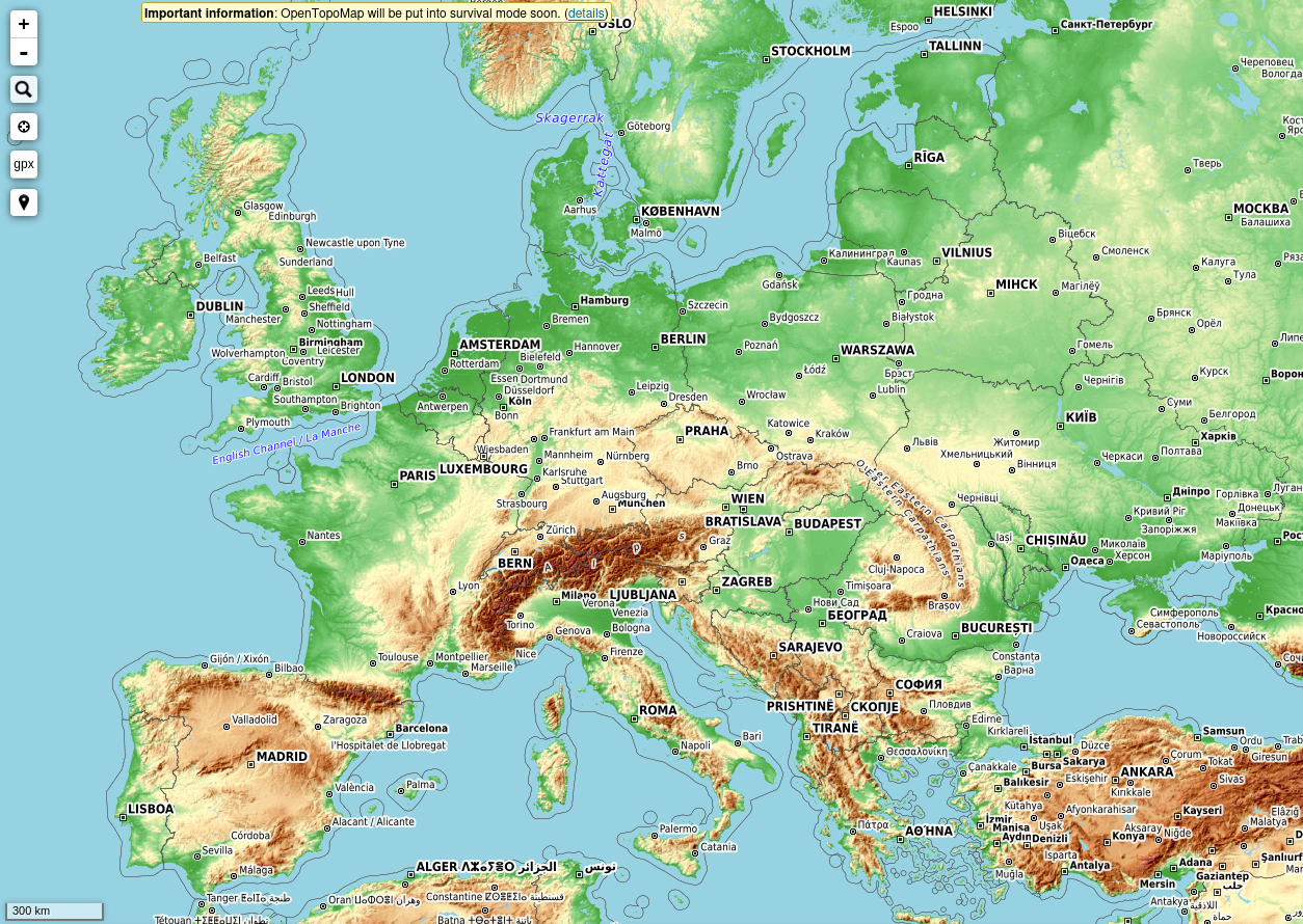
[1] After 14 years of service, the OpenTopoMap developers have decided to discontinue the project shortly. There are intentions to create vector tiles, but there is no timeline. If you would like to support the project, the team invites you to get in touch.
Julcnx has updated their browser extension that enables Strava Heatmap data to be viewed directly within iD.
Programming
Martijn van Exel outlined the extract-transform-load workflow for OpenStreetMap data, demonstrating the use of osm2pgsql and osmium to process and manage the dataset.
GanderPL has experimented with an AI chatbot to speed up object tagging and better match tags to their purposes. His key tool is an MCP server, providing OpenStreetMap tagging schema for AI assistants. It enables tag validation, value querying, preset searching, and improvement suggestions. Initially the AI produced hallucinations and mismatched tags, but after converting the id-tagging-schema into a dedicated MCP tool, errors dropped significantly, though GanderPL is continuing to refine the process.
Did you know that …
… there is a Mastodon bot that toots the recent changes made using MapComplete? It includes beautiful photos about a variety of themes.
… SPOT is an AI-assisted geolocation service developed by Deutsche Welle Innovation? It works with natural language prompts and OSM data, requires no coding skills, and builds on the precision of overpass turbo.
Other “geo” things
Daniel DiDonato, 18, used free mapping software at home to redraw Alabama’s voting districts, and a federal judge later adopted his proposal to correct voting-rights violations, making it the map now in effect under state law.
rtnF explained how to access recent Sentinel satellite imagery to examine the effects of Cyclone Senyar, which caused catastrophic flooding and landslides across Indonesia in late November 2025. At least 867 deaths, more than 2,600 injuries, and 521 missing persons were reported in the provinces of North Sumatra, West Sumatra, and Aceh.
Jonathan Kemper, of Photographix Magazine, reported ► that the Copernicus Sentinel-1D satellite successfully delivered its first high-resolution radar images just 50 hours after launch. The satellite’s radar system is capable of mapping the Earth’s surface under any weather or lighting conditions. Sentinel-1D enters service as the replacement for Sentinel-1A, which has operated in orbit for nearly eleven years.
James Killick, of Map Happenings, highlighted Bee Maps, a company that has developed a dash-mounted AI camera called the ‘Bee’ for collecting map data. The unit combines a primary camera, stereo depth sensors, high-precision GNSS and integrated LTE for real-time data uploads. The company offers access to the device through subscriptions beginning at US$19 per month, while drivers can earn cryptocurrency by collecting mapping data on the road.
Upcoming Events
| Country | Where | Venue | What | When |
|---|---|---|---|---|
UN Mappers #ValidationFriday Mappy Hour  | 2025-12-05 | |||
 | Olomouc | SotM CZ+SK 2025 | 2025-12-05 | |
 | 大阪市 | 大阪大学中之島センター | State of the Map Japan 2025 | 2025-12-06 |
 | Paris | Carrefour Numérique² de la Cité des Sciences | PSL XXL | 2025-12-06 - 2025-12-07 |
 | Biella | Sala Riunioni 2, CTV Centro Territoriale per il Vo | Incontro dei mapper di Biellese, Vercellese e Canavese | 2025-12-06 |
 | Braunschweig | Stratum0 | Braunschweiger Mappertreffen im Stratum0 Hackerspace | 2025-12-06 |
| Kiel | Toppoint e.V. | Kieler Radinfrastruktur mappen | 2025-12-07 |
 | नई दिल्ली | Jitsi Meet (online) | OSM India - Monthly Online Mapathon | 2025-12-07 |
| Missing Maps : Mapathon en ligne - CartONG [fr] | 2025-12-08 | |||
| Grenoble | La Turbine | Atelier de décembre 2025 du groupe local de Grenoble | 2025-12-08 |
 | 臺北市 | MozSpace Taipei | OpenStreetMap x Wikidata Taipei #83 | 2025-12-08 |
 | Salt Lake City | Woodbine Food Hall | OSM Utah Monthly Map Night | 2025-12-09 |
| Hamburg | Voraussichtlich: “Variable”, Karolinenstraße 23 | Hamburger Mappertreffen | 2025-12-09 |
| iD Community Chat | 2025-12-10 | |||
 | Amsterdam | TomTom Amsterdam | Missing Maps/Maptime Amsterdam In-Person Mapathon | 2025-12-10 |
 | Žilina | GLOBESY s.r.o. | Missing Maps mapathon Žilina #20 | 2025-12-11 |
| München | WikiMUC | Münchner OSM-Treffen | 2025-12-11 |
| Online | OpenStreetMap Midwest Meetup | 2025-12-11 | |
 | Zürich | Bitwäscherei Zürich | 182. OSM-Stammtisch Zürich | 2025-12-12 |
 | Zaragoza | Etopia | GeoCamp - State of the Map España 2025 | 2025-12-13 |
 | MAP Mercator museum | OpenStreetMap Belgium at the MAP-Mercator museum | 2025-12-13 | |
| Jalpaiguri | Thana More | 10th OpenStreetMap West Bengal Mapping Party | 2025-12-13 |
 | København | Cafe Bevar’s | OSMmapperCPH | 2025-12-14 |
| Missing Maps London: (Online) Mid-Month Mapathon [eng] | 2025-12-16 | |||
| Lyon | Tubà | Réunion du groupe local de Lyon | 2025-12-16 |
| Bonn | Dotty’s | 195. OSM-Stammtisch Bonn | 2025-12-16 |
 | City of Westminster | Monkey Puzzle pub | London xmas pub meet-up | 2025-12-16 |
| Online | Lüneburger Mappertreffen | 2025-12-16 | |
| Düsseldorf | Online bei https://meet.jit.si/OSM-DUS-2025 | Düsseldorfer OpenStreetMap-Treffen (online) | 2025-12-17 |
| Karlsruhe | Chiang Mai | Stammtisch Karlsruhe | 2025-12-17 |
 | Stainach-Pürgg | Online | 19. Österreichischer OSM-Stammtisch (online) | 2025-12-18 |
| UN Mappers Mappy Hour | 2025-12-19 | |||
| Potsdam | Luisenplatz, Potsdamer Weihnachtsmarkt | Potsdamer Mappertreffen | 2025-12-19 |
| MAP Mercator museum | OpenStreetMap Belgium at the MAP-Mercator museum | 2025-12-20 | |
| Missing Maps : Mapathon en ligne - CartONG [fr] | 2025-12-22 |
This weeklyOSM was produced by MarcoR, MatthiasMatthias, PierZen, Raquel IVIDES DATA, Andrew Davidson, barefootstache, derFred, jcr83.
We welcome link suggestions for the next issue via this form and look forward to your contributions.
Leave a reply