01/11/2022-07/11/2022
Mastodon-Server on a uMap [1] | © JazMichaelKing | map data © OpenStreetMap contributors
Mapping campaigns
- At the request of OpenStreetMap Ireland, Włodzimierz Bartczak blogged about the lessons learnt from collecting AED data in Poland.
Mapping
- rtnf shared
 a tutorial on how to display OSM data as a Wikipedia interactive map by using Kartographer > , a Mediawiki extension to display GeoJSON-based interactive maps.
 - OSM contributor Graptemys blogged on his process of revising restaurant cuisine tags in Canada using JOSM.
- historic_bruno wrote about how his bridge tagging method has progressed over time and suggested some helpful links.
- A request has been made for comments on
amenity=street_vendor, a proposal to deprecatestreet_vendor=*and to tag mappable street vendors withamenity=street_vendor,vending=*andopening_hours=*instead. - Voting is underway for the following proposals:
- Voting on the following proposals has closed :
castle_type=citadel, a tag for historic fortifications inside cities that served as defensive cores, was approved with 10 votes for, 1 vote against and 1 abstention.amenity=mailroom, a tag to identify the location of shared mail rooms, receiving packages or letters, at a university, an apartment building complex, or in an office building complex, was approved with 15 votes for, 1 vote against and 0 abstentions.
 a tutorial on how to display OSM data as a Wikipedia interactive map by using
  >
> 
Community
- Jochen Topf shared his progress on the osm2pgsql cartographic generalisation project.
- OSM Belgium has named Patricia Solis as their Mapper of the Month.
- Following Elon Musk’s purchase of Twitter, many have switched to the alternative and FOSS protocol named Mastodon. Amanda McCann has been hosting a Mastodon-instance for quite a while (en.osm.town) where many contributors and official accounts live, such as OpenStreetMap, State of the Map, JOSM, MapComplete, MapRoulette, Osmose QA, Open Inframap and many regional accounts such as LATAM, BE, Guyane, Swiss, Pyrénées-Orientales, Catala, Berlin+Brandenburg, Missing Maps Slovakia,OSMChina and weeklyOSM as well.
- Amanda McCann is running the very successful OSM ‘home base’ (tech speak: instance) of the Twitter alternative Mastodon. She is looking for a logo for the Mastodon instance.
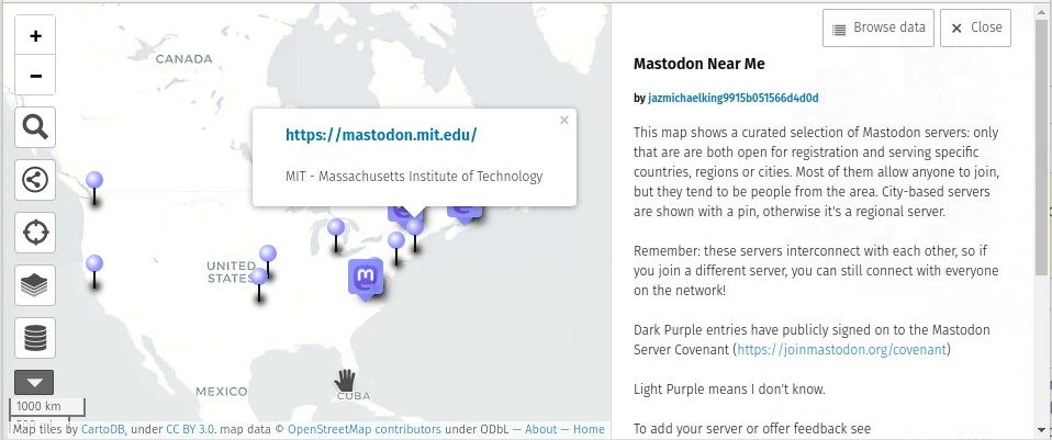
- [1] JazMichaelKing is maintaining ‘Mastodon Near Me’, a directory of Mastodon and Pleroma instances aimed at regional users.
Events
- The 30-Day Map Challenge has been running since 1 November. Topi Tyukanov opened the challenge on Day 1 with wind farms. Unfortunately, we can only present a few examples. A bot from Topi Tjukanov retweets every post marked with the hashtag ‘#30DayMapChallenge’.
- Day 1: Points
| samia @samiasab90 * Languages of London | @gontsa * Destroyed cultural heritage of Ukraine | にゃんこそばデータ可視化 @ShinagawaJP * Railwaystations in Japan 1872–2022 |
- Day 2: Lines
| Abdoul Madjid @issa_madjid * Every African airport connected to
its 10 nearest neighbors | Eric Armijo @rcrmj * Rios en Bolivia | @nordaufnordost * Flights to Madagascar |- Day 3: Polygons
| Marcel Reinmuth @GIScienceHD * isochrones (2h) by openrouteservice | D&G Place-Names
@dgplacenames * Buildings in Dumfries | Nicolas Lambert @neocartocnrs * Countries and People in Africa |- Day 4: Colour Friday: Green
| Xemartin Laborde @XemartinLaborde * green canopy global map | Stan McShinsky @smcshinsky * world moss map | ᴘᴏᴋᴀᴛᴇᴏ ᴍᴀᴘs @pokateo_ * Greenland in ten different projections |
- Day 5: Ukraine
| Keith Jenkins @kgjenkins * Outgoing shipments under the Black Sea Initiative | Daniel B. @DOh_Bams * Super sleek street map of Kiev (Kyiv) | gontsa @gontsa * Forests of Ukraine |
- Day 6: Network
| Julian Hoffmann @Julian_H0ffmann * Global Submarine Cable Network | Wendy Shijia @ShijiaWendy * Shanghai Metro | Cécile @CecileMatusiak * Travel to work |
- Day 7: Raster
| Boris Mericskay @BorisMericskay *
cuisine=crepeen France | D&G Place-Names
@dgplacenames * NX96 100 Piece 3D Puzzle | Urban Analytics Lab @urbanalyticslab * Global Building Morphology Indicators | - The State of the Map Nigeria will take place from 1 to 3 December in Port-Harcourt, Nigeria.
- The Trufi Association hosted a webinar ‘Digitalising Informal Transport in the Global South’ as part of the UN Habitat’s ‘Urban October’.
Education
- Martijn van Exel demonstrated in a tutorial how to tag
parking=surfaceefficiently using MapRoulette.
OSM research
- On this week’s episode of Geomob Podcast Ed chats with Tobias Jordans about a parking data project in Berlin. It’s something you may not have considered, but data about parking spaces and their use can have a big impact on urban dynamics. Tobias explains how city planners, NGOs, and politicians pushing for positive changes can all benefit from accurate parking data. Using OpenStreetMap, Tobias and his colleagues are making it easier to record, retrieve, and update information about parking spaces in Berlin. Listen in to find out about the challenges, learnings, and how you can bring this project to your city.
- ‘Digital civic engagement, open data, and the informal sector: a think piece’, a journal paper authored by Marc Hasselwander, Mwendwa Kiko, and Ted Johnson, has been published in Transportation Research Interdisciplinary Perspectives.
switch2OSM
- The Office for National Statistics, the UK’s largest independent producer of official statistics, has published a map showing ‘migration movements’ on an OSM derived base layer.
- TomTom announced its new mapping platform and ecosystem called the TomTom Maps Platform. The new map will be a pool of different databases, including OpenStreetMap, in order to become ‘the smartest map on the planet’. Public release is expected by mid-2023. A discussion on the
OSM Community forum has already started.
Software
- Baremaps is a toolkit for creating custom vector tiles from OpenStreetMap and other data sources using Postgis and Java. The development takes place on GitHub.
- Francisco Rodríguez-Sánchez and Jesús Sánchez-Dávila have published CityShadeMapper, an R package to create shade maps from OpenStreetMap and LiDAR data. A demo is available for Sevilla.
- Stamen has begun work on improving MapLibre Native, an Open Source SDK for rendering maps, with funding from AWS.
Programming
- Gustavo Soares has presented his ‘redesign project’ for the OSM website. The comments on GitHub issue are worth reading.
- Timothée Giraud has released version 4.0 of the osrm R package. This major release resulted from improvements to the Open Source Routing Machine API.
- Sarah Heidekorn reported that the oshdb (OpenStreetMap Historic Data Analysis) now contains more than 10 billion objects.
Releases
- MapTiler Server 4.2 now has many improvements to give you more control over your maps.
- Roland Olbricht released Overpass API 0.7.59.1 to correct a performance regression in 0.7.59 on systems that are disk bound.
- Brandon Liu outlined what’s new in PMTiles version 3.
Did you know …
- … that Natural Earth data doesn’t quite have the correct boundary for Ukraine? The participants of the #30DayMapChallenge faced difficulties on Day 5, Ukraine, because the Natural Earth dataset lacks complete data about the Ukrainian borders.
- … there may have been another ‘TerribleMaps’ competition on Twitter alongside the 30DayMapChallenge? 1, 2, 3.
- … Martijn van Exel is sharing his daily OSM tips? The tips will be pretty random; some technical, some community related, and some highlighting interesting OSM uses.
Other “geo” things
- Vox has published a video with a brief overview of how hiking trails are designed and what designers take into account when designing a trail.
- Following the recent changes at Twitter, numerous people, including geographers, have moved to a Mastodon instance, which is part of the Fediverse. Rob Kitchin from The Programmable City started a curated list of Mastodon geographers’ accounts before eventually making it into a blog post. As a remainder, even if moving instances is a breeze on Mastodon, please follow the etiquette and try to sign up for other instances apart from the main one, being mastodon.social, such as en.osm.town administered by @amapanda.
- The Chartered Institution of Civil Engineering Surveyors spoke with the Maxar News Bureau on how satellite imagery combats misinformation and increases global transparency, as well as warning of a potential food crisis as a result of the war in Ukraine.
Upcoming Events
| Where | What | Online | When | Country |
|---|---|---|---|---|
| OSM Indoor Meeting | 2022-11-14 | |||
| Lyon | Rencontre mensuelle Lyon | 2022-11-15 |  | |
| 157. Treffen des OSM-Stammtisches Bonn | 2022-11-15 | |||
| City of Edinburgh | OSM Edinburgh Social | 2022-11-15 |  | |
| Lüneburg | Lüneburger Mappertreffen (online) | 2022-11-15 |  | |
| Fort Collins | CSU GIS Days Humanitarian Mapathon | 2022-11-17 |  | |
| Greeley | UNC GIS DAY MAPATHON | 2022-11-17 | | |
| Roma | Incontro dei mappatori romani e laziali – novembre 2022 | 2022-11-16 |  | |
| Zürich | Missing Maps Zürich November Mapathon | 2022-11-16 |  | |
| Berlin | Missing Maps – DRK & MSF Online Mapathon | 2022-11-16 | | |
| Karlsruhe | Stammtisch Karlsruhe | 2022-11-16 | | |
| Ville de Bruxelles – Stad Brussel | FOSS4G & State of the Map Belgium | 2022-11-17 |  | |
| Daerah Khusus Ibukota Jakarta | OSMGeoWeek Indonesia 2022 | 2022-11-17 |  | |
| Letterkenny Municipal District | Online Map & Chat: Manor, Co Donegal, Ireland | 2022-11-17 |  | |
| Zürich | 10 Jahre SOSM mit Fondue-Abend | 2022-11-17 | | |
| Bahi | Improve the map of Tanzania with tomtom and MapRoulette | ✓ | 2022-11-18 |  |
| Grenoble | Atelier positionnement GNSS temps réel | 2022-11-21 | | |
| OSMF Engineering Working Group meeting | 2022-11-21 | |||
| 서울 | Let’s map Korea(렛츠맵코리아) | 2022-11-22 | kr | |
| Barcelona | Geomob Barcelona | 2022-11-22 |  | |
| San Jose | South Bay Map Night | ✓ | 2022-11-23 | |
| City of Nottingham | OSM East Midlands/Nottingham meetup (online) | ✓ | 2022-11-22 | |
| Gent | Meetup @ TomTom Gent | 2022-11-23 | | |
| [Online] OpenStreetMap Foundation board of Directors – public videomeeting | 2022-11-25 | |||
| 福岡市 | 「Mapping Hour」 in OSC2022 Online Fukuoka | 2022-11-26 |  | |
| 京都市 | 京都!街歩き!マッピングパーティ:第33回 佛光寺 | 2022-11-27 | | |
| Bremen | Bremer Mappertreffen (Online) | 2022-11-28 | | |
| Düsseldorf | Düsseldorfer OpenStreetMap-Treffen | ✓ | 2022-11-30 | |
| Cojata | Reunatón Latam | 2022-12-03 |  | |
| 加古川市 | State of the Map Japan 2022 in Kakogawa | 2022-12-03 | | |
| 京都市 | 京都!街歩き!マッピングパーティ:第34回 渉成園 | 2022-12-04 | |
Note:
If you like to see your event here, please put it into the OSM calendar. Only data which is there, will appear in weeklyOSM.
This weeklyOSM was produced by Lejun, LuxuryCoop, PierZen, Strubbl, Ted Johnson, TheSwavu, TrickyFoxy, YoViajo, andygol, derFred, richter_fn, rtnf, 冰觞沐雨.
We welcome link suggestions for the next issue via this form and look forward to your contributions.
> \”because the Natural Earth dataset lacks complete data about the Ukrainian borders.\”
update: https://twitter.com/pokateo_/status/1589327504640442369
IMHO: complicated ..
Multiple worldviews supported: including Ukraine, Russia, United States …
\”Natural Earth includes support for defacto and alternate points of view (aka worldview) with different admin-0 fclass_* properties (like fclass_iso). The QGIS project includes a data driven toggle for adjusting the point-of-view for country, map units, state and provinces, and disputed boundaries (since version 5).\”
see more: https://github.com/nvkelso/natural-earth-vector/blob/master/packages/Natural_Earth_quick_start/LOCALIZATION.md
disclaimer: I am a \”Natural Earth\” contributor, helping with the wikidata issues.