OSMkilawiki 852
We are looking for volunteers to help us translate! Please get in touch with us: info@weeklyOSM.eu
12/11/2026-18/11/2026
Mapping
Voting has started on the crossing cleanup and deprecation proposal and is open until 2 December 2026. The proposal aims to formally approve
crossing:signals=*and deprecate most uses ofcrossing=*in favour of separate tags for crossing signals and markings. The valuescrossing=noandcrossing=informalwould remain in use.Baprischka has proposed a new tag,
tomb=loculi, for walls fitted with burial niches (loculi), which are particularly common in Italian cemeteries. The tag should only be used on lines, with the niches situated to the right of the line’s direction. So far, only`tomb=columbarium`exists for buildings with niches inside; alternatively, this tag could also be used on lines. The community has been discussing the proposal on the OSM Community forum since 12 November.
pavvv is reviving the proposal, originally put forward by riiga, to approve crossing:signals=* and to classify crossing=* (except crossing=no) as deprecated. He argues that deprecation does not prohibit anything, but encourages editors and validators to switch to crossing:markings=* and crossing:signals=*. Peter Elderson considers this counterproductive, as crossing=* continues to convey a great deal of information. It also remains unclear how related keys such as traffic_signals:sound=* should be handled.
Community
- Sarah Hoffmann suggested that shutting down all critical OpenStreetMap-related infrastructure, including Overpass, Nominatim, Photon, tile servers, OSRM, Valhalla, Waymarked Trails, the OSM API, Geofabrik, and OSM-FR extracts, may be required to force the general public to discuss the sustainability of these freely available services. This concern is particularly relevant in an era when AI scrapers, autonomous AI agents, and AI-generated applications are increasingly placing excessive demands on the infrastructure and the humans who maintain it.
Another OSM contributor noted a second dimension, the need to safeguard downloads for OSM edits asking where developers suggest contributors could have a ‘well-trailled holiday’. The conversation moved to various solutions to reduce the stress on servers and mitigate downloads problems for OSM contributors:
- use OSM accounts for authentication and authorisation to query servers
- download Planet OSM extracts and query locally with adapted tools.
Some Brazilian mappers are noticing an increase in the number of incorrect edits to important features on OSM, such as administrative boundaries, waterways, and the locations of high-voltage power poles, which end up disrupting the operation of routers, other programs that use data on the power grid, and countless apps that use the OSM base map and administrative boundary data, etc. It is being reported that most of the edits are made by inexperienced users and that there is some difficulty communicating with the organisers of these edits in local mapping groups, many of whom are college students. The creation of a subcategory on the OSM Community forum is being proposed to try to resolve this situation and guarantee data quality.
Jochen Topf asked on the OSM Community forum whether he, as maintainer of Taginfo, should remove the ‘Projects’ feature. Software projects can be listed there if they use a certain tag. Recently the number of apps that want to be listed has increased. He suspects that the tag lists and requests to be listed are created by machines without any human understanding of what is being done.
Harry Wood reported on the London OSM meetup at The Volunteer pub, where participants discussed benches and OpenBenches, among other topics. The group also discussed how AI scrapers are putting strain on OSM infrastructure and why uMap users with OSM accounts are often mistakenly blocked as spammers. The next meetup will take place on 9 December at the Monkey Puzzle pub in Paddington.
OpenStreetMap Foundation
- The OpenStreetMap Foundation announced that the State of the Map 2027 will take place from 2 to 4 July 2027 in Bogotá, Colombia. It is the first time that the global event will be held in South America. The local team, led by AC3, which represents the OSM Chapter in Colombia, is preparing the conference; details about the schedule and tickets will follow. You are invited to submit a proposal for the event’s logo. It should reflect OpenStreetMap, the virtual conference and Bogotá’s culture, be released under the CC BY-SA 4.0 open licence, and be submitted by email to the SotM Working Group by 13 December 2026.
OSM research
Facilo, a Spanish web studio, used OpenStreetMap data to identify 1713 websites belonging to bars, restaurants and cafés across Andalusia, Spain, and measured 1537 of them in November 2026. The study found ► that 17.6% of websites no longer work, only 22.7% display menus with prices as text, and 51.1% lack a tappable phone number. The report includes results by province, methodology and margin of error, alongside a per-province CSV released under ODbL.
Ruben Lopez Mendoza has trained a machine learning model to classify open OSM notes by issue type, such as missing places, incorrect roads, or spam, and display them on a map. The model only classifies notes; mappers decide how to handle them.
Socionet, a Czech web studio, has analysed Czech businesses with a
websitetag in OpenStreetMap using Geofabrik extracts. The summary CSV is available under CC BY 4.0, with OpenStreetMap contributors credited under ODbL. Socionet also published a second study examining website security and cookie practices using a similar sample.Get a List Of has analysed the completeness of OpenStreetMap’s local business records in 11 countries by examining the website, phone and
opening_hourstags across 465,929 named businesses in 84 cities.
Maps
Demianov DM has created Mapiko, a social mapping platform that allows users to collaboratively add pins to a shared map of Ukraine, built partly from OpenStreetMap data (pharmacies, hospitals, clinics and more).
Alp Yenigün has made Slopie, a free 3D map covering more than 4000 ski resorts across 69 countries. Using OpenStreetMap piste and aerialway data from OpenSkiMap, it displays ski runs in their respective difficulty colours over 3D terrain. Slopie is available in any web browser and as an iOS app.
13ug1mb has fashioned Tiny València, an isometric pixel-art map of València. The building data comes from the Dirección General del Catastro, while the roads, boundaries, coastline, and metro lines come from OpenStreetMap.
OSM in action
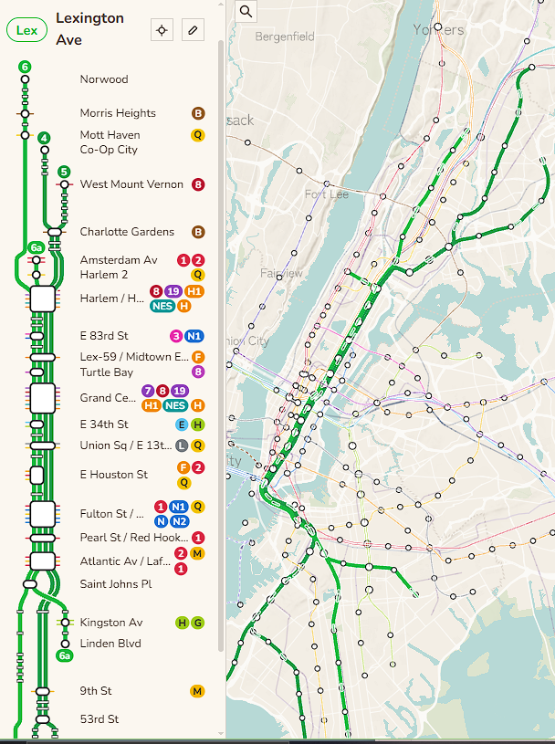
[1] Anita Chen wrote Trainsworld, a free browser game that lets players build train networks around the world using OpenStreetMap data.
Jens Rohde has put together dokumap.de, a web map that visualises around 3500 travel documentaries from public media libraries (such as ARD, ZDF, 3sat and arte) on an OpenStreetMap basemap. Users can select a location, choose a documentary and follow a link to the corresponding media library. For around 300 documentaries, individual stops are extracted from subtitles and displayed with their corresponding timestamps in the film.
Mariusz Fituła developed Etapano, a free web service that creates one-, two-, or three-day sightseeing itineraries across more than 70 European cities using OpenStreetMap data. It ranks attractions by the number of Wikipedia language editions linked through
wikidata=*, calculates walking routes using a self-hosted Valhalla instance, and usesopening_hoursto avoid including closed places.Tatsuya Yamamoto has constructed Onsen Wellness Journal, a web dashboard that displays information about Japanese hot springs (onsen), including their source names, spring types, temperatures, mineral compositions, and bathing and drinking indications, in accordance with Article 18 of the Hot Springs Act (Act No 125 of 1948). The dashboard imported around 5700 of its approximately 6700 hot springs, public baths, and onsen inns from OpenStreetMap, using
natural=hot_spring,amenity=public_bath, andtourism=hotelwith ‘温泉’ (hot spring) in the name. It also includes multilingualname:*tags and displays the locations on a map, with visual breakdowns of water chemistry for places with official onsen analysis reports.Mike Hurenkamp has released version 1.0 of Wandering Around, a free browser game that lets players explore towns worldwide using OpenStreetMap data. This update adds churches based on their actual outlines, mosques and cemeteries, street-network-based walking, railway routes extracted from Geofabrik data for faster worldwide train travel, and Wikipedia articles displayed in the local language using Wikidata tags.
Enfilade is an independent, ad-free museum guide: 202 museums in 22 cities, in four languages. Its maps run on tiles built from OpenStreetMap data and served from the guide’s own server (a Protomaps build, shown with Leaflet). Every museum point can be downloaded as KML, GeoJSON, or GPX, for one city or for the whole catalogue. Enfilade is published by a group of compilers. Michael Grinzaid is responsible for the catalogue.
Katsuyuki Sakanoshita created EXPO2025 Maniacs Map, a web map that displays the Expo 2025 venue using OpenStreetMap data. Following the Expo’s conclusion, the map will serve as an archive. In addition to venues and facilities, the project added data on roads, footpaths, water areas, and forests on Yumeshima, the artificial island in Osaka Bay where the Expo was held.
Software
osmuser63783 has presented their Bypass Web, an experimental alternative to Overpass Turbo, in which Overpass QL queries are executed entirely within the browser. To do this OSM data for a selected map section is downloaded from Open Planet Data and stored locally. Such data is useful for analysis but lacks the metadata necessary for OSM edits.
Kaveh Khoshkhah has made duckOSM Studio, a web tool that converts OpenStreetMap data into a routable road network for traffic simulation.
In the 314th episode of Freakshow, Tim Pritlove explained how Kugelblitz, a macOS app that displays OpenStreetMap data in 3D, works (starting at 1:36:02 timestamp) and discusses plans to eventually turn it into an OSM editor.
Blue Elk Soft has developed Lunar Frame, a web tool that helps photographers and drone operators plan shots of the Moon and Sun relative to a chosen subject or location. It shows the rising and setting directions of celestial bodies over the target and identifies terrain strips from which such shots may be possible.
Wolfram Schneider has released mapillary-takeout-v4, a Python script for backing up your own Mapillary images at full resolution, with GNSS and EXIF metadata restored. It uses the Mapillary API v4 and replaces the old
mapillary_takeout, which stopped working after the retirement of API v3. Incremental backups skip already downloaded images, making the script suitable for automated weekly cron jobs. Interrupted downloads can be resumed, while--max-sizeand--max-timeallow large backups to be split across multiple runs. Listing one million images takes approximately 1.5 to 5 minutes. Note that Mapillary images are privacy-blurred and re-compressed, not original camera files.mcliquid has developed SCEE-mc, a fork of StreetComplete Expert Edition that adds cycling quests, additional overlays, traffic signs, map layers, and more. The latest release, v64.1-mc.2, introduced tree genus, cycleway marking colours, international traffic signs, improved side path mapping, and more reliable uploads.
Erick de Oliveira Leal described how to integrate free Sentinel-2 satellite imagery, in false-colour mode, into JOSM through the Copernicus Data Space Ecosystem. The false-colour imagery makes paved roads in rural areas clearly visible, with a resolution of 10 m. However, it is not suitable for mapping buildings or narrow urban streets.
Blue Elk Soft has built Shadow Planner, an Android app that visualises building and terrain shadows on a 3D map for any selected date and time. The app uses OpenStreetMap building footprints, height data and roof information, where available, to simulate how buildings cast shadows throughout the day.
Terento is a free, open-source Mac app that installs OpenStreetMap-based maps, such as OpenTopoMap, Freizeitkarte, and MapRando, on Garmin watches and Edge bike computers. macOS does not show these devices as a drive, which has made putting OSM maps on them awkward for Mac users. Terento downloads the map, checks free space, and leaves Garmin’s own maps untouched. It is available on the Mac App Store and as a DMG on GitHub.
Releases
HeiGIT presented an updated version of their ohsome Country Quality Report, which assesses OpenStreetMap data quality in 27 countries across five topics: buildings, roads, schools, hospitals, and land cover. The dashboard now includes new indicators, interactive maps and charts, and more detailed checks for attribute completeness. The results are also available as open data on the Humanitarian Data Exchange.
The Organic Maps team has released an update with 3D terrain, ocean depths, and contour lines, using OpenStreetMap data as of 10 November 2026. The release also added importing of KML, KMZ, and GeoJSON areas, a button to reverse routes with all stops, and a redesigned speed display on Android.
Did you know that …
… the HOT Tasking Manager originated during a HOT project in Indonesia to map buildings? The initial idea for ‘OSM Tasking Manager’ had already been discussed during the earlier response to the 2010 Haiti earthquake, but the project formally began as part of the HOT Indonesia project, funded by the Australia-Indonesia Facility for Disaster Reduction. The software was initially developed as a paid project, but the developer, Pierre Giraud, enjoyed working on it so much that he continued maintaining and developing it even after HOT stopped paying him.
… Mapillary has updated their list of supported cameras? This list can help you decide which device best suits your needs, even if you use other street-level imagery platforms.
Other “geo” things
The Global AI Observatory maintains a web map showing how 61 governments are bringing artificial intelligence into schools and universities, and which nations are building AI models of their own.
Reuters reported that South Korea will soon lift its two-decade restriction on exporting high-precision map data to overseas servers, allowing Google Maps to work properly in the country. The approval comes with strict security requirements, including blurring military and sensitive facilities, and restricting coordinates on Google Maps and Google Earth. The decision is expected to challenge local giants Naver and Kakao, which currently dominate South Korea’s digital mapping market.
Upcoming Events
| Country | Where | Venue | What | When |
|---|---|---|---|---|
| 🇫🇷 | Metz | Espace Arob@se - Metz | Atelier OpenStreetMap Metz  | 2026-11-21 |
| 🇫🇮 | Espoo | Aalto-University, Space 21. | OSM Suomi 2026 | 2026-11-21 |
| 🇧🇪 | Gent | Wintercircus, Gent | Bewakingscamera’s op de kaart (wandeling) | 2026-11-21 |
| 🇩🇰 | DTU Lyngby Building 357 + Aarhus Café Mellemfolk | EWB Student Mapathon Denmark | 2026-11-22 | |
| 🇩🇪 | Magrathea Laboratories e.V. | 1. OSM Stammtisch Fulda | 2026-11-22 | |
| 🇮🇳 | Siliguri | Vega Circle Mall, Sevoke Road, Siliguri | 15th OpenStreetMap West Bengal Mapping Party | 2026-11-22 |
| 🇮🇳 | Delhi | Avaya Cafe and Bakery, Green Park | OSM Delhi Mapping Party No.34 (South Zone) | 2026-11-22 |
| 🇨🇿 | Brno | Univerzitní kampus Bohunice, Kamenice 753/5, Brno, | Listopadový brněnský Missing Maps Mapathon na Ústavu botaniky a zoologie | 2026-11-23 |
| CartONG : Mapathons en ligne 2026-2027 | 2026-11-23 | |||
| 🇬🇧 | Llanfairfechan Library | Mapwyr Cymru: Mapathon Gogledd Cymru #2 🏴 | 2026-11-23 | |
| 🇩🇪 | Stadtgebiet Bremen | Online und im Hackerspace Bremen | Bremer Mappertreffen | 2026-11-23 |
| 🇮🇹 | Bologna | Room VIII, Viale del Risorgimento 4, Bologna | Unibo Mapathon 2026-11 | 2026-11-24 |
| Pravidelný Missing Maps CZ-SK online Mapathon | 2026-11-24 | |||
| 🇬🇧 | Derby | The Brunswick, Railway Terrace, Derby | East Midlands pub meet-up | 2026-11-24 |
| 🇺🇸 | San Jose | Online | South Bay Map Night | 2026-11-24 |
| 🇩🇪 | Berlin | Online | OSM-Verkehrswende #80 | 2026-11-24 |
| 🇫🇷 | La Fabrique des possibles | Réunion du groupe local de Nancy | 2026-11-25 | |
| 🇩🇪 | Heidelberg | Berliner Straße 205, 69120 Heidelberg | Mapathon with Zurich | 2026-11-25 |
| 🇩🇪 | Mannheim | RaumZeitLabor, Mannheim | Rhein-Neckar OSM Treffen | 2026-11-25 |
| 🇩🇪 | Würzburg | FabLab Würzburg | Würzburger OSM-Treffen | 2026-11-25 |
| 🇩🇪 | Düsseldorf | Online bei https://meet.jit.si/OSM-DUS-2026 | Düsseldorfer OpenStreetMap-Treffen (online) | 2026-11-25 |
| 🇩🇪 | Freiburg im Breisgau | CCCFR | OSM-Treffen Freiburg/Brsg. | 2026-11-25 |
| 🇸🇰 | Bratislava | Prírodovedecká fakulta UK Bratislava | Missing Maps mapathon Bratislava #15 | 2026-11-26 |
| CartONG : Mapathons en ligne 2026-2027 | 2026-11-30 | |||
| 🇫🇷 | Saint-Étienne | Zoomacom | Rencontre Saint-Étienne et sud Loire | 2026-11-30 |
| 🇦🇹 | Salzburg | Bewohnerservice Elisabeth-Vorstadt | OSM-Treffpunkt | 2026-12-01 |
| Missing Maps London Mapathon Beginner Friendly (with Training) (Online) [eng] | 2026-12-01 | |||
| iD Community Chat | 2026-12-02 | |||
| 🇳🇱 | Amsterdam | TomTom HQ | Maptime Amsterdam: Map & Meet | 2026-12-02 |
| Stammtisch Hannover | 2026-12-02 | |||
| 🇩🇪 | Stuttgart | Forum 3 Café | Stuttgarter OpenStreetMap-Treffen | 2026-12-02 |
| 🇫🇷 | Angers | L’Arrière Train, 3 rue de Frémur, Angers | Angers : Rencontre mensuelle OpenStreetMap | 2026-12-03 |
| 🇫🇷 | Bar Le Schmilblik | Rencontre mensuelle des contributeurs Paris sud | 2026-12-03 | |
| 🇨🇿 | Olomouc | Machovský s.r.o, Náves Svobody 8/14,Olomouc-Holice | SotM CZ+SK 2026 | 2026-12-04 |
| 🇫🇷 | Paris | Cité des Sciences et de l’Industrie, 75019 Paris | PSL XXL - Stand et Ateliers de contributions à OSM | 2026-12-05 - 2026-12-06 |
| 🇮🇹 | Val di Sole, Trentino, Italy | Speck&Tech Mapathon 2026 Christmas edition | 2026-12-05 | |
| 🇫🇷 | Bibliothèque de Chaponnay | Cartopartie OpenStreetMap | 2026-12-05 | |
| 🇭🇺 | Budapest | Zarándokközpont Budapest | OpenStreetMap Térképész-workshop | 2026-12-05 |
| 🇮🇳 | नई दिल्ली | Jitsi Meet (online) | OSM India - Monthly Online Mapathon | 2026-12-05 |
| 🇹🇼 | 臺北市 | TomTom Taipei Office | OpenStreetMap x Wikidata Taipei #95 | 2026-12-07 |
This weeklyOSM was produced by MatthiasMatthias, PierZen, Raquel Dezidério Souto, Strubbl, Andrew Davidson, barefootstache, derFred, mcliquid.
We welcome link suggestions for the next issue via this form and look forward to your contributions.
Leave a reply