04/04/2024-10/04/2024
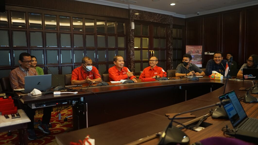
Meeting of the GeoSDS team on the response time of the emergency ambulance service in Jakarta [1] | © Akrim, GeoSDS
Mapping
- Suresh Devalapalli described how to improve the quality of OpenStreetMap data by identifying and correcting untagged pedestrian crossings, which are critical to improving the accuracy of pedestrian networks in urban areas such as Los Angeles. Using algorithms, they have automated the detection and correction of mapping inconsistencies, significantly improving the utility of the data for navigation and planning.
- PineappleSkip has written a diary entry on tagging rural roads in Queensland, Australia.
- Minh Nguyễn has mapped all the time zones of the United States and their history going back to 1919, when time zones were first established in the US.
- Take part in the vote and discussion on the interpretation of
maxwidth:physicalfor gates and doors, debating whether it refers to the passable width without opening or after the gate/door is fully opened.
Community
- Arjunaraoc shared his efforts at improving the accuracy of geospatial data on OpenStreetMap and Wikidata for Indian locations, focusing on correcting mismatches in the locations of villages in Andhra Pradesh.
- In the second week of their EU Camera Grant project Anne-Karoline Distel has uploaded around 30,000 images, using a GoPro Max, experimenting with different modes of transportation including cycling, walking, and taking the bus to capture imagery. Despite weather challenges, their efforts were enhanced by using an e-bike, allowing for broader coverage. They also discussed the project in a local radio interview and began testing uploads to Panoramax.
- bkil is calling for developers to help contribute to an OSM accessibility initiative. They want to aid blind editors and others with a disability through micro-mapping and documentation.
- In Timor-Leste, the Red Cross Red Crescent Climate Centre, in collaboration with local and international partners, is pioneering anticipatory action mapping to mitigate climate-related risks. This project uses satellite imagery to map critical infrastructure and is complemented by community knowledge of flood history and early warning mechanisms.
- GovernorKeagan continued his mapping efforts in Gqeberha, South Africa, focusing on adding missing buildings, micro-mapping schools and shopping centres, and making small corrections. His detailed work included correcting misalignments and improving data quality through local knowledge and aerial photography, making a significant contribution to the OpenStreetMap project in South Africa from Ireland.
- The UN Mappers of the Month for April are the extraordinary team of Chinese translators who translated the UN Maps Learning Hub courses: OSM Basics and OSM Advanced. Their dedication helps overcome language barriers, allowing future Chinese mappers to gain skills directly in their native language.
OpenStreetMap Foundation
- The OpenstreetMap Foundation’s Communication Working Group tweeted about weeklyOSM.
- The OSMF announced that the York Region Open Data provided under the Open Data Licence and OGL 1.0 Toronto have been deemed compatible with OSM by the LWG. It lists several licences, such as OGL Canada 2.0 and various local variants, and notes their compatibility with specific standards. The list is a work in progress and will be updated as more information becomes available.
Events
- The Heidelberg Institute for Geoinformation Technology will release Sketch Map Tool 2.0 on Tuesday 16 April. The new version will offer enhancements for participatory mapping with offline data collection, digitisation, and georeferencing. Join the launch event in the first session at 9 am or the second session at 5 pm (UTC+2).
- The call for academic track abstracts for the State of The Map 2024 is open until Friday 10 May.
- On Thursday 25 April the Trufi Association will host a webinar exploring GTFS-Flex’s potential. This extension to the General Transit Feed Specification can represent real-world dynamic conditions, including informal transport in the global South and services for communities supported by small urban, rural, and tribal transit agencies.
Education
- Zeke Farwell explored the art of mapping rural forests in JOSM by demonstrating how to efficiently outline forest areas using existing road maps. This tutorial reveals handy techniques, including the time-saving tip of using the ‘alt’ key for tagless copying, which makes forest mapping easier and more accurate.
- The IVIDES Institute have hosted
 ► a workshop on the collaborative mapping of points of interest (POI) with OpenStreetMap. Dr Raquel Souto commented ► about it in her diary, sharing that she presented on how to map coastal and marine POIs.
 ►
►
OSM research
- [1] GeoSDS team have analysed the emergency response time of ambulances in Jakarta, Indonesia, by using the
emergency=ambulance_stationtag in OpenStreetMap. - A new study from Qi Zhou, Zixian Liu, and Zesheng Huang presented a method integrating OpenStreetMap and Google satellite imagery to map the road surface types (paved or unpaved) in Kenya, addressing the challenge of large-scale, accurate road surface identification. The dataset created contains over 1.2 million road segments, with the method proving highly accurate, offering valuable insights for improving local infrastructure and economic development.
- Rhett Butler discussed the significant effect of illegal ‘ghost roads’ on rainforests, focusing on their role in facilitating unauthorised access and deforestation. The article highlights the use of OpenStreetMap data to show how technology and mapping data can reveal the vast network of these roads and draw attention to the urgent need for conservation efforts in these critical areas. The study highlights the value of geospatial data in environmental conservation strategies.
Maps
- Berliner Badeseen (Berlin Bathing Lakes) puts the places in Berlin where you can swim (like beaches and lakes) on a map, indicating water quality with coloured umbrella icons and offering filters for personalised searches. It was created using Maperitive, OpenStreetMap data, and Leaflet.js, with water quality data from daten.berlin.de and swimming pool data from the municipal pool operator Berliner Bäderbetriebe.
- OSM India community member sahilister has started a thread on the OSM Community forum highlighting places in India that have highly detailed and beautiful looking maps on OSM. #NicelyMappedIndia places will be showcased on OSM India’s Mastodon and X handles.
- Nat Henry has launched Close, an interactive map that shows walkable, bikeable, and transit-friendly neighbourhoods across every block in the United States.
- Matt Whilden has created a map of the US state of Washington based on OSM data that can be searched using filters without having to follow Overpass syntax. Using an example, he shows how he can easily visualise Indian and Thai takeaway restaurants on the map with a very simple search query.
OSM in action
- ‘Infection Free Zone’, a post-apocalyptic strategy game, was launched on Steam Early Access on Thursday 11 April. The game features integration with OpenStreetMap, allowing players to rebuild cities in any real-world location, facing threats from the infected and resource scarcity. Players must make strategic decisions to ensure survival, using the game’s detailed replication of real-world topography to plan defences and resource gathering efficiently.
- The Russian marketplace Ozon is testing transitioning from Yandex Maps to its own geoplatform based on OSM data. Now OSM maps can be found on the page of order pick-up points and the website for selecting a location for opening pick-up points. The company is also testing a platform for filling in missing buildings and addresses in OSM based on messages from couriers.
- Bobropiton noticed that the public transport information boards in St. Petersburg are using an OpenStreetMap map.
 transitioning from Yandex Maps to its own geoplatform
 Software
- Starting with version 19030, JOSM now builds for macOS, with native support for Apple Silicon.
- Mapilio has integrated OpenStreetMap login functionality, a significant step towards improving accessibility and map quality. This development allows users to seamlessly connect their OpenStreetMap accounts, making it easier to contribute and use Mapilio’s tools for a better mapping experience.
- Kamil Monicz discussed his progress in the development of OpenStreetMap’s NextGen, highlighting enhancements such as client-side SVG rendering for trace images for faster uploads and improved UI, and updates to deployment scripts, while thanking project sponsors and contributors.
- AlexandrPS has made a dark theme user style for osm.org and has improved the visibility of building outlines in the iD editor. By the way, there is documentation for the iD editor, which makes it easier to create your own styles.
Programming
- overturemaps-py is the official Python command-line tool of the Overture Maps Foundation, designed to download Overture Maps data in various formats, with features currently in the experimental phase.
- Alexander Nozik talked about the creation of maps-kt, a cartographic library for Compose Multiplatform.
- William Edmisten’s docker-openstreetmap-stack provides a set of Docker services to serve OpenStreetMap (OSM) tiles, routing, and geocoding. It includes detailed instructions on setting up the environment, prerequisites, hardware requirements, and steps to build the demo application, import data, and run the applications.
- Igor Sukhorukov spoke about openstreetmap_h3, a tool to help analyse OSM data, at the PGConf.Russia conference.
Did you know …
- … there is an OpenStreetMap tag on StackOverflow and GIS StackExchange?
- … the various options for supplying your Garmin devices with OSM maps?
- … there are wikis that are focused solely on highways? AARoads covers North America and SABRE covers the UK and Ireland.
 ►
►OSM in the media
- Elias Probst has discovered and Paketda! reported ► that the Post and DHL Group now use OpenStreetMap instead of the previous Google Maps service for the display of branches and packing stations on their website and in the Post and DHL app ►. A step that, according to CHIP, was probably motivated ► by financial considerations.
Other “geo” things
- Students from the University of Stralsund, in collaboration with the Störtebeker Brewery, have developed ► a ‘beer map’ comparing 13 different types of beer in a project that combines scientific analysis with beer tasting. Guided by statistical standards, the project aims to help beer lovers identify their favourite beers more easily, using multi-dimensional statistics to map the similarities and differences in flavour profiles.
- OpenCage’s last #geoweirdness toot was about Finland to celebrate the GeoMob event held on 9 April in Turku.
Upcoming Events
| Where | What | Online | When | Country |
|---|---|---|---|---|
| Berlin | 190. Berlin-Brandenburg OpenStreetMap Stammtisch | 2024-04-12 |  | |
| OSMF Membership Campaign Webinar | 2024-04-13 | |||
| Dover | Beer and Mapping! | 2024-04-13 – 2024-04-14 |  | |
| Delhi Cantonment | 7th OSM Delhi Mapping Party | 2024-04-13 |  | |
| OpenStreetMap visual impaired accessibility initiative – kickoff (online) | 2024-04-13 | |||
| City of Belmont | Social Mapping Sunday: Ascot Bridge | 2024-04-14 |  | |
| København | OSMmapperCPH | 2024-04-14 |  | |
| Žilina | Missing Maps mapathon Žilina #13 | 2024-04-15 |  | |
| Amsterdam | Maptime Amsterdam – Spring Mapping! | 2024-04-15 |  | |
| Budapest | 2024.04 – OSM találkozó | 2024-04-15 |  | |
| Hannover | OSM-Stammtisch Hannover | 2024-04-15 | | |
| Berlin | DRK Beginner Online Mapathon | ✓ | 2024-04-15 | |
| England | OSM UK Online Chat | ✓ | 2024-04-15 |  |
| Tagbilaran | OSM-PH outreach in Tagbilaran, with UB-YMC | 2024-04-16 |  | |
| Lyon | Réunion du groupe local de Lyon | 2024-04-16 |  | |
| San Jose | South Bay Map Night | ✓ | 2024-04-17 | |
| Bonn | 174. OSM-Stammtisch Bonn | 2024-04-16 | | |
| City of Edinburgh | OSM Edinburgh pub meetup | 2024-04-16 | | |
| [Online] Map-py Wednesday | 2024-04-17 | |||
| Bielefeld | OSM Ostwestfalen-Lippe | 2024-04-17 | | |
| Kiel | Mapping-Party “Surveillance under surveillance” Kiel | 2024-04-17 | | |
| Karlsruhe | Stammtisch Karlsruhe | 2024-04-17 | | |
| iD Community Chat | 2024-04-24 | |||
| Düsseldorf | Düsseldorfer OpenStreetMap-Treffen (online) | 2024-04-24 | | |
| Wien | 71. Wiener OSM-Stammtisch | 2024-04-24 |  | |
| Aachen | 5. Treffen Aachener Stammtisch 2.0 | 2024-04-25 | | |
| Potsdam | Radnetz Brandenburg Mapping Abend #6 | 2024-04-25 | | |
| Fianarantsoa | State of the Map Madagascar | 2024-04-28 – 2024-04-29 |  |
Note:
If you like to see your event here, please put it into the OSM calendar. Only data which is there, will appear in weeklyOSM.
This weeklyOSM was produced by MatthiasMatthias, Strubbl, TheSwavu, TrickyFoxy, YoViajo, barefootstache, derFred, euroPathfinder, mcliquid, muramototomoya, rtnf.
We welcome link suggestions for the next issue via this form and look forward to your contributions.