22/08/2024-28/08/2024

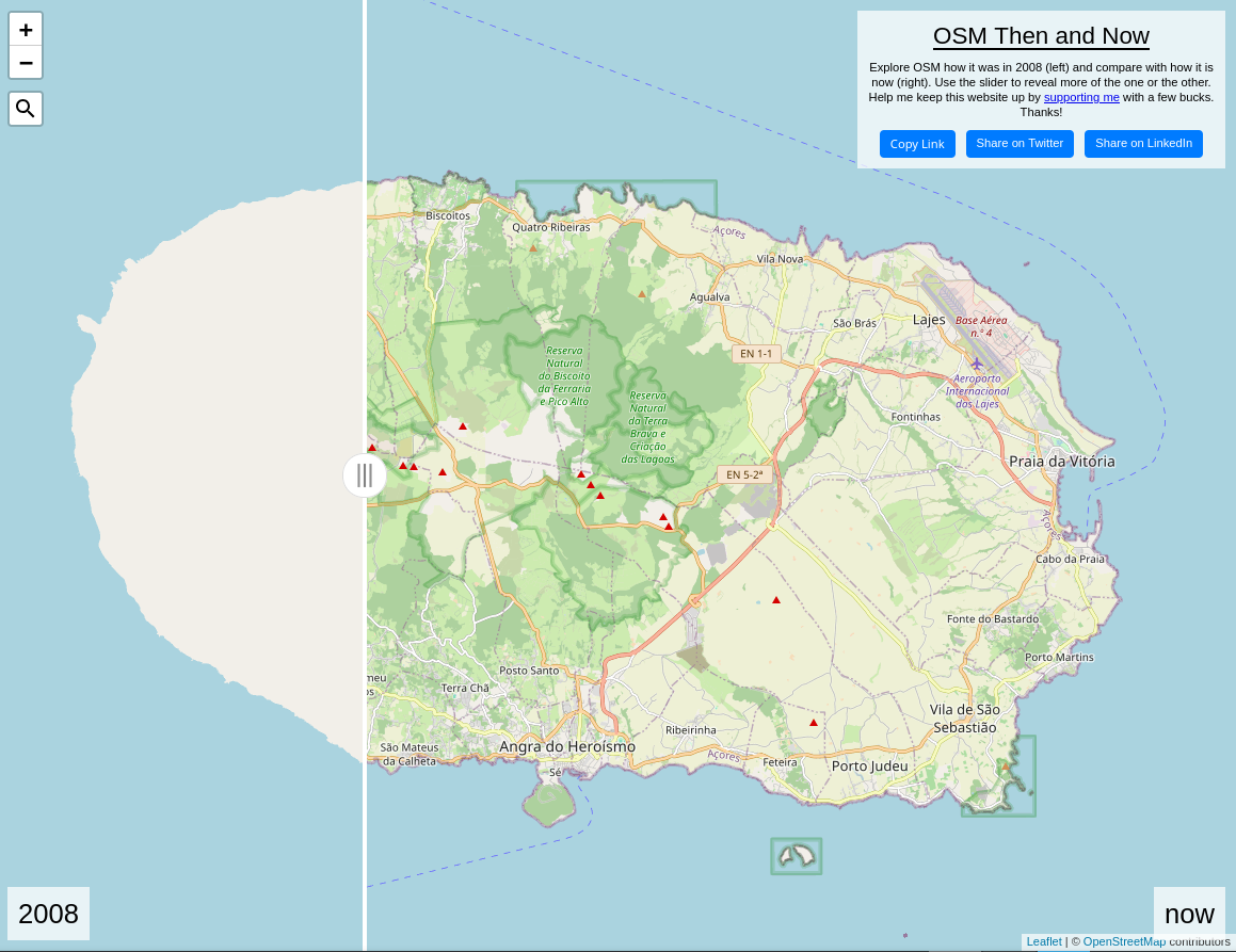
OSM em 2008 e em 2024 [1] | © Martin van Exel | Map data © Contribuintes do OpenStreetMap
Sobre nós
- Pieter Vander Vennet criou um gráfico que analisou as ligações de saída do SemanárioOSM, comparando o número de ligações do Twitter e do Mastodon.
Mapeamento
- Barro partilhou uma análise do equipamento utilizado para o micro-mapeamento no terreno, enquanto andava de bicicleta.
- Zh95967 criou um mapa de visualização que descreve a distribuição das localizações dos edifícios que cartografou, na área de Klang Valley, na Malásia.
Comunidade
- Abhishek Nagaraj, da Universidade da Califórnia, Berkeley, e Henning Piezunka, do INSEAD, discutem a forma como a concorrência pode ter efeitos positivos e negativos na motivação dos voluntários, sugerindo que, embora a concorrência possa aumentar a participação de alguns voluntários, pode desencorajar outros, dependendo de fatores como os objetivos pessoais e a perceção da justiça da concorrência.
- 南山少帅Felix198 celebrou o aniversário de um ano com o OpenStreetMap, completando o seu 1000.º conjunto de alterações.
- Lhirlimann cartografou recentemente a Mongólia e tornou-se o utilizador mais ativo do StreetComplete na Mongólia, nos últimos 7 dias.
- Omundy explica como se podem carregar registos GPS da aplicação Strava para o OpenStreetMap.
- Voluntários em San José, Califórnia, celebraram o aniversário do OSM, mapeando os complexos habitacionais acessíveis da cidade (e saboreando um bolo).
- Sangonzag mapeou a cidade de Marinilla, na Colômbia.
Eventos
- Como sabem, na próxima semana, de 6 a 8 de setembro, o SotM 2024 terá lugar em Nairobi, no Quénia. O nosso colega francês SeverinGeo (do weeklyOSM ) estará em Nairobi e informará na sua conta Mastodon o mais possível sobre o evento. O weeklyOSM tentará reportar e informar o mais possível.
Investigação OSM
- A investigação de Benjamin Herfort concluiu que o grau de integridade dos edifícios OSM a nível mundial é de 21%, por centro urbano.
Mapas
- [1] Martijn van Exel cria uma visão histórica dos dados do OpenStreetMap tal como apareciam no início de 2008, com o mapa a cobrir principalmente áreas facilmente acessíveis a um contribuidor local, refletindo as fases iniciais dos esforços de mapeamento da comunidade.
OSM em ação
- Alexey Afanasovich demonstrou um artigo da Wikipédia com um modelo que inclui um mapa que apresenta o tema com base em dados OSM. Mais tarde, Alexander Sapozhnikov mostrou um modelo que apresenta os limites administrativos das várias povoações.
- A iamsummer desenvolveu o Noraneko Finder (のらねこふぁいんだー), um mapa interativo que apresenta a localização de gatos vadios em todo o mundo. As localizações dos gatos vadios são recolhidas através de crowdsourcing via Google Forms e Google Spreadsheets.
Dados abertos
- Harry Wood também promove o projeto irmão da Wikipédia, WikiVoyage, como uma atividade de férias 😉
Software
- Sempre quis fazer a georreferência das suas imagens carregadas no Wikimedia Commons? Um guia passo-a-passo para a ferramenta de localização explica como o pode fazer facilmente.
- Martin Raifer discute as recentes actualizações do editor iD para o OpenStreetMap, incluindo a adição do suporte Panoramax para imagens ao nível da rua, novas diretrizes de esquemas de etiquetagem, e funcionalidades futuras como o modo de mapeamento de edifícios, bem como contribuições da comunidade e eventos futuros.
Releases
- A versão 2.30 do editor iD do OpenStreetMap introduz uma atualização significativa da interface do utilizador, adiciona a capacidade de editar restrições de mudança de direção complexas e melhora o tratamento dos dados do mapa, otimizando o desempenho e melhorando o processo de validação.
Outras coisas “geo”
- A OpenCage lançou uma série de curiosidades geográficas sobre o País de Gales.
- O sítio Web Blitzortung fornece mapas em tempo real de relâmpagos, em direto, em todo o mundo, permitindo aos utilizadores acompanhar a atividade das tempestades e os eventos de relâmpagos à medida que vão ocorrendo.
Próximos eventos
Nota: Se pretender ver o seu evento aqui, por favor OSM Kalender coloque-o no calendário. Só dados lá colocados aparecerão no weeklyOSM.
Este semanárioOSM foi produzido por Elizabete, NunoMASAzevedo, Raquel Dezidério Souto, Strubbl, derFred, mcliquid.