31/01/2023-06/02/2023

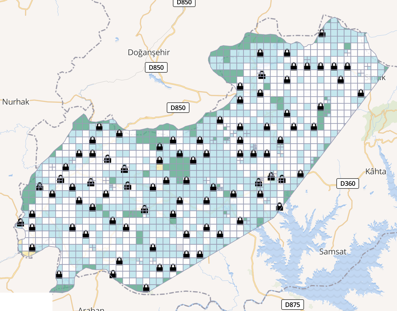
Day-zero mapping in Turkey by the OpenStreetMap community immediately after the earthquake [1] | © Screenshot of HOT Tasking Manager by Arne Kimmig | map data © OpenStreetMap contributors
Mapping
- Pieter Vander Vennet expressed his concerns about the MapBuilder program that allows Bing users to indirectly edit OSM.
- António Madeira presented
►
a proposal to the OSM Portugal Telegram community to standardise the mapping of school estates in Portugal. The proposal will be discussed over the next two weeks in the Telegram Channel of the OSM Portugal community and then a vote will follow. All help, critiques, and suggestions are welcome.
- GHOSTsama2503 proposed
►
an approach for the uniform tagging of educational institutions in Cuba.
Community
- Charmyne Mamador shared her experiences of participating at the Pista ng Mapa 2022 Conference. She is project lead at Ausome Maps, a ‘She Leads and She Inspires’ grant-funded project, and co-founder of GeoLadies PH.
- Valerie Norton encouraged readers of her hiking blog, Moments in Dirt and Ink, to fix map errors in OpenStreetMap and provided detailed advice on how to edit the map.
- Jemimah Mukisa, a scholarship recipient, shared her experiences of the State of the Map Tanzania 2023 Conference.
- OpenStreetMap Belgium’s mapper of the month is Erik (Eebie).
- Pascal Neis tweeted that he has added some new features to the OSM Notes Overview, including a map view of the latest created notes.
- The UN Mapper of the Month is Sajeevini Sivajothy, from Sri Lanka.
Events
- mstock gave an interesting insight into the software and services behind the State of the Map conferences, from planning through to realisation.
- Trufi recorded a recent webinar ‘A Sustainable Approach to Transport Data Collection’ organised by the World Resources Institute along with partners from the Digital Transport for Africa consortium.
Education
- Tailored specifically for the French-speaking community, 328 participants from 32 countries have attended the first training session organised by UN Mappers. Every Thursday for 9 weeks, they will be meeting to learn more about #UNMaps and #OSM.
OSM research
- The LocationIQ Blog shared their answer to the question ‘Why Open Source Is Best for Your Business: The OpenStreetMap vs Google Debate’.
Humanitarian OSM
- [1] Mapping in the Turkey/Syria earthquake region is urgently needed.Via the tasking manager you can get an overview of the tasks with high urgency and start mapping immediately.
New tasks are being added hourly and their progress is also documented on the wiki page.
You can also search for MapRoulette challenges. Examples include: Afsin – Damaged Buildings, Islahiye – Damaged Buildings and Building Damage – Nurdagi.
Said Turksever tweeted that Maxar has published satellite images taken after the earthquake in southern Turkey, which are being processed for post-disaster mapping.
You can watch the daily work of the mapping community by using Pascal Neis’ OSMstats.
- Pete Masters and Rubén Martín have published their HOT Community Weeknotes: 5 / 2023. They report on what is happening and coming up in the world of HOT mapping. Feedback is welcomed on whether the newsletter is useful or what could be improved!
Maps
- dktue has made an experimental map that you can enter an airport’s ICAO code into (e.g. EDDH) and be presented with a vector map based on data retrieved via the Overpass API.
- Luke Seelenbinder has built a full-screen, nothing-but-the-map view for Stadia Maps.
Software
- Starting with StreetComplete version 51.0, the functionality for measuring things via camera has been outsourced to a new stand-alone app StreetMeasure. The source code for the app is available on GitHub, although some of the required libraries are not free.
Programming
- Sarah Hoffmann reported on an initial experiment with using Nominatim and SQLite. This is part of the work being done to make Nominatim work better with with less powerful hardware.
- tomczk shared a demonstration web app that analyses OSM changeset data. He asked for ideas on extending the types of statistics produced.
- Igor Suhorukov showed
►
how to use his project, Openstreetmap_h3, to fit the whole world into a regular laptop and do analytics using PostgreSQL and OpenStreetMap.
Did you know …
- … the
!bangshortcuts in DuckDuckGo? Open DuckDuckGo and try!osm. - … that in Makiivka, Ukraine (the neighbouring city of Donetsk) there are 157 streets with the same names in the city; 65 that are repeated three times; 12 four times; eight streets are repeated five times; Zhovtneva Street six times (yes, Soviet fetish); Stepova Street eight times, five times in the same area… and for more see
on Twitter
Other “geo” things
- The Heidelberg Institute for Geoinformation Technology is seeking
►
a deep-learning engineer. The scope of duties includes deep feature extraction using multimodal data, such as satellite imagery and OSM data.
- Stamen cartographers Alan McConchie and Stephanie May were asked to summarise their thoughts on the new cartographic landscape, and explain what the phrase ‘full stack cartography’ means to them.
Upcoming Events
Note:
If you like to see your event here, please put it into the OSM calendar. Only data which is there, will appear in weeklyOSM.
This weeklyOSM was produced by MatthiasMatthias, Nordpfeil, SK53, Strubbl, TheSwavu, TrickyFoxy, derFred.
We welcome link suggestions for the next issue via this form and look forward to your contributions.
A palavra território refere-se a uma área delimitada sob a posse de um animal, de uma pessoa (ou grupo de pessoas), de uma organização ou de uma instituição. O termo é empregado na política (referente ao Estado Nação, por exemplo), na biologia (área de vivência de uma espécie animal) e na psicologia (ações de animais ou indivíduos para a defesa de um espaço, por exemplo).
Refere-se a uma área delimitada sob posse de algo ou alguém