13/06/2017-19/06/2017
Carte de notes OSM avec code couleur en fonction de la dernière édition, par pole_climber 1 | © pole_climber, uMap and map data © OpenStreetMap contributors ODbL
Cartographie
- Chetan a écrit un article sur la publication par Microsoft de plus de 9,8 millions d’empreintes de bâtiments pour 102 villes de 44 états des États-Unis. La qualité générale des données lui semble bonne, et il encourage les communautés locales à évaluer les possibilités d’import.
- Christoph Hormann explique comment faire pour cartographier avec précision les côtes et les zones de marées dans OSM, grâce à des images aériennes récentes et détaillées.
- Jochen Topf annonce un nouveau défi à propos des multipolygones. La nouvelle version 4.0 d’OSM Carto rend en effet visible sur le rendu une mauvaise pratique qui passait auparavant inaperçue, lorsque la même clé apparaît sur la relation et l’un des chemins.
- Volker Schmidt demande comment on cartographie un circuit, zone dédiée à l’apprentissage de la conduite (exemple).
- Joachim évoque les limitations de la clé
placeet propose un nouveau mot-cléboundary=place. - Malte Heynen suggère d’indiquer sur les chemins piétons et cyclables la classe des clés « highway » voisines. Cela permettrait aux calculateurs d’itinéraires de favoriser des routes éloignées du trafic. La proposition est de remplacer
cycleway=sidepathparcycleway=sidepath:primary. - La proposition de Lukas Sommer pour indiquer le langage utilisé a été acceptée à 57 % des 26 votants. Il va cependant revoir sa rédaction pour expliquer de façon plus détaillée en quoi cette information est indispensable, notamment pour l’exploitation des caractères Unicode.
- Le 9 juin, Topo Lusitania rapporte
 sur la liste de diffusion portugaise la surprenante disparition de l’île São Jorge (Açores). Le problème n’était pas encore résolu à la parution de cette édition d’ hebdoOSM. (http://www.weeklyosm.eu/wp-content/uploads/2017/06/Faial.jpg).
 - Polyglot veut commencer à faire de réunions en ligne via Hangouts on Air pour discuter le sujet du transport en commun et comment cartographier en utilisant JOSM et le greffon PT_Assistant.
- Marthaleena explique comment elle cartographie sa ville natale de Visakhapatnam (Andhra Pradesh, Inde).
- Pascal Neis [a publié]en allemand(http://neis-one.org/2017/06/detecting-vandalism-osm/) un article de blog pour résumer sa présentation « détection du vandalisme dans OpenStreetMap », (présentation et vidéo) à la conférence FOSSGIS & OSM 2017.
 sur la liste de diffusion portugaise la surprenante disparition de l’île São Jorge (Açores). Le problème n’était pas encore résolu à la parution de cette édition d’ hebdoOSM. (http://www.weeklyosm.eu/wp-content/uploads/2017/06/Faial.jpg).
Communauté
- Antoine Riche a mis en place une carte des rencontres régulières OSM en France (en général mensuelles).
- Ilya Zverev a lancé l’appel pour les nominés des « OpenStreetMap Awards 2017 ». La procédure est un peu différente cette année.
- Dans le cadre de son jumelage avec la commune rurale de Dianguirdé dans le nord-ouest du Mali, la ville d’Ivry-sur-Seine aide à cartographier le village et ses environs avec le soutien de CartONG.
- Un utilisateur a publié sur le forum allemand des extraits d’une lettre de l’« association allemande de gestion de l’énergie et l’eau ». La cartographie des bouches d’incendie (hydrants) via le projet OpenFireMap (i.e. dans OSM) a déplu à l’association qui craint pour la sécurité d’infrastructures critiques. La communauté a désapprouvé cette publication.
- Simon Poole a rappelé l’existence d’un compte d’organisation pour OpenStreetMap sur Transifex où vous pouvez désormais facilement déplacer votre projet de traduction pour davantage de visibilité.
Fondation OpenStreetMap
- La fondation OSM a publié les minutes de la rencontre du groupe technique (Engineering Working Group) qui a eu lieu le 30 mai.
- Martijn van Exel a écrit sur la liste talk-fr en tant que secrétaire de la fondation OSM. Dans le cadre de la candidature d’OpenStreetMap France pour devenir une antenne locale de la fondation, il demande à la communauté de partager toutes ses questions et commentaires. Son message a été traduit en français.
Événements
- Sev_osm annonce deux ateliers de sensibilisation et formation à la cartographie numérique libre (OpenStreetMap) et à la géomatique libre (QGIS et geOrchestra), du 12 au 24 juin à Niamey, au Niger. Cette action est soutenue et organisée par l’OIF/DFEN, l’association Les Libres Géographes (LLG), le projet EOF et les communautés OSM du Niger, du Bénin, du Burkina Faso et du Togo.
- Le 15 juin l’équipe de Mapbox a organisé un atelier OSM pour les élèves de CM1 e CM2 de l’école Mariscal Caceres à Ayacucho, Pérou. Les élèves ont été surpris de voir comment différentes données géographiques peuvent être ajoutées facilement à OSM.
- OSM Pérou participe à la « Conférence pour la reconstruction des coopératives paysannes » (après les graves inondations des mois passés) le 6 juin à Lima.
 un atelier OSM pour les élèves de CM1 e CM2 de l’école Mariscal Caceres à Ayacucho, Pérou. Les élèves ont été surpris de voir comment différentes données géographiques peuvent être ajoutées facilement à OSM.
OSM et l’humanitaire
- L’Institut Drucker de la Claremont Graduate University a publié la liste des 50 semi-finalistes pour le Drucker Prize 2017, et HOT en fait partie. Le gagnant du prix (100.000 $) sera annoncé le 29 septembre prochain.
- HOT organise un mapathon avec les étudiants du département de géographie de l’université d’Indonésie.
- Fatima Alher mentionne un mapathon organisé le 17 juin à Niamey (cf catégorie « Évenements »), pour cartographier la région de Diffa au Niger, affectée par les exactions du groupe Boko Haram, via cette tâche. L’annonce est disponible dans les archives de HOT Francophone et HOT.
- HOT s’associe avec Global Earthquake Model et ImageCat pour le développement d’une base de données globale pour l’analyse multi-risques. L’objectif est d’innover dans l’identification des risques pour améliorer les prises de décision et la résilience.
 la liste des 50 semi-finalistes pour le Drucker Prize 2017, et HOT en fait partie. Le gagnant du prix (100.000 $) sera annoncé le 29 septembre prochain.
Cartes
- La nouvelle version 4.0 de CartoCSS est en cours de déploiement sur les serveurs de la fondation OSM. Il n’y a pas encore d’annonce officielle, mais quelques commentaires ici ou là. Une des grandes avancées dans la souplesse du style vient de l’inclusion du pré-traitement en LUA.
- HeiGIT (GIScience Heidelberg) annonce la publication d’une version stable d’OpenRouteService spécifique pour les situations de crise. Elle sera utilisée pour la logistique des interventions humanitaires en Afrique, Amérique du Sud et Indonésie, en se basant sur les données OSM.
- L’éditeur en ligne Lokaler Editor, qui permet la création de cartes pour le web et pour l’impression est maintenant en version beta. Il permet à des journalistes de créer des cartes personnalisées en ajoutant leurs propres notes. L’ouverture du service selon un modèle « freemium » est prévue à l’automne et le code sera ouvert en 2018.
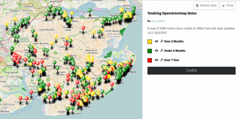
- [1] pole_climber a publié un article très complet sur la création d’une carte de notes OSM avec un code couleur en fonction de la date de dernière édition.
Licences
- La municipalité de Milan a utilisé la localisation de fontaines d’eau potable dans OSM dans des conditions à l’origine d’une discussion détaillée sur la liste talk-it.
Applications
- Jean-Maxime Fillau a récemment contribué au projet OSRM en ajoutant une option qui permet de s’assurer qu’un véhicule tel un camion de livraison arrive du bon côté de la route.
Développement
- Graphhopper recherche des indépendants ou des entreprises intéressées pour des travaux de développement ou d’intégration autour du calculateur d’itinéraires GraphHopper, de jsprit ou de l’API GraphHopper Directions.
Nouvelles versions
| Logiciel | Version | Date de Liberation | Commentaire |
|---|---|---|---|
| Komoot Android * | var | 14/06/2017 | Pas d’infos. |
| Mapillary Android * | 3.60 | 14/06/2017 | Téléchargemet / Lecture EXIF plus robuste. |
| Mapillary iOS * | 4.7.1 | 14/06/2017 | Deux bugs fixés. |
| OSRM Backend | 5.7.4 | 14/06/2017 | Correction de bugs. |
| StreetComplete | 0.12 | 16/06/2017 | Ajout de langues (Ukrainien et Finnois), message d’avertissement si un usager essaie d’ajouter de l’information ailleurs qu’à sa location, Correction de bugs. |
| Kurviger Free * | 1.1.0-2 | 17/06/2017 | Modification à la navigation, geocodage and Interface usager. |
| Simple GIS Client * | 9.1 | 18/06/2017 | Modifications à l’API du service du Recensement US, meilleure gestion de la mémoire pour les fichiers OSM volumineux. |
Fournisseur: OSM Software Watchlist. Timestamp: 2017-06-19 14:20:12+02 UTC
(*) sous licence propriétaire. Voyez: freesoftware.
Connaissez-vous…
- … la procédure lorsque vous tombez sur une carte OSM dont l’attribution est manquante ?
- … la plateforme trilingue de la communauté Belge ?
- … le portail berlin.de qui utilise OpenStreetMap pour sa carte de Berlin ?
- … la mise à jour quotidienne des données OSM d’Italie sur les serveurs de la fondation Edmund Mach ?
OSM dans les médias
- Le reportage de Delphine Bousquet (AFP) sur la communauté OSM du Bénin est largement repris, entre autre par La Presse, France Soir, le Point, le Parisien, Capital et TV5 monde.
Autres sujets géographiques
- Une équipe de recherche internationale a publié un article dans Nature sur la validation collaborative de données d’occupation des sols relevées par des capteurs. Quatre campagnes ont été ouvertes sur la plateforme GeoWiki. Les variations de précision ont été analysées et les jeux de donnés rendus disponible pour d’autres recherches.
- L’université d’Heidelberg recherche un développeur.
- ResearchNReports a publié le « Global Cloud GIS Market Research Report Forecast 2017-2021 », une source appréciable de données pour les stratèges d’affaires.
- Inc42 raconte l’histoire de MapMyIndia, une société indienne qui fournit des services de navigation GPS et suivi, ainsi qu’une vaste sélection de données geo-démographiques – tout cela avant l’arrivée de Google sur le subcontinent.
- L’utilisateur ff5722 demande si il y a vraiment plus de 4,5 millions de km de routes en Chine. Différentes méthodes d’estimation semblent le confirmer. Seulement 1,2 millions de km ont été cartographiées dans OSM qui ne peut donc pas être utilisé comme source de données pour fournir une analyse plus détaillée.
Événements à venir


Note: Pour que votre événement apparaisse dans l’hebdoOSM, ajoutez-le au calendrier.
Cet hebdoOSM a été préparé par Anmaca, Anne Ghisla, Lamine Ndiaye, Nakaner, Peda, PierZen, SK53, augustind, derFred, jcoupey, jinalfoflia, wambacher.