02/03/2021-08/03/2021

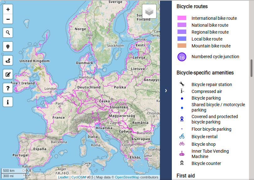
CyclOSM released the 0.5 update of it’s map [1] | © CyclOSM.org | map data © OpenStreetMap contributors
Mapping campaigns
- To celebrate this year’s St Patrick’s Day, the OpenStreetMap community in Ireland will map objects in places related to the saint and his associated legends. The campaign spans the five days from 17 to 21 March.
- Trufi will create, using a team of Mauritanian locals, the first thorough public transport map of Nouakchott, Mauritania’s capital, along with on-the-ground photos of transportation infrastructure. The work is supported by the World Bank.
- OSMTeenMaptivists reported on their Mappy Hour held on 8 March.
Mapping
- Christopher Beddow has written about the possible decentralisation toward regional, local, or national mobile map apps that oppose Google Maps’ centralised domination of global maps on mobile phones, and suggests it may both empower OpenStreetMap as a data source and give private information directly to governments rather than corporations.
- Microsoft Open Maps team will begin work on the OSM data in Chile, focusing on the road network, and will investigate other map features as well. Details are on GitHub.
- Requests have been made for comments on the following proposals:
shop=barbershop, a place specialising in cutting men’s hair, where you can get a haircut, style your beard, or profile your moustache.seaway=port, cargo_port, cruise_port, ferry_port, fishing_port, for maritime transport installations.trailblazed=poles;cairnsto specify the type of trail signs.
- Voting is underway for the following proposal:
natural=shrubberyfor cultivated, maintained, or otherwise managed land covered with shrubs, bushes, or shrubbery, often for decorative or space-filling purposes (until Sunday 21 March)
Community
- Once a geographer, always a geographer! This is the theme of
 > the in-depth interview by Charlotte Carpentier with Florian Lainez, an enthusiastic mapper and head of Jungle Bus.
 - Morten Lind, consultant to Septima, but formerly with the Danish Geodata Agency, expresses > his enthusiasm for OSM on the occasion of the 100 million changesets milestone.
- Leigh Dodds has launched a new website, OSM Queries, that provides a useful collection of Overpass queries and a 26 part tutorial to help people learn the query language. More details can be found in his blog post.
 >
> 
 >
> OpenStreetMap Foundation
- In episode 63 of the Geomob Podcast Ed Freyfogle and Steven Feldman spoke with OSMF Board Chair Allan Mustard about the recent OSMF community survey.
- OSM Ireland has provided a half-way report on the buildings project, which is being supported by an OSMF microgrant.
- As part of the wave of visualisations and interpretations of the OSMF 2021 community survey, user Øukasz produced a set of world maps visualising the five ‘sentiment’ questions.
Local chapter news
- OpenStreetMap France announced a partnership with Enedis, the public electricity distribution network operator for 95% of Metropolitan France. OSM contributors will get access to 5 cm imagery, while OpenStreetMap France will encourage the mapping of the power distribution network and provide data extracts. We already reported on the first project: power poles.
- Rhobi Samwelly is promoting and teaching mapping in her home country, Tanzania, in order to achieve better protection of girls from genital mutilation.
- Simon Poole, from the Swiss OSM Association, explained the conditions for using swisstopo data and products with OpenStreetMap. At present only the aerial imagery can be used directly for mapping.
Events
- This year’s FOSS4G (Free and Open Source Software for Geospatial), initially planned to take place in Buenos Aires, will take place online from 27 September to 2 October 2021.
Humanitarian OSM
- With support from the Humanitarian-to-Humanitarian Network (H2H Network), HOT is engaging the humanitarian mapping community worldwide, thereby strengthening global and local COVID-19 approaches.
Education
- The Ecomuseum Terra del Castelmagno and the Ecomuseum Pietraporzio Pastorizia are offering > a free four-hour OSM evening course combined with a mapping excursion.
 >
> Maps
- CyclOSM released the version 0.5 update of its map, featuring contour lines, cycle tracks and better rendering of lanes shared between buses and bicycles.
- Frank Schmirler visualises, on his sea beacon map, in an impressive way, beacons operating in their different modes. Sector lights can be displayed as either sectors or the colour visible at the user specified location. You see lights flashing as you would see them while sailing nearby. As a background you can choose between the OSM map, a Google map, or a satellite image. The menus (so far: DE, ES, EN, PT, RU) are now also available in French.
- Walter Nordmann (wambacher) released version 1.2.4 of his Healthcare Map with German, French, and English menu navigation, better icons and other improvements. Currently permalinks will not save the active layers.
Open Data
- InsideIT.ch reported > about a new digital service from the Federal Office of Topography (swisstopo), freely accessible for companies, research and science, e.g. engineers, architects, programmers or planners but also private users. The data may also be used for commercial purposes free of charge. The only condition for publication is that the source is acknowledged.Included in the geodata offered are most digital products such as national maps, aerial photographs, landscape models and geological vector data. Every current dataset is now available in the most common formats and variants. No registration is required to download and use the services. In this way, Switzerland intends to make an active contribution to innovation and economic growth.
- Paul Keller and Alek Tarkowski are founders of ‘Open Future‘, a ‘think tank for the Open Movement’. Classic projects such as Wikipedia/Wikimedia and OpenStreetMap are part of it. They were interviewed > by netzpolitik.org.
 >
> Software
- Christopher Beddow advises how to prepare for the new Mapillary API. The post provides some key information for developers including how they can handle the transition between the launch of version 4 of the API and phasing out version 3.
- Simon Poole announced that the first beta release of Vespucci 15.2 is now available in the Google Play Store or from the Vespucci repository. Simon is looking for users to help rapidly test this release.
Programming
- Paul Norman, the current maintainer of ogr2osm on GitHub, is looking for someone interested in maintaining this Python script that makes the link between the ogr and osm formats.
Releases
- Following OpenStreetCam’s transition to KartaView at the end of last year, KartaView has announced many further innovations.
Did you know …
- … the Discord server page where you can find links to chat with the OSM community? New to the groups are the Unite Maps Initiative/UN Mappers. They offer support in English, French, Italian, Portuguese, and Spanish.
OSM in the media
- Tech Exec reflected on the performance, strengths and weaknesses of OSM, most of which would have been familiar to readers of the corresponding OSM wiki page.
- Tages Anzeiger took (paywall) an in-depth look at the implications of swisstopo open data (as we reported earlier). Although OSM is one of several likely uses mentioned, a couple of the experts quoted may be familiar names: Stefan Keller and Simon Poole.
Other “geo” things
- Carolin Klonner, and others from GIScience Heidelberg, have published a paper about the OSM Sketch Map Tool. This supports participatory mapping approaches and risk communication using and extending OSM Field Papers. It also includes a fitness-for-purpose analysis of the OpenStreetMap data for the respective region, similar to the approach in the ohsome Quality analysT (OQT) tool.
- Engaging Data provides an unusual interactive map that combines a planet (or moon) of the Solar System and a country/continent of choice.
- Check out this impressive animation of the year-to-year increase in node density of OSM data in the Philippines from January 2012 to January 2021.
Upcoming Events
| Where | What | Online | When | Country |
|---|---|---|---|---|
| Berlin | Remote DB Regio Hackathon | 2021-03-12 – 2021-03-13 |  | |
| Missing Maps Friends of MSF Lancaster Mapathon | 2021-03-13 | |||
| Inclusão de Nomes de Ruas na Cidade da Bahia, Brasil / Inclusion of Street Names in the City of Bahia, Brazil | 2021-03-13 | |||
| Bamako | She Maps & GIS | 2021-03-13 | ml | |
| Missing Maps CartONG Mapathon | 2021-03-15 | |||
| Lyon | Rencontre mensuelle (virtuelle) Lyon | ✓ | 2021-03-16 |  |
| 137. Treffen des OSM-Stammtisches Bonn | 2021-03-16 | |||
| Berlin | OSM-Verkehrswende #21 (Online) | 2021-03-16 | | |
| Lüneburg | Lüneburger Mappertreffen (online) | 2021-03-16 | | |
| Birr | #MapPatrick | 2021-03-17 – 2021-03-21 |  | |
| Albuquerque | MapABQ March virtual meetup | 2021-03-18 |  | |
| San Jose | Virtual Civic Hack & Map Night | ✓ | 2021-03-19 | |
| UN Mappers weekly mapathon | 2021-03-19 | |||
| Missing Maps CartONG Mapathon | 2021-03-22 | |||
| Bremen | Bremer Mappertreffen (Online) | 2021-03-22 | | |
| Missing Maps CZ Mapathon 2021 #2 | 2021-03-23 | |||
| Geomob ft. Michael Montani (Unite Maps, UN Mappers) | 2021-03-24 | |||
| Osborne County | ✓ | 2021-03-25 | | |
| Osborne County | OpenStreetMap U.S. Virtual Mappy Hour | ✓ | 2021-03-25 | |
| GISRUK Webinar: Semantic geographic knowledge on a world-scale, interlinking OpenStreetMap and knowledge graphs | 2021-03-25 | |||
| UN Mappers weekly mapathon | 2021-03-25 | |||
| Mapio Cymru: Found in a map of Wales Workshop | 2021-03-26 | |||
| [Online] OpenStreetMap Foundation board of Directors – public meeting | 2021-03-26 | |||
| Webinar GEAM – GFOSS.it: OpenDroneMap, un ecosistema libero per foto aeree | 2021-03-26 | |||
| Collaborative and Humanitarian Mapping #3: Mapping informal settlements with Mapillary and JOSM | 2021-03-26 | |||
| Düsseldorf | Düsseldorfer OSM-Treffen (online) | 2021-03-26 | | |
| Budapest | Exhaustive mapping within certain Budapest administrative boundaries (Hungarian) | 2021-03-29 |  | |
| Missing Maps CartONG Mapathon | 2021-03-29 | |||
| Missing Maps DRK Online Mapathon | 2021-03-30 | |||
| Ville de Bruxelles – Stad Brussel | Virtual OpenStreetMap Belgium meeting | ✓ | 2021-03-30 |  |
| UN Mappers weekly mapathon | 2021-03-31 |
Note:
If you like to see your event here, please put it into the OSM calendar. Only data which is there, will appear in weeklyOSM.
This weeklyOSM was produced by Anne Ghisla, Nordpfeil, PierZen, rogehm, SK53, Sammyhawkrad, TheSwavu, YoViajo, richter_fn.