31/08/2021-06/09/2021
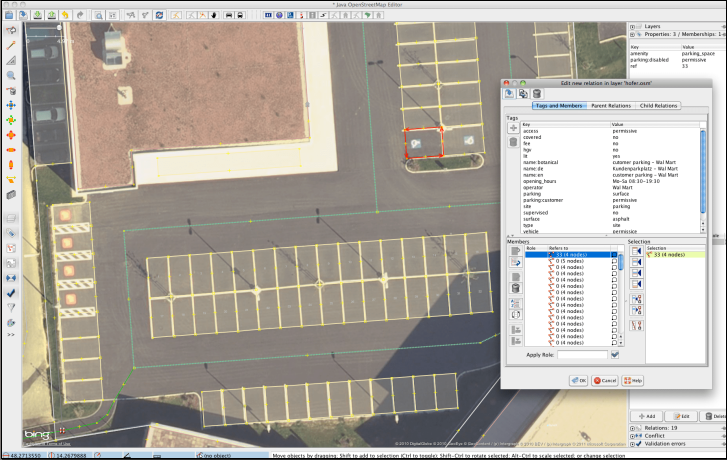
Mapping individual parking spaces [1] © Lejun | map data © OpenStreetMap contributors
Mapping campaigns
- Радченко Алексей invited
 us to participate in the OpenStreetMap markup contest > running from 10 to 30 September. There are simple instructions and dozens of prizes to be won. Join in.
 - The OSM-US project to map playgrounds in Philadelphia (we reported earlier) was completed on 1 September.
 us to participate in the
Mapping
- Jeroen Hoek noticed a page on the wiki relating to a proposal to regularise the tag
china_population. The tag seems to designed to change the way some larger cities in China are rendered. - The authorities of the French commune of Torsac have recently completed a project to name streets and assign house numbers. Wilfried, a commune representative, asked , on the OSM-FR forum, why these addresses and street names do not yet appear in OSM. The answer turned out to be somewhat complex, as the long thread in the forum shows. However, the issue was resolved by Christian Quest.
- Andrés (User AngocA) from Bogotá explained > in a diary entry how to analyse Notes and how, if there are many Notes open in the area of interest, you can develop a strategy to close them.
- [1] User Lejun has written up some interesting tips for mapping individual parking spaces.
- Monika Tota asked members of the OpenStreetMap Polska group how they tag properties that are somewhat subjective, like
smoothness=goodvsintermediateorwheelchair=yesvslimited. People responded with many methodologies they use, pointing out that reality often resists clear-cut classification and that this question is related to the issue of cartographic generalisation. - Voting is open until Sunday 19 September for the proposal
club=cadet, intended to be used to map the locations where various Youth Cadet groups meet, together with details of each group.
 , on the OSM-FR forum, why these addresses and street names do not yet appear in OSM. The answer turned out to be somewhat complex, as the long thread in the forum shows. However, the issue was resolved by Christian Quest.
 >
>  members of the OpenStreetMap Polska group how they tag properties that are somewhat subjective, like
 Community
- User Assange expressed their dismay at mapping changes in China and Taiwan which they perceive to be politically driven. For example, is this a vacation school or concentration camp?
- GeOsm has launched its open-source, globally distributed map database service for countries around the world.
- JaLooooNz wrote a diary entry about the use of
service=drivewayand the ‘need’ for aservice=residential_driveway. - OpenStreetMap Belgium has chosen Constantine Tumwine from Tanzania as Mapper of the Month and interviewed him.
- Noé discovered that a town in Ivory Coast with a population of over 30,000 bears his first name, Noé. It wasn’t mapped on #OpenStreetMap, so he took care of it.
- Feye Andal shared that Youthmappers in the Philippines grew from four to nine local chapters in just one year.
Humanitarian OSM
- HOT published their Annual Report for 2020 (covering the period from July 2020 to June 2021). Note the report is large and may load slowly.
- The Open Mapping Hub – Asia Pacific, organised by HOT, is launching a newsletter to share highlights of open mapping projects, communities, and opportunities across the region and invites you to subscribe.
Maps
- SmokyMountains.com has released a 2021 Fall foliage prediction map showing the progressive change of leaves’ colour through the USA.
- Tif.hair used > data from the French national statistical institute, INSEE, in order to map 4,000 hairdressers in France with, mostly bad, puns in their names. While using OpenStreetMap as a baselayer, clicking on a shop marker links to Google Maps.
- The Ordnance Survey, Britain’s national mapping agency, withdrew support for OS Open Space on 31 August. OpenSpace was launched in 2008 using OpenLayers. OSM’s founder, Steve Coast, worked as a consultant to the OS on the initial project. Replacement services continue to be available via the new hub, but a number of existing applications and websites no longer work.
Open Data
- After a small pilot project in 2017, the Church of England announced their intention to map graves in all 19,000 churchyards in their care. The mapping, funded by Historic England, the National Lottery Heritage Fund and Caring for God’s Acre, uses LiDAR and is expected to take seven years. It is hoped that the resulting data will be open.
Software
- It looks like placemark.io is working on an editor that allows collaborative work.
Programming
- Christian Quest wrote > about his summer work on optimising performance for the new French tile server.
Releases
- Bryan Housel announced release 1.1.7 of RapiD, including bugfixes and validation improvements.
- A September release (2021.09.01-6-android) of Organic Maps on Android is now available on Play Store.
Did you know …
- … the OpenParkingMap? Forked by jakecoppinger from zlant’s Parking Lanes Viewer, this version has Australian parking signs.
- … OSMCha is a tool for checking OSM changesets for data quality? The tool was developed by Wille Marcel in 2015, and Wille remains the maintainer.
- … that you can find user names or the user id associated with a partial user name using Who’s That? Particularly helpful if you can’t remember how a user name is capitalised.
OSM in the media
- Natfoot provided an audio-visual version of weeklyOSM 580 on YouTube.
Other “geo” things
- The Guardian previewed the new book Atlas of the Invisible by UCL geographer James Cheshire and graphics designer Oliver Uberti. The book contains many visualisations of geographic data relating to climate change.
- Episode 84 of the Geomob podcast featured Dave Gee, creator of hand-drawn Doodle Maps.
- OpenCage’s latest #geoweirdness thread is focused on Canada.
Upcoming Events
| Where | What | Online | When | Country |
|---|---|---|---|---|
| OSM Africa Monthly Mapathon: Map Malawi | 2021-09-04 – 2021-10-04 | |||
| Bogotá Distrito Capital | Agreguemos y editemos rutas de transporte en OpenStreetMap | 2021-09-11 |  | |
| Zürich | Mapping-Party/132. OSM-Treffen Zürich | 2021-09-11 |  | |
| Arlon | Réunion des contributeurs OpenStreetMap, Arlon | 2021-09-13 |  | |
| 臺北市 | OpenStreetMap x Wikidata 月聚會 #32 | 2021-09-13 |  | |
| Hamburg | Hamburger Mappertreffen | ✓ | 2021-09-14 |  |
| PHXGeo Meetup (Phoenix, AZ, US) | 2021-09-15 | |||
| The ISPRS SC Webinar Series: Collaborative Humanitarian Mapping with PoliMappers and UN Mappers | 2021-09-16 | |||
| Karlsruhe | Karlsruhe Hack Weekend | 2021-09-17 – 2021-09-19 | | |
| Nantes | Journées européennes du patrimoine 2021, Nantes | 2021-09-18 |  | |
| Grenoble | Atelier OpenStreetMap – retrouvailles et initiation ! | 2021-09-20 | | |
| Lyon | Rencontre mensuelle Lyon | 2021-09-21 | | |
| Bonn | 143. Treffen des OSM-Stammtisches Bonn | 2021-09-21 | | |
| Berlin | OSM-Verkehrswende #27 (Online) | 2021-09-21 | | |
| Lüneburg | Lüneburger Mappertreffen (online) | 2021-09-21 | | |
| DRK Missing Maps Online Mapathon | 2021-09-23 | |||
| [Online] OpenStreetMap Foundation board of Directors – public meeting | 2021-09-24 | |||
| Düsseldorf | Düsseldorfer OSM-Treffen (online) | 2021-09-24 | | |
| Amsterdam | OSM Nederland maandelijkse bijeenkomst (online) | ✓ | 2021-09-25 |  |
| FOSS4G 2021 Buenos Aires – Online Edition | 2021-09-27 – 2021-10-02 | |||
| Bremen | Bremer Mappertreffen (Online) | ✓ | 2021-09-27 | |
| Grenoble | Mapathon Missing Maps – Cartographier des cartes humanitaires sur un mode collaboratif et libre. | 2021-09-28 | | |
| Bruxelles – Brussel | Virtual OpenStreetMap Belgium meeting | ✓ | 2021-09-28 | |
Note:
If you like to see your event here, please put it into the OSM calendar. Only data which is there, will appear in weeklyOSM.
This weeklyOSM was produced by Lejun, Nordpfeil, PierZen, SK53, Supaplex, TheSwavu, YoViajo, derFred.