21/03/2017-27/03/2017
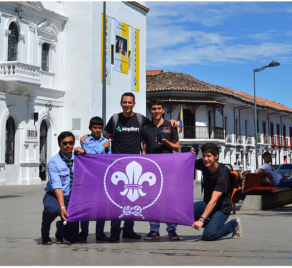
Scouts in Popayán, Colombia learn how to use tools in emergency cases and to share data with rescue workers. 1 | © Photo: Carlos F. Castillo
Mapping
- At the FOSSGIS conference, data privacy on OSM was discussed. Frederik Ramm summarizes
 (automatic translation) some relevant aspects in the German forum. There was also a brief discussion on Talk-de mailing list. Personally identifiable data, such as mapping activities, is still visible to anyone.
 - Voting window for the new tag
amenity=courieris open until April 7th. - Martijn van Exel is working on a monthly newsletter for MapRoulette. Take a look at the March edition.
- Following Harry Wood’s idea to upload OSM notes in MAPS.ME, Noémie Lehuby generated a file to spot bus stops with missing names around Paris.
- Telenav’s mapping team members disappoints the Canadian community by armchair mapping of turn restrictions.
- Areas tagged
landuse=farmwon’t be rendered (automatic translation) any longer in our standard map style. In re-tagging these legacies, the NoFarm map might be a great help. - Martin Koppenhoefer explained where the center of Berlin is defined, after having recently looked at the history of the city center of Rome.
 (automatic
 Community
- Harald Hartmann asks in the German forum, whether there should be more “gamification” at OSM, for example in the form of virtual awards and rewards. (automatic translation)
- [1] Carlos F. Castillo aka kaxtillo runs a scout group called ScoutMappers in Popayán, Colombia. The scouts should be enabled to know and apply useful tools in emergency cases and to share data with rescue workers. The group from Popayán will publish their experiences from the past six years on REME to share their knowledge with all the scouts around the world so that every scout can do a good deed every day.
- According to Spanish OSM, there are many mazes mapped in OpenStreetMap.
OpenStreetMap Foundation
- In Belgium, there is currently an OSM local chapter in formation. The charter is still being elaborated.
Events
- The organizers of the 2018 FOSS4G Conference in Dar es Salaam, Tanzania, are looking for a logo and have launched a competition.
- This year’s international State of the Map conference will take place in Aizu-Wakamatsu, Japan. This is a gentle reminder to send in your proposals for talks and/or workshops if you have not already done so. The deadline to submit your session proposal is Sunday, 2nd April.
- Vincent de Château-Thierry asks (automatic translation) for submissions to SotM France on the talk-fr mailing list. It takes place in June from 2nd to 4th at Avignon.
Humanitarian OSM
- HOT is currently redeveloping the “Export Tool“ and hosted a community text chat on their Slack #export-tool channel on March 30th at 15:00 UTC.
- Kate Chapman explained the importance of OpenSource software and the need for developers for humanitarian purposes.
- Joost Schouppe is looking for validators after the successful Belgian National Mapathon. The more than 300 participants completed the last few gaps in the map of Sierra Leone, which had been mapped in several previous HOT projects. A novelty as MapSwipe was used beforehand to find those spots, so mappers could concentrate on them. They also made a dent in the monster project #1396 in Nigeria, which has been ongoing for more than a year now. Also several tasks to help MSF fight malaria.
- The flood disaster in Peru is still ongoing. (We reported last week). The tasks that need your help – mapping or validation:
- Russell Deffner has published a first task in the OSM Tasking Manager to support the elimination of malaria in Zimbabwe.
switch2OSM
- Local authorities from Digne, France, proudly announced that their new printed tourist map is based on OSM data. The design process will be presented at the SotM France in June in Avignon. (automatic translation)
 (automatic
 Software
- The OpenStreetMap location monitoring app OsMo is now using MapZen vector tiles.
- OsmAnd+ offers a 50% discount for the app.
Programming
- Lukas Martinelli, one of the two guys behind OSM2Vectortiles is now a part of Mapbox.
Releases
| Software | Version | Release date | Comment |
|---|---|---|---|
| QGIS | 2.18.5 | 2017-02-24 | No infos. |
| Komoot iOS * | 9.0 | 2017-03-21 | Route planning and search reworked. |
| Mapillary Android * | 3.35 | 2017-03-21 | Allow higher resolution and wider aspect ratio of images. |
| Osmose Backend | v1.0-2017-03-23 | 2017-03-21 | No infos. |
| OSRM Backend | 5.6.4 | 2017-03-21 | Some bugfixes. |
| GeoWebCache | 1.11.0 | 2017-03-22 | No Infos. |
| Mapillary iOS * | 4.6.10 | 2017-03-22 | Two bugs fixed. |
| GeoServer | 2.11.0 | 2017-03-23 | Ten bugfixes and some undocumented enhancements. |
| Maps.me iOS * | 7.2.2 | 2017-03-23 | Bugfix release. |
| Komoot Android * | var | 2017-03-25 | Minor enhancements. |
| Potlatch 2 | 2.5 | 2017-03-25 | Please read release info. |
| QMapShack Lin/Mac/Win | 1.8.0 | 2017-03-26 | No infos. |
Provided by the OSM Software Watchlist. Timestamp: 2017-03-27 18:15:39+02 UTC
(*) unfree software. See: freesoftware.
Other “geo” things
- Web developer and artist Hans Hack created a map of London and Berlin with collapsed buildings to compare it to the situation in Aleppo.
- At the National Library of Scotland in Edinburgh, researchers have pieced together a 17th-century Dutch map that has spent part of its life up a chimney, and part under the floorboards at a Scottish castle.
- London scientists found (automatic translation) that using navigation aids has a deep effect on brain’s activity.
Upcoming Events


Note: If you like to see your event here, please put it into the calendar. Only data which is there, will appear in weeklyOSM. Please check your event in our public calendar preview and correct it, where appropriate.
This weeklyOSM was produced by Hakuch, Nakaner, Peda, Polyglot, Rogehm, Spec80, SrrReal, YoViajo, derFred, jcoupey, jinalfoflia, kreuzschnabel, vsandre.