2021.10.12.-2021.10.18.

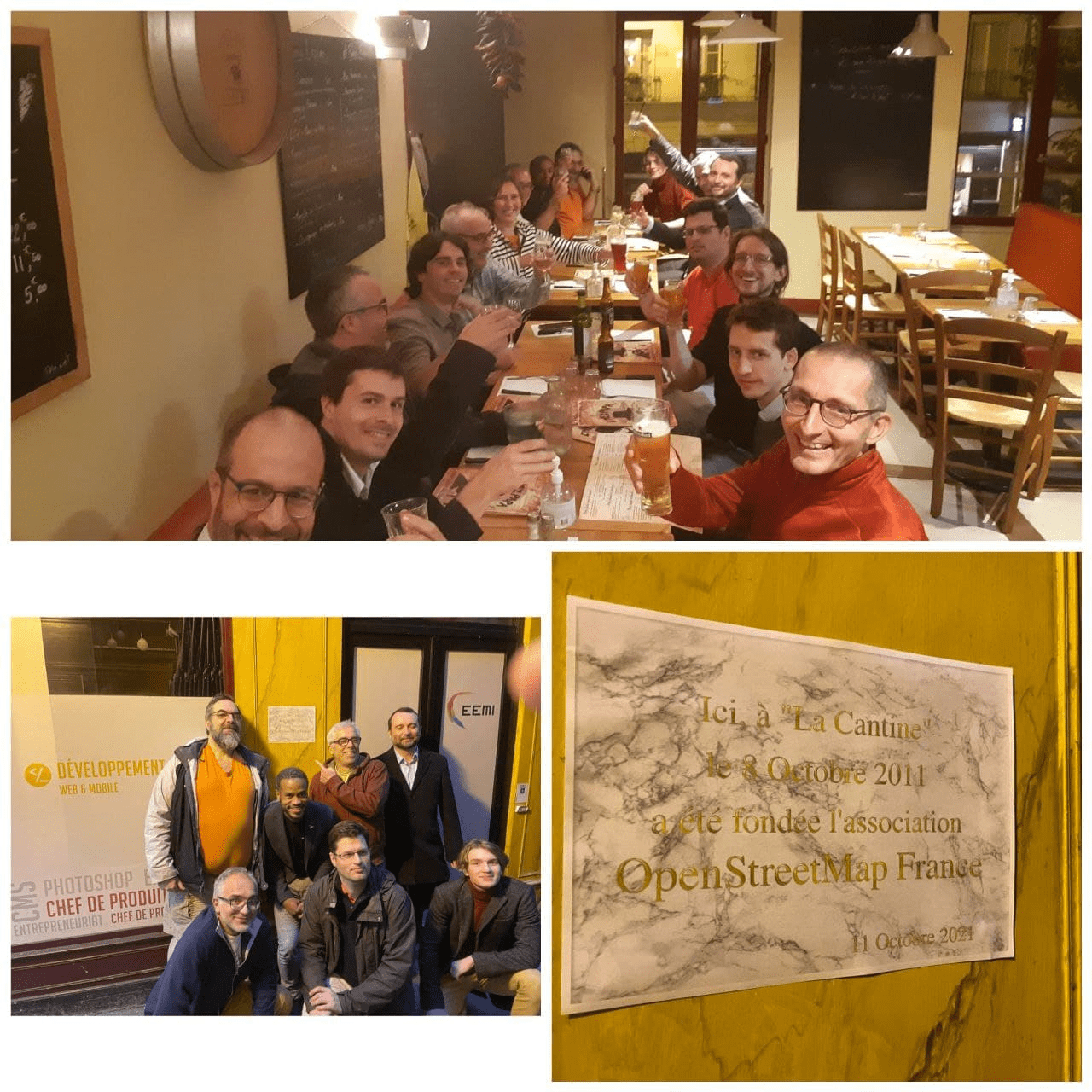
OpenStreetMap France가 설립 10주년을 맞았습니다 [1] © OpenStreetMap France
지도 제작 캠페인
- 마다가스카르 교육부 계획부서에서 유네스코 국제 교육 계획 기관(IIEP-UNESCO)과 UN Mappers와 함께 바키낭카라트라 지역의 전체 도로망 지도를 만들고자 합니다. 이렇게 만들어진 도로망 지도는 IIEP-UNESCO 학교 저수지 플러그인과 결합해 어린이들이 집에서 학교까지 이동하는 가장 짧은 경로를 찾아내는 데 활용됩니다. 도로망 지도 만들기 매파톤은 10월 27일에 열릴 예정입니다.
지도 제작
- 매필러리(Mapillary) API가 버전 3에서 4로 업그레이드되면서
mapillary=*에 들어가는 사진 ID의 부여 방식이 바뀌었습니다. 이 때문에 앞으로mapillary=*태그를 어떻게 처리해야 하는지를 두고 토론이 벌어지고 있습니다. Mateusz Konieczny는 일괄 수정이 불가능하다면 아예mapillary=*태그를 폐기하자고 제안했습니다. - Sebastian이 talk-de 메일링 리스트에서 파란색 국경 표지판이 붙은 소화전을 오픈스트리트맵에 어떻게 나타내야 하는지 물어보았습니다.
>
- DUGA가 잘못된 편집 관습과 그 해결책을 유머러스하게 표현했습니다.
- 피드백을 받고 있는 제안들은 다음과 같습니다.
inlet=*: 유체가 터널이나 파이프라인으로 들어가는 지점을 자세히 나타내기 위한 태그.- 눈사태 신호기 연습 구역: 스키어들이 눈사태 신호기 사용법을 익히는 곳을 오픈스트리트맵에 나타내자는 제안.
- 찬반 투표가 종료된 제안들은 다음과 같습니다.
natural=fumarole: 증기나 가스가 분출되는 판의 경계 부분을 오픈스트리트맵에 나타내자는 제안으로, 찬성 16표, 반대 0표, 기권 0표로 가결되었습니다.landuse:secondary=*: 토지의 보조 용도를 나타내자는 제안으로, 찬성 14표, 반대 23표, 기권 3표로 부결되었습니다.headlight=*: 전조등을 의무적으로 사용해야 하는 구간을 나타내자는 제안으로, 찬성 28표, 반대 1표, 기권 0표로 가결되었습니다.foraging=*: 식물 채집의 가능/불가능 여부를 나타내자는 제안으로, 찬성 11표, 반대 0표, 기권 3표로 가결되었습니다.
- tffmh가 독일 뮐하임안데어루르 지역 오픈스트리트맵에
de:strassenschluessel(도로의 고유 식별자) 태그가 적절히 달려 있는지 평가했습니다.
커뮤니티
- 영어를 몰라 HOT 인도주의 열린 지도 제작 프로젝트에 관한 정보를 알 수 없는 사람들을 위해 arnalielsewhere가 ‘포용 및 참여 조력자로서의 현지화’ 프로젝트를 제안했습니다. 해당 프로젝트는 베트남, 마다가스카르, 모잠비크의 오픈스트리트맵 커뮤니티와 기여자들, 그리고 아시아/태평양 열린 지도 제작 허브, 동/남아프리카 열린 지도 제작 허브를 프로젝트에 참여시키는 것을 목표로 합니다.
- HOT 아시아/태평양 열린 지도 제작 허브에서 2021년 12월부터 2022년 6월까지 여성 기여자 100명이 참여하는 리더십 프로그램, ‘이끌고, 영감을 주는 여성들(She Leads and She Inspires)’를 진행합니다.
- 오픈스트리트맵 재단 중재팀에 참여할 자원봉사자들이 필요합니다!
- 지불 방법 태그에 암호화폐를 추가하자는 제안에 투표하기 위해 누군가가 계정을 다수 만드는 일이 일어났습니다. 이번 일로 ‘투표 시스템에 근본적인 문제가 있는 게 아닌가’라고 생각하는 사람들이 많아졌습니다.
- Valerio Bozzolan이 토끼🐇 동물병원의 위치를 오픈스트리트맵에 나타내는 방법을 소개하면서, 수의사 태그의 범주를 넓히자는 2012년의 제안을 다시 끌어올릴 필요가 있다고 말했습니다.
- 동남아시아 YouthMappers 대사를 맡고 있는 Feye Andal이 소감을 밝혔습니다. Feye가 대사를 맡은 후 지금까지 2년 간 필리핀의 YouthMappers 지부는 4곳에서 9곳으로 늘어났습니다.
오픈스트리트맵 재단
- 오픈스트리트맵 재단의 Allan Mustard 이사가 차기 선거에 후보자로 나서지 않겠다고 발표했습니다.
- OSMF-Talk 메일링 리스트에서 Dorothea Kazazi가 차기 재단 이사회 선거 후보자들에게 보낼 질문을 11월 2일까지 위키에 올려 달라고 발표했습니다.
- 오픈스트리트맵 재단의 지부 및 커뮤니티 작업반(LCCWG)에서 지부와 커뮤니티 모임 2021(Local Chapters and Communities Congress 2021)이 11월 6일에 개최된다고 발표했습니다.
- 소규모 보조금 위원회에서 보조금 프로그램의 시범 운영 보고서를 제출했습니다. 보조금 수혜자들이 제출한 보고서도 해당 페이지에 같이 있습니다.
오픈스트리트맵 지부
- [1] 프랑스 오픈스트리트맵 커뮤니티에서 OpenSteetMap France 설립 10주년을 축하했습니다.
>
이 모임 자리에 OpenStreetMap France의 설립자 중 한 명이 등장해서 기념 현판을 주고 갔습니다.
- 2022년 4월 1일부터 3일까지 미국 애리조나주 Tucson에서 개최되는 State of the Map US 2022의 제안 접수가 12월 17일에 종료됩니다.
오픈스트리트맵 연구
- Siddharth Joshi 외 5명이 네이처 커뮤니케이션에 전 세계 옥상 태양광 발전기의 재생 가능 에너지 생산 능력을 평가한 논문을 게재했습니다. 해당 논문은 오픈스트리트맵의 도로와 건물 데이터를 사용했습니다.
인도주의 오픈스트리트맵
- HOT 재난 대응팀(HOT Disaster Services Team)에서 지중해 산불 대응 보고서를 게시했습니다.
- HOT 품질 관리 및 보증 작업반에서 태스팅 매니저의 관리자가 하는 일을 명문화하는, ‘태스킹 매니저 프로젝트 정리 작업’ 위키 문서를 만들었습니다. 정리 1단계는 “더 이상 활성화할 필요가 없는 프로젝트 보존(아카이브)하기”입니다.
지도
- webkid에서 베를린의 건물 연식을 보여주는 오픈스트리트맵 기반 지도를 만들었습니다. 해당 지도는 Berliner M(Old or new building? So lives Berlin)orgenpost지의 ‘오래된 건물? 새 건물? 그래서 베를린은 살아 있다’에 게재되었습니다.
- 카트만두 리빙랩의 Aishworya Shrestha가 시간에 따른 지도의 변화를 보여주는 이전/이후 지도 쿼리를 발표했습니다. 해당 도구를 사용하려면 이름과 생성된 지도를 받을 이메일 주소를 제출해야 합니다.
소프트웨어
- Geo Data Merger는 csv, json, geojson, topojson 파일을 합치는 오픈소스 데스크톱 프로그램입니다.
- Davey Lovin(닉네임 mDav)이 State of the Map 2021에서 하이킹 경로의 품질을 검증하는 도구를 소개했습니다. Superroute는 하이킹하는 사람들이 모여 지도 상의 하이킹 경로 품질을 유지하고 개선하는 것을 목표로 합니다.
- A/B Street 교통량 시뮬레이터로 기존의 도시를 안전하게 자전거가 이용할 수 있는 도시로 만들 수 있습니다. 해당 시뮬레이터의 목표는 이러한 변화가 도시 내부 이동에 어떤 영향을 끼치는지를 알려주는 것입니다.
프로그래밍
- 하이델베르크 대학교 지리과학 연구소와 HOT가 협력해 인도주의 오픈스트리트맵 통계 사이트를 개선했습니다.
알고 계셨나요?
- Go Map!!을 컴퓨터 맥에서도 돌릴 수 있다는 사실을 알고 계셨나요?
- MAPS.ME를 포크한 Organic Maps를 알고 계셨나요? Organic Maps는 광고도 없고, 추적 기능도 없으며, 사용자 정보를 수집하지 않습니다.
기타 ‘지리’ 관련 소식
- 구글이 이제 팔레스타인 지역 항공 사진을 검열하지 않기로 했습니다.
다가오는 행사
참고: 행사를 여기에 추가하고 싶다면, 캘린더에 행사 일정을 작성해 주세요. 캘린더에 있는 데이터만 주간OSM에 나타납니다. 캘린더 미리보기에서 행사를 확인하고, 만약 행사 정보가 틀렸다면 적절하게 수정해 주세요.
이 주간OSM은 다음 사람들이 제작했습니다. Climate_Ben, LuxuryCoop, Nakaner, SK53, TheSwavu, arnalielsewhere, derFred, tordans.