10/10/2024-16/10/2024
More than just another globe [1] | © Cartes | © MapTiler | Map data © OpenStreetMap contributors
Breaking news
- Guillaume Rischard shared the OpenStreetMap Foundation 2024 chairperson’s report.
- Craig Allan, Laura Mugeha, Maurizio Napolitano, and Héctor Ochoa Ortiz have been elected as new OpenStreetMap Foundation board members. A total of 740 ballots were cast out of 1,971 eligible voters in this election.
Mapping
- There are several useful tutorials on iD editor and JOSM in Japanese. For example, Kisaragi’s tutorial
 ► on how to split an area on OpenStreetMap using the iD editor and Kohei Otsuka’s guide ► to splitting and joining OSM objects in JOSM.
 - Requests for comments have been made on these proposals:
brt=*for indicating if aroute=busis a bus rapid transit service.- to deprecate
busway=*for bus lanes. access_key=*to describe places that are accessible using a (centralised) key system.public_transport=access_spacefor mapping areas within a stop place such as a concourse or booking hall, immigration hall, or security area that is accessible by passengers, but without direct access for vehicles.
- Voting is underway on the proposal
sac_scale=strolling, indicating a wide and smooth trail, until Tuesday 29 October.
 ►
► 
Community
- In 'It Started with a Road – Global South Version’ the Trufi Association imagines OSM and transportation justice transforming cities in the global South BEFORE car culture becomes endemic.
- Justine shared her experience of participating in State of the Map 2024, held in Nairobi, Kenya.
- Raquel Dezidério presented ► a proposal for harmonisation between the variables in Brazil’s National Register of Addresses for Statistical Purposes and OpenStreetMap tagging, specifically for educational establishments. Raquel asked for comments on the OSM Community forum. On the forum there is also another request for comments on the standardisation of addresses in Brazil.
- Valerie Norton has expressed frustration about people mapping remote areas by guesswork, perhaps prompted by the iD editor’s listing of 'issues’ in yellow.
 ►
► Local chapter news
- OpenStreetMap US launched the Community Project programme to support volunteer-run projects and technologies that benefit the OpenStreetMap community. OpenStreetMap Americana, a project inspired by the cartographic aesthetics of American paper maps, has been chosen as the first OSM US Community Project.
Events
- With November approaching it’s time again for the #30DayMapChallenge, a chance to create maps based around different themes each day of November, posting using the hashtag #30DayMapChallenge. Stamen blogged some of their highlights from 2023 and 2022, if you would like to see samples of the work from previous years.
- Oliver Rudzick and Katja Haferkorn shared ► a report from the 22nd FOSSGIS-OSM Community Meeting, held on 3 to 6 October in Essen, Germany.
 ►
► Maps
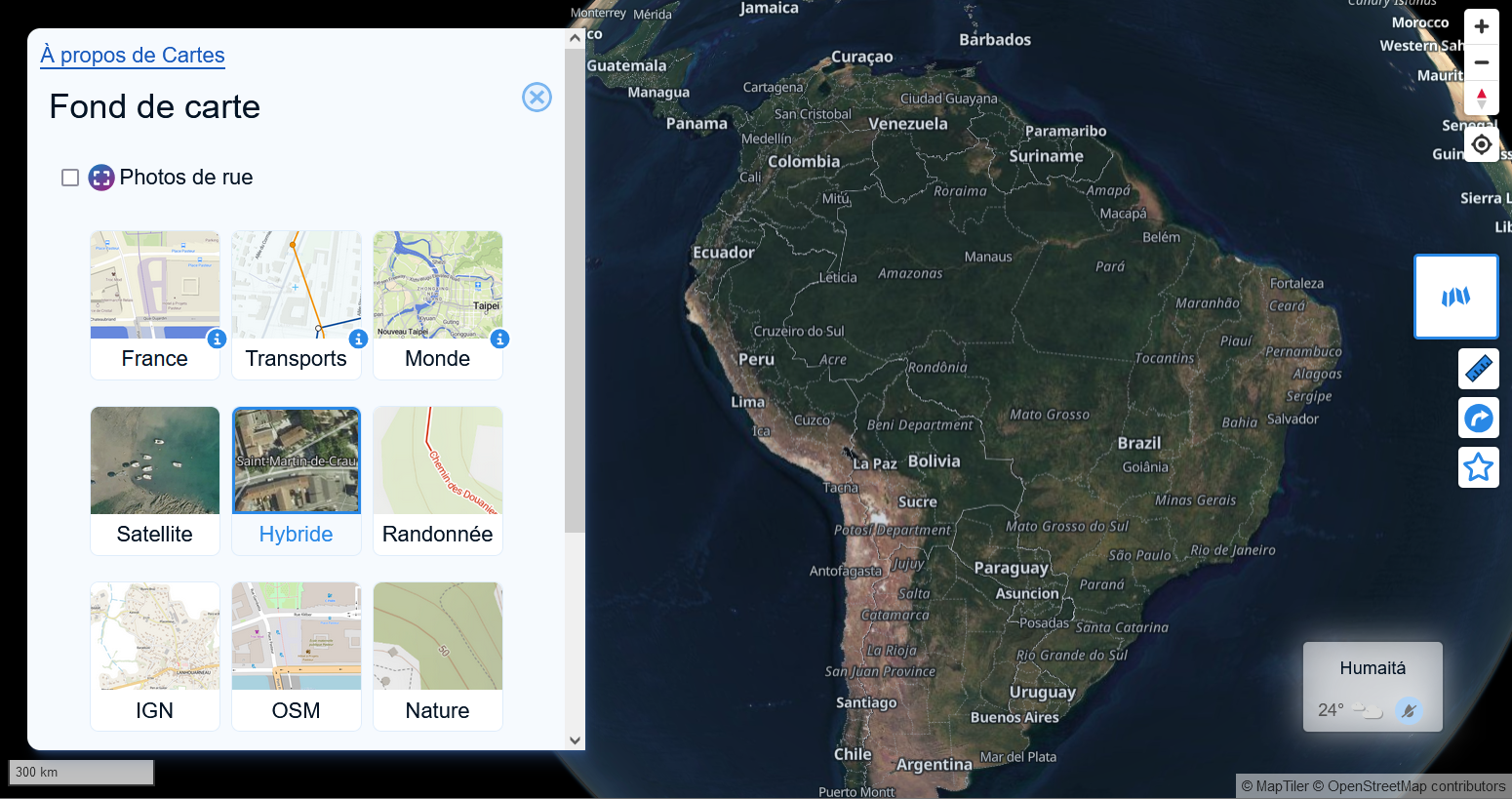
- Maeool tooted that Cartes, an OpenStreetMap-based online map, now supports a globe view feature when zoomed out, powered by the MapLibre GL v5 pre-release.
Software
- HOT has added MVT and PMTiles as formats to their Export Tool, along with the option to include metadata elements such as timestamp and user information.
Programming
- Tykayn has improved their Mapillary export script to be able to retrieve Mapillary sequences from multiple users and import them into Panoramax in bulk. They offered to do this for anyone who wanted it, and were able to rescue over 14 million photos. Tykayn gave a presentation > explaining the implications and methods used at the State of the Map France.
- Edward Betts delivered a talk at GeoPython 2024 on using Python-based tools to help link Wikidata and OpenStreetMap.
 >
> Releases
- Christoph Hormann announced that v5.9.0 of the OpenStreetMap Carto stylesheet (the default stylesheet on the OSM website) has been released. He says: 'Once changes are deployed on openstreetmap.org it will take couple of days before all tiles show the new rendering.’ So stay tuned.He outlined the new changes in his email:
- Adding rendering of
shop=hearing_aidswith a dedicated symbol - Restoring rendering of name labels for
natural=reef - Adding rendering of lines with
barrier=jersey_barrier - Removing rendering of
railway=preservedin favor of interpretingrailway:preserved=yeson otherrailway=* - Removing rendering of
shop=jewelleryas synonym forshop=jewelry - Adding rendering of
leisure=dancewith a point symbol and label - Interpretation of transport mode specific access tags on roads/paths.
- Adding rendering of
- Christoph Hormann blogged about the new release of OSM Carto, where he explained that we have solutions for some very old problems now.
Did you know …
- … mediawiki2latex? After the WikCon in Wiesbaden, Germany, the author Dirk Hünniger adapted this software, originally written for Wikipedia, to our OSM wiki so it can be used to create very good .pdf files.
- … that Thunderforest offers ten different map tile set styles based on OpenStreetMap data?
Other “geo” things
- France’s IGN offered ► us some excerpts from Maxime Blondeau’s soon to be published book Géoconscience, a work richly illustrated with surprising maps and immersive photographs, which reveal the vital and fascinating nature of our common habitat, the Earth.
- Harel Dan tooted that there is an Easter egg in QGIS that allows you to play a 15 panel slider game, with your map, if you type 'bored’ into the coordinate box.
- In response to Hurricane Helene’s devastating effects across multiple states, the US Geological Survey (USGS) has activated its landslide event team and collected images and data in the southern Appalachian Mountains. This information was shared across multiple state and federal agencies to inform, prioritise resources, and better predict future events. The data can be accessed by the public on a newly launched USGS Landslide Observations Dashboard Map.
- TeleGeography maintains an interactive and regularly updated Submarine Cable Map. These submarine cables keep us connected, but they can also occasionally become sources of friction.
- Jacquelyne Germain, from Smithsonian Magazine, reviewed Native-Land.ca, an interactive map that shows the location of Indigenous territories around the world.
Upcoming Events
| Where | What | Online | When | Country |
|---|---|---|---|---|
| Karlsruhe | Karlsruhe Hack Weekend October 2024 | 2024-10-19 – 2024-10-20 |  | |
| Cabecera Municipal Duitama | Estado del Mapa – Duitama 2024 | 2024-10-19 |  | |
| Yelahanka taluku | OSM Bengaluru Mapping Party | 2024-10-19 |  | |
| Nonnweiler | 2024-10-19 | | ||
| Spatial Girls Network Webinar Launch | 2024-10-19 | |||
| Kalyani Nagar | OSM Mapping Party at TomTom | 2024-10-19 | | |
| Toulouse | Rencontre du groupe local de Toulouse | 2024-10-19 |  | |
| [Online] 18th Annual General Meeting of the OpenStreetMap Foundation | 2024-10-19 | |||
| Amsterdam | A Synesthete’s Atlas: Cartographic Improvisations Between Eric Theise and Edward Schocker | 2024-10-19 |  | |
| Mumbai | Mumbai Online Remote Mapping Pre-Party | 2024-10-20 | | |
| Berlin | DRK & HeiGIT Online Beginner Mapathon | 2024-10-22 | | |
| Berlin | OSM-Verkehrswende #63 | ✓ | 2024-10-22 | |
| City of Edinburgh | OSM Edinburgh pub meetup | 2024-10-22 |  | |
| Flensburg | OK Lab Flensburg Community OSM Treffen | 2024-10-23 | | |
| Lübeck | 147. OSM-Stammtisch Lübeck und Umgebung | 2024-10-24 | | |
| OSMF Engineering Working Group meeting | 2024-10-25 | |||
| Bologna | OpenStreetMap al Linux Day di Bologna | 2024-10-26 |  | |
| 中正區 | 台北城內商家mapping party暨慶賀MozTW 3.0喬遷之喜 | 2024-10-26 |  | |
| Mumbai | Mumbai Mapping Party | 2024-10-26 | | |
| City of South Perth | Social Mapping Sunday: Perth Zoo FREE TICKETS | 2024-10-27 |  | |
| Bremer Mappertreffen | 2024-10-28 | |||
| Saint-Étienne | Rencontre Saint-Étienne et sud Loire | 2024-10-28 | | |
| San Jose | South Bay Map Night | ✓ | 2024-10-30 |  |
| Tentative: OSMF Affiliation Models brainstorming | 2024-10-30 | |||
| Amsterdam | Maptime Amsterdam: Autumn mapping party | 2024-10-30 | | |
| Wien | 73. Wiener OSM-Stammtisch | 2024-10-30 |  | |
| Düsseldorf | Düsseldorfer OpenStreetMap-Treffen (online) | 2024-10-30 | | |
| Moers | Community-Hackday am 1. – 3. November 2024 im JuNo, Moers Repelen | 2024-11-01 – 2024-11-03 | | |
| Berlin | OSM Hackweekend Berlin 11/2024 | 2024-11-02 – 2024-11-03 | |
Note:
If you like to see your event here, please put it into the OSM calendar. Only data which is there, will appear in weeklyOSM.
This weeklyOSM was produced by Elizabete, Raquel Dezidério Souto, Strubbl, TheSwavu, barefootstache, derFred, miurahr, rtnf.
We welcome link suggestions for the next issue via this form and look forward to your contributions.