12/22/2015-12/28/2015
 «Leafmap» from Nils Westergard [1]
Mapping
- Now you can locate old, parked or museum-piece locomotives in the historic places map if they have been tagged and mapped appropriately in OSM.
- User baditaflorin created a cheat sheet with the most important shortcuts for JOSM that would make editing with JOSM more efficient.
- Felix Delattre wants to map the 42 bus routes in Managua and Ciudad Sandino (Nicaragua) in OSM and asks for help.
- Marc Zoutendijk points out that there are numeours examples of meaningless values in the «source» tag on OSM. In his series on seldom used tag values he provides some amusing examples but concludes that the errors are mainly harmless as they are a minority and seldom used.
- Matthijs Melissen proposes the tag aquatics_centre. He also proposes to discourage the use of amenity=swimming_pool tag instead use leisure=swimming_pool.
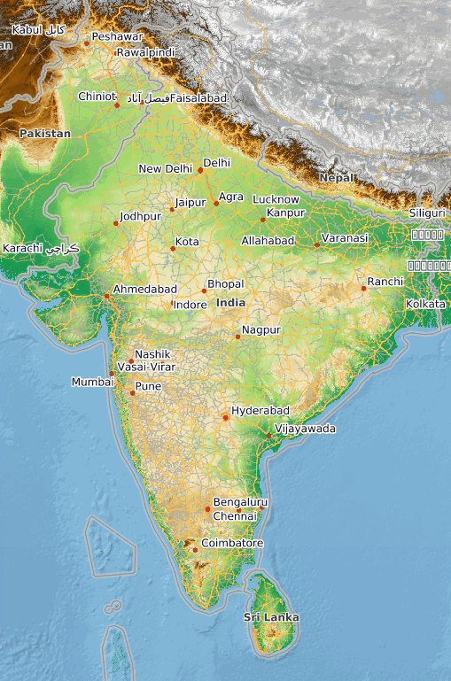
- User JinalFoflia from Bangalore proposes a re-tagging of 0.12% picnic_sites. A lot of incumbents are answering. 😉
She has re-tagged the picnic sites withleisure=picnic_siteandamenity=picnic_sitetags totourism=picnic_sitetag, the changesets related to this can be found in this diary entry.
Community
- Discussion about Nominatim and its surprising search results continues.
- OSM user nesim shared the names of the most active contributors who have contributed to the data for Turkey (katpatuka, nesim, ayhanozates, penom and Ghybu) in the Community’s Facebook Group.
- Richard Cantwell states that OSM is going great in Ireland. His PDF article in Geoconnexion suggests that OSM «has become a shining example of how crowdsourcing can work».
- The board of the OSMF on request from the Data Working Group have indefinitely banned a user who threatened another mapper. Appeals against this decisions will only be considered after police and legal investigations are completed.
- Tom Taylor (active HOTtie) passed away on December 24th.
- BushmanK in his dairy asks what comes first, Map or Database? His post also asks should we tell newbies the truth?, but the principles he discusses extend beyond «newbies» to how OSM in general is explained.
OpenStreetMap Foundation
- OSMF Board Minutes of 2015-12-12
Humanitarian OSM
- Drishtie Patel looks back at the success stories of the Missing Maps project in 2015.
Maps
- User derStefan announced a new version of OpenTopoMap 2.0. (automatic translation)
- Muindialis have described how they created a multi-scale topographic map of the world with an OSM main features overlay. A demonstration of the client application can be viewed here.

- Markus Mayr answers the question: Why tree imports? To produce beautiful maps.
- An Interview, with Raphael Reimann one of the creators of «Roads to Rome».
- [1] Nils Westergard has combined parts of the city of Stadt Amsterdam along with the skeleton of a leaf. He spent about 100 hours on this artwork. Other works of Nils Westergard.
switch2OSM
- In Austria, OSM based maps with the current traffic situation are online. The Austrian public radio station ORF reported. (automatic translation).
Software
- Summary of all GraphHopper related activities for the year 2015.
- The new OpenRouteService is now with new features like live traffic data, improved route profiles, new Leaflet client and more!
- Releases
Software Version Release Date Comment Maps.me 5.3 2015-12-21 Fixed zoom buttons bug Locus Map Free 3.14.1 2015-12-22 Bug fixes OSRM Backend 4.9.0 2015-12-24 API changes, bug fixes, maintenance, new features Osmose Backend 1.0-2015-12-27 2015-12-27
Did you know …
- … Framasoft, a French association promotes FOSS since 2011. Lately Framasoft is hosting a version of uMap under the name Framacarte
- … the place where you can find all minutes of OSMF and OSMF workgroups?
- … the world’s Largest Cylindrical Map of the World? See a video as well.
Other “geo” things
- Arzu Coltekin recalled that the first website, which went online was already adorned with a map.
- Mapzen has a Christmas present for all the users who have asked for a batch geocoder 😉
- Calling all couch-mappers at the end of the year: Please click once, sit back and enjoy the world that you have mapped just over and over again with the finest details.
- Humitos and Ella Quimica have mapped a restaurant on the Peruvian coast, shared the knowledge about OpenStreetMap, programming with the owner and were rewarded with a complimentary ceviche dish. weeklyOSM wonders whether this activity falls into the category of «paid mapping» 😉
- Tools for getting data out of OpenStreetMap and into Desktop GIS.
- Toyota wants to make Google’s mapping tech obsolete
Upcoming Events
| Where | What | When | Country |
|---|---|---|---|
| #geowebchat twitter chat web mapping predictions for 2016, 20:00 UTC | 01/05/2016 | World | |
| London | London missing maps event | 01/05/2016 | UK |
| Münster | Stammtisch / OSM Treffen | 01/05/2016 | Germany |
| Vienna | 54. Wiener Stammtisch | 01/07/2016 | Austria |
| Lyon | Rencontre mensuelle mappeurs | 01/12/2016 | France |
| Osnabrück | Stammtisch / OSM Treffen | 01/18/2016 | Germany |
| Lüneburg | Mappertreffen Lüneburg | 01/19/2016 | Germany |
Note: If you like to see your event here, please put it into the calendar. Only data which is there, will appear in weeklyOSM. Please don’t forget to mention the city and the country in the calendar.
This weekly was produced by Alexandre Magno, Rogehm, SB79, Bogus, Manfred, escada, jinalfoflia, mgehling, stephan75, wambacher.
