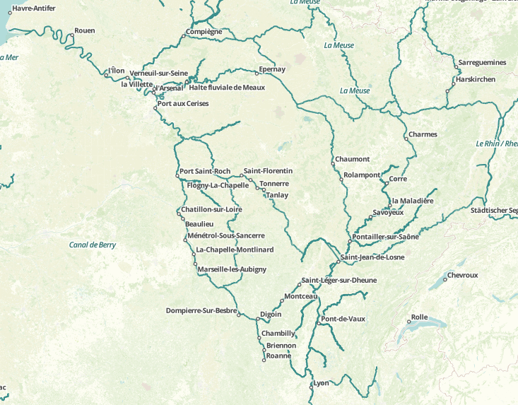
OpenWaterWay can be found in tile.openstreetmap.fr | © OpenStreetMap contributors
Yes, OSM is a database, but the data is nevertheless collected with the aim of deriving maps from it. When we wanted to compile an “ordinary” annual review, we noticed how many remarkable articles we have reported in our “Maps” section during the year. That is why we decided to serve you exactly this retrospect and appreciate the efforts of the map enthusiasts and cartographers.
Along these lines – we wish you a lot of fun while exploring the “old” maps from 2016. 😉
January
- Tristram Gräbener found out, that although all Roads led to Rome, all roads start from Notre Dame in Paris. (… at least all roads to destinations in France 😉 ) Tristram has prior experience with routing, so he describes how to visualize that all roads in France start from here “au point zero des routes de France”. Fits to: Steve Coast’s launched campaign on Kickstarter.
- Mapper999 provides his project OSMStreetLight for detailed representation of streetlights. Visit the test Installation for trying it out.
- SMOG or fresh air? The first worldwide Air-Map shows the quality of air in 206 cities in 40 countries around the globe, with somehow terrifying results.
- The developer of Luna Render (announced in one of the recent weeklyOSM reports) now presented a map style related to old Soviet military maps.
- A map showing the tram and bus traffic in Berlin, and how to relate to the former border between East and West Berlin.
- A map of all roundabouts in the world has been created by folks at Mapbox.
February
- Derstefan announced a prerelease of OpenTopoMap 2.0.
- The British Library has cataloged, conserved and digitized over 550 military intelligence maps.
Andy Mabbett asks about the potential, Richard Fairhurst points to a solution and Jez Nicholson starts a test. - Martin Raifer published tortuOSMity, a project that displays the curviness of roads on a map.
- OpenMeatMap? The idea was born by the journalist Miguel Graziano and realized by mapache or Mapa Ché 😉. #ElMapaDelAsado shows the prices of meat collected by the crowd. Miguel Graziano said to weeklyOSM: “The mapa was born with the intention of responding to higher prices and the loss of purchasing power of wages.” … the whole statement from Miguel Graziano.
- Mapping different types of smell as colours on the OpenStreetMap road network. Smelly Maps lets you choose a City from Barcelona via London to Seattle and smells from emissions via food to waste.
- Metrocosm (a collection of projects that analyze life through statistics and data) published an interactive OSM based map about “every disputed territory” in the world.
March
- The “Alianza Libres Sin Violencia” (Free Alliance without violence) is an association of 50 organizations in Bolivia which opposes violence against women. In this map, you can find contacts for psychological counseling centers, police, and state institutions to which women can apply.
- A virtual walk with a smartphone through historic Berlin. The app features OSM as a comparison layer to the historic maps.
- Gisela is your new “location-based assistant”. She will help to find places near you that you need in your daily life. Read this for more. (automatic translation)
- These isochrone maps driving maps of the world offer an interesting look at the similarities and differences in road design and their effects on travel for different cities of the world.
- Christopher Möller of webkid explains how they used Mapbox GL to generate a vector based and an interactive map of cycleways in Berlin.
- Moritz explains how he creates great interactive maps with OSMBuildings, e.g. the one of Berlin.
April
- The annual rings of Moscow, an article from OstExperte.de which is a German blog on Russian Business. An Interactive Russian map on building ages in Moscow.
- A map to visualize noise pollution for the whole world which uses OSM data. A simple noise model is used which is inspired by noise pollution concept of Cities Skylines.
- Hakan Tando?an publishes his map of mosques in OSM.
- Michael Schön has published Geopedia.info. It displays georeferenced Wikipedia articles on an OSM layer, it is available as an Android App. An iOS app is under construction.
- Andrew Hill created a map using the 2014 USA census to show how many women live (in percent of the total population).
- Meggsimum shows an interactive map of the German Wine Road and its villages in Palatinate (Germany).
- Citee Fashion offers OSM based map images of your favourite city printed on t-shirts.
- Tactile OpenStreetMap created a tactile map offered by TOUCH MAPPER. More information can be found in GitHub.
- The Historic Place Map has been extended. Lutz implemented (automatic translation) routing and measurement tools (developed by Netzwolf) as well as various monuments layer. A new feature is a black and white Mapnik-background layer to emphasize the historic monuments.
May
- Geocacher PicoKnirps published PicoMaps.
- Chris Koerner opened a wikipage to talk together with the OSM Community about the use of interactive maps in Wikipedia. Feedback or ideas from our community are appreciated. The wikipage Help:Extension:Kartographer explains how to use the tags <mapframe> and <maplink>.
- MapContrib is a site similar to uMap that allows a simple generating of your own map. Example maps include fire hydrants, mail boxes and bicycle parking.
- Laura Barroso, the weeklyOSM correspondent in Cuba, built the app MapaDCuba for her employer (we reported here). The app is rated recently as the best Cuban map app by a blogger in Cuba but read it yourself.
June
- Peter Liu from Mapbox uses the data from USGS (US Geological Servey) and created a real-time map of all earthquakes which are measured by the USGS. Please be patient, retrieving more than 9000 quakes of this month takes some time. 😉 Hover over each marker to inspect the quake, and click to zoom in and view satellite imagery of the surrounding area.
- The piano map is quite new and not yet listed in the map collection.
- The members of the Latin-American Telegram group show their locations on a uMap.
- This very detailed map of Bexhill (UK) by Dr-Mx is available on github. It is a fork of the Spanish language upoi.org by Manuel Kaufmann aka humitos.
- Josh Cohan (Next City) describes a new “AccessMap Seattle” map, currently accessible as a beta version. Parts of Seattle are very hilly, and AccessMapSeattle shows that, and other barriers to accessability. The map is of course using OSM data.
- Caleb Pershan writes in SFist about some special “typographic” maps of American cities that have been created. All municipalities, roads, and water areas are exclusively represented in writing, and all are OSM based.
July
- The Bismarckturm map for historical Bismarck towers used the tag
network=Bismarckturm. - The Preußischer optical Telegraf is now complete.
- The Institute of Wines of Germany uses an interactive OSM Map to show the locations of all the vineyards growing regions.
- HistOSM is a new map which visualizes historic data that is present in the OSM database.
- Geraldine Sarmiento plays with “sphere mapping” and tests it with different textures.
- In their OSM diary, tyr_asd showcases an updated map visualisation of how OSM node density has changed over the last 2 years.
- Mapzen shows on a map, which showcases its produced extracts get downloaded most often.
- OpenRouteService, the first routing service based on OpenStreetMap, now provides routing services for North and South America including all the main routing profiles, e.g. for a car, pedestrian, heavy vehicles, bikes – the latter with several options from MTB, road bike to safest bike route etc.
August
- Markus Reuter from Netzpolitik.org introduces an OpenStreetMap project Surveillance under Surveillance. It is an interactive map of all the surveillance cameras mapped so far.
- Stamen launched a worldwide version of the OSM-based Terrain map. The repo is public and Stamen welcomes collaborators.
- Lukas Martinelli published osm-activity, a global heat map of OpenStreetMap where one can see the number of changes made to OSM in each tile dating back to 2008. The sources are available on Github. Lukas Martinelli says: “When you click on a region a timeline is displayed and you can see imports and long-term trends.”
- Opentopomap doesn’t update anymore? Stefan Erhardt is looking for help.
 (automatic translation)
 - The New Cloud Atlas is a special map for telecommunications infrastructure presented by Tim Waters on the talk mailing list and on his blog.
- Laser Atelier created this detailed laser engraved paper map of Tokyo with OSM data.
 (automatic
 September
- Andy Allan runs his map services (OpenCycleMap, Transport map) under the label Thunderforest. These services are converted to API keys (instead of the previous HTTP Referrer).
- The Guardian published an interesting quiz – ‘Can you identify the world cities from their running heat-maps?”. Try it.
- The German business journal ‘Manager Magazin’ illustrates the cyclist routes of the ten major European cities.
- Luke Smith writes about grough developing a composite map, which would be a combination obtained by blending OSM data with OS OpenData to fill in the gaps, and using public rights of way data directly from the local authorities which have released it.
- The Open Transport Net project with 14 European partners involved, opens and visualizes transport data in Europe. The city of Pilsen (Czech republic) visualized the traffic flow before and when major public works were taking place in the center of the city. The Pilsener citizens can see on the web which traffic issues they can expect.
- Yvecai has created a new base layer for OpenSnowMap, which allows good contrast and good visibility for the display of ski slopes.
October
- monochome.com is now selling pillows, skirts, and tablecloths with self-selectable map excerpts.
- Anton of Transit wrote a very detailed and quite interesting explanation of how they autogenerate their transit maps for their supported cities worldwide.
- Srikanth Lakshmanan reported that he has installed a language selection for 12 languages for India openstreetmap.in.
- NOSOLOSIG, a Spanish Geo-Blog, wrote a short blog (automatic translation) about Multimaps (automatic translation). Javier Jiménez Shaw, a Spanish software engineer who lives and works in Berlin, has combined many historical, topographic, satellite and road maps. Map enthusiasts can enjoy maps from seven countries, which are in an overlay, synchronized or tangent. By the way, there is a nice tutorial to explain the buttons on the right side.
- Candid Dauth presented the completely redesigned version 2 of the FacilMap based on Leaflet.
November
- A new global WebMap prototype OSMLanduse.org has been launched by GIScience Research Group, Heidelberg. In the blog post, GISRG Heidelberg says: “Therefore our aim is to evaluate the overall possibility and suitability of OpenStreetMap (OSM) data for these specific purposes (landuse and landcover information), identify ways for improvement and to provide all this information globally to the interested communities in an automated way.”
December
- OpenInfraMap, a project by Russ Garrett, has been updated with new layers.
- Christian Quest announced the renewed French map style and moved to a new server. See the new map and what was changed.
- Sven Geggus improved the “German-Map-Style”. Very nice feature: The map shows names in two languages. Sven is looking for help.