22/12/2020-28/12/2020
OpenTopoMap now for Garmin worldwide 1 | © OpenTopoMap | map data © OpenStreetMap contributors
About us
- The entire weeklyOSM team thank you for your interest and wish you a Happy New Year 2021.
Mapping
- Comments are currently being sought on the following proposals:
- Reservoir: deprecating
landuse=reservoirand clarifying the definitions of a number of values for the keywater(Tagging list announcement). highway=cart_path: for tagging paths specifically constructed for golf carts use on golf courses (Tagging list announcement).traffic_calming=hillocky: for tagging a line of small speed bumps laid out across a road (Tagging list announcement).- Power storage: aims to standardise the tagging of different methods of storing energy (Tagging list announcement).
addr:range: to indicate how a hyphenated house number (for exampleaddr:housenumber=190-196) should be interpreted (Tagging list announcement).spring:name: to record the name of the spring that is the source of water at a tap (Tagging list announcement).
- Reservoir: deprecating
- Voting has started on these proposals:
- Pumping Proposal: to add more detail to something tagged
man_made=pump. - Rescue Stations: to extend the list of values for the
emergencykey to better map facilities involved in rescue operations.
- Pumping Proposal: to add more detail to something tagged
- Voting has closed on the following proposals:
- Hazard: was approved with 35 votes for, 0 votes against, and 1 abstention.
- Vaccination: was approved with 25 votes for, 0 votes against, and 4 abstentions.
- Anders Torger asked the tagging list ‘Fuzzy areas again: should we have them or not?’. Fuzzy areas are things such as the Libyan Desert or Dinaric Alps, which everyone can point to on a small scale map, but as we zoom in the more arguments you’ll get.
- Carlos Brys has written
 > an introduction to editing OpenStreetMap using OSM Go!
 - Taylor Smock, the maintainer of the JOSM Mapillary plugin, has added new functionality called ‘Smart Edits’, which allows mappers to add missing features detected by Mapillary’s object detection to OSM. Clicking on the markers opens a pre-filled edit dialogue with the relevant properties.
- Mappers in Poland processed over 2000 notes during December 2020. It is the highest number since notes were added to OpenStreetMap. It is worth noting that these notes were actually processed and not just blindly closed. See the note situation in you country and maybe solve some of them! And thanks to eBin who processed a massive amount of notes which encouraged others to do the same.
- Paul Dutronc (user polo0000) has analysed > the mapping of glass bottle recycling collection points in Lyon for accuracy and completeness. He found that OSM is more precise about where the collection points are located, than the Métropole de Lyon’s dataset, but less complete, with only 33% of points currently mapped.
- Tobias Jordans reported, in his diary, about a camera tripod prototype he has developed for capturing Mapillary pictures by bicycle.
- Map Bundles is a new service by Protomaps for downloading vector basemap tiles based on OpenStreetMap data updated minute by minute. Example HTML and map styles are included. Bundles are designed to encourage rapid integration of OSM edits into custom slippy maps. You can find more details in Brandon Liu’s diary entry.
 >
> 
 >
> Community
- Pointing out the discouragement felt by some new mappers within the OSM community and supporting a free and more inclusive approach, Jikka Defiño shared some tips for new mappers and described how to use the #newbie tag in her diary.
Local chapter news
- FOSSGIS is the largest German-speaking user conference for free geographic information systems and free geodata. The organising committee is calling > for expressions of interest from people who want to present at the conference, to be held 6 to 9 June 2021 as a hybrid online and in-person event (at Rapperswil if the pandemic situation allows). Submissions from those who wish to participate must be in by 7 February 2021.
- Nominations for the OpenStreetMap US 2021 Board election opened on 1 January 2021 and close on 24 January. Nominations can be made on the wiki page. 29 January 2021 is the deadline to become a member and be eligible to vote.
- Inspired by Projet du mois > and Wochenaufgabe, OpenStreetMap US has launched ’12 Months of OpenStreetMap’. January’s theme is ‘Let it Snow! A Celebration of Winter’, concentrating on snowmobile routes, ski resorts, and emergency snow routes. Suggestions of themes for future months can be made on the wiki page.
 >
> Humanitarian OSM
- Oğuzhan Er reported on the progress being made by Yer Çizenler using their HOT community development microgrant. Their aim is to add Turkish language support to OpenStreetMap related tools, to translate the existing OpenStreetMap documents into Turkish, and to expand the infrastructure of Yer Çizenler’s volunteer base while considering gender equality and community diversity.
- Yer Çizenler, a local NGO in Istanbul Turkey, has shared the data collected and report written after the Aegean Sea Earthquake, on Github.
- Adhitya Dido Widyanto outlined what the Pacific Disaster Center Indonesia achieved in 2020.
- Geoffrey Kateregga shared his thoughts about ‘Localising Community Support through regional hubs’. Geoffrey’s review of the mapping communities of East Africa is part of his work as the Community Programs Manager based out of the HOT Uganda office.
Maps
- Walter Nordmann (Wambacher) has set up his ‘Healthcare Map’, which allows the display of doctors, pharmacies and vaccination centres against a selectable background.
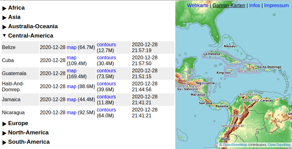
- [1] From 25 December OpenTopoMap now provides OSM maps for Garmin worldwide.
Software
- ’15-minute Santa’ is a game where you deliver presents across Seattle. You earn more points delivering to high-density housing, and you need to refuel from shops, so you’ll have to understand where people live in relation to where they work and shop. You can download it to run on Windows, Mac, or Linux; or just play it online (slower and without music).
- As we reported last week, version 2.0 of Maps.Me on Apple hardware has lost significant functionality. A thread on HackerNews provides further discussion with various recommendations for suitable replacement software.
- Telegram is a messaging service used widely by the OSM community. TechCrunch reports that its founder Pavel Durov said that the platform needs to generate revenue starting next year to keep the business afloat. The service will introduce its own ad platform for public one-to-many channels and the question remains as to if these will be extended to groups in the future.
- WHODIDIT is now working again after a server upgrade.
Releases
- StreetComplete continues to have new features added and existing ones improved. These features include support for tagging shops and other objects as gone (directly within SC), improvements to the interface, and asking about the maximum allowed vehicle heights for roads passing under bridges.
Did you know …
- … that support for Adobe Flash in major browsers was removed at the end of 2020? And that Adobe will block Flash content from running in Flash Player beginning 12 January 2021? As a result Potlatch 2 will be no more. Its replacement Potlatch 3 runs under Adobe AIR on Mac and Windows (Linux is a work in progress).
- … Rob’s OSM Stuff includes a list of OSM objects in the UK that you’d expect to have a name, but which do not have a
nametag? - … the OSM Editor Layer Index lists aerial imagery and map layers that can be used in OpenStreetMap? The equivalent list for JOSM can be found on their wiki.
- … this simple calculator can show the shortest connection (geodesic) between two points on a world map? The site can also calculate other things such as distance to the horizon or distance from a point to a line.
- … that MapRoulette has its own blog?
Other “geo” things
- For over 100 years, King William’s College, a private school on the Isle of Man, has set a fiendish general knowledge quiz for its students. Originally the paper was examined twice: once sight unseen before the Christmas break, and once again when pupils returned to school. There are usually a number of geo-related questions or themes (for instance group 3 this year), but rest assured they’re as hard as the rest. The average score on the unseen paper was 2/180 with the best scores being around 50.
- Analysis of data from weather stations near Mount Everest has shown that the height of the mountain measured by an altimeter (or your lungs) can vary by up to 740 m. This means that at times K2 can feel taller than Everest.
- eBikeNews introduced > the new, very versatile Bryton Rider 750 bicycle navigation system.
- The Australian edition of The Guardian presented the oddest (sometimes rude) names for real places in Australia.
- The Geospatial Evaluation and Observation Lab (Geolab) shared their 2020 Annual Report. This Lab based at the William & Mary research university campus, Williamsburg, Virginia, collects and provides open GeoBoundaries data of administrative zones and other geolocated data. It also conducts AI projects.
Upcoming Events
| Where | What | Online | When | Country |
|---|---|---|---|---|
| Missing Maps London Mapathon | 2021-01-05 | |||
| Landau an der Isar | Virtuelles Niederbayern-Treffen | ✓ | 2021-01-05 |  |
| San Jose | Virtual Civic Hack & Map Night | ✓ | 2021-01-08 |  |
| Bochum | Bochum OSM-Stammtisch (online) | 2021-01-07 | | |
| Dresden | Dresdner OSM-Stammtisch | ✓ | 2021-01-07 | |
| Warszawa | Virtual community meeting. | 2021-01-08 |  | |
| Virtual meeting of the Polish OSM Association | 2021-01-09 | |||
| Zürich | OSM-Treffen Zürich | 2021-01-11 |  | |
| Chippewa Township | Michigan Online Meetup | ✓ | 2021-01-14 | |
| OpenStreetMap US Mappy Hour | 2021-01-14 | |||
| Berlin | 151. Berlin-Brandenburg OpenStreetMap Stammtisch (Online) | 2021-01-14 | | |
| Warszawa | Virtual community meeting. | 2021-01-15 | | |
| Lyon | Rencontre mensuelle (virtuelle) Lyon | ✓ | 2021-01-19 |  |
| Missing Maps DRK Online Mapathon | 2021-01-19 | |||
| 135. Treffen des OSM-Stammtisches Bonn | 2021-01-19 | |||
| Berlin | OSM-Verkehrswende #19 (Online) | 2021-01-19 | | |
| Lüneburg | Lüneburger Mappertreffen (online) | 2021-01-19 | |
Note:
If you like to see your event here, please put it into the OSM calendar. Only data which is there, will appear in weeklyOSM.
This weeklyOSM was produced by Mateusz Konieczny, Nordpfeil, Polyglot, rogehm, SK53, Sammyhawkrad, TheSwavu, derFred.