03/04/2018-09/04/2018
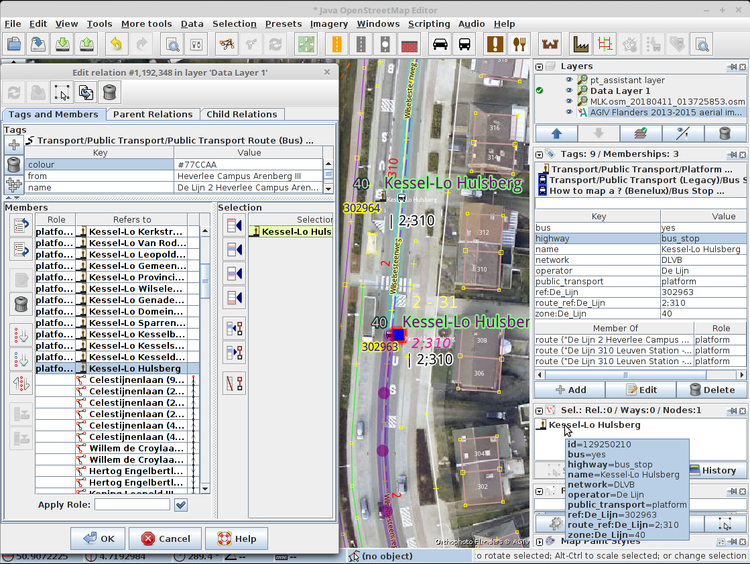
Illustration of how Polyglot proposes to simplify mapping of public transport. 1 | Image © Polyglot
About us
- Last week we reported about the revert of invented names for runways. Contrary to our report, the revert itself and the
noname=yeswas not performed by Frederik Ramm.
 by Frederik Ramm.
Mapping
- John Willis looks for the most appropriate tagging for flower fields specifically cultivated as a tourist attraction.
- Thorsten Engler in Australia criticized the mappers from Microsoft’s open data team, because they added, in his opinion, unnecessary turn restrictions near roundabouts.
- Mateusz Konieczny suggests changing the description of
amenity=bus_stationin the OSM wiki. - On talk-de a discussion is going on about whether to glue landuse to highways (reuse their nodes), or not. The project started out as an abstraction, so reusing the nodes of highways to avoid empty triangles in the rendering was the best solution for a long time, at least until we started to be able to map in more and more detail thanks to better imagery. Now it is perceived as imprecise by some and annoying by others. It seems like we will have to map all the highways as their own landuse areas (comparable to larger rivers), in order to avoid empty spikes on the map.
- Over the past weeks, a probably organized, group of mappers corrected alleged mistakes on roads (gaps, one-way streets, bans,…) in Germany and Great Britain, but did so in an incorrect, possibly automated way, thereby hiding real mistakes. See the discussion in the German forum and two emails on the talk-gb mailing list.
- Nicolas Chavent published a Twitter moment about the open science based project CohéSIoN in Bouaké (second city of Ivory Coast) where after two weeks of training, a mapping collective (local OSM members and young researchers) have started a four week long urban survey based on OSM: buildings, health, education, Central State and local authorities amenities, places of worship, markets and drinking water points.
- DWG has blocked 29 user accounts editing in Jakarta on behalf of GlobalLogic India because a local mapper felt overwhelmed.
- User pierzen created a new MapCSS style for JOSM to visualise boundary relations with user configurable levels.
- Another group of organised mappers adding minor roads attracts attention in India due to editing errors and unsuccessful attempts to get in touch with them. DWG issued user blocks on their accounts.
- After several years of mapping
public transportand looking in different places around the world how it is done, user Polyglot proposes a simplification to the schema to make it straightforward to understand and maintain for all mappers.The principle hinges on usingnodesnext to the highways/railways to represent the stops for their full ‘lifetime’ and only adding these nodes to therouterelations, one object per stop. This does not mean that platform ways/areas can’t be mapped any more in addition to these nodes.
Community
- On the osm-talk mailing list, Daniel Koć announces the creation of a new subforum focused on OSM Carto rendering.
- User Michał reports about a bot that comments changesets with wrongly tagged addresses and wonders about the community’s opinion on this practice.
- User rurseekatze proposes (automatic translation) to delete wiki pages of municipalities and counties lacking maintenance and proper content.
Imports
- The OpenStreetMap communities in France and Germany reject the NavAds gas station import due to quality issues.
OpenStreetMap Foundation
- The Minutes of the Engineering Working Group meeting of April 5th was published.
Events
- From October 5th to 7th, Detroit is the place to be for the State of the Map US.
- On April 23rd there will be a Field Cartography Workshop in Grenoble, France. It will be a mapping party with specific focus on mobile apps, but also a small retrospective step with Walking Papers.
- The organizers look back at FOSSGIS 2018, the German conference for OpenStreetMap and open source software. With 465 participants, it was the second-largest FOSSGIS so far.
- State of the Map Asia 2018 is happening in Bengaluru, India from 17th till 18th of November. You can already submit proposals for talks or workshops.
Maps
- Twitter user davvyk shared some pictures of the etched maps of San Francisco which he made using OpenStreetMap data. He also shares the process behind making this happen.
switch2OSM
- Met Éireann, the Irish Meteorological service, uses OSM as its background map.
Software
- OpenRouteService celebrates its 10th anniversary. This makes ORS the oldest OSM route planning service. You can reread Pascal’s original announcement from 2008 and this is a nice summary from GIScienceBlog.
Programming
- From May 7 onwards all unencrypted HTTP requests will be forwarded to planet.openstreetmap.org on HTTPS (port 443). For Curl, Java (Osmosis) and other HTTP clients this following of redirects must be activated manually!
- Arne Johannessen has published his diploma thesis (PDF) with the title “Algorithms for automated generalization by combining polylines in OpenStreetMap for specific special cases” and he also released the corresponding Java source code.
- Jochen Topf presents the innovation of Libosmium 2.14 and Osmium-Tool 1.8. Many bugs related to missing timestamps and other metadata fields have been fixed and the ability to write OSM files with only certain metadata fields was added.
Did you know …
- … that the German forum wondered about the origin of these grey networks of GPS traces on osm.org?
Other “geo” things
- Jason Grinblat (@ptychomancer) tweets about his love of map generators, and demos several of them, for example, Red Blob Games’ Map Gen 2.
- Damon Burgett from Mapbox explains how his team developed a Satellite Health Index. Taking the distributions of users into account, this tool finds the priority areas for imagery updates.
- Cityzenith launched the commercial Smart World Pro 3D data platform, which allows to combine many different data sources in 3D visualisations, including OSM data.
- On the 50th anniversary of Martin Luther King Jr.’s assassination, National Geographic created a magazine with pictures of streets around the globe dedicated to his memory. Further pictures are reachable via Google Street View and an interactive OSM map.
Upcoming Events
| Where | What | When | Country |
|---|---|---|---|
| Poznań | State of the Map Poland 2018 | 2018-04-13-2018-04-14 |  |
| Sulbiate | Festival dell’Ambiente | 2018-04-13-2018-04-15 |  |
| Tokyo | 東京!街歩き!マッピングパーティ:第18回 本郷大横丁通り商店街 | 2018-04-14 |  |
| Berlin | Berlin Hack Weekend April 2018 | 2018-04-14-2018-04-15 |  |
| Lüneburg | Lüneburger Mappertreffen | 2018-04-17 | |
| Cologne Bonn Airport | Bonner Stammtisch | 2018-04-17 | |
| Karlsruhe | Stammtisch | 2018-04-18 | |
| Mumble Creek | OpenStreetMap Foundation public board meeting | 2018-04-19 | |
| Leoben | Stammtisch Obersteiermark | 2018-04-19 |  |
| Leicester | Pub Meetup | 2018-04-19 |  |
| Freiberg | Stammtisch | 2018-04-19 | |
| Shizuoka | 静岡!街歩かない!マッピングパーティ2 | 2018-04-22 | |
| Bremen | Bremer Mappertreffen | 2018-04-23 | |
| Nottingham | Pub Meetup | 2018-04-24 | |
| Essen | Mappertreffen | 2018-04-25 | |
| Dusseldorf | Stammtisch | 2018-04-25 | |
| Lübeck | Lübecker Mappertreffen | 2018-04-26 | |
| Graz | Grazer Linuxtage | 2018-04-27-2018-04-28 | |
| Bochum | OSM Einführungsworkshop für Anfänger mit praktischer Umsetzung | 2018-04-28 | |
| Rome | Incontro mensile | 2018-04-30 | |
| Toulouse | Réunion mensuelle | 2018-05-02 |  |
| Montreal | Les Mercredis cartographie | 2018-05-02 |  |
| Stuttgart | Stuttgarter Stammtisch | 2018-05-02 | |
| Bochum | Mappertreffen | 2018-05-03 | |
| Dresden | Stammtisch Dresden | 2018-05-03 | |
| Urspring | Stammtisch Ulmer Alb | 2018-05-03 | |
| Grenoble | [Missing Maps mapathon] | 2018-05-03 | |
| Disneyland Paris Marne/Chessy Railway Station | FOSS4G-fr 2018 | 2018-05-15-2018-05-17 | |
| Bordeaux | State of the Map France 2018 | 2018-06-01-2018-06-03 | |
| Milan | State of the Map 2018 (international conference) | 2018-07-28-2018-07-30 | |
| Dar es Salaam | FOSS4G 2018 | 2018-08-29-2018-08-31 |  |
| Bengaluru | State of the Map Asia 2018 (effective date to confirm) | 2018-11-17-2018-11-18 |  |
Note: If you like to see your event here, please put it into the calendar. Only data which is there, will appear in weeklyOSM. Please check your event in our public calendar preview and correct it, where appropriate.
This weeklyOSM was produced by Anne Ghisla, Nakaner, Polyglot, Rogehm, Spanholz, Spec80, YoViajo, derFred, jinalfoflia.
Any chance for the English version?
Please note that the original report (in english) did not list Frederik as responsible for the revert of the made up aerodrome name. Only the initial translation to german apparently did.
I add turn restrictions on roundabout feeders/slip roads. Some time these feeders can be quite long so it would be possible to a router app to suggest making a u-turn if a wrong exit was taken.
I also don’t think that a developer should be forced to have to code a load of work-arounds. Sure, I know it’s possible but it raises the barrier to making good routers.