02.06.–08.06.2020
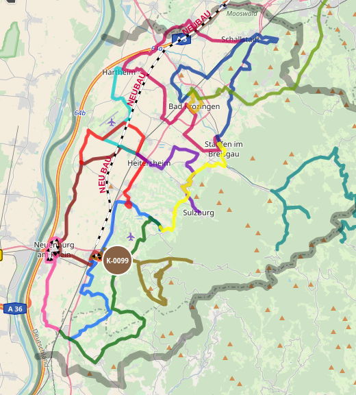
Nové nápady a koncepty pro regionální veřejnou dopravu 1 | © AGUS Markgräflerland e.V. | © přispěvatelé OpenStreetMap
OSM CZ
- Bude další kvartální pivo s přihlédnutím na COVID-19? A co takhle virtuální pivo?
- Informace o novém editoru bodů zájmu pro Android LoPOI.
OSM SK
- Byl nasazen nový server pro freemap.sk a starý se po 10 letech služby odebral na odpočinek.
- Člověk pracující jako kurýr se ptá na aplikaci nebo způsob, jak zaznamenat a později do OSM přidat názvy ulic nebo čísla domů.
- Mapy.cz nově umí plnohodnotnou navigaci pro auta včetně řazení do pruhů.
Mapování
- Otázka, zda mapovat objekty, které aktuálně nebo nadále nejsou na povrchu viditelné, se opět objevila na mail listech talk a tagging.
- Rafael Avila Coya ukazuje tři rozdílné způsoby mapování ‘překrývajících se přírodních prvků’.
- Smazali byste místo mapované jako boulderovou stěnu pro sportovní lezení tagem
sport=climbing, pokud Poznámka OSM žádá o nezveřejňování takovýchto míst? Tato otázka se diskutovala (automatický překlad) na německém fóru.
 - Návrh od Jana Michela na tagování přístupu pro nové typy elektrických mobilitních zařízení jako jsou skútry, koloběžky nebo elektrokola byl schválen.
- Další nedávno schválený návrh byl vytvořen uživatelem Fanfouer. Dovoluje popsat konkrétní topologii rozvodů elektřiny zavedením klíče
line_management=*. - Návrh uživatele Pelderson na nové hodnoty rolí, jmenovitě
alternative,excursion,approachaconnection, členů relací rekreačních tras byl otevřen pro hlasování.
 (automatický
 Komunita
- Ilya Zverev zrušil hlasování pro letošní ceny OSM Awards a také vyhlásil nový formát cen pro rok 2021. WeeklyOSM upozorňuje, že všichni nominovaní udělali velký kus cenné práce pro celý projekt OpenStreetMap. Seznam nominovaných pro jednotlivé kategorie najdete zde:
- Byl obnoven (automatický překlad) účet OpenStreetMap Deutschland na YouTube a hledá pomoc a zajímavý obsah.
- Stejně jako Nadace OSM i lokální zastoupení pro Německo, organizace FOSSGIS, nabízí vlastní program mikrograntů. Rozdíl mezi těmito dvěma programy je, že nemusíte být členem Nadace OSM ani FOSSGIS, abyste mohli podat žádost (automatický překlad) o grant FOSSGIS, a že program FOSSGIS běží již přes 10 let. Mezi granty pro letošní rok je také populární mapa historických prvků Historic Place.
- Toshikazu Seto, Hiroshi Kanasugi a Yuichiro Nishimura publikovali článek o kontrole kvality s použitím Poznámek OSM. Článek je rozšířením jejich prezentace z akademické sekce SotM 2019.
- Ilya Zverev se do OpenStreetMap zaregistroval před 10 lety. Při této příležitosti zaslal (automatický překlad) na kanál na Telegramu krátké ohlédnutí. Vypadá to, že se dnes již věnuje OSM méně, na úkor své práce a dalších koníčků, ale to se může a nemusí kdykoliv změnit 😉
 (automatický
 Nadace OpenStreetMap
- Michael Reichert si myslí, že by Nadace OSM neměla udělit práva na použití svého jména v konkrétním případě projektu ‘OSM Buildings’, protože se snaží ochránit firmu 3DBuildings, která existuje od roku 2013. Impulzem byla žádost firmy Cesium používat název ‘Cesium OSM Buildings’. Rozdíl oproti 3DBuildings, která provozuje web osmbuildings.org a firmou Cesium je, že ten druhý požádal Nadaci OSM o použití jména a že prohlížeč pro 3DBuildings je dostupný na GitHubu.
- Předseda rady Nadace OSM Allan Mustard přišel s návrhem, jak vylepšit vztahy mezi částmi komunity a vývojáři editoru iD. Cituje často kritizované rozhodování týmu kolem iD ohledně zvolených tagů, ale jde mnohem dále. Návrh byl publikován jako příspěvek na blogu a jako mail do mail listů talk a osmf-talk. Allan explicitně žádá o komentáře. Tento návrh by se mohl aplikovat i na jiné projekty a vývojáře.
- Pracovní skupina OSM pro data vydala svůj report aktivit pro 4. čtvrtletí roku 2019. Obsahuje i neobvyklý případ znovu-používání uzlů.
- Jsou k dispozici zápisy z jednání systémových administrátorů z 4. května a 22. května.
- Komise pro mikrogranty Nadace OSM provedla dle Chrise Beddowa kontrolu všech návrhů na projekty mikrograntů a nyní finalizuje výsledky a potvrzuje si rozhodnutí s radou Nadace OSM. Informace o přijetí příjemcům financí a oznámení komunitě bude učiněno v první polovině června. Výbor velmi děkuje všem, kteří zaslali své žádosti ke zvážení. Craig Allan a Mike Collinson byli jmenováni pro dohled nad celým procesem.
Události
- Environmental Futures & Big Data Impact Lab bude 16. června 2020 pořádat hodinové on-line představení světa OSM, včetně průvodce aktualizací dat v OSM.
Humanitární OSM
- HOT vítá 27 nových členů s právem hlasování.
- Humanitární tým OpenStreetMap a nizozemský Červený kříž/510 spustili experiment pro měření efektu mapování podpořeného umělou inteligencí v porovnání s klasickým mapováním.
Vzdělávání
- Italský uživatel Ferruccio Cantone publikoval (automatický překlad) průvodce s radami a vysvětleními, jak mapovat pomocí programu OsmAnd během jízdy na kole.
- Otevřené vzdělávací zdroje (Open Educational Resources) je to, o čem teď každý mluví. Prof. Stefan Keller z HS für Technik Rapperswil oznámil na Twitteru dostupnost své prezentace ‘Materiály OpenSchoolMaps o OpenStreetMap a o (geo)vizualizaci’. Mimo jiné tato prezentace odkazuje na:
- Materiály pro výuku (pracovní sešity): Otevřený vzdělávací zdroj ve formátu PDF.
- Vše je dostupné v rámci repozitáře v originálním formátu.
- Struktura výukových materiálů nebo pracovních sešitů jako PDF:
- Informace pro učitele, představení a příprava.
- Pracovní sešity s řešeními.
 (automatický
 Mapy
- Švédská televizní stanice SVT vytvořila cestovní mapu ukazující, jak daleko se dá dostat za dvě hodiny. To je maximální vzdálenost od domu, na kterou je doporučeno ve Švédsku v rámci COVID-19 cestovat. Podkladem jsou data z OSM.
- Americká mediální firma PBS vytvořila mapu postavenou na OSM, která vizualizuje výstražnou síť Wireless Emergency Alerts, používanou ve Spojených státech pro varování veřejnosti.
Přechod k OSM
- Michael Norelli použil plugin pro QGIS jménem MMGIS pro geokódování 48 000 lokálních adres s využitím Nominatimu. To rapidně snížilo množství adres, které následně geokódoval s použitím služeb Google. To demonstruje, že i pokud nejsou zmapovány všechny adresy, chytrý čtenář je stále může využít. Uživatelé by měli mít na paměti Pravidla použití Nominatim.
Otevřená data
- V podrobném příspěvku na blogu popisuje (automatický překlad) uživatel Robhubi problém se získáním výškových dat z GPS a barometrických senzorů. Ve svém článku se věnuje mnoha detailům, které je potřeba vzít v úvahu, pokud chcete tato data používat.
Software
- Do Guru Maps byla ve verzi v4.5 přidána podpora pro GeoJSON a MapCSS. Uživatelé mohou přidávat do mapy vrstvy se svými daty.
- Nad mapou lze zobrazit několik souborů GeoJSON najednou.
- Zobrazení souborů GeoJSON lze upravit s pomocí MapCSS.
- Pro změnu souborů GeoJSON a MapCSS lze nastavit aktualizaci odkazem.
- Všechny tyto vlastnosti jsou dostupné zdarma pro všechny uživatele.
- OsmAnd dosáhl věku 10 let. Editoři gratulují k tomuto výročí.
- Existuje služba podobná Tasking Manageru, která rozdělí oblasti na menší části pro mapování lidmi, nazvaná ‘Divide and map. Now’. Ve svém deníku píše uživatel qeef o zkušenosti s nastavováním služby na levném virtuálním serveru a její testování se 100 mappery.
Programování
- Ubipo vydalo dva pluginy pro JOSM: Center Node pro vytváření uzlu ve středu výběru a Shrinkwrap pro vytváření různých typů obalů kolem výběru. Užitečné pro mapování využití půdy a další oblasti.
Nová vydání
- Nová verze JOSM, stabilní vydání verze #16538, přichází s překlady do islandštiny a perského farsí a nespočetně nových vlastností a vylepšení.
- Track Guru (automatický překlad), nástroj pro analýzu GPS stop v GPX souborech, má novou verzi (automatický překlad). Byla přidána funkce na korekci pozice (manuální posun bodu na trase).
Věděli jste …
- … o Ethermap od Chrise Lamba? Zdrojový kód byl publikován na GitLabu. Karlos z OSMgo vytvořil pěknou mapu postavenou na Ethermap. Informace o akcích bere stejně jako WeeklyOSM z OSM kalendáře na wiki.
- … o knihovně pro JavaScript openglobus od uživatele zemledelec? Dovoluje zobrazovat 3D mapy a autor žádá o zpětnou vazbu.
- … o webu ‘Kde je trh?’ od Tobiase Preuße ukazující týdenní trhy v různých městech v Německu? Software pro tento web je svobodný a otevřený pod licencí MIT a je dostupný na GitHubu.
OSM v médiích
- Markgräflerland Environmental Protection Association nabízí sérii map 1, 2, 3, 4, 5, 6, 7, 8, 9, 10 s informacemi k životnímu prostředí včetně ‘Nové nápady a koncepty pro regionální veřejnou dopravu’. Report byl publikován v Badische Zeitung (automatický překlad).
Ostatní geo záležitosti
- Francouzská archeologická mise v Kitionu publikovala příběhovou mapu , která zve návštěvníka na cestu skrz historii dávného města Kition, které bylo založeno ve 13. století před naším letopočtem a dnes je překryto současným kyperským městem Larnaca.
- Sesuv půdy strhl v norském městě Alta do moře několik domů. Tato dramatická událost byla zachycena na video. Všimněte si, že čára pobřeží potřebuje v OSM vylepšit.
- Již jsme psali o mapě vizualizující jména ulic v Bruselu podle pohlaví. Nyní na základě stejného projektu bylo přidáno další město: srbský Bělehrad. Je zmapována etymologie všech jmen ulic v Bělehradu a 11 % ulic je pojmenováno po ženách. Je to téměř dvojnásobek oproti Bruselu, ale daleko od rovnosti pohlaví. Původní projekt byl přepracován, aby umožnil jednoduché použití v nových městech. Které město tedy bude další?
- GIScienceHD publikoval krátký příspěvek ‘Výzkum chybějících zastavěných oblastí v OpenStreetMap v Mozambiku pomocí hierarchického shlukování Twitteru a hlubokého učení’, který odkazuje na článek od Hao Li a kol. na Science Direct.
- Blog Map of the Week píše o Tetsuya Fujitovi, zvaném pan tornádo, který nejen vytvořil F-stupnici pro měření intenzity tornád, ale také kreslil zajímavé mapy.
- Blog Geoobserver (automatický překlad) zmiňuje utopení sochy obchodníka s otroky Edwarda Colstona v Bristolu v kontextu celosvětového hnutí #BlackLivesMatter. Uvidíme, jestli uživatel stadtvermesser zadal místo přesunu správně.
 , která zve návštěvníka na cestu skrz historii dávného města
 Plánované události
| kde | co | kdy | země |
|---|---|---|---|
| Mnichov | Münchner Treffen | 11.06.2020 |  |
| Curych | 117. OSM Meetup Zurich | 11.06.2020 |  |
| San José | Virtual Civic Hack Night & Map Night | 11.06.2020 |  |
| Berlín | 144. Berlin-Brandenburg Stammtisch (Online) | 12.06.2020 | |
| Berlín | OSM Berlin Verkehrswende (Online) | 16.06.2020 | |
| Lüneburg | Lüneburger Mappertreffen (Online) | 16.06.2020 | |
| letiště Kolín-Bonn | 128. Bonner OSM-Stammtisch (Online) | 16.06.2020 | |
| Leoben | Stammtisch Obersteiermark (cancelled) | 18.06.2020 |  |
| Sheffield | Sheffield pub meetup | 23.06.2020 |  |
| Guarda | EuYoutH OSM Meeting (cancelled) | 24.06.–28.06.2020 |  |
| Düsseldorf | Düsseldorfer OSM-Stammtisch | 26.06.2020 | |
| Rennes | Atelier découverte | 28.06.2020 |  |
| Stuttgart | Stuttgarter Stammtisch | 01.07.2020 | |
| Kapské Město | HOT Summit | 01.07.–02.07.2020 |  |
| Kandy | 2020 State of the Map Asia | 31.10.–01.11.2020 |  |
Poznámka: Pokud zde chcete vidět vaši akci
Toto číslo přeložil tom.k a redakčně upravili mkyral a YjM. Budeme velmi rádi, pokud podpoříte a oceníte naši práci tím, že budete dílo dále šířit, např. sdílením na sociálních sítích (like, retweet, boost…). Předem za to děkujeme.
Každé číslo v CZ verzi je promováno zde: @osmcz |
  @osmcz |
  Talk-cz | osm_sk |
  rss
rss
Můžete nás kontaktovat e-mailem:  weekly@openstreetmap.cz
Originál tohoto souhrnu připravili: AnisKoutsi, Anne Ghisla, LorenzoStucchi, Nakaner, NunoMASAzevedo, PierZen, Polyglot, Rogehm, SK53, SunCobalt, TheSwavu, derFred, jinalfoflia, mOlind, renecha.