29/06/2021-05/07/2021
KGeoTag um programa autónomo de geotagging para Linux [1] | © Tobias Leupold – KDE.org | map data © OpenStreetMap contributors
Mapeamento
- A comunidade polaca propõe
 > uma edição automatizada para atualizar os limites de velocidade urbana noturna.
 - A proposta para complementar
man_made=utility_polecomutility=*. A votação foi aprovada com 16 votos a favor, 2 votos contra e nenhuma abstenção.
 >
> 
 para complementar
 Comunidade
- Apocolocyntōsis ponderou > sobre de onde vem o prazer de mapear.
- DeBigC reviu >
edições na Irlanda, usando o StreetComplete nos últimos 5 anos. - laznik propõe-se >
enviar às empresas que empregam mapeadores uma fatura que demonstre o nosso trabalho comunitário e recebe muitos comentários. Para relatar os esforços, ele explica a aplicação Rovas que também tem um plugin JOSM. - O Mapeador do Mês > do OpenStreetMap Bélgica de julho é s8evq.
Importações
- O utilizador Michael propõe-se > importar cerca de 1000 bocas de incêndio ao redor da cidade de Gangelt.
- Komadinovic Vanja anunciou > a intenção da comunidade sérvia OSM de importar e atualizar cerca de 1500 postos de correio, usando dados do serviço postal local (JP Pošta Srbije).
- qeef escreve > no seu blogue sobre como a importação > a partir do Tanga Building Footprints o inspira e apresenta um fluxo de trabalho de mapeamento com os dados.
Eventos
- A FOSS4G TOKAI 2021 será realizada online a 28 de agosto. As inscrições para apresentadores e participantes estão a ser feitas agora.
- O podcast Geomob apresentou > uma entrevista com Gregory Marler sobre o próximo State of the Map. Gregory é um membro da comissão organizadora.

Investigação OSM
- Utilizando o cyclestreets R package da Robinlovelace, Elise Desjardins e os colegas descobriram como o fluxo da bicicleta, em Hamilton, se correlaciona com as rotas mais curtas e silenciosas que minimizam o tráfego.
Mapas
- Usando o OpenStreetMap como camada base, o utilizador quitegrey mapeou os itinerários mais eficientes que os bombeiros de Hornsey, de Londres, poderiam ter usado para resgatar 13 gatos de 13 árvores diferentes, desde 2009.
- A equipa do OpenStreetMap Ops anuncia no Twitter novos históricos para ícones gráficos frequentemente vistos. Pode-se usar para mapeamento de algo objetivo, pré-renderização e muito mais.
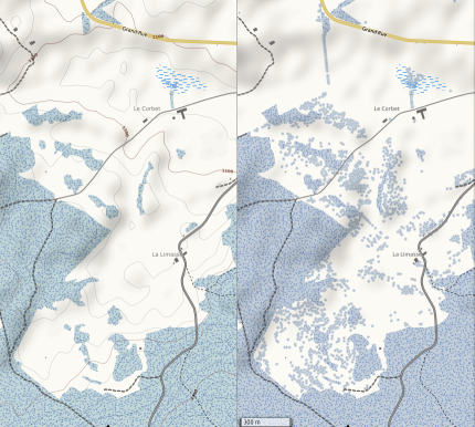
- yvecai atualizou > o estilo para o OpenSnowMap. Uma das coisas que agora se incluem são árvores isoladas (natural=tree)
Software
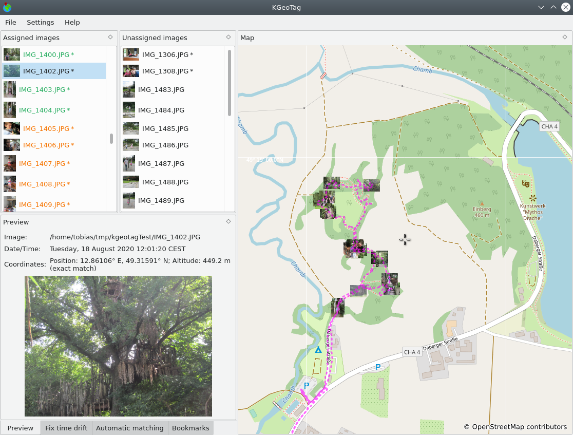
- KGeoTag é uma nova aplicação no universo KDE para mapear arquivos de imagem para localizações GPS. Isto pode ajudar a lembrar o local exato onde uma foto foi tirada ou para descobrir fotos tiradas no mesmo local.
- Tobias Zwick criou o StreetCompleteness, uma interface web que mostra a percentagem de conclusão de alguns testes StreetComplete escolhidos como uma ferramenta de análise de qualidade de dados.
Programação
- Lonvia deu-nos > uma visão geral de como o Nominatim lida com abreviaturas, como St. em inglês (para Street ou Saint).
Sabia que…\Conhece…
- … o www.lightningmaps.org baseado no OSM?
- … os geothreads da OpenCage, nomeadamente os de geoweirdness, por exemplo, Noruega ou Itália?
- … as Estatísticas do OpenStreetMap – @OSMstats no Twitter?
OSM nos média
- Alex Hern, do The Guardian, relatou > a intenção da OSMF de procurar relocalizar-se dentro da UE (como relatamos).
- A edição polaca de PC Format convidou > > a OSMF a mudar-se para a Polónia.

Próximos eventos
| Onde | O quê? | Online | Data | País |
|---|---|---|---|---|
| OSM Africa Monthly Mapathon: Map Nigeria | 2021-07-02 – 2021-08-02 | |||
| State of the Map 2021 | 2021-07-09 – 2021-07-11 | |||
| Saint-Louis | Geomatica Mapathon: Réserve de Guembeul | 2021-07-10 – 2021-07-11 | sn | |
| Bogotá Distrito Capital | Resolver notas de Bogotá creadas en OpenStreetMap | 2021-07-10 |  | |
| Missing Maps Online Mapathon | 2021-07-12 | |||
| Hamburg | Hamburger Mappertreffen | 2021-07-13 |  | |
| OSM US Mappy Hour | 2021-07-15 | |||
| Albuquerque | MapABQ July virtual meetup | 2021-07-16 |  | |
| Missing Maps MSF-USA Virtual July Mapathon | 2021-07-16 | |||
| Bogotá Distrito Capital | Resolver notas de Bogotá creadas en OpenStreetMap | 2021-07-17 | | |
| Derby | East Midlands OSM Pub Meet-up : Derby | 2021-07-20 |  | |
| Bonn | 141. Treffen des OSM-Stammtisches Bonn | ✓ | 2021-07-20 | |
| Berlin | OSM-Verkehrswende #25 (Online) | 2021-07-20 | | |
| Lüneburg | Lüneburger Mappertreffen (online) | 2021-07-20 | | |
| Lüneburg | 2021-07-20 | | ||
| Berlin | Missing Maps Ärzte ohne Grenzen Mapathon | 2021-07-21 | | |
| Virtueel treffen OpenStreetMap NL | 2021-07-24 | |||
| Bogotá Distrito Capital | Resolver notas de Bogotá creadas en OpenStreetMap | 2021-07-24 | | |
| Bremen | Bremer Mappertreffen (Online) | ✓ | 2021-07-26 | |
| Ville de Bruxelles – Stad Brussel | Virtual OpenStreetMap Belgium meeting | ✓ | 2021-07-27 |  |
| Aubière | Rencontre OpenStreetMap Clermont | 2021-07-28 |  | |
| Zürich | Missing Maps Zürich Mapathon | 2021-07-28 |  | |
| Düsseldorf | Düsseldorfer OSM-Treffen (online) | 2021-07-28 | | |
| [Online] OpenStreetMap Foundation board of Directors – public meeting | 2021-07-30 | |||
| 臺北市 | COSCUP 2021 OpenStreetMap x Wikidata 開放內容議程軌 (CfP) | 2021-07-31 – 2021-08-01 |  |
Nota: Se pretender ver o seu evento aqui, por favor OSM Kalender coloque-o no calendário. Só dados lá colocados aparecerão no weeklyOSM.
Este semanárioOSM foi produzido por Elizabete, Lejun, NunoMASAzevedo, derFred.
Wie lässt sich KGeoTag installieren?
There is a mistake in this week’s issue. I do not run the website “StreetCompleteness”, I have no association with it. Credit goes to reddit user haukauntrie, see
https://www.reddit.com/r/openstreetmap/comments/msw9vk/i_made_a_little_webtool_where_you_can_see_the/