2021.10.26.-2021.11.01.
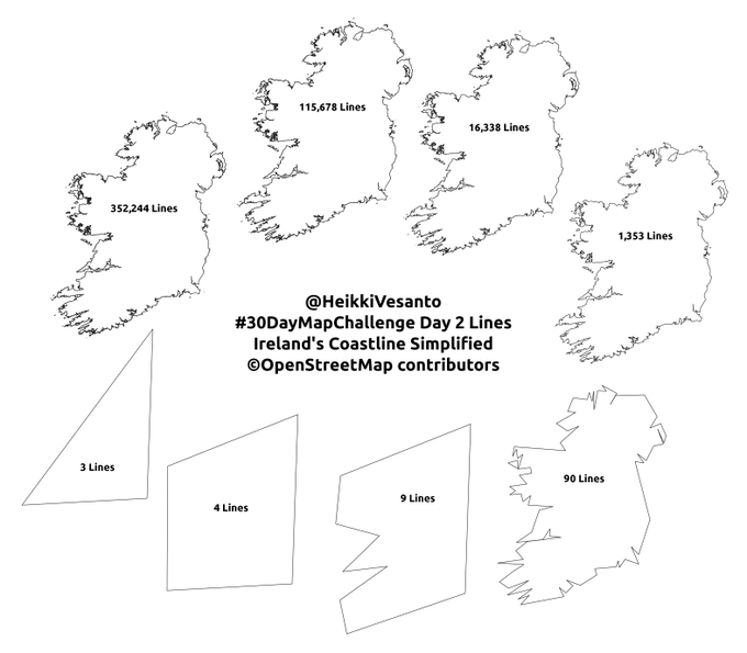
단순화한 아일랜드의 해안선 [1] | © HeikkiVesanto | map data © OpenStreetMap contributors
지도 제작 캠페인
- Jinal Foflia가 필리핀과 말레이시아 지역 오픈스트리트맵을 개선하는 데 참여할 사람을 구하고 있습니다. 관심이 있으시다면 여러분도 참여해 보세요!
- 러시아 오픈스트리트맵의 도로망을 개선하는 대회(이전에 보도한 적이 있습니다)가 종료되었습니다. 결과는 여기에서
 볼 수 있습니다.
 볼 수 있습니다.
지도 제작
- 인구 밀집지(시내, 읍내 등)을 적절하게 나타내기 위한 태그를 찾는 포럼 스레드가 다시 활성화되었습니다. 해당 스레드는 2015년, 오스트리아 잘츠부르크에 산재한
place=town태그에 문제를 제기하면서 시작되었습니다. - 찬반 투표가 종료된 제안들은 다음과 같습니다.
historic=creamery: 우유로부터 버터나 치즈, 아이스크림을 제조하는 건물을 나타내는 태그로, 찬성 12표, 반대 2표, 기권 1표로 가결되었습니다.currency:crypto:*=yes,no: 기존의 지불 체계 태그에 암호화폐를 포함하자는 제안으로, 찬성 22표, 반대 34표, 기권 2표로 부결되었습니다. 암호화폐 지지자들은 많았지만, 정작 다들 오픈스트리트맵 기여 경험이 적어 태그 체계를 잘 이해하지 못했던 것이 부결의 원인이 되었습니다.boundary=border_zone: DMZ와 같은 국경 지대를 나타내기 위한 태그로, 찬성 16표, 반대 0표, 기권 0표로 가결되었습니다.
- 지하 배수로나 파이프라인이 끝나는 지점에서 나오는 유체의 종류를 나타내기 위해 fanfouer가 제안한
outlet=*태그의 찬반 투표가 11월 11일에 종료됩니다. - SK53이 웨일스의 생태학적 서식지 분포 데이터와 오픈스트리트맵의
natural=heath(관목의 일종인 히스가 서식하는 곳 – 역주) 태그 분포를 비교했습니다.
커뮤니티
들여오기
- 최근 매필러리(Mapillary) 소프트웨어가 버전 3에서 4로 업데이트되면서 업로드된 사진의 ID가 모두 변경되었습니다(이전에 보도한 적이 있습니다). 이에 Kai Poppe가
mapillary태그를 일괄 수정하려는 계획을 세웠습니다.자동으로 수정할 수 없는 태그를 수정하기 위한 MapRoulette 도전도 있으니 확인해 보세요.
오픈스트리트맵 재단
- 이사회의 요청으로, 오픈스트리트맵 재단의 밴 정책에 “특정 조치를 취하기 전까지 계속 차단(Blocks until a particular action has been taken)” 항목이 추가되었습니다. 비록 지금까지의 관습을 문서화한 것에 불과하지만, 이사회 측에서는 관습의 성문화가 중요하다고 생각한 것 같습니다.
오픈스트리트맵 지부
- 내년 4월에 미국 애리조나 Tucson에서 개최되는 State of the Map US 2022의 참가 장학금 신청서를 제출할 수 있습니다.
행사
- 현지 오픈스트리트맵 설립 및 유지하는 방법을 공유하기 위해 HOT 인도주의 열린 지도 제작 커뮤니티 작업반에서 스페인어권 오픈스트리트맵 커뮤니티 설립자, 관리자, 구성원들을 찾고 있습니다. 회의는 11월 9일 새벽 1시(한국 시각)에 열립니다. 참가 신청은 여기에서 할 수 있습니다.
- 올해 이탈리아에서 개최되는 Genoa Science Festival의 주제는 ‘지도’입니다. 오픈스트리트맵 재단 이탈리아 지부에서는 오픈스트리트맵 기여자 4명을 회의에 참여시켜 전문적인 오픈스트리트맵 기여 활동을 소개할 계획을 마련했습니다. > 그 외에 국경없는의사회에서도 오픈스트리트맵과 관련해 발표를 진행할 예정입니다.
 >
> 
지도
- [1] 이전에 보도했던 30일 지도 챌린지(#30DayMapChallenge)가 시작되었습니다.
- 오픈스트리트맵 우간다(OpenStreetMap Uganda)에서 기존 급수 시설과 새로 건설한 태양광 급수 시설을 비교하는 트윗을 올렸습니다. 해당 작업은 Water Compass와 함께 진행했습니다.
- Mateusz Konieczny가 폴란드 바르샤바 지역 구글 지도의 버스 노선의 경로를 오픈스트리트맵에서 가져온 듯하다고 말했습니다. Mikołaj Kuranowski는 Mateusz의 의견이 사실이라고 답했습니다. 참고로 저작자 표기는 제대로 되어 있습니다.
- Cathalas가 레딧에 올라온 ‘유럽의 성 지도’를 평가했습니다. Cathalas는 국가별로 태그 체계와 관습에 차이가 있다면서, 지도에 나오지 않은 성들이 매우 많다고 말했습니다.
소프트웨어
- Wille가 OSMCha의 업데이트를 발표했습니다. 이제 스마트폰이나 태블릿에서 OSMCha를 더 편하게 쓸 수 있습니다.
- iOS/안드로이드 지도 앱, Organic Maps를 번역해 주세요.
- Zverik이 오픈스트리트맵 재단의 전용 Overpass 서버를 소개했습니다. > 해당 서버는 오픈스트리트맵 홈페이지의
↖?(지물 탐색) 버튼을 클릭했을 때 생성되는 쿼리를 처리하는 용도로만 사용됩니다.
프로그래밍
- 박정호 디지털 아티스트가 오픈스트리트맵 데이터를 예술적으로 시각화했습니다.
- 최근 엔지니어링 작업반에 합류한 Brandon Liu가 왜 오픈스트리트맵 데이터는 유니코드로만 이루어져 있다고 가정할 수 없는지 설명했습니다.
알고 계셨나요?
- 오픈스트리트맵 홍보 스티커와 저작권 스티커를 무료로 받을 수 있다는 사실을 알고 계셨나요?
기타 ‘지리’ 관련 소식
- Atomos 잡지사 소속 Ruth Hopkins 기자가 북아메리카의 토속 지명을 복원하려는 움직임을 조사했습니다. Uldis Balodis는 이러한 움직임이 다른 곳(발트 3국 등)에서도 나타나고 있다고 지적했습니다. 실제로 리브어(라트비아 일부 지역에서 사용하는 소멸 위기 언어 – 역주)로 이루어진 지명을 수집하는 프로젝트가 진행 중에 있습니다.
- 옛날 지도를 보여주는 사이트, Chronoscope World를 알고 계셨나요?
- 포르투갈에서 희귀한 내비게이션 사고가 두 건이나 일어났습니다. 하나는 보행자 도로로 가라는 내비게이션 안내를 그대로 따르는 바람에 지방 의회 옆 계단에 걸린 사고입니다.
- 또 다른 하나는 동 루이스 다리를 건너던 운전자가 지하철 터널(톰톰)에 진입한 사고입니다. 참고로 두 차량은 모두 르노 사의 자동차로, 톰톰(TomTom)의 지도를 사용합니다.

다가오는 행사
| 장소 | 명칭 | Online | 일시 | 국가 |
|---|---|---|---|---|
| Черкаси | Open Mapathon: Digital Cherkasy | 2021-10-24 – 2021-11-20 | ua | |
| Crowd2Map Tanzania is 6! Join our party mapathon to learn more about our work.. | 2021-11-07 | |||
| Cuiabá | Construcción de comunidad local en OSM: Consejos, trucos y desafíos | 2021-11-08 |  | |
| 臺北市 | OSM x Wikidata Taipei #34 | 2021-11-08 |  | |
| Toronto OpenStreetMap Enthusiasts Meeting | 2021-11-09 | |||
| Missing Maps Artsen Zonder Grenzen Mapathon | 2021-11-09 | |||
| Hamburg | Hamburger Mappertreffen | 2021-11-09 |  | |
| Zürich | OSM-Treffen Zürich | 2021-11-11 |  | |
| Berlin | 161. Berlin-Brandenburg OpenStreetMap Stammtisch | ✓ | 2021-11-11 | |
| FOSS4G State of the Map Oceania 2021 | 2021-11-12 | |||
| Missing Maps MonarchMappers Fall 2021 Mapathon | 2021-11-13 | |||
| Bogotá Distrito Capital | Resolvamos notas de Colombia creadas en OpenStreetMap | 2021-11-13 |  | |
| Geography 2050 Symposium – Mapathon for an Equitable Future | 2021-11-13 | |||
| Crowd2Map Tanzania GeoWeek Human Right’s Day FGM Mapathon | 2021-11-15 | |||
| UP Tacloban YouthMappers: MAPA-Bulig, Guiding the Youth to Community Mapping | 2021-11-15 | |||
| Grenoble | OSM Grenoble Atelier OpenStreetMap | 2021-11-15 |  | |
| OSMF Engineering Working Group meeting | 2021-11-15 | |||
| Missing Maps PDX GIS Day Mapathon | 2021-11-16 | |||
| Lyon | Lyon : Réunion | 2021-11-16 | | |
| Bonn | 145. Treffen des OSM-Stammtisches Bonn | 2021-11-16 | | |
| Berlin | OSM-Verkehrswende #29 (Online) | 2021-11-16 | | |
| Lüneburg | Lüneburger Mappertreffen (online) | 2021-11-16 | | |
| Missing Maps Arcadis GIS Day Mapathon | 2021-11-17 | |||
| Missing Maps WMU GIS Day Mapathon | 2021-11-17 | |||
| Köln | OSM-Stammtisch Köln | 2021-11-17 | | |
| Zürich | Missing Maps Zürich November Mapathon | 2021-11-17 | | |
| Chambéry | Missing Maps CartONG Tour de France des Mapathons – Chambéry | 2021-11-18 | | |
| MSF Global Mapathon | 2021-11-19 | |||
| State of the Map Africa 2021 | 2021-11-19 – 2021-11-21 | |||
| Lyon | EPN des Rancy : Technique de cartographie et d’édition | 2021-11-20 | | |
| HOT Summit 2021 | 2021-11-22 | |||
| Bremen | Bremer Mappertreffen (Online) | ✓ | 2021-11-22 | |
| Derby | East Midlands OSM Pub Meet-up : Derby | 2021-11-23 |  | |
| Düsseldorf | Düsseldorfer OSM-Treffen (online) | 2021-11-24 | | |
| [Online] OpenStreetMap Foundation board of Directors – public videomeeting | 2021-11-26 | |||
| Brno | November Brno Missing maps mapathon at Department of Geography | 2021-11-26 |  | |
| Amsterdam | OSM Nederland maandelijkse bijeenkomst (online) | ✓ | 2021-11-27 |  |
| HOTOSM Training Webinar Series: Beginner JOSM | 2021-11-27 | |||
| 長岡京市 | 京都!街歩き!マッピングパーティ:第27回 元伊勢三社 | 2021-11-27 |  |
참고: 행사를 여기에 추가하고 싶다면, 캘린더에 행사 일정을 작성해 주세요. 캘린더에 있는 데이터만 주간OSM에 나타납니다. 캘린더 미리보기에서 행사를 확인하고, 만약 행사 정보가 틀렸다면 적절하게 수정해 주세요.
이 주간OSM은 다음 사람들이 제작했습니다. LuxuryCoop, SK53, Strubbl, TheSwavu, derFred.
Follow us on the Fediverse
https://botsin.space/@OSMBlogde