19.07.–25.07.2022
Mapa akce May Contain Hackers 2022 [1] přispěvatelé OpenStreetMap
OSM CZ
- Má smysl mít u objektů Alzy i tag
name:cz, který nabízí editor iD? - Jak správně mapovat vinné sklípky?
OSM SK
- Jedna z Poznámek OSM je dobrá jako téma na diskuzi aneb omezení vstupů v chráněných územích.
- Odstranění chyb měření v datech z Lidaru při vlastním zpracování dat pro DMR 5.0 na Slovensku.
- Informace o dokončení re-importu chráněných oblastí na Slovensku.
- Žádost o podporu vykreslování značených běžeckých tratí na webu freemap.sk od uživatele z Francie.
Mapování
- Andrea Spinelli zjišťuje, jak v editoru iD nejlépe přidat body zájmu na přesné souřadnice. Oficiálně je tato funkce požadována. Vývojáři doporučují použít příkaz
Cmd+Opt+Mnebo ekvivalentní pro zobrazení panelu pro měření, který také ukazuje přesnou polohu vybraného uzly. V komentářích sdílí čtenáři své alternativní postupy. - Cyklostezka spojující německý Stuttgart a francouzský Strasbourg byla přidána i do OSM. O počátečních snahách jsme informovali minule. V terénu neznačená stezka vyvolala pochybnosti o tom, zda splňuje kritéria pro přidání do OpenStreetMap. Na různých komunikačních kanálech najdete názory jak pro, tak i proti: francouzský mail list
 > nebo německé fórum > .
 - EdoBoo informuje ve svém deníku o své návštěvě Forte di Montecchio, která ho motivovala k revizi mapování této pevnosti a přidání detailů.
- Mapování veřejné dopravy zřejmě stále zůstává pro nové mappery výzvou, přestože wiki obsahuje podrobný návod.
- ngumenawesamson z HOT prezentoval detailní klasifikaci různých aspektů kvality dat v OSM rozdělenou do 10 bodů. Plán je použít tuto klasifikaci pro identifikaci akcí, které je možné podniknout v rámci projektu HOT a které omezí možnost vzniku těchto problémů.
- Hlasování pro dokumentaci
předpon a přípon klíčů, jehož cílem je ustanovení konvencí a jich dokumentace na stránkáchKey:prefix:*respektiveKey:*:suffixna wiki, je otevřeno do neděle 7. srpna. - Skončilo hlasování o následujících návrzích na tagování:
school=entrancepro označení tohoto tagu jako zastaralý bylo schváleno s 26 hlasy pro, 3 hlasy proti a nikdo se nezdržel.amenity=library_dropoffpro mapování míst, kde lze vracet knihy do knihovny i mimo vlastní knihovnu byl schválen 12 hlasy pro, 1 hlasem proti a nikdo se nezdržel.
 >
> 
 >
> Komunita
- Národní kartografická agentura Velké Británie Ordnance Survey (OSGB) nedávno zveřejnila novou mapu nazvanou OS Map. Ta je dostupná jak přes web, tak i jako mobilní aplikace. Mapa nabízí vrstvy bezplatně dostupné, ale i vrstvy na bázi předplatného. Volně dostupné vrstvy integrují data z několika zdrojů: otevřená data OSGB, uzavřená data OSGB a data OpenStreetMap skrze MapBox. Komunita OSM ve Spojeném království zaznamenala problémy s vrstvami, které obsahují i soukromé cesty, což vyústilo v mazání zcela validních dat v OSM naštvanými vlastníky půdy.
- Uživatel TrickyFoxy vznesl dotaz ohledně příliš obtížné registrace nových uživatelů v OpenStreetMap přes mobilní platformy a odkazuje na různé problémy na GitHubu, jeden z nichž byl otevřen již v roce 2015. Jak poukázal Tom Hughes, jakékoliv nové řešení musí umožnit novým mapperům odsouhlasit podmínky přispívání do projektu.
Vzdělávání
- Představení odpovědného mapování mladým lidem skrze vzdělávání a školení je určitě mnohem užitečnější než pouhé sbírání uzlů. Skvělými příklady jsou akce skupiny Muni Mappers z Ugandy a Laury Mugeha z Technické univerzity v keňském Nairobi.
Výzkum OSM
- Roberto Pizzolotto z University v Kalábrii publikoval vědecký pohled na projekt OpenStreetMap. Ve své práci studuje publikace na téma OSM a zjistil, že hlavní témata jsou spojena s technickými záležitostmi, kdežto spolupráce mezi školami a institucemi není příliš silná a vědomosti tak cirkulují v omezené skupině lidí.
Mapy
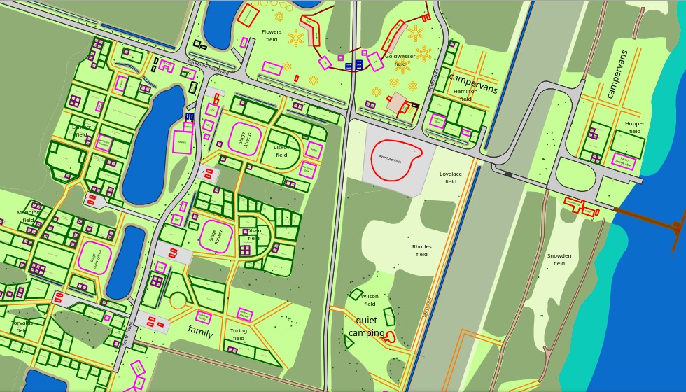
- Pro akci May Contain Hackers 2022 pořádanou v Holandsku je k dispozici speciální mapa postavená na OSM, kterou Evelyn připravila také pro aplikaci OsmAnd.
Přechod k OSM
- Francouzská organizace Randonner Leger > , sepsala > průvodce pro používání programu OsmAnd při turistice.
Software
- Kanadští přispěvatelé si všimli problémů s dostupností dlaždicových serverů OSM. Provozní skupina OpenStreetMap si je problémů s odezvou pro uživatele v Severní Americe vědoma. Důvodem je, že server Pyrene, určený pro renderování dlaždic pro USA, kapacitně nestačí narůstajícím požadavkům. Brzy by měl být přidán další server pro východ Severní Ameriky.
- Benjamin Clark z firmy Meta publikoval na GitHubu plán vývoje editoru RapiD pro rok 2022. Je možné komentovat a zaslat zpětnou vazbu.
- Ilya Zverev zkoumá, jak editovat hodnotu tagů přímo z webu openstreetmap.org. Připravil návrh řešení, které funguje jako rozšíření pro prohlížeč – dostupné je pro Firefox a Chrome.
Programování
- Paul Norman vzal nedávný výpadek standardní vrstvy dlaždic jako motivaci a popisuje způsoby monitorování funkčnosti systému.
Věděli jste …
- … že je mnoho způsobů, jak přispívat pravidelně do OSM?
Desktop:
- OSM Streak
- MapRoulette
- Pic4Review
- Nezmapovaná místa
- Hledání podezřelých sad změn
- OSMCha
- NotesReview
- Mnoho instancí Tasking Manageru
Chytré telefony:
Určitě jsme na nějaký zapomněli. Pokud vás napadne, napište nám a my ho zařadíme do dalšího čísla našeho týdeníku.
Ostatní geo záležitosti
- Cyklistický závod Tour de France Femmes nabízí živou mapu závodu, která využívá knihovnu Leaflet, známou mimo jiné používáním OpenStreetMap jako poskytovatele základní vrstvy.
Plánované události
| kde | co | Online | kdy | země |
|---|---|---|---|---|
| iD for Beginner Training | 30.07.2022 | |||
| 臺北市 | COSCUP 2022 OpenStreetMap x Wikidata 聯合議程軌 | 30.07.2022 |  | |
| Buenos Aires | 4a reunión bimestral de OSM Latam (organiza OSM Argentina) | 30.07.2022 |  | |
| Ernakulam | OSM Kerala Community Meetup 2022 | 31.07.2022 |  | |
| OSMF Engineering Working Group meeting | 01.08.2022 | |||
| MapRoulette Monthly Community Meeting | 02.08.2022 | |||
| Stuttgart | Stuttgarter Stammtisch | 02.08.2022 |  | |
| San Jose | South Bay Map Night | ✓ | 03.08.2022 |  |
| Westminster | Missing Maps London Mapathon | 02.08.2022 |  | |
| Berlín | OSM-Verkehrswende #38 (Online) | ✓ | 02.08.2022 | |
| Salt Lake City | OSM Utah Monthly Meetup | 04.08.2022 | | |
| Cayambe | Notathon en OpenStreetMap – resolvamos notas de Cayambé, Ecuador | 06.08.2022 |  | |
| OSM Africa August Mapathon: Map Rwanda | 06.08.2022 | |||
| 新北市 | OpenStreetMap 街景踏查團 #3 | 07.08.2022 | | |
| Washington | MappingDC Mappy Hour | 10.08.2022 | | |
| Hamburk | Hamburger Mappertreffen | 09.08.2022 | | |
| Kolín n. Rýnem | 25. Stammtisch Köln | 10.08.2022 | | |
| Salt Lake City | OSM Utah Monthly Meetup | 11.08.2022 | | |
| Mnichov | Münchner OSM-Treffen | 10.08.2022 | | |
| Curych | 143. OSM-Stammtisch | 11.08.2022 |  | |
| Berlín | 170. Berlin-Brandenburg OpenStreetMap Stammtisch | 12.08.2022 | | |
| 臺北市 | OpenStreetMap x Wikidata Taipei #43 | 15.08.2022 | | |
| San Jose | South Bay Map Night | ✓ | 17.08.2022 | |
| 154. Treffen des OSM-Stammtisches Bonn | 16.08.2022 | |||
| Lüneburg | Lüneburger Mappertreffen (online) | 16.08.2022 | | |
| Firenze | State of the Map 2022 | 19.08.–21.08.2022 |  |
Poznámka: Pokud zde chcete vidět vaši akci
Toto číslo přeložil tom.k a redakčně upravil mkyral. Budeme velmi rádi, pokud podpoříte a oceníte naši práci tím, že budete dílo dále šířit, např. sdílením na sociálních sítích (like, retweet, boost…). Předem za to děkujeme.
Každé číslo v CZ verzi je promováno zde: @osmcz |
  @osmcz |
  Talk-cz | osm_sk |
  rss
rss
Můžete nás kontaktovat e-mailem:  weekly@openstreetmap.cz
Originál tohoto souhrnu připravili: Lejun, MatthiasMatthias, Nordpfeil, PierZen, SK53, TheSwavu, derFred.