08/08/2023-14/08/2023
Une des nombreuses cartes OSM utilisées par les radioamateurs. [1] © EA6VQ, Gabriel Sampol | Contributeurs et contributrices OpenStreetMap
Cartographie
- L’adoption de routes, de chemins ou de places est une pratique courante aux États-Unis et au Canada. Partytax a rédigé une proposition à ce sujet.
- Le vote sur la proposition « Ascenseurs et rampes pour fauteuil roulant » de wielandb se termine le 28 août.
- La proposition « Extended_playground_equipment » (liste étendue des types de terrains de jeux) par Supaplex030, Tordans, Ygramul a été acceptée par 51 voix contre 0.
Communauté
- adreamy a commencé une collection de lieux qui imitent un terrain ou qui ont la forme de quelque chose, par exemple une péninsule dans un parc en Corée du Nord qui a la forme de la Corée du Sud.
- La communauté OSM turque a publié une carte collaborative sur Felt afin de déterminer quelle couche d’imagerie est la plus à jour en fonction de l’emplacement. Un billet de blog
 ► expliquant comment contribuer est également disponible.
 - La contributrice jmty8 a fait un beau travail en réparant un rond-point dans OSM.
- KingViks a réfléchi à son parcours avec le gestionnaire de tâches de cartographie de terrain de HOT (Field Mapping Tasking Manager — FMTM), qui lui a permis d’acquérir une expérience inestimable en matière de collecte de données dans le secteur de Shyira dans le district de Nyabihu au Rwanda.
- La communauté a profité du 19e anniversaire d’OpenStreetMap pour se féliciter, réfléchir ► et faire un retour en arrière ► dans plusieurs articles de blog.
- Dean Howell rend hommage au 19e anniversaire d’OSM sur Neowin en donnant un aperçu de la situation : « Alors qu’OSM approche de sa 20e année, sa croissance et son engagement à fournir un accès à des données cartographiques de qualité sont un exemple brillant pour d’autres projets open source ». Au passage, il tente d’illustrer la complexité d’OSM avec un joli graphique.
 ►
►
 ►
►Fondation OpenStreetMap
- Vous êtes invités à participer à la prochaine vidéo-réunion mensuelle du conseil d’administration de l’OSMF qui aura lieu le jeudi 24 août 2023 à 15h00 UTC. La salle vidéo s’ouvre 20 minutes environ avant la réunion. L’ordre du jour préliminaire se trouve sur le wiki … et c’est aussi là que le projet de compte-rendu sera ajouté.
Les sujets sont les suivants :
- Rapport du trésorier
- Rapport du secrétaire
- Plan stratégique
- Recommandation des modérateurs au Conseil d’Administration
- Présentation mensuelle – Map4SaintLucia et/ou communauté OSM dans les Caraïbes
- La fondation OpenStreetMap informe ► sur les différents types d’adhésion ou de dons pour soutenir la stabilité, la qualité et l’indépendance d’OSM.
Éducation
- Le 12 juillet, Marcel Reinmuth et Alec Schulze-Eckel de HeiGIT ont tenu un atelier présentant les données géographiques ouvertes et leur utilisation dans l’aide humanitaire et la réponse aux risques de catastrophe lors de l’événement Summer School Disaster Risk Reduction 2023 organisé par le campus environnemental de l’UAS Trier. Au cours de l’atelier, les participantes et les participants ont appris à visualiser et à créer leur propre carte web en interrogeant et en extrayant des données OSM, et en combinant ces données avec d’autres informations géospatiales. Les ressources de l’atelier sont disponibles sur demande.
- HeiGIT, l’Institut de Heidelberg pour la technologie de la géoinformation, fournit un guide sur la façon de visualiser les résultats de l’API de l’analyseur de qualité d’ohsome (OQT) dans QGIS en utilisant le tableau de bord d’ohsome.
OSM – Recherches universitaires
- Lars Reckhaus a examiné la pertinence d’OpenStreetMap pour les analyses de localisation dans le cadre de projets immobiliers résidentiels.
- L’équipe Big Spatial Data Analytics du HeiGIT a combiné les données de son OSHDB et de la base de données des groupes de modification (changeset) d’OSM pour produire une base de données plus enrichie et plus complète afin d’explorer les statistiques des éditeurs OSM. L’ensemble de données permet d’étudier le nombre d’éditions, les contributeurs actifs et le logiciel d’édition utilisé pour la cartographie dans OSM.
- Sachit Mahajan a publié un article préliminaire sur greenR (Green Index Quantification), un module R open source qui utilise les données OSM pour quantifier la verdure urbaine dans les rues.
- L’équipe Big Spatial Data Analytics de HeiGIT a développé un nouveau tableau de bord pour le suivi des contributions à OSM en temps réel en coopération avec l’équipe humanitaire OSM HOT, appelé ohsomeNow stats. Ce tableau de bord remplace le Missing Maps Leaderboard et fournit une vue d’ensemble de la quantité de cartographie réalisée lors de certains événements et campagnes de cartographie.
Cartes
- LySioS a découvert un type de plan d’accès dans le schéma d’un plan de métro appelé Metrominuto à Pontevedra en Espagne (nous en avons parlé auparavant). Inspiré par ce plan, il a créé ses propres cartes et décrit le processus en détail.
- Piotr Strębski présente ► le projet « OpenStreetMap for pets » — cartographie des lieux liés aux animaux de compagnie : refuges pour animaux, cabinets et cliniques vétérinaires, parcs/parcours pour animaux, crématoriums, cimetières…
- Ilya Zverev partage ► son opinion sur le développement actuel et futur des cartes.
 ►
► ►
►switch2OSM
- David Rutland nous donne ► six raisons importantes d’utiliser OSM au lieu de GMaps, de son point de vue.
- Le planificateur d’itinéraires NHVR du gouvernement australien est désormais alimenté par OpenStreetMap.
Données ouvertes
- UndueMarmot a analysé l’exactitude des données de points d’intérêt d’Overture Maps autour de son domicile.
Applications
- Après un processus de développement de six mois, Sarah Hoffmann (contributrice lonvia) présente ► la réécriture de l’interface de recherche de Nominatim. Elle a également expliqué les changements apportés à l’interface de programmation applicative (API) de Nominatim.
Nouvelles versions
- K. Sakanoshita a amélioré l’outil Easy Changeset Viewer (Visualiser facilement les groupes de modifications) qui permet de visualiser l’historique des modifications d’OpenStreetMap pour une période donnée.
Connaissez-vous ? …
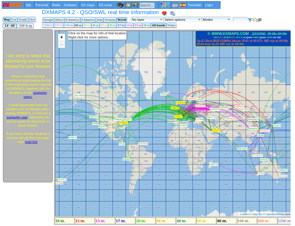
- [1] … le fait que les radioamateurs sont friands de nouvelles technologies, y compris la cartographie ? De nombreuses applications utilisent OSM, comme le service de localisation APRS avec sa carte APRS, qui affiche la distribution des récepteurs KiwiSDR, ou la populaire carte des relais, qui montre la position des stations de relais de radioamateur. Cependant, les radioamateurs ne sont pas seulement des consommateurs d’OSM, ils y contribuent également. Vous pouvez les trouver partout, écrivant pour hebdoOSM, cartographiant simplement, ou au conseil d’administration de l’OSMF. Il n’est donc pas surprenant qu’il y ait des fonctions de radioamateur dans les projets communautaires OSM, comme la couche optionnelle de localisation QTH, qui est un système de coordonnées géographiques spécial, sur l’OpenTopoMap. Les radioamateurs ont également produit leur propre carte pour vérifier les conditions de propagation sur les différentes bandes de fréquence qu’ils utilisent.
OSM dans les médias
- Noraly, alias ItchyBoots est arrivé au Ghana. Elle voyage et navigue avec OsmAnd.
Autres sujets géographiques
- Michael Grothaus affirme sur FastCompany que Google-Maps est devenu une véritable horreur. Il tente de le prouver en présentant cinq faits.
Événements à venir
| Où | Quoi | Online | Quand | Pays |
|---|---|---|---|---|
| Recording milk churn stands for Ireland’s National Heritage Week 2023 | 2023-08-12 – 2023-08-20 | |||
| Salt Lake City | OpenStreetMap Utah Birthday Map Night | 2023-08-17 |  | |
| Lorain County | OpenStreetMap Ohio Meetup | ✓ | 2023-08-17 | |
| Singapore | OpenStreetMap and Wikimedia: Awesome Together! | 2023-08-17 | sg | |
| Singapore | Giving Contexts to Places We Love – The Power of OpenStreetMap and Wikidata | 2023-08-17 | sg | |
| Windsor | Every Door Mapping Party: Walkerville | 2023-08-18 |  | |
| The Municipal District of Kilkenny City | Heritage Week Heritage Mapping Clinic | 2023-08-17 |  | |
| Zehdenick | Getting started with OpenStreetMap (talk) | 2023-08-18 |  | |
| Localidad Teusaquillo | Volvamos a cerrar notas de OSM en Colombia – Notathon | 2023-08-19 |  | |
| Hannover | Maker Faire Hannover 2023 | 2023-08-19 – 2023-08-20 | | |
| 2nd OSM Delhi Mapping Party | 2023-08-20 | |||
| OSMF Engineering Working Group meeting | 2023-08-23 | |||
| Maricá | Mapathon – Maricá City, Rio de Janeiro, Brazil | 2023-08-24 – 2023-09-24 |  | |
| Rapperswil-Jona | 14. Mapathon & Mapping Party Rapperswil | 2023-08-25 |  | |
| Town of Cottesloe | Social mapping Saturday: Cottesloe | 2023-08-26 |  | |
| Localidad Teusaquillo | Junta Bimensual OSM LATAM – Agosto August | 2023-08-26 | | |
| Kalyani Nagar | GeoPune OSM Mapping Party | 2023-08-26 |  | |
| Bremen | Bremer Mappertreffen (Online) | ✓ | 2023-08-28 | |
| Salzburg | Salzburger Stammtisch | 2023-08-29 |  | |
| San Jose | South Bay Map Night | ✓ | 2023-08-30 | |
| Düsseldorf | Düsseldorfer OpenStreetMap-Treffen | 2023-08-30 | | |
| Localidad Teusaquillo | Volvamos a cerrar notas de OSM en Colombia – Notathon | 2023-09-02 | |
Note: Pour que votre événement apparaisse dans l’hebdoOSM, ajoutez-le au calendrier OSM.
Cet hebdoOSM a été préparé par MatthiasMatthias, PierZen, SeverinGeo, TheSwavu, adiatmad, derFred, renecha, rtnf.