15/08/2017-21/08/2017
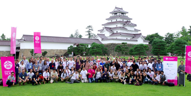
Group photo of this year’s participants @ SotM 2017 in Aizuwakamatsu 1 | Picture by 剛広 渡邉 CC-BY-SA 4.0
SotM 2017, Aizuwakamatsu Japan
- [1] State of the Map 2017 took place in Aizuwakamatsu, Japan from August 18th-20th.
- A short summary by Jun Meguro;
- All talks are online;
- A lot of photos on Facebook and Flickr;
- Florian Lainez, Loïc Ortola and Adrien Pavie wrote a summary “sur la contribution française“.
- The award winner list is published. Congrats to all winners and to all nominees from the whole WeeklyOSM team.
Mapping
- Kevin Bullock notices that HERE Maps also digitalized the footways he traced for OpenStreetMap in a cemetery outside of Denver.
- Séverin Ménard has announced the launch of the Tagging-FR mailing list to ease discussions among French speaking mappers on tagging matters. In response, some fear was voiced that adding yet another channel might make discussions harder to follow overall.
- José Moya presented his proposal to describe pre-Romanesque sites using
building:architecture=preromanesque. - Javier Sánchez Portero has some thoughts on how to simplify complex buildings tagged with
building:part=. - Some contributors of the German list consider
 several tagging solutions for military exercise areas over sea. Where they are tagged with the same schema as land military areas, they are always rendered as inaccessible, while they are only sporadically set up for exercises. (automatic translation)
 - The discussion on bilingual objects in Wales continues.
 several tagging solutions for military exercise areas over sea. Where they are tagged with the same schema as land military areas, they are always rendered as inaccessible, while they are only sporadically set up for exercises. (automatic
 Community
- User Geospa_gal has launched a survey to investigate the effects of participation biases in OSM. A few users already commented about the survey’s questions. Feel free to ask for more information or clarifications.
- The ‘Mapper of the Month’ August 2017 chosen by OpenStreetMap Belgium is Gaurav Thapa from Nepal.
Imports
- Joachim Van Edom wants to import Waterpoints in Tanzania. He also adds that he wants to split the import in smaller parts and that local mappers are going to verify it.
OpenStreetMap Foundation
- The Data Working Group (DWG) published its Activity Report for the second quarter.
Humanitarian OSM
- OSM Niger held a mapathon on August 14th in the Niamey CNF on Diffa region affected by Boko Haram-related conflicts and the city of Tahoua hit at the end of 2016 by the Rift Valley fever. The announcement by Alio Samalia (OSM Niger) on Talk-Africa and other lists is here .
- HOT’s job offer Country Manager (Turkey) – Open Mapping for Refugees
- Julia Kleine of YouthMappers at Texas Tech University reports on a mapathon and YouthMappers.
- A new group on Wikimedia created a page to “respond more efficiently and in a way that can be more tightly integrated with emergency responses from other communities” in a case of disasters. They just collected an enormous task list.
Maps
- Dominic Royé created a map out of all
amenity=drinking_waterand shows their frequency on lat/lon scale.
switch2OSM
- Troy Lambert compares the different map options that can be used for fitness apps. Open source (OpenStreetMap) vs. Closed-source ones like Google Maps or Apple Maps. Strava users miss Google StreetView since the change to OpenStreetMap but like the detailed maps in rural areas.
Programming
- Jochen Topf asks on JOSM-dev mailing list if the structure of the OSM XML files JOSM writes is fixed and if he can rely on the order of objects by type and ID. Sorting the content of the files makes processing easier.
Did you know …
- … Pascal Neis’ OSMstats with daily updated statistics relating to the OSM user base?
Other “geo” things
- Keen to work in London as Geographic Information Systems (GIS) and eHealth Coordinator?
- There is a vacancy as mapping training and project assistant preferably in Dar es Salaam, Tanzania or Kampala, Uganda.
- How were Globes made in former times? A short video on Twitter shows it.
- The Japanese satellite navigation system for determining position (QZSS) (we reported) is complete with the successful launch of the third unit. The plan of QZSS has been expanded and it is supposed to be launched to Unit 7 in 2023.
- OsmAnd published a guide about the new Mapillary plug-in, which is integrated in the newest version of their app.
Upcoming Events
| Where | What | When | Country |
|---|---|---|---|
| Bremen | Bremer Mappertreffen | 2017-08-28 |  |
| Taipei | OpenStreetMap Taipei Meetup, MozSpace | 2017-08-28 |  |
| Graz | Stammtisch Graz | 2017-08-28 |  |
| Viersen | OSM Stammtisch Viersen | 2017-08-29 | |
| Dijon | Rencontre mensuelles | 2017-08-29 |  |
| Dusseldorf | Stammtisch Düsseldorf | 2017-08-30 | |
| Freital | Elbe-Labe-Meeting 2017 | 2017-09-01-2017-09-03 | |
| Rennes | Atelier Wikidata et OSM | 2017-09-02 | |
| Dortmund | Mappertreffen Dortmund | 2017-09-03 | |
| Essen | Mappertreffen Essen | 2017-09-05 | |
| Rostock | Rostocker Treffen | 2017-09-05 | |
| Stuttgart | Stuttgarter Stammtisch | 2017-09-06 | |
| Praha/Brno/Ostrava | Kvartální pivo | 2017-09-06 |  |
| Tokyo | 東京!街歩き!マッピングパーティ:第11回 清澄庭園 | 2017-09-09 |  |
| Passau | Mappertreffen | 2017-09-11 | |
| Rennes | Réunion mensuelle | 2017-09-11 | |
| Lyon | Rencontre mensuelle ouverte | 2017-09-12 | |
| Patan | State of the Map Asia 2017 | 2017-09-23-2017-09-24 |  |
| Boulder, Colorado | State of the Map U.S. 2017 | 2017-10-19-2017-10-22 |  |
| Brussels | FOSS4G Belgium 2017 | 2017-10-26 |  |
| Lima | State of the Map LatAm 2017 | 2017-11-29-2017-12-02 |  |
| Bonn | FOSSGIS 2018 | 2018-03-21-2018-03-24 | |
Note: If you like to see your event here, please put it into the calendar. Only data which is there, will appear in weeklyOSM. Please check your event in our public calendar preview and correct it, where appropriate.
This weeklyOSM was produced by Anne Ghisla, Nakaner, Polyglot, Rogehm, Spanholz, Spec80, YoViajo, derFred, jcoupey, keithonearth.