28/09/2021-04/10/2021

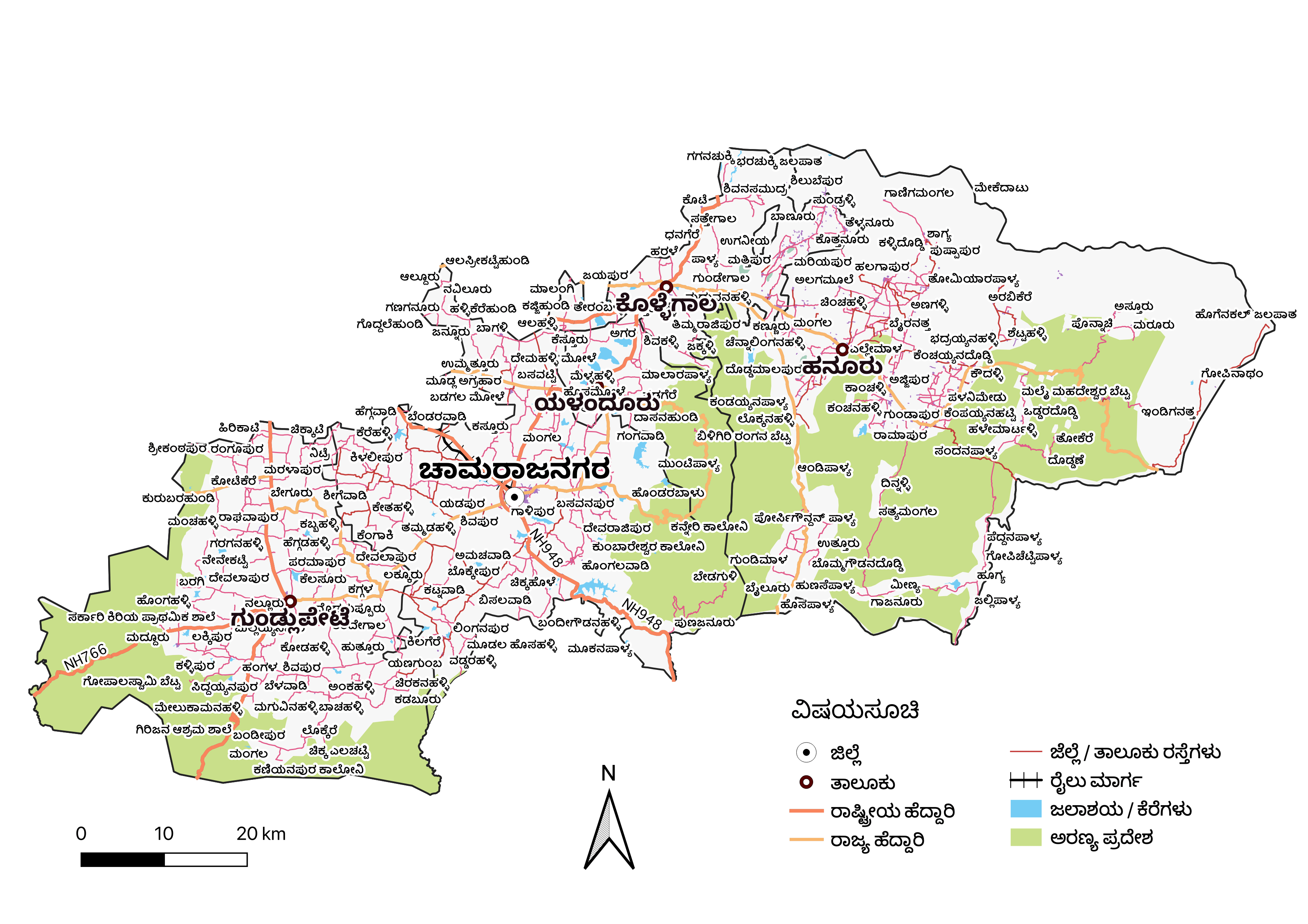
Chetan_Gowda’s map in Kannada [1] © Chetan Gowda | map data © OpenStreetMap contributors
Mapping campaigns
- The OrganicMaps team asked users to help fix issues with subway mapping using this validator. Brandon suggested that the makers of the recently released new app for Jungle Bus could perhaps initiate a collaboration?
Mapping
- MapSpot has created several maps detailing the progress of the river modernisation project, which replaces
waterway=riverbankwithnatural=waterandwater=river.
Community
- OpenStreetMap Belgium’s Mapper of the Month for October is Donat Robaux (gendy54) from France.
Imports
- foxandpotatoes explained, in detail, how to use official sources related to Belgian cadastral boundaries to complete and/or correct OpenStreetMap data for administrative boundaries.
OpenStreetMap Foundation
- Roland Olbricht explained the mission and tasks of the new Engineering Working Group (EWG), of which he has become chairman.
- Here you can find all the necessary information to become a candidate for the OSMF board (election in December), or to nominate someone else.
Local chapter news
- Happy birthday OSM-FR! The French local chapter will celebrate its 10th birthday on Monday 11 October at several locations in France.
- The University of Arizona will host the next State of the Map US on 1 to 3 April 2022. So let’s go to Tucson!
- The September issue of the monthly newsletter from the US local chapter has been published.
Events
- Topi Tjukanov has announced the categories for the 30 day map challenge to be held during November 2021. OpenStreetMap features directly as one of the data challenges.
- The call for a venue for the State of the Map 2022 (we reported earlier) has gone unanswered. Andrew Hain asked if we need to think more carefully about how we meet? Or have the explicit or implicit demands placed on venues become too onerous?
Maps
- Chetan Gowda is looking for some feedback on their printable Kannada maps.
- Marcos Dione blogged about how he manages the rendering of isolated points of interest at lower zoom levels compared with the same type of POI in dense areas.
Software
- Bryce Cogswell announced that Go Map!! v3.0 has been released for iOS. In the diary post Bryce also reminisced about how Go Map!! came to be.
- Version 4.0 of the GraphHopper routing engine has been released. ‘Spatial rules’ have been replaced and extended with custom areas. You can use custom areas to customise properties of GraphHopper’s road network in arbitrary areas. A typical use case is to amend rules on a country-by-country basis, such as default speed limits.
- NLnet is a foundation that ‘funds those with ideas to fix the internet’. A call for open funding proposals, for projects that would help with creating an ‘open, trustworthy and reliable internet for all’, may cover projects helping OpenStreetMap, and it may be a good idea to apply.
Did you know …
- … Richard Fairhurst has written Providing data to OpenStreetMap, an illustrated anglophone guide for local authorities and other data owners?
- … that Anne-Karoline Distel (OSM user b-unicycling) maintains a YouTube channel with lots of ideas and advice on OSM for history buffs?
- … you can find a list of external data that has been imported into the OSM database on the wiki?
- … that the colour scheme of the OSM Mapnik layer, now replaced by CartoCSS with a revised scheme, was investigated by researchers from Hamburg University in 2013? Richard Fairhurst, who created the original colour scheme, speculated that the effort spent on research was considerably greater than that spent on choosing the colours in the first place.
Other “geo” things
- OpenCage’s latest and very recent #geoweirdness thread is focused on Spain. The thread starts with the image of a multipolygon
natural=lavathat contributor sergionaranja entered into OSM on the occasion of the current eruption of the volcano Cumbre Vieja on the island of La Palma. - Fancy a bit of aerial surveying using a drone? Be careful not to get too close to aggressive wildlife. A crocodile took out a low-flying drone in Australia, which captured its own last moment on video.
- Google has released an app, Address Maker, which is designed to encourage the use of Plus Codes as addresses in areas where there are no government assigned addresses.
- There are surviving references to the existence and geography of North America from as early as the 14th century, thanks to an Italian monk.
- The radio signals of a large number of low-flying and GNSS-independent Internet satellites are being used by scientists to determine their location.
Upcoming Events
Note:
If you like to see your event here, please put it into the OSM calendar. Only data which is there, will appear in weeklyOSM.
This weeklyOSM was produced by Nordpfeil, PierZen, SK53, TheSwavu, derFred.