02/04/2019-08/04/2019
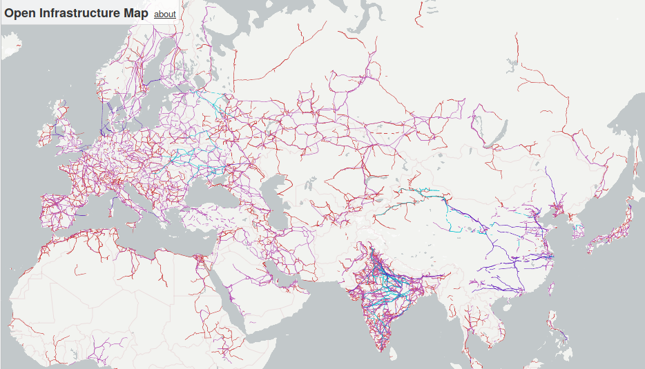
View of the world’s hidden infrastructure mapped in the OpenStreetMap database 1 | © OpenInfraMap | © MapTiler | Map data © OpenStreetMap contributors
Mapping
- In a series of tweets, Tyler Busby updates progress on using machine learning to identify rooftop solar panels in Austin, Texas. The data are used to maintain a MapRoulette challenge for adding the data to OSM.
- Nuno Caldeira announced with a tweet the work done by OSM’s Portuguese Telegram working group. More than 4,000 buildings on the islands of Flores and Corvo, in the western group of the Azores archipelago, were mapped in 35 days.
- Brian Prangle suggests improving the POI data quality in the United Kingdom as the project for the second quarter. First priority should be businesses that no longer exist or have changed their name. The project follows a successful first quarter where nearly 70,000 addresses were improved or confirmed with use of public Food Hygiene Rating Standard data.
- Dan S proposes a UK-specific project to map solar electricity panels. He points to wiki pages for rooftop solar panels and large solar farms that have data that should help in completing the task.
- JM82 is surprised
 (automatic translation) that the coverage of mapped buildings in Austria seems to be decreasing.
 - Kleper from Colombia invites all active mappers to help complete the following task: 121. It is suggested to start with the area of Chocó, which is affected by constant migration of people from different regions and recently had to deal with a further increase of migration due to the crisis in Venezuela.
- The intensive mapping of garage access roads in residential areas by employees of newspaper publishers is intensively discussed (automatic translation) in the German forum. User boldtrn has found, in a sample, an error rate of 30 to 50 percent in the posts in his street.
- LorenzoStucchi has drafted three proposals for the tag landcover. He suggests
landcover=cultivatedfor areas which are cultivated by humans such as farmland or meadows,landcover=artificialfor areas that are altered by construction, mining or other human activities andlandcover=barrenfor areas without vegetation and with bare soil. The request for comments period started on 6 April 2019. - CapitaineMoustache has drafted a proposal for
industrial=grain_storage_centreas a specification oflanduse=industrial. The request for comments period is planned to start on 5 April 2019. - The British national mapping agency, the Ordnance Survey, tweeted a photo of surveying work starting on Tottenham Hotspur’s new stadium which opened this month. Steve Chilton points out that OSM has had it mapped in detail for a while now.
 (automatic
 Community
- Colin Blackburn is intrigued by a “Clothing Optional” labelled beach in OSM on a route that he has vaguely planned to run. We hope he is not helping Mapillary during his runs.
- In his diary, hvalentim wrote (automatic translation) some reflections on the mapping of national registered Portuguese-built heritage sites in OSM: some gaps were detected and many other suggestions made for the improvement and standardisation of tagging.
Imports
- Jason Owen drafted a plan to import water well positions in Harare, Zimbabwe and announced it on the import mailing list.
Events
- The Call for Proposals for the HOT Summit 2019, that will take place on 19-20 September 2019 directly before the State of the Map 2019 in Heidelberg, is now open.
- Registration for SotM France, which will take place in Montpellier from 14 to 16 June 2019, is open! (automatic translation)
 (automatic
 Humanitarian OSM
- HOT brings transparency to staff salaries. While it does not publish individual salaries, it has made the formula/method open. The article, on HOT’s website, explains why they wanted to be more open about the salaries, the different forms of transparency and the difficulties they faced during the process to find a new model to increase equality. The article also details how the new model eliminates inequalities and the effect it had on the payroll after the implementation.
- This year’s nomination phase for new members at HOT US Inc. has started and lasts until 16 April 2019. As Natalie Sidibe wrote on the mailing list, HOT is allowing self-nominations this year in order to increase the diversity of membership.
- Gaurav Thapa, from Kathmandu Living Labs, describes the collection process for gathering geospatial data on the ground in Kathmandu Valley, Nepal as part of a project to increase the understanding of exposure to natural hazards and to help minimise risks resulting from these threats.
- Jorieke Vyncke gave a huge Thank You from Doctors Without Borders to HOT for the work and support HOT has provided after Cyclone Idai.
Education
- A collection of 200+ videos in English (and another 200 in German) about OpenStreetMap, FOSS4G, OSGeo, GIS, etc. is available on TIB AV-Portal.
- Mapbox’s article “Your first steps with JOSM” helps you contribute to OpenStreetMap.
Maps
- Russ Garrett made some enhancements to OpenInfraMap: different aspects of infrastructure are now shown as layers, and a heat map layer of solar photovoltaic generators has been added.
Programming
- Heidelberg University’s GIScience Research Group released a preview of a new Openrouteservice client for the web and mobile devices.
Releases
- OSM Software Watchlist reports: Cruiser Android & Desktop 1.6; Magic Earth iOS 5.05; Mapbox Navigation; OsmAnd+ Android 3.3.7; StreetComplete 11.0; Umap 1.1; Vespucci 13.0
Did you know …
- … the tool comparemaps.drona.ro which allows you to compare OSM with Google Maps, Bing Maps and Nokia Maps?
- …the App KartaGPS?
- … NotesReview, which you can use to search for OSM notes using search terms?
- …the webpage Pic4Review? It allows mapping, using Mapillary images, and participating in various missions, such as adding accessibility for wheelchairs, adding ecopoints, or integrating missions over public toilets. You can also add your own quests!
- … the concept of an “advanced stopping line” for cyclists? These allow bicycles to wait at traffic lights in front of other traffic. In OSM these can be tagged as
cycleway=asl.
Other “geo” things
- Even vultures can recognise the international border between Spain and Portugal. (Or rather, the difference in legislation between both countries regarding abandonment of cattle carcasses.)
- Many economists claim that larger cities are more productive than smaller cities, usually known as the agglomeration effect. Tom Forth, of ODI Leeds, writes in CityMetrics that this does not apply to Birmingham because of poor public transport.
- In a tweet, Simon Küstenmacher refers to a publication by the World Economic Forum. The publication explains five “maps that reveal the world’s remaining wildernesses.”
- Mike Blackmore posted an animation on Twitter showing how almost all rivers in Europe have “developed” or straightened over the past centuries.William du Plooy posted a similar shocking comparison: The deforestation in Mozambique.
Upcoming Events
| Where | What | When | Country |
|---|---|---|---|
| Leoben | Stammtisch Obersteiermark | 2019-04-11 |  |
| Zurich | OSM Stammtisch Zurich | 2019-04-11 |  |
| Berlin | 130. Berlin-Brandenburg Stammtisch | 2019-04-12 |  |
| Salt Lake City | University of Utah Campus Mapping Party | 2019-04-13 |  |
| Biella | Incontro mensile | 2019-04-13 |  |
| Cologne Bonn Airport | Bonner Stammtisch | 2019-04-16 | |
| Lüneburg | Lüneburger Mappertreffen | 2019-04-16 | |
| Reutti | Stammtisch Ulmer Alb | 2019-04-16 | |
| Toulouse | Rencontre mensuelle | 2019-04-17 |  |
| Karlsruhe | Stammtisch | 2019-04-17 | |
| Tokyo | 史跡を訪ねてマッピングパーティ(蒲田、六郷) | 2019-04-20 |  |
| Bremen | Bremer Mappertreffen | 2019-04-22 | |
| Salt Lake City | SLC Map Night | 2019-04-23 | |
| Nottingham | Nottingham pub meetup | 2019-04-23 |  |
| Joué-lès-Tours | Rencontre Mensuelle | 2019-04-23 | |
| Barcelona | #geomobBCN | 2019-04-24 |  |
| Montpellier | Réunion mensuelle | 2019-04-24 | |
| Düsseldorf | Stammtisch | 2019-04-24 | |
| Phone/Video Conferencing | Mappy Hour US | 2019-04-24 | |
| Mumble Creek | OpenStreetMap Foundation public board meeting | 2019-04-24 |  |
| Lübeck | Lübecker Mappertreffen | 2019-04-25 | |
| Greater Vancouver area | Metrotown mappy Hour | 2019-04-26 |  |
| Graz | Grazer Linuxtage 2019 | 2019-04-26-2019-04-27 | |
| Resistencia | Taller de edición en FLISoL2019 | 2019-04-27 |  |
| Rennes | Recensement des parcs et jardins | 2019-04-28 | |
| Montpellier | State of the Map France 2019 | 2019-06-14-2019-06-16 | |
| Angra do Heroísmo | Erasmus+ EuYoutH_OSM Meeting | 2019-06-24-2019-06-29 |  |
| Minneapolis | State of the Map US 2019 | 2019-09-06-2019-09-08 | |
| Edinburgh | FOSS4GUK 2019 | 2019-09-18-2019-09-21 |  |
| Heidelberg | Erasmus+ EuYoutH_OSM Meeting | 2019-09-18-2019-09-23 | |
| Heidelberg | HOT Summit 2019 | 2019-09-19-2019-09-20 | |
| Heidelberg | State of the Map 2019 (international conference) | 2019-09-21-2019-09-23 | |
| Grand-Bassam | State of the Map Africa 2019 | 2019-11-22-2019-11-24 |  |
Note: If you like to see your event here, please put it into the calendar. Only data which is there, will appear in weeklyOSM. Please check your event in our public calendar preview and correct it, where appropriate.
This weeklyOSM was produced by Nakaner, NunoMASAzevedo, Polyglot, Rogehm, SK53, SunCobalt, TheSwavu, YoViajo, derFred, jinalfoflia.