09/05/2017-15/05/2017
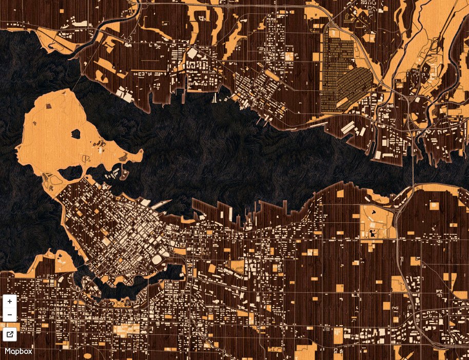
Intarsia in Vancouver 1 | © Mapbox © OpenStreetMap Contributors ODbL
About us
- The weeklyOSM team is looking for new members to join the team. weeklyOSM publishes 52 issues per year currently in eight languages, regardless of holidays or public holidays. To do this we need to get reinforcements. As a part of weeklyOSM, you can work on: collecting and evaluate links belonging to OSM, writing articles, translating and proofreading, editing images, etc. Please drop an email to ( blog at openstreetmap dot de ) with your OSM account.
Mapping
- DigitalGlobe and Mapboxshared two new global satellite imagery layers for live tracing on OpenStreetMap. Now, mappers will have even more sources of high quality, recent imagery layers to trace, identify, and validate roads, places, and buildings to continue to expand this free and open database of the Earth’s features. In JOSM, you have to activate it explicitly under
Background→Background Settings. For more information read DigitalGlobe’s employee Kevin Bullock’s diary entry, the discussions in the German forum and the mailing lists: Talk-en and Talk. The License Terms are available in the OSM Wiki. - There is an interesting discussion in the OpenStreetMap forum about tips, tools and apps that can be used for videomapping while biking.
Community
- Roland Olbricht highlighted three suggestions for improving data protection, which were discussed at the FOSSGIS conference in Passau. There were related discussions in the German forum (automatic translation) and on the mailing list Talk-de (automatic translation) and later on the mailing list talk.
- Yuri Astrakhan writes about the SPARQL (rdf) database with both OSM and Wikidata being ready for testing. It allows massive cross-referenced queries between two datasets. This service is a test, and needs a permanent home to stay alive.Oleksiy Muzalyev points to his Web app, in which one click on the map shows the associated Wikipedia articles.
- Jinalfoflia shares her experience of being a part of the mapping party hosted by the Ottawa OpenStreetMap community.
Imports
- Ilya Zverev has suggested importing Shell petrol stations (initially in the UK) on the Import and talk-gb lists. The import discussion thread covered whether storing external IDs was a good idea and whether the sources of data were all OK to import fromor even any good. The import was commissioned by the company NavAds, which has been discussed previously in Germany
 (automatic translation) over alleged “search engine optimisation” in OSM.
 (automatic
 Humanitarian OSM
- The Guardian reported on an Ebola outbreak in the Democratic Republic of the Congo. Pete Masters and Claire Halleux have published the tasks. Nicolas Chavent summarized the priorities on two wiki pages in English and in French.
Maps
- [1] Melody Cao designed maps of cities to look like they were made of wood. At multiple zoom levels, explore the different textures she has made use of.
- The whole world on the console 😉
- Making maps with React, with a tweet.
switch2OSM
- At Rotterdam Central Station, OpenStreetMap is shown on a big screen where people can explore the city by dragging and tapping the screen. It is the only interactive map in the station, so it has been consciously chosen.
- The French National Institute for preventive archaeological research provides a visualization tool based on OSM for its archaeological sites.
Open Data
- OpenData France published a mid-term review. (automatic translation)
 (automatic
 Programming
- Baran Kahyaoglu from Mapbox writes about the creation of geo coordinates data structure to match Unity World Space with the real world. Read more about this and other things that have been added in the latest Mapbox Unity SDK release.
Releases
| Software | Version | Release date | Comment |
|---|---|---|---|
| Mapserver | 7.0.5 | 2017-05-09 | Please read release info. |
| Vespucci | 0.9.8 | 2017-05-09 | Please read release info. |
| OpenStreetMap Carto Style | 3.3.0 | 2017-05-10 | Many changes, please read release info. |
| Overpass-Turbo | 2017-05-11 | 2017-05-11 | Many changes during the last days, please read release infos. |
| PostgreSQL | 9.6.3 | 2017-05-11 | This release contains a variety of fixes from 9.6.2. |
| iD | 2.2.1 | 2017-05-12 | Three bugs of the freshly released version 2.2.0 eliminated. |
| Kurviger Free * | 10.0.24 | 2017-05-12 | Various enhancements. |
| Maps.me Android * | var | 2017-05-12 | No infos. |
| Komoot Android * | 9.1 | 2017-05-13 | Synchronization tool Komoot Connect available, improved collections and more. |
| Route Converter | 2.20 | 2017-05-13 | Many changes, see release info. |
| Traccar Client Android | 4.2 | 2017-05-13 | Allow new general top level domains. |
| QMapShack Lin/Mac/Win | 1.8.1 | 2017-05-14 | No infos. |
| iOsMo | 1.8 | 2017-05-15 | Updates of group points and tracks data on map. |
| Komoot iOS * | 9.1 | 2017-05-15 | Tour planning revised and simplified, improved difficulty assessment and color design for backgrounds and path types. |
| Naviki Android * | 3.59 | 2017-05-15 | Texts and translations have been revised, two mistakes have been eliminated. |
Provided by the OSM Software Watchlist. Timestamp: 2017-05-15 22:00:37+02 UTC
(*) unfree software. See: freesoftware.
Did you know …
- Casio started the sales of a new Smartwatch, named “Pro Trek”. The watch loads OSM maps powered by Mapbox.
Other “geo” things
- Google now offers to certify panoramic cameras as compatible with Street View. Street View has been accepting crowd sourced images for some time now, however similar services Mapillary and OpenStreetCam, also do and keep the images available under a free license.
- On ápfelmagazin.de you can read (automatic translation) an interview with Tobias Hallermann by komoot.
- Geoawesomeness publishes a beginner’s guide to GIS.
Upcoming Events
| Where | What | When | Country |
|---|---|---|---|
| Bremen | Bremer Mappertreffen | 22/05/2017 |  |
| Graz | Stammtisch Graz | 22/05/2017 |  |
| Derby | Derby Pub Meetup | 23/05/2017 |  |
| Lübeck | Lübecker Mappertreffen | 25/05/2017 | |
| Vancouver | Vancouver mappy hour | 26/05/2017 |  |
| Leuven | 2nd Leuven Monthly OSM Meetup | 31/05/2017 |  |
| Dusseldorf | Stammtisch Düsseldorf | 31/05/2017 | |
| Dresden | Stammtisch | 01/06/2017 | |
| Avignon | State of the Map France 2017 | 02/06/2017-04/06/2017 |  |
| Lviv | Map Solutions 2017 | 03/06/2017 |  |
| Taipei | OSM Taipei Meetup, MozSpace | 05/06/2017 |  |
| Toronto | Mappy Hour | 05/06/2017 | |
| Rostock | Rostocker Treffen | 06/06/2017 | |
| London | Missing Maps London Mapathon, Royal Geographic Society | 06/06/2017 | |
| Salzburg | AGIT2017 | 05/07/2017-07/07/2017 | |
| Kampala | State of the Map Africa 2017 | 08/07/2017-10/07/2017 |  |
| Champs-sur-Marne (Marne-la-Vallée) | FOSS4G Europe 2017 at ENSG Cité Descartes | 18/07/2017-22/07/2017 | |
| Boston | FOSS4G 2017 | 14/08/2017-19/08/2017 |  |
| Aizu-wakamatsu Shi | State of the Map 2017 | 18/08/2017-20/08/2017 |  |
| Patan | State of the Map Asia 2017 | 23/09/2017-24/09/2017 |  |
| Boulder | State of the Map U.S. 2017 | 19/10/2017-22/10/2017 | |
| Buenos Aires | FOSS4G+State of the Map Argentina 2017 | 23/10/2017-28/10/2017 |  |
| Lima | State of the Map LatAm 2017 | 29/11/2017-02/12/2017 |  |
Note: If you like to see your event here, please put it into the calendar. Only data which is there, will appear in weeklyOSM. Please check your eventin our public calendar preview and correct it, where appropriate.
This weeklyOSM was produced by Nakaner, Peda, Polyglot, Rogehm, SomeoneElse, Spec80, SrrReal, YoViajo, derFred, jcoupey, jinalfoflia, keithonearth.
Hi, thanks for all !
Just a link mistake for Ebola Outbreak english Wiki page, correct one is :
https://wiki.openstreetmap.org/wiki/WikiProject_Congo-Kinshasa/2017_Ebola_Outbreak_OSM_Response
and not
https://wiki.openstreetmap.org/wiki/WikiProject_Congo-Kinshasa/2017_Ebola_RDC_R%C3%A9ponse_OSM
thanks for the info.
updated – in all languages.
Manfred