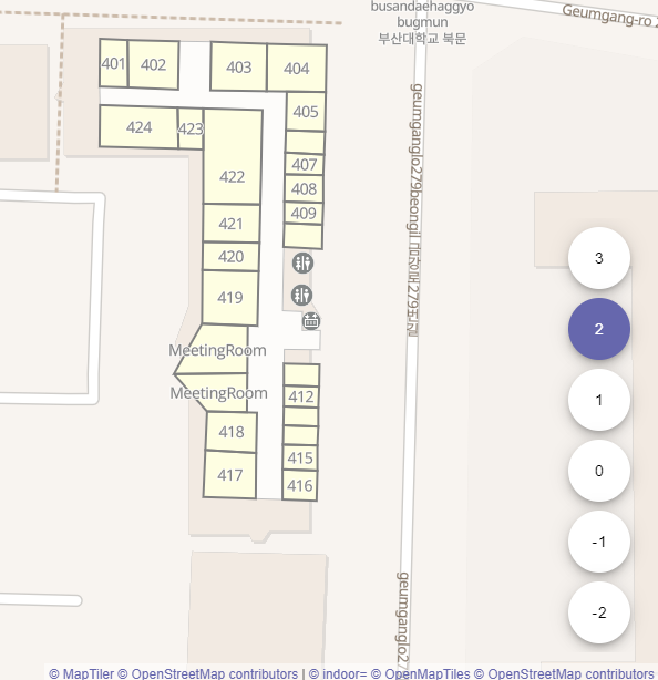
Steve Coast suggests the creation of a SIG (Special Interest Group) on Addressing in OSM. He points to a prototype address QA tool. In the replies various people point out that OSM already has a rich range of tools to assist with address mapping.
Jan Michel suggests we should consider access rules and specific amenity values for small electric vehicles like bicycles and scooters as they are becoming increasingly common. He has created a proposal and asked for comments and suggestions.
In a tagging discussion about extremely large flood control features, John Willis shows an impressive example of Japanese flood management.
Neena2309 blogs about the MapRoulette challenge that aims to improve the OSM coverage of health facilities in India.
Kreuzschnabel luckily spotted (automatic translation) a mass displacement of London roads, and quickly reverted the change. See various comments in the Q&A forum. Among other suggestions, Richard Fairhurst suspected it might be a OSM file being opened which has the same OSM IDs as the nodes in London and Oslo.
Community
The iD developers temporarily deactivated commenting on issues and pull requests, and the creation of new issues for everyone except collaborators. A few hours before, users complained again about iD transferring user data, without consent, to Facebook by loading brand logos. It now appears possible for non-collaborators to raise issues again.
Frederik Ramm had it with the behaviour of the iD development team. He thinks the relationship with OSM, which he calls “abusive”, should come to an end. According to his post, the iD team has shown that decisions to implement features are not driven by what the community wants or needs but by the editor developers alone. Therefore, he recommends replacing the default osm.org editor iD with a fork using the version from Frédéric Rodrigo. A heated discussion ensued.
Simon Poole noted a key milestone for OSM: a sustained editing rate of over 100 million edits per month. This is the highlight of his regular update of OSM editing statistics on the wiki.
TZorn reports (automatic translation) about his user experience with JOSM on a Microsoft Surface Pro in tablet mode .
The recently launched OpenStreetMap Calendar simplifies publishing of OSM-related events, allows downloading events to your own calendar and gives people the possibility to indicate their participation without having to use the wiki. In addition, RSS feeds can be used to stay updated about events in your area.
Valeriy Trubin continues a series of interviews with Russian mappers. Sergei Sinitsyn (automatic translation) told how mapping in OSM is connected with discovering interesting life stories and Artem Svetlov (automatic translation) talks about shooting Mapillary panoramas and the use of OSM data.
Imports
Guillaume Rischard announced the import of administrative boundaries and addresses in Kosovo, which local mappers have received from authorities there.
OpenStreetMap Foundation
Frederik Ramm, Treasurer of the OSM Foundation, announced that the board will evaluate ways of working with Dorothea full-time, as her help on administrative tasks as well as on the State of the Map conference organisation is extremely helpful. Dorothea is the only paid person working for the OpenStreetMap Foundation.
The next OSMF board meeting will take place on 20 November 2019 at 19:00 London time. Everyone is invited to join the public meeting in Mumble. Some interesting items have been put on the agenda.
Frederik Ramm recommends that we consider “Newbs” (people who haven’t served on the board before) when voting in the upcoming OpenStreetMap Foundation board election.
The State of the Map Working Group is looking for volunteer supporters. The “job description” has a long list of ways that people can help which should include something for everyone.
Events
Ilya Zverev invites everyone to FOSDEM 2020. It is one of the major events for free and open source software, and it is on 1 and 2 February 2020 in Brussels, Belgium.
Pedja announced the first OSM Meetup in Serbia and hopes to attract a decent number of participants. The meeting will take place on 7 December 2019 in Belgrade.
Humanitarian OSM
Imperial College London reported about the help its students have provided to vulnerable countries by participating in a Mapathon hosted by the Friends of Médecins Sans Frontières. The area of focus was Bangassou in the Central African Republic, which is a blank area on Google Maps…
Education
A call is being made for articles for a special issue of the ISPRS International Journal of Geo-Information. The special issue is primarily aimed at collecting papers that extend the research works presented in the Academic Track at SotM 2019. However, other original submissions aligned with the area of research are also highly welcome. The deadline for submissions is 31 March 2020.
Maps
Frank Schmirler created “Lights of the Sea” (“mapa de balizas” in Spanish) adding the option to select as the menu language German, English or Spanish. It is really worth taking a look at these formidable maps and feel encouraged to map beacons to illuminate the coasts of the world that still appear dark.
switch2OSM
The report of a Tesla owner about the improved route guidance of his car’s Smart Summon application after adding parking lanes on OSM caused further discussions at Hacker News with mixed responses.
Open Data
The High Court in London has passed judgement on an important case with implications for geodata released under open licences, including INSPIRE. The start-up 77m tried to use open data from various sources to build “Matrix”, their own product of address polygons, but were then sued by the British Ordnance Survey (OSGB).77m lost the case, but neither OSGB, nor the cadastral agency (Land Registry), escaped censure by the judge. The full implications are not yet clear, but Jeni Tennison (CEO of the Open Data Institute) has tweeted some first thoughts and open data commentator Owen Boswarva has a more detailed blog post.Useful OSM background on some of the data involved can be read on the blogs of Chris Hill and SK53.
Software
Simon Poole, maintainer of Vespucci, informed the community about potential crashes of the mobile editor following a change in the data format provided by the Osmose API. This was resolved at the Osmose end (they undid their breaking change).
Programming
Gravitystorm went to great lengths to figure out if it would be possible to run openstreetmap.org on Heroku (a cloud computing service). This may be interesting for people who want to experiment with the setup, as it can be accomplished almost for free.
akashihi wants OSRM to penalise routes with embedded_rails=* for cyclists. The merits of the suggestion are discussed in the pull request.
Releases
We have overlooked recent developments of OpenLayers. Recent releases contain some interesting features such as the ability to compose layers with different renderer types, a number of vector tile rendering improvements, a lower memory footprint overall and many more. We encourage users of versions below the recently released OpenLayers v6.1.1 to check the release history.
Did you know …
… Digital Egypt, which was founded in 2011 and specializes in GIS data and map production, will start a project to develop OSM Maps of Egypt and verify all data entered? (For example, Badr City.) The aim of the project is to increase the accuracy of the maps and add missing road names and geographical codes. OSM standards and the Egyptian Wiki Page will be strictly adhered to and they will work closely with the OSM community.
Other “geo” things
New York has a new attraction. The fifth highest viewing platform called “Edge” was built at a height of 335 m. A glass floor offers a special thrill. The F4 Map offers an approximate impression of the view over New York. The OSM mapping of the skyscraper “30 Hudson Yards” is not yet complete.
Morten Lind tweeted about Christiansø, the last populated place in Denmark to be assigned addresses. Christiansø was originally a military settlement on the island of Ertholmene, which explains the anomaly.
Geospatial Worldreported Google’s new initiative to offer free licences for Google Earth Engine worth US$ 3 million to support organisations and initiatives that make use of Google’s geospatial data.
The German Federal Armed Forces University has archived something that was previously only possible in mobile phone manufacturers’ advertisements. They were able to reach 1–2 cm accuracy with a commercial Android smartphone (placed on a choke ring platform to mitigate multipath effects) by using raw position data from the Android API, reportsInside GNSS. The details of the setup can be found at the University’s website.
The US Transportation Safety Board has, once again, issued a plea for online map providers in the USA to incorporate information on railway level crossings. Deaths at level crossings are still high (270 in 2018), and lack of driver awareness is still a contributory factor. Many map apps do not notify drivers of their presence. As an aside, the OSM Weekly team wondered how many were mapped on OSM: about 100,000, of which 5,000 lack railway=level_crossing.
The New York Timesreported about a research project which says that many cities (such as Ho Chi Minh City, Bangkok, parts of Shanghai, Mumbai and Alexandria) could be flooded by 2050. 110 million people already live below sea level and by 2050 an additional 150 million people may be affected, requiring large investments in protective measures like seawalls and other barriers.
Upcoming Events
Where
What
When
Country
Niš
Missing Maps Mapathon Niš #1
2019-11-16
Istanbul
Yer Çizenler
2019-11-16
Cologne Bonn Airport
Bonner Stammtisch
2019-11-19
Reading
Reading Missing Maps Mapathon
2019-11-19
Lüneburg
Lüneburger Mappertreffen
2019-11-19
Derby
Derby pub meetup
2019-11-19
Lansing
Meetup at Kelly’s
2019-11-19
Prešov
Missing Maps Mapathon Prešov #4
2019-11-21
Grand-Bassam
State of the Map Africa 2019
2019-11-22-2019-11-24
Izmir
Yer Çizenler Mapathon with HKMO-Izmir
2019-11-23
Izmir
Yer Çizenler
2019-11-24
Bremen
Bremer Mappertreffen
2019-11-25
Salt Lake City
OSM Utah Mapping Night
2019-11-26
Rémire-Montjoly
Réunion mensuelle OSM Guyane
2019-11-26
Zurich
Missing Maps Mapathon Zürich
2019-11-27
Düsseldorf
Stammtisch
2019-11-27
Singen
Stammtisch Bodensee
2019-11-27
Kilkenny
Kilkenny Mapping Event
2019-11-30
Nantes
Participation à « Nantes en sciences »
2019-11-30
Ivrea
Incontro Mensile
2019-11-30
London
Missing Maps London
2019-12-03
Stuttgart
Stuttgarter Stammtisch
2019-12-04
Stuttgart
Stuttgarter Stammtisch
2019-12-04
Bochum
Mappertreffen
2019-12-05
San José
Civic Hack & Map Night
2019-12-05
Ulmer Alb
Stammtisch Ulmer Alb
2019-12-05
Dortmund
Mappertreffen
2019-12-06
Belgrade
OSM Serbia Meetup
2019-12-07
AoA and other changes
Voting on OSMF board elections
2019-12-07-2019-12-14
world
Cape Town
State of the Map 2020
2020-07-03-2020-07-05
Note: If you like to see your event here, please put it into the calendar. Only data which is there, will appear in weeklyOSM. Please check your event in our public calendar preview and correct it, where appropriate.