28/08/2018-03/09/2018
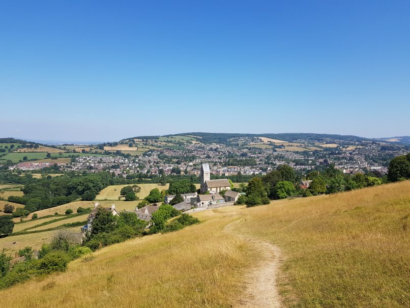
Public footpath on Selsley Common (part of the Cotswold Way national trail), near Stroud, Gloucestershire [1] | Photo © 2018 Nick Johnston
Mapping
- The city of Stuttgart allows OSM to use its aerial imagery, which has a ground resolution of 20 cm. This step was discussed with the local OSM community during the last local OSM meetup where the city representatives also asked what data could help OSM further.
- On the tagging mailing list Joseph Guillaume introduces his proposal for
canal=qanat; these are underground channels for conveying groundwater. - On talk-GB Microsoft asked for help with some unnamed roads that they have identified.
- [1] Nick Johnston wrote a blog post about mapping Britain’s paths in OpenStreetMap. He includes much background information on public rights of way paths, He got the data for the paths in his home region Gloucestershire from Rowmaps and surveyed using OsmAnd with the tracks in the background. Even if you have no intention to map paths in the UK, just the pictures of his beautiful home region make the article worth reading. He ends his article with the warning that you should not import the data straight away for a number of reasons.
- User MKnight has refined (automatic translation) the reservoir Lac de Petit-Saut in French Guiana in weeks of hard work. He also summarises the negative environmental consequences of the dam.

- OpenSnowMap.org’s maintainer yvecai has compiled up-to-date statistics about ski pistes in OSM. The combined length of all ski pistes in OSM exceeds 100 000 km!
- Land parcel data in OSM is mentioned in a study about the impact of spatial data on the development of slums in cities with rapid urbanisation. According to the report, OSM has not reached a consensus as to whether parcel-level data should be mapped due to concerns about data quality, validity, and maintainability. The same applies to metadata on parcel data. It also mentions that mapping parcel data is becoming more common.

Community
- We recently wrote about Matthias Plennert’s article “The social construction of technological stasis: The stagnating data structure in OpenStreetMap” in the journal Big Data & Society. The article in general and one of the key points in the article, i.e. that hidden gatekeepers would be responsible for technological stagnation in OSM, caused some discussions. The author responded to the feedback in a special article.
- Noémie Lehuby, Florian Lainez, Flora Hayat and Jocelyn Jaubert have revamped the OSM France website. This was also discussed on the Talk-Fr mailing list. (automatic translation)
- MySociety, a UK-based non-profit organisation, providing technology, research and data to help people become active citizens, is looking for worldwide electoral boundaries. David Earl forwarded the query to the OSMF mailing list.
- A lot of text about Facebook and its contribution to OpenStreetMap has been written recently. LukeWalsh’s article provides a new perspective on it. He wrote about his experience during the college rotational program, when his placement was at the Facebook department, which makes OSM contributions.
- The Kosovo community now has a Kosovo-wide Telegram group. Recent topics include open data and the naming of things in an ethnically diverse country. All mappers from anywhere in any language are welcome.
- United States ambassador to Turkmenistan, Allan Mustard (OSM apm-wa) wrote two articles about his work on OSM, currently the best map of Turkmenistan available to the general public. As you can read in one article, being an ambassador has the advantage that you can use the head of the Motor Roads State Concern as a QA tool. In his second article he gave some insight into his tour to a southern Balkan Province in Turkmenistan where he updated road information and collected POIs, GPS traces, and Mapillary pictures.
 (automatic
 Imports
- Andrew Harvey plans to import buildings in the Australian Capital Territory into OSM and started the required discussion on the import mailing list. The import would add over 60,000 buildings with over 500,000 nodes to OSM but does not include address data.
- The import of road network data is planned in Kerala, India, a region affected by severe flooding recently. The data was generated by Facebook making use of machine learning. The plan is to allow Facebook’s mapping team to do the initial import, after which the OSM-India community will validate the data. The local community requested Facebook’s assistance with this import. However, during the discussion it was highlighted that the import guideline was not followed exactly and some remarks were made.
Events
- FOSS4G TOKAI 2018 (automatic translation) was held on Aug 24-25 in Tokai. The organising committee published the collected tweets of the event and published a video of the „core day” as well.
- Mapping events will be hosted during OSM Geography Awareness Week on Nov 11-17, 2018 in several places around the world.
- Michael Schultz from the GIScience Group at Heidelberg University invites participation in a validation mapathon on September 13 during EuroGEOSS in Geneva. The goal is to validate a forthcoming Landuse-Dataset that is being generated through fusion of OSMlanduse Data and Sentinel-2 Data using machine learning.
 of the event and published a
 Humanitarian OSM
- The World Bank is funding the improvement of OpenStreetMap-Analytics (OSMA) with new functionality through the project Open Cities Africa and the Global Facility for Disaster Reduction and Recovery (GFDRR). HOT reported at FOSS4G. The development, as well as the hosting of the project, is being carried out by the Heidelberg Institute for Geoinformation Technology (HeiGIT).
Maps
- Laurence Tratt complains on Twitter that he can’t really read anything on the „official” osm.org map in those countries where no Latin characters are used. Laurence knows about openstreetmap.de, but looks for a map listing names in English (Munich, not München – or Milano = Milan and not Mailand. 😉 )Sven Geggus maintainer of the German style and the localisation code used there (available from here), thinks that a change from osm.org is barely possible with the currently used technology. However, in his opinion, this issue should also be addressed as part of the switch to vector tiles. In principle, however, the operation of an English version of the localised map would not be a big problem. Sven already runs a server for his employer’s projects.
- OpenAndroMaps, a website for free Android vector maps, now provides additional information like peaks, capitals and ocean depths. The maker of OAM explains his motivation and gives some background information in a blog post.
- Daniel Koć, maintainer of OSM’s main map style on osm.org, has written a second article about his personal design principles for the OSM Carto map style. It discusses why the size of a feature is the primary property considered for showing some objects earlier than others. The article also has hints on how to choose a proper zoom level for starting to show them.
- Christoph Hormann addresses the possibilities of using patterns to mark different area types in his blog post „More on Pattern use in Maps”.
switch2OSM
- The website wedemain.fr published (automatic translation) an article about how local authorities and administrations are using open-source alternatives to Google services. The recent change by the department Maine-et-Loire from Google Maps to OSM and other institutions mainly to Framasoft is discussed. The association Framasoft hosts many open source services, free of charge.
- Gadgets360 published an article about some companies that have based their business model on free access to Google Maps. The article examines the trouble they are now in and provides some information on alternatives, including OSM.
- etourisme.info recommends that Tourist Offices switch to OpenStreetMap and explains what other benefits this brings on top of the saved G-Maps fees. (automatic translation)
Software
- An overview of important OSM apps for Mobile, classified according to purpose, was made for a mapathon event in Kinshasa.
Programming
- Fabian Kowatsch from the Heidelberg Institute for Geoinformation Technology (HeiGIT) published a first draft of the documentation of the ohsome API, which is a REST API for analysing the history of OSM data through the OSM History Analytics platform Ohsome.org.
- manoharuss gives a short introduction in his user diary on how to use OSMCha to find suspicious edits in OSM.
Releases
- Simon Poole announced the release of Vespucci 11.1 BETA. The newly implemented features include:
- improved preset handling
- lookup in taginfo now happens manually for the recently introduced „auto-presets”
- improved copy and paste of tags
- more minor changes.
Did you know …
- … the website autobahnkilometer.ch created by dktue? He has, according his announcement (automatic translation) in the forum, created this page to measure the current length of the OSM motorway network in Switzerland and to count the tagged motorway kilometres.
- … the site share.mapbbcode.org that allows you to easily create and share maps with custom markers and geometries? You can invite others to edit or view your map. The site also provides [map] bbcode that is supported by some forums.
- … the site mundraub.org? Originally used mainly in Germany, the user base of the site is expanding. The name „mundraub” means petty theft of food. The sites shares the location of plants, mainly fruit trees, that are freely available for harvesting by everyone.
OSM in the media
- Our map was vandalised recently at a prominent location. As usual the offensive data was fixed after a very short time by volunteer OSM contributors. This time the data was corrected within two hours. Unfortunately Mapbox, whose maps are used by many companies including SnapChat, pulled the data for updating their maps during this two hour window. Hence the vandalism was visible to a very large audience and found a loud echo in the media with Techchrunch, BBC, Gizmodo, Buzzfeednews and many more reporting about it. In an official article OSM condemns this kind of vandalism.
Other “geo” things
- Melanie Froude has set up an online tool that allows mapping of landslides. Dave Petley wrote a blog post about the new tool, where he mentions it’s still experimental. It provides a global and regional view of deaths from landslides. Both Melanie and Dave are from the Department of Geography, University of Sheffield. They also authored Global fatal landslide occurrence from 2004 to 2016.
- As Eric Wilson reported on Twitter, the Russell Senate Office Building in the US was renamed to John McCain Senate Office Building on Google Maps after McCain’s death. According to the Washington Post it is not clear yet by whom and why the entry was changed. The name was later reverted to its previous version.
- Agence France-Presse has published a map illustrating emergency medical care in France. All white areas are more than 30 minutes away from an emergency department.
Upcoming Events
| Where | What | When | Country |
|---|---|---|---|
| Bochum | Mappertreffen | 2018-09-06 |  |
| Nantes | Discussions et préparations | 2018-09-06 |  |
| Rennes | Réunion mensuelle | 2018-09-10 | |
| Lyon | Rencontre mensuelle pour tous | 2018-09-11 | |
| Munich | Münchner Stammtisch | 2018-09-13 | |
| Berlin | 123. Berlin-Brandenburg Stammtisch | 2018-09-14 | |
| Posadas | Mapatón de parajes y caminos | 2018-09-15 |  |
| Berlin | Berliner Hackweekend | 2018-09-15-2018-09-16 | |
| Grenoble | Rencontre mensuelle | 2018-09-17 | |
| Toronto | Mappy Hour | 2018-09-17 |  |
| Cologne Bonn Airport | Bonner Stammtisch | 2018-09-18 | |
| Lüneburg | Lüneburger Mappertreffen | 2018-09-18 | |
| Nottingham | Pub Meetup | 2018-09-18 |  |
| Lonsee | Stammtisch Ulmer Alb | 2018-09-18 | |
| Karlsruhe | Stammtisch | 2018-09-19 | |
| Mumble Creek | OpenStreetMap Foundation public board meeting | 2018-09-20 |  |
| Leoben | Stammtisch Obersteiermark | 2018-09-20 |  |
| Kyoto | 幕末京都オープンデータソン#06:壬生の浪士と新撰組 | 2018-09-22 |  |
| Buenos Aires | State of the Map Latam 2018 | 2018-09-24-2018-09-25 | |
| Detroit | State of the Map US 2018 | 2018-10-05-2018-10-07 |  |
| Bengaluru | State of the Map Asia 2018 | 2018-11-17-2018-11-18 |  |
| Melbourne | FOSS4G SotM Oceania 2018 | 2018-11-20-2018-11-23 |  |
| Lübeck | Lübecker Mappertreffen | 2018-09-27 | |
| Manila | Maptime! Manila | 2018-09-27 |  |
Note: If you like to see your event here, please put it into the calendar. Only data which is there, will appear in weeklyOSM. Please check your event in our public calendar preview and correct it, where appropriate.
This weeklyOSM was produced by Nakaner, PierZen, Polyglot, Rogehm, SK53, SunCobalt, TheSwavu, YoViajo, derFred, geologist, jcoupey, jinalfoflia, keithonearth.