29/01/2019-04/02/2019
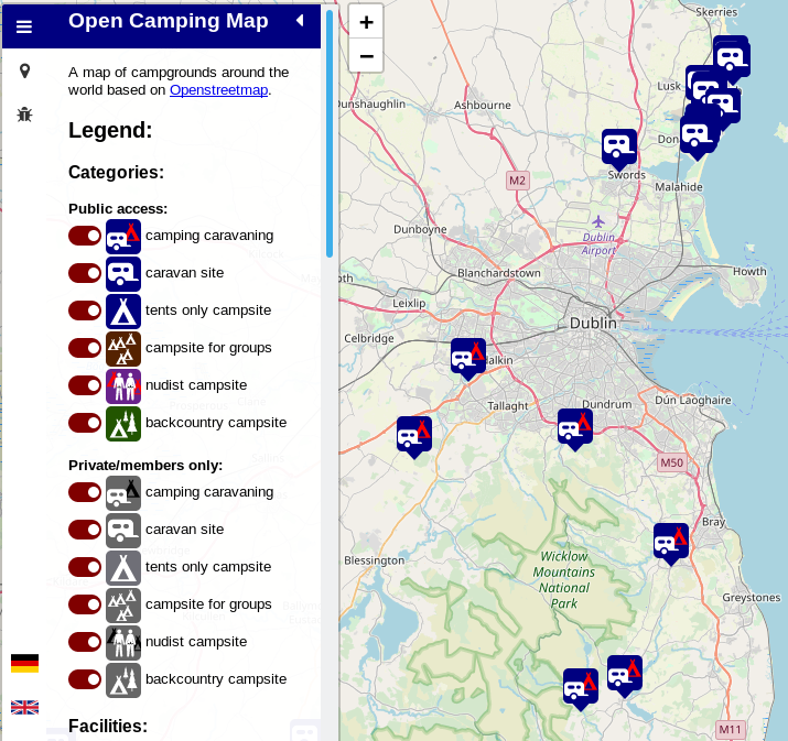
Open Camping Map by Sven Geggus 1 | © Sven Geggus © Map data OpenStreetMap contributors
Mapping
- After his first proposal to add stores which sell top-ups for prepaid services such as phones or public transport failed, Danysan has reworked the proposal and is giving it another try.
- An isthmus is a narrow strip of land, bordered by water on both sides and connecting two larger land masses. Contributer SelfishSeahorse suggests using
natural=isthmusto tag it. - Andrew from Apple shares on several mailing lists, including Ecuador, Chile and Turkey, that they have created multiple tasks on MapRoulette. These tasks are determined using Apple’s data analysis tool Atlas. Amongst the tasks created he mentions about creating tasks for correcting intersections of buildings and roads and overlapping lanes.
- The Brumadinho dam disaster, a dam failure that caused at least 157 deaths, was reflected in OSM two days after the catastrophe. Simon Gascoin describes how he investigated the extent of the mudflow using Sentinel-2 imagery and noticed that OSM was already up-to-date. This Twitter message shows the extent of the disaster.
- Mapillary have added another 42 different features which are detected automatically from contributors’ photos.
- Some OSM mappers go the extra distance in mapping. HonourableNath travelled to Yaguine at a time when rivers were flooding. Her post (automatic translation) on the OSM Mali blog shows some of these travel modes, as well as the before-and-after mapping of the area.
Community
- Frederik Ramm’s question as to whether there should be ethical standards for corporate members has not yet received an answer. It is probably easier to discuss the question in advance of any specific case arising.
- The ‘Mapper of the Month’ chosen by OpenStreetMap Belgium is Guirec Halflants a.k.a. Correcaminos604 from Belgium.
- Tigerfell published his thoughts about what information should be kept for documenting the history of OSM and invites you to join the discussion.
OpenStreetMap Foundation
The Board has not yet published its reasons for deciding on borders in Crimea.Martin Koppenhoefer puts this topic back on the agenda.- Discussions about the 101 membership applications of GlobalLogic from India continue unabated.
Events
- Paul Desgranges gave a talk on 29th January at the Floss Conference in Grenoble introducing the participative mapping project OpenStreetMap!
- Thomas Rupprecht announced the first OSM „Stammtisch” for OSM communities in the Wiener Becken. The first meeting will be on 28th February at the Leobersdorf maker space,
- FOSDEM 2019 in Brussels took place on 2nd and 3rd February 2019. The program for the Geospatial devroom, which was started a few years ago, was made available. Almost all talks were recorded.
Humanitarian OSM
- As part of the EuYoutH_OSM Erasmus+ Project Ciaran Staunton provided training to students from Portmarnock Community School on using an LG360ActionCAM and Mapillary in preparation for their humanitarian mapping trip to Lesotho in February.
- Ramani Huria blogs about the collection of soil samples across Dar es Salaam on a 2 km grid by community members. The samples were assessed professionally and the data will be used to underpin flood hazard modelling.
- HOT’s website features an article about Tanzania’s first patient origin tracking system. It explains why the origin of a patient matters and how HOT helps to improve the situation.
- The HOT website hosts two articles from a 15 year old student who got mobile phones provided to the Peruvian GAL School by a NetHope and HOTOSM device grant. In the two articles Ana Paula Figueroa and Abril Gomez describe why they decided to record all sexist advertising and the reasons for analysing the degree of sexism that is generally accepted by Peruvian society, and how they proceeded to achieve that goal.
- The Toronto Observer describes in an article how volunteer Torontonians helped some of the most vulnerable communities in the world in Nigeria at a mapathon organised by Missing Maps held at the Toronto headquarters of Doctors Without Borders.
- The United Nations, in this case the UN Support Office for Somalia (UNSOS), which has been active in Somalia for many years, has recently developed a mapping initiative for the country, which is to serve peacekeeping and conflict prevention. In an unusual step for the UN, the organisation has decided to process all data provided directly in OpenStreetMap and thus support all humanitarian institutions. The first project of this initiative is described in the OSM wiki in detail. The HOT Tasking Manager will be used for managing this project. The first public mapathon will take place in Italy at the FOSS4G-IT 2019, as Alessandro P. posted on the Talk-it mailing list.
Maps
- Disappointed by the mapping quality of camping grounds in OpenStreetMap and having in mind that often only an appropriate special interest map helps to improve the situation, Sven Geggus started Open Camping Map. In a blog post he explains some further details about his motivation and some technical info.
- If you are looking for a restaurant with vegan or vegetarian offerings, this online map and this Android app make sure you don’t go home hungry.
switch2OSM
- Lesson learned: „… it’s better to put it right on OpenStreetMap,” writes FragDenStaat, a German NGO in their blog. They explain this in detail and describe their way from Yelp via Google to OpenStreetMap. Recommended for imitation. (automatic translation)
Open Data
- Christoph Grenz created (automatic translation) a nice website that displays information from the city of Bonn’s open data portal on a slippy map with additional functions such as edit with JOSM links and comparisons between the datasets and OSM.
- thinkWhere is developing a portal to improve access to official European geospatial open data. The company has partnered with EuroGeographics, an umbrella organisation representing 63 European state organisations such as the UK Ordnance Survey.
Licences
- The Open Data Institute published a guide to licences for geodata. Although it mainly targets commonly sourced UK geospatial data, it covers OSM’s licence as well and compares the major licences for (British) Ordnance Survey data with Google’s proprietary one.
Software
- OSMF’s local chapter in Germany, FOSSGIS, is now operating (automatic translation) the Open Source Routing Machine (OSRM) based routing backend for OSM’s main website. The BSD licensed routing engine, hosted on two servers, calculates the routing graphs and provide the requested route directions. Like the Graphhopper service, which is provided by the company Graphhopper, OSRM gives directions for cars, bicycles and pedestrians.
Programming
- For many years Richard Fairhurst has silently managed the API key for Bing Imagery on OSM. He is now asking on Github for someone else to take on the arduous task of wrangling Bing’s bureaucracy, in order to ensure that imagery continues to be available in all editors.
- Bryan Housel’s tweet reminds possible mentors or people who want to suggest a project for the Google Summer of Code to visit the GSoC wiki site.
- GTFS feeds, i.e. timetable data for public transport and associated geographical information such as stops, often do not include geodata about the routes. Thanks to the open source tool pfaedle, by Patrick Brosi from the University of Freiburg, these data can now be enriched using OSM data. The MITFAHR|DE|ZENTRALE offers the enriched GTFS feeds for Baden-Württemberg for download. The tweet
 of MITFAHR|DE|ZENTRALE, which draws attention to this service, also points to the theoretical background of the map matching.
 of MITFAHR|DE|ZENTRALE, which draws attention to this service, also points to the
 Releases
- openstreetbrowser.org’s recent update allows you to filter category results by certain criteria. For example, you can now filter by Italian restaurants.
Did you know …
- … the nicely written manual on how to find your way around the OSM universe as a beginner and how to make your first edits? Created by Volker Gringmuth aka kreuzschnabel, the comprehensive manual describes the OSM basics, the data model and what help is available for the first edits, and at the end it touches on relations and JOSM plug-ins.
- … street-patterns a tutorial on using OpenStreetMap road data to make physical visualizations using Fablab equipment?
- … OSM SEED, a collection of Docker files that allows you to run your own OSM microcosm. This can be useful if you want to add your own data to a closed data pool, for example, for planning scenarios in a city administration or for training. A presentation is available on YouTube.
OSM in the media
- The European Commission’s Joint Research Centre (JRC) published recently Cultural Gems, an OpenStreetMap based service to help tourist to find „cultural gems” in European cities. The Dundee Evening Telegraph is amused by the fact that the city’s toilets are registered as „worth seeing”.
- A local media outlet interviews Franco Benedetti (@mweper) (automatic translation) from Funes, Argentina, and tells how the city map has been greatly improved.
- The Yorkshire Post explains why Google’s recent price hike is the reason that many apps, with Adobe Lightroom being the most prominent example, have stopped working properly. The article also explains why reliance on free Google services is a bad thing and predicts that OSM will gain an ever-increasing importance.
Other “geo” things
- The British House of Lords discussed if digital mapping restrictions should be imposed. Owen Boswarva summarised the discussion on Twitter with Lords are concerned that „a foreign-owned company that bases its services on Russian mapping software” is „pinpointing our civil infrastructure” with a „major high-definition survey”. Lord Wallace of Saltaire pointed to the interesting fact that „… a suspicious foreigner taking pictures of houses would have been stopped by some doughty Britain such as Mark Francois and challenged in case he was a German”. The issue with overeager Germans mapping the world is apparently much older than OSM.
- House of Commons Library (UK) has created a set of neighbourhood names for every Middle-Layer Super Output Area (MSOA) in England and Wales — and they want to borrow your local knowledge to help correct and improve it.
Upcoming Events
| Where | What | When | Country |
|---|---|---|---|
| Helsinki | Missing Maps Mapathon at Finnish Red Cross HQ – Feb 2019 | 2019-02-07 |  |
| Dresden | Stammtisch Dresden | 2019-02-07 |  |
| Nantes | Réunion mensuelle | 2019-02-07 |  |
| San José | Civic Hack Night & Map Night | 2019-02-07 |  |
| Berlin | 128. Berlin-Brandenburg Stammtisch | 2019-02-08 | |
| Ulm | ÖPNV-Mapathon Ulm | 2019-02-09 | |
| Rennes | Réunion mensuelle | 2019-02-11 | |
| Bordeaux | Réunion mensuelle | 2019-02-11 | |
| Zurich | OSM Stammtisch Zurich | 2019-02-11 |  |
| Toronto | Mappy Hour | 2019-02-11 |  |
| Lyon | Rencontre mensuelle pour tous | 2019-02-12 | |
| Salt Lake City | SLC Mappy Hour | 2019-02-12 | |
| Munich | Münchner Stammtisch | 2019-02-13 | |
| Barcelona | Mapes i Birres Febrer (Trobada d’usuaris d’OpenStreetMap)[1] | 2019-02-15 |  |
| Taipei | OSM x Wikidata #1 | 2019-02-18 |  |
| Cologne Bonn Airport | Bonner Stammtisch | 2019-02-19 | |
| Derby | East Midlands Pub meetup | 2019-02-19 |  |
| Salt Lake City | SLC Map Night | 2019-02-19 | |
| Reading | Missing Maps Reading Mapathon | 2019-02-19 |  |
| Lüneburg | Lüneburger Mappertreffen | 2019-02-19 | |
| Mumble Creek | OpenStreetMap Foundation public board meeting | 2019-02-20 |  |
| Karlsruhe | Stammtisch | 2019-02-20 | |
| Padua | FOSS4G-IT 2019 (OSMit2019) | 2019-02-20-2019-02-24 |  |
| Salt Lake City | SLUG meeting (with OSM presentation) | 2019-02-21 | |
| Greater Vancouver area | Metrotown mappy Hour | 2019-02-22 | |
| Biella | Incontro mensile | 2019-02-23 | |
| Manila | 【MapaTime!】 @ co.lab | 2019-02-23 |  |
| Karlsruhe | Karlsruhe Hack Weekend February 2019 | 2019-02-23-2019-02-24 | |
| Rennes | Créer ses propres cartes avec uMap | 2019-02-24 | |
| Bremen | Bremer Mappertreffen | 2019-02-25 | |
| Digne-les-Bains | Conférence « Communs numériques – Cartes sensibles » | 2019-02-26 | |
| Düsseldorf | Stammtisch | 2019-02-27 | |
| Lübeck | Lübecker Mappertreffen | 2019-02-28 | |
| Leoberdorf | Leobersdorfer Stammtisch | 2019-02-28 |  |
| Montrouge | Rencontre des contributeurs de Montrouge et alentours | 2019-02-28 | |
| Bordeaux | Réunion mensuelle | 2019-02-11 | |
| Dresden | FOSSGIS 2019 | 2019-03-13-2019-03-16 | |
| Portmarnock | Erasmus+ EuYoutH_OSM Meeting | 2019-03-25-2019-03-29 |  |
| Montpellier | State of the Map France 2019 | 2019-06-14-2019-06-16 | |
| Angra do Heroísmo | Erasmus+ EuYoutH_OSM Meeting | 2019-06-24-2019-06-29 |  |
| Edinburgh | FOSS4GUK 2019 | 2019-09-18-2019-09-21 | |
| Heidelberg | Erasmus+ EuYoutH_OSM Meeting | 2019-09-18-2019-09-23 | |
| Heidelberg | HOT Summit 2019 | 2019-09-19-2019-09-20 | |
| Heidelberg | State of the Map 2019 (international conference) | 2019-09-21-2019-09-23 | |
| Grand-Bassam | State of the Map Africa 2019 | 2019-11-22-2019-11-24 |  |
Note: If you like to see your event here, please put it into the calendar. Only data which is there, will appear in weeklyOSM. Please check your event in our public calendar preview and correct it, where appropriate.
This weeklyOSM was produced by Nakaner, Polyglot, Rogehm, SK53, Guillaume Rischard, SunCobalt, TheFive, TheSwavu, YoViajo, derFred, jinalfoflia.