25/02/2020-02/03/2020
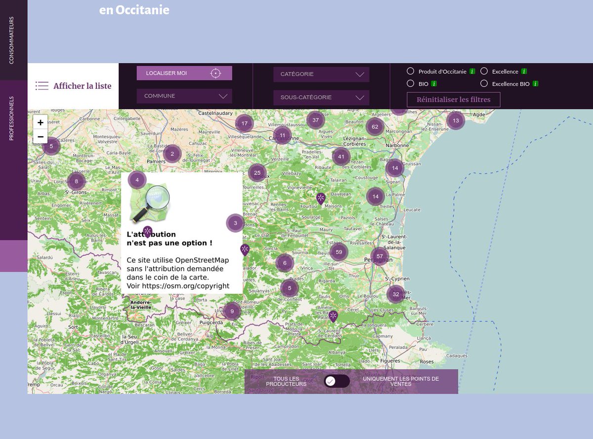
OSM-FR reminder „Attribution is not an option!” 1 | © Picture by Christian Quest | © map data OpenStreetMap contributors
Mapping
- Markus Peloso created a proposal for locations used to share surplus food with others, and asks the readers of the Tagging mailing list for their opinions. The proposed tag is analogous to give_box and public_bookcase, but for food.
- Martin Koppenhoefer has revived the 2014 proposal, originally submitted by Hno, for
amenity=student_accommodationand asks for comments. - Rory McCann asks whether there is a tag for marking information boards which display OSM-based maps. (Nabble)
- Crossing Highways (roads) in India is a map of spots in India where highways cross or overlap each other without sharing a node. Users can see details and click to open the same location in the OpenStreetMap iD editor to fix it. The map updates daily. It was created by processing the output of OSMLint. The frontend map uses leaflet-simple-csv. Note: it may contain false positives such as pedestrian overbridges.
- The European Water Project’s proposal for
drinking_water:refill=<yes/no>anddrinking_water:refill_scheme=<scheme-name/multiple>was approved. - Brian Prangle enjoyed a short 90 minute stroll, on a crisp showery early spring day, around Ward End Park in Birmingham (UK). In a blog post on Mappa Mercia Brian explains not only how his walk contributed to the OSMUK first quarter project, but also some of the history of Ward End Park and his observations on how the park has changed since it was last mapped in 2009.
- Manonv and Kateregga1 created a proposal for the tag
place=refugee_siteto solve the lack of consensus within the OSM community regarding the way to reference refugee camps in OSM. - Mateusz Konieczny published statistics on how many OSM elements were edited by each StreetComplete quest.
Community
- Gerry McGovern will give a series of talks at An Event Apart about the environmental impact of digitalisation and will propose ways to improve it. He is looking for arguments as to why OSM is more environmentally friendly than Google Maps.
- mavl detailed the first 3000 out of more than 7500 reported issues at openstreetmap.org in a diary post. The reader can learn, for example, that most reported issues are about spam, and if a user is reported, because of vandalism.
- Ibrahima Sory Diallo, a Masters student in 'Geography – urban spaces and societies’ at Gaston Berger University (UGB), Saint-Louis, Senegal, shares his experience about the inaugural Africa Geospatial Data and Internet Conference (AGDIC2019) he attended in Accra, Ghana on the YouthMappers blog.
Imports
- Deane Kensok is planning an import of buildings for Flagstaff, Arizona, USA. He has detailed his plan to import the data, provided by City of Flagstaff GIS Team, in the OSM wiki.
- Stefan Baebler seeks advice on how to improve municipal and city boundaries for Slovenia in OSM following the release of new official border data. The new boundaries align with cadastral parcels. This means they do not fit to the data already in OSM as well as the older public data did.
Events
- The local community of OpenStreetMap, OsGeo/FOSS4G, and other map-py enthusiasts in the Philippines announced the upcoming Pista ng Mapa (Festival of Maps) 2020 conference to be held in Cebu City, on 27 to 29 May 2020. For updates, follow them on Twitter.
- The State of the Map US 2020 will be held from 5 to 7 November in Tucson, Arizona. The organising committee is holding a logo design competition, entries are due by 22 March. If you want to do more than attend the committee is looking for help organising.
Humanitarian OSM
- MapSwipe has won the Global Mobile Award for the Best Mobile Innovation Supporting Emergency or Humanitarian Situations. The GIScience News Blog explains the aims and background of the MapSwipe project.
switch2OSM
- The city of Düsseldorf, in Germany, in cooperation with surrounding municipalities has updated its official maps and now combines cadastral with OSM data. In an article they mention
 (automatic translation) the advantages of the combination.
 (automatic
 Licences
- Christian Quest reports on Twitter and talk-fr about the OSM-fr 'Reminder tile actions’ to address the lack of OSM attribution by some sites using the tile.openstreetmap.fr tile service. Several websites reacted in under 24 hours, and added the appropriate attribution.
Software
- Binnette wrote an article, in his diary, on how he become a 'noob contributor’ to uMap. He is looking for translators and contributors (see his article for details).
Programming
- Frederic Rodrigo’s article, 'ImpOsm2pgRouting Route planning on OpenStreetMap road network with the benefit of updates’, presents the ImpOsm2pgRouting programming tool that can import OSM data, including pbf format, into PostgreSQL/PostGIS and transform it to the PgRouting data model.This allows synchronisation of a PgRouting database with OSM data. OSM highway lines are cut at each crossing and the characteristics of each road network segment are kept to calculate the route with the 'lowest cost’, respecting various constraints such as road speed, one ways, etc.
Releases
- OsmAnd has released version 3.6 of their Android app. The new version includes improved navigation profiles, the use of exit numbers in navigation, a direct-to-point navigation mode for marine users, and an Antarctica map.
- Florimond Berthoux announced the release of a new version of CyclOSM, on its first anniversary. In his mail he briefly mentions the rendering improvements made in recent versions.
Did you know …
- … mechanical edits are not condoned in OSM and doing that is a violation of the Automated Edits code of conduct?
Other “geo” things
- MobiGyaan ran an article about everything you need to know about NavIC. Navigation with Indian Constellation (NavIC) is India’s autonomous regional satellite navigation system.
- Google Earth is finally available in browsers other than Chrome. Google beta tested a switch from its NaCI implementation to WebAssembly over the past six months, and it has successfully led to the launch of Google Earth for Firefox, Edge, and Opera. If you’d like to try out Google Earth in a web browser it is available at Google’s site.
- HERE has released Geodata Models to help the telecommunications industry plan and deploy 5G wireless networks. The physical characteristics of mmWave 5G networks may require operators to install up to 10 times as many cell sites per km2 compared to 4G networks, so planning for the networks will require much more precise location data.
- Far & Wide has created a gallery of their favourite maps from Terrible Maps.
- It may surprise you to learn that paper maps still sell. Sales of print maps and road atlases have had a five-year compound annual growth rate of 10% in the USA. Edward Baig’s article in USA Today explains why you’ll never tear some folks away from their paper maps.
Upcoming Events
| Where | What | When | Country |
|---|---|---|---|
| Dortmund | Mappertreffen | 2020-03-06 |  |
| Riga | State of the Map Baltics | 2020-03-06 |  |
| Amagasaki | GPSで絵を描いてみようじゃあ~りませんか | 2020-03-07 |  |
| Rennes | Réunion mensuelle | 2020-03-09 |  |
| Grenoble | Rencontre mensuelle | 2020-03-09 | |
| Taipei | OSM x Wikidata #14 | 2020-03-09 |  |
| Toronto | Toronto Mappy Hour | 2020-03-09 |  |
| Hamburg | Hamburger Mappertreffen | 2020-03-10 | |
| Lyon | Rencontre mensuelle | 2020-03-10 | |
| Zurich | 115. OSM Meetup Zurich | 2020-03-11 |  |
| Hanover | OSM-Sprechstunde | 2020-03-11 | |
| Freiburg | FOSSGIS-Konferenz | 2020-03-11-2020-03-14 | |
| Nantes | Rencontre mensuelle | 2020-03-12 | |
| Berlin | 141. Berlin-Brandenburg Stammtisch | 2020-03-12 | |
| Ulmer Alb | Stammtisch Ulmer Alb | 2020-03-12 | |
| Chemnitz | Chemnitzer Linux-Tage | 2020-03-14-2020-03-15 | |
| Freiburg | OSM-Samstag @ FOSSGIS-Konferenz | 2020-03-14 | |
| Nottingham | Nottingham pub meetup | 2020-03-17 |  |
| Lüneburg | Lüneburger Mappertreffen | 2020-03-17 | |
| Cologne Bonn Airport | 127. Bonner OSM-Stammtisch | 2020-03-17 | |
| Hanover | OSM-Sprechstunde | 2020-03-18 | |
| Hanover | Stammtisch Hannover | 2020-03-19 | |
| Munich | Münchner Treffen | 2020-03-19 | |
| San José | Civic Hack & Map Night | 2020-03-19 |  |
| Bremen | Bremer Mappertreffen | 2020-03-23 | |
| Reading | Reading Missing Maps Mapathon | 2020-03-24 | |
| Hanover | OSM-Sprechstunde | 2020-03-25 | |
| Prešov | Missing Maps Mapathon Prešov #5 | 2020-03-26 |  |
| Lübeck | Lübecker Mappertreffen | 2020-03-26 | |
| Valcea | EuYoutH OSM Meeting | 2020-04-27-2020-05-01 |  |
| Guarda | EuYoutH OSM Meeting | 2020-06-24-2020-06-28 |  |
| Cape Town | HOT Summit | 2020-07-01-2020-07-02 |  |
| Cape Town | State of the Map 2020 | 2020-07-03-2020-07-05 | |
Note: If you like to see your event here, please put it into the calendar. Only data which is there, will appear in weeklyOSM. Please check your event in our public calendar preview and correct it, where appropriate.
This weeklyOSM was produced by Elizabete, NunoMASAzevedo, PierZen, Polyglot, Rogehm, SK53, Sammyhawkrad, SunCobalt, TheSwavu, derFred.