30/06/2020-06/07/2020
GroundZero published Wambachers Boundaries – still in pre-alpha 1 | map data © OpenStreetMap contributors
About us
- To strengthen our teams, we are urgently looking for volunteer native speakers to help us with proofreading.Okay, I want in. What do I have to do? Just:
- visit https://osmbc.openstreetmap.de/ – then we already have your OSM nickname and an email address for the invitation to our MatterMost instance.
- then please write an email to theweekly[.]osm[at]gmail[.]com, so we know that you want to participate. Then we will send you a link to our internal wiki page where we try to explain how OSMBC works.
Mapping
- Tan is considering expanding their
shop=bubble_teaproposal to cover all shops providing takeaway beverages. - Garry Keenor’s proposal to tag railway tracks with electrification systems using third or fourth rails has been approved.
Community
- The OpenStreetMap Asia community has decided to have State of the Map Asia 2020 as an online event. To volunteer please login to Slack or GitHub.
- The record recently set for the number of daily mappers has attracted attention (we reported earlier). Andrew and other CWG members asked Pascal Neis if he could provide some insight. According to Pascal, the record week in May featured increased mapping in Peru, Botswana, Central African Republic and other countries. In particular, a large number of newly registered members started contributing to the Cusco region of Peru.
- Sarah Treanor and Katie Prescott wrote up a series of interviews that they had with people involved with HOT, for the BBC. The article highlights how the availability of good maps can be a matter of life and death and the lack of a commercial incentive to identify the nearest Starbucks leaves large parts of the world inadequately mapped.
- Volker Gringmuth, aka kreuzschnabel, known through countless very productive posts in the German forum and from his tutorial ’Getting started with OpenStreetMap’
 , declared (automatic translation) on his blog that he does not want to contribute to the OSM community any more and wants to give up mapping. Hopefully the numerous blog comments will encourage him to change his mind.
 - Frederik Ramm’s talk 'There might have been a misunderstanding…’ at SotM 2020 inspired a philosopical discussion (automatic translation) on the German forum. Skinfaxi started the conversation by asking 'We have map in the name. Shouldn’t we then also convey a clear mission statement that the information we collect meets basic cartographic requirements?’.
 ,
, Imports
- Claire Halleux asked for feedback on a proposed import of around 3.8 million building footprints in north-eastern DRC and 2.7 million building footprints in western Uganda.
OpenStreetMap Foundation
- The OSMF microgrants committee announced 12 successful applicants who will receive grants in the 2020 tranche. Projects range from mapping new cities in Uganda, to education (Pacific Islands, Albania, Kosovo), publicity material (UK), and software development (Street Complete and OSM Calendar).
- Allan Mustard, the chair of the OpenStreetMap Foundation, answered questions from participants of SotM 2020. The video of Allan’s talk is available here.
Events
- Poster presentations from the State of the Map 2020 have been uploaded here.
- One of the biggest and most important Open Source conferences in Taiwan, COSCUP, will be held on 1 and 2 August in Taipei, Taiwan. And of course the OpenStreetMap Taiwan community will be around, collaborating with the Wikidata Taiwan community, providing numerous lectures on the second day of COSCUP. Even with the threat of COVID-19, they are still having the COSCUP event in a physical venue, with some speakers’ talks in streaming format. In-person attendees need to follow the Guidelines for Prevention and Protection of COVID-19 and fill out the Personal Health Declaration Form before participating the event.
- Videos from SotM 2020 are now starting to be available from here. Session pads are also available for each session.
- Christoph Hormann reviewed the SotM 2020 artwork from a cartographic perspective and uses it to note some of the pitfalls of generalisation; it is hard to shrink the world to the size of a sticker. Bernelle Verster responded by explaining the realities of time constraints, available skills, and available contributors.
Humanitarian OSM
- The Missing Maps Group congratulated HOT on being selected as an Audacious Project.
- The HOT Tech Team has launched their new blog.
- The second round of rapid response micrograntees has been announced.
Education
- Researchers from the Ohio State University have studied access to green spaces in metro areas. They combined census-block-group demographics, OpenStreetMap data and socioeconomic data with satellite imagery to analyse access to green spaces and vegetation in two metropolitan areas: Columbus, Ohio, and Atlanta, Georgia.
Maps
- OpenAndroMaps reports that more and more boundaries are grouped in relations and thus cannot be reliably processed by the MapsForgeWriter.
- Andreas Schneider reported about his work on the adaptation of the OSM leisure map for the Garmin Fenix smartwatch.
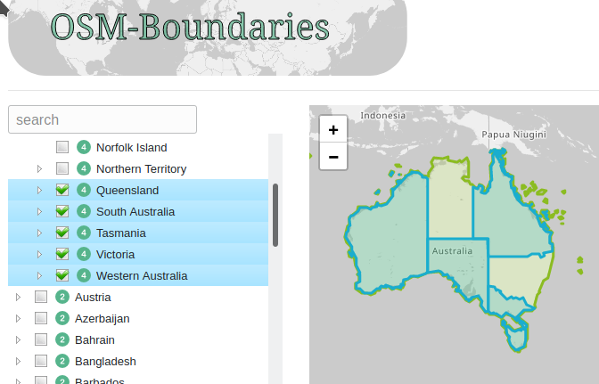
- [1] Swedish company, Ground Zero Communications AB, are trying to rebuild Wambacher’s OSM-Boundaries map series. The new site is pre-alpha.
switch2OSM
- Pierre Béland thanks DJI for using an OpenStreetMap background for their Drones interactive rescue map and suggests that they should add the appropriate OSM attribution to recognise efforts of the community in supporting such projects.
Software
- Michal Migurski, of the Operations Working Group, reported on action to monitor the server used for the OSM Q&A site. It is hoped that greater instrumentation of the server will help identify the cause of sporadic faults in the UI which we reported earlier.
- Xiao Guoan has written a manual on setting up an OSM tile server for Debian Buster.
- ZeLonewolf wrote a guide how to install a 'complete’ Overpass stack on an Ubuntu 18.04 server.
Programming
- Even Rouault, one of the main developers of the GDAL library, pointed out in an e-mail to the mailing lists GDAL-Dev and QGIS-Developer that Spatialite, with no new release for almost five years now, will soon no longer be compatible with current versions of the Proj library. The geospatial community has to decide whether to fork Spatialite or to remove spatial analysis functions from GDAL and QGIS.
- Write access to the OpenStreetMap Trac will be disabled at the end of July. The OpenStreetMap Subversion repository will follow in August.
- Mapbox took a further step out of the open source ecosystem. The release notes of the first alpha releases of Mapbox GL Native for iOS 5.10 and Mapbox GL Native for Android 9.3.0 mention that they have started depending on non-free dependencies released under Mapbox Terms of Service, not a free and open licence. Only Mapbox clients can access these binaries. (via @RichardF on Twitter).
Releases
- Changelog JOSM / 2020-07-02: Stable release 16731 (20.06).
- François has released a new version of indoor= that brings visual, interaction, and deployment enhancements. indoor= renders indoor data available in OpenStreetMap .
Did you know …
- … Prof. Alexander Zipf presents HeiGIT gGmbH, the Heidelberg Institute for Geoinformation Technology at Heidelberg University, which aims to improve knowledge and technology transfer from fundamental research in geoinformatics to practical applications.
- … the journaliststoolbox, a list of mapping and geocoding resources for journalists?
- … the OSM mailing list for science?
OSM in the media
- Listen to Jerry Brotton who navigates the transformation from paper to digital mapping, from print to pixels, and asks what is being gained and lost.
- Julien Guillot searched (automatic translation) for an application that will find you the ideal cycling route. In their Libération article they note that both Google and Apple maps are indicative of the influence of car traffic in our societies, by their lack of cycling infrastructure information.
- On the website of the Ukrainian blog 0629.com.ua an article has appeared (automatic translation) in which the 'on-the-ground’ rule is discussed in relation to the disputed parts of the Donbass region.
 (automatic
  (automatic
 Other “geo” things
- Bosch announces a new Nyon on-board computer and Kiox software update that will greatly improve e-bike riders’ experience. Navigation is now fully integrated using 'Open Street Map’.
- How smart bins are helping one city understand the impact of lockdown.
- ’Israeli Military Launches Radical New Google Maps Alternative’ by Zak Doffmann in Forbes.
- ’OpenStreetMap, a global map for worldwide insight’ by Mikel Maron, Lead Mapbox community team.
- What’s new in ArcGIS Online?
Upcoming Events
| Where | What | When | Country |
|---|---|---|---|
| Munich | Münchner Stammtisch | 2020-07-14 |  |
| Hamburg | Hamburger Mappertreffen | 2020-07-14 | |
| Nottingham | Nottingham pub meetup | 2020-07-21 |  |
| Lüneburg | Lüneburger Mappertreffen | 2020-07-21 | |
| Berlin | 13. OSM-Berlin-Verkehrswendetreffen (Online) | 2020-07-21 | |
| Düsseldorf | Düsseldorfer OSM-Stammtisch | 2020-07-29 | |
| Kandy | 2020 State of the Map Asia | 2020-10-31-2020-11-01 |  |
Note: If you like to see your event here, please put it into the calendar. Only data which is there, will appear in weeklyOSM. Please check your event in our public calendar preview and correct it, where appropriate.
This weeklyOSM was produced by AnisKoutsi, Joker234, Nakaner, Nordpfeil, PierZen, Polyglot, Rogehm, SK53, Supaplex, TheSwavu, YoViajo, derFred, geologist.
Doffman with 1 n / Doffman avec un seul n.
Le lien vers l’article / Link is:
https://www.forbes.com/sites/zakdoffman/2020/06/30/just-like-google-maps-secret-israeli-military-unit-launches-radical-new-app/