22/09/2020-28/09/2020
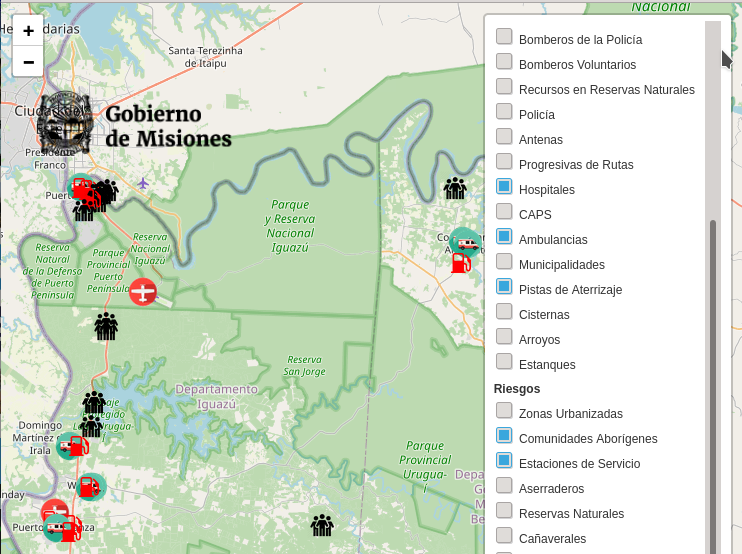
Interactive Map for Environmental Emergency Management 1 | © Gobierno de Missiones CC-BY-SA map data © OpenStreetMap contributors
About us
- The number of local chapters recognised by the OSM Foundation is increasing. For this reason from issue #533, weeklyOSM will have a new category ’Local Chapter News’. Here every local chapter will have the opportunity to post articles using our guest mode. The local chapter can also decide in which language(s) the article should be published.
Mapping
- OSM contributor bkil proposed a scheme for tagging auditory signals, which are often used at pedestrian lights.
- User Vollis proposed the tag
amenity=chapel_of_restfor a room or building where families and friends can come and view someone who has died before their funeral.
Community
- Mateusz Konieczny recommended the following links as good instructions for 100% beginners in JOSM: https://wiki.openstreetmap.org/wiki/JOSM,
https://wiki.openstreetmap.org/wiki/JOSM/Guide and https://learnosm.org/en/josm/. Mikel Maron also suggested the instructions on the Mapbox website. - Lukasz Kruk laments the lack of mapping quality in some regions and explains his view on causes and possible remedies.
- The idea to create a French newsletter (we reported) is discussed
 > on loomio.
 - Map maintenance with StreetComplete is the first of the 12 projects funded by the first OSMF microgrant to submit a final report.
- OpenStreetMap US published the 11th issue (September 2020) of its newsletter.
- A (draft) wiki page concerning limitations on mapping private information has been set up. It states where mapping efforts should stop, for example not adding the names of inhabitants of dwellings or limiting the mapping of personal possessions (like TV sets, numbers of livestock or washing machines) to only those for communal use.
 >
> 
Imports
- Pieter (user: pcmill) would like to start a project to import around 160,000 trees in the city of Utrecht, The Netherlands, and asks for comments.
- The wiki page 'Friesland Hydranten Import’ describes > a procedure to import an official and complete list of
fire_hydrants=*(only two were mapped before in OSM); user osmcux asked > for support to avoid duplication in a more complex scenario.
 >
> OpenStreetMap Foundation
- The OSMF Board approved two new local chapters during their September monthly meeting: USA and Kosovo.
- The Board is considering forming a personnel committee to have a structured way to support people working with the OSMF nearly full time. Mikel Maron is now asking for input to the discussion draft.
Humanitarian OSM
- The Forecast-based Financing Programme blogged on the work of the HOT-OSM community and 'Missing Maps’ of the American Red Cross in the interest of cooperation through worldwide mapping to combat the COVID-19 epidemic.
- HOT reported on the progress of mapping in Liberia in connection with financial support through a microgrant from the COVID-19 Rapid Response programme.
- Can Unen reports that BİMTAŞ A.Ş. and HOT partner Yer Çizenler are working together to put the Istanbul Planning Agency campus on OpenStreetMap.
Maps
- Michael Schultz reports on a contiguous high resolution OSM landuse map of the European Union made by combining Copernicus data and OpenStreetMap.
- Robert Goedl, Head of Linux Bibel Österreich > , in the past has presented > Marble as a Linux alternative to Google Earth; now he describes > how to use Marble for navigation, based on OpenStreetMap data.
switch2OSM
- [1] The Ministry of Ecology and Renewable Natural Resources of the Province of Misiones presented the ’Interactive Map for Environmental Emergency Management’ , based on OpenStreetMap.
 the ’
the ’Licences
- A company using OSM data passed on complaints > about outdated OSM data in Mexico and asked for help.
- Adam Franco found his contributions to OSM on maps being used by a college in the USA and asked if he should follow the path described in the wiki for missing attribution.
Software
- MRVDH launched BuDongSang, a real estate idle game based on OpenStreetMap data. It is still in early development on GitHub; feel free to leave feedback and suggestions.
- Jochen Topf reported the launch of the new osm2pgsql.org website, the first visible result of the support by the OSMF for osm2pgsql development.
- Sven Geggus, maintainer of the German Style OSM Carto fork, explained why the development of the fork of the OSM Carto Style is currently stuck.
Releases
- HeiGIT presents version 6.3.0 of openrouteservice, with an improved technique to speed up the calculation of isochrones (a map area that can be reached from a starting point within a given time or distance limit). By taking advantage of the topological properties of a road network, network cells connected to other cells by very few roads can be identified; with this technique, called partitioning, it is possible to drastically reduce the computational time required to find all roads that can be reached within a given time limit.
Did you know …
- … that the JOSM plugin Gridify will generate a grid of ways (as blocks or lines) from any four nodes? It may be useful for creating repeating features, such as individual parking spaces.
- … Mapping with OpenStreetMap? This website, hosted by MapBox, provides multiple resources to help learn how to map, from novice level to power user.
- … that OpenStreetMap India has a YouTube channel?
- … the ’Europe map with countries and their capitals’? The English menu navigation has some unexpected Cyrillic submenu entries. There is still some room for improvement.
Other “geo” things
- Matthias Schwindt reviewed > the new Garmin 'TOPO Switzerland V2 PRO’ map, which brings together government and commercial data sources. His conclusion was: 'It would only be worth the price to me if I were touring the Swiss mountains very often. Otherwise, the free OSM maps are also very suitable for mountain biking’.
- SuperMap, a China based GIS platform developer, displayed at the GIS Technology at 2020 GIS Software Technology Conference.
- Heise reported > about projects that rethink unethical 'Smart City’ concepts for the common good. Among the linked projects are works against surveillance, projects that benefit citizens, and a conference held with an interesting schedule.
- Garmin launched their first GPS devices with multi-band GNSS receivers. Previously, accuracy has been improved by better antennas and multiple GNSS satellite systems (GPS, GLONASS, Galileo). Now Garmin has added a new GNSS receiver chip that can evaluate both frequency bands.
- On 23 September 2020, Norway’s Ministry of Climate and Environment entered into a contract with Kongsberg Satellite Services (KSAT) and its partners, to provide universal access to high-resolution satellite monitoring of the tropics in order to support efforts to stop the destruction of the world’s rainforests.
- The mathematics learning website Mathigon uses different map projections to sum up their lesson about spheres, cones, and cylinders. The interactive map projection animation is worth a try – not only for kids.
- Kate Behncken, Vice President and Lead of Microsoft Philanthropies, reported on their planned expansion of programmes to support underserved refugee camps. Over the past two years, the company has worked with non-profit and humanitarian organisations to help address global humanitarian issues, such as disaster relief by improving open mapping of vulnerable areas with Bing and the Humanitarian OpenStreetMap Team (HOT).
- Beginning this week, Google Maps will show, after an update, how prevalent COVID-19 is in a geographic area (we reported earlier). For an area, seven-day averages of daily new COVID-19 cases per 100,000 people will be shown using colours together with shadings, and labels will show whether cases are increasing or decreasing.
- Understanding the risks associated with COVID-19 outbreaks in British universities requires navigating many datasets, and a deep understanding of the arcane administrative geographies of the United Kingdom and their inter-relationships. David Kernohan provides a useful guide in a post on the WonkHE blog.
- Michael Prodger shared his insights about maps and landscape painting in the 16th century.
Upcoming Events
| Where | What | When | Country |
|---|---|---|---|
| Taipei | OSM x Wikidata #21 | 2020-10-05 |  |
| London | Missing Maps London Mapathon | 2020-10-06 |  |
| Montrouge | Rencontre des contributeurs de Montrouge et alentours | 2020-10-07 |  |
| Stuttgart | Stuttgarter Stammtisch | 2020-10-07 |  |
| Berlin | 148. Berlin-Brandenburg Stammtisch (Online) | 2020-10-09 | |
| Michigan | Michigan Online Meetup | 2020-10-12 |  |
| Cologne Bonn Airport | 132. Bonner OSM-Stammtisch (Online) | 2020-10-13 | |
| Munich | Münchner Stammtisch | 2020-10-13 | |
| Salt Lake City / Virtual | OpenStreetMap Utah Map Night | 2020-10-13 | |
| Cobb Virtual Academy | OSMUK AGM plus presentations | 2020-10-17 | |
| Lüneburg | Lüneburger Mappertreffen | 2020-10-20 | |
| Berlin | OSM-Verkehrswende #16 (Online) | 2020-10-20 | |
| Nottingham | Nottingham pub meetup | 2020-10-20 | |
| Online | 2020 Pista ng Mapa | 2020-11-13-2020-11-27 |  |
| Online | FOSS4G SotM Oceania 2020 | 2020-11-20 |  |
Note: If you like to see your event here, please put it into the calendar. Only data which is there, will appear in weeklyOSM. Please check your event in our public calendar preview and correct it, where appropriate.
This weeklyOSM was produced by Elizabete, Climate_Ben, Lejun, MatthiasMatthias, MichaelFS, Nordpfeil, PierZen, Polyglot, Rogehm, TheSwavu, richter_fn.
„Adam Franco found his contributions to OSM on maps being used by a college in the USA and asked if he should follow the path described in the wiki for missing attribution.”
The usage was is by online news magazine „U.S. News and World Report” https://www.usnews.com/ which publishes well-known rankings of colleges and universities in the US, not any particular college or university.
Thank you all!