12/12/2017-18/12/2017
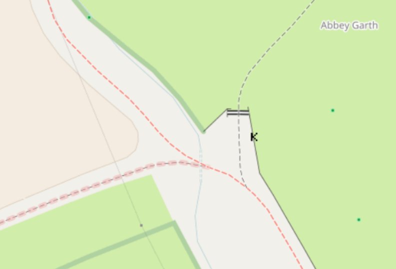
SomeoneElse’s fork of OSM’s Carto map style rendering of cattle grids 1 | © OpenStreetMap Contriubutors
Mapping
- Imagico, one of the maintainers of the carto rendering style of the default map on OSM’s website, warns that rendering decisions by the „OSM Carto” map style may push mappers to create giant multipolygon relations in order to see collections of small elements, covering a larger area together already appear at lower zoom levels, than they do at present.
- Martin (dieterdreist) proposes a new tag for an
emergency=dry_riser_inlet. These are used for fighting fires in buildings. - There are discussions in the German OSM forum about possible changes to the public transport tagging scheme: routes, segments and variants, stop position and platform, objective of a modified public transport model. Contributor Polyglot has shared his thoughts for a public transport tagging change in his user diary.
Community
- Dale Kunce, president of hotosm.org, claims on Twitter that the OSM mailing list is a „viper pit of racism and misogyny”. This triggers yet another round of heated arguments on the OSMF-talk list until finally a career diplomat intervenes to apply some common sense.
- Bryan Housel, the chief maintainer of the iD editor has unsubscribed from the HOT mailing list when an „I hate you, iD devs” comment (thankfully, immediately condemned as soon as it appeared) became the final straw.
- From the ongoing discussions related to code of conduct in the osmf-talk mailing list, John Gilmore shared an article from The Atlantic that focuses on how trigger warnings are hurting mental health.
- Former HOT board member and former OSMF board candidate IknowJoseph writes a post about his perspective around how the mailing lists are becoming a place to develop a dangerous feedback loop of inappropriate behaviour. Others participate in this conversation by adding their take on it.
- This (translation) post of „openstreetmapper” in the German forum (saying that only half the addresses of Ludwigsburg had been mapped) motivated several other mappers to map the other half in a matter of days. „openstreetmapper” is visibly amazed.
- „Skinfaxi” talked in the German OSM forum (automatic translation) about what he’s been doing and how he’s promoted OSM in Sweden this year, also referring to the discussion (translation) about paid community managers on the German OSM forum.
- Hokko-sha submitted a poll to players of Niantic’s Ingress game in Japan, asking them whether the in-game map improved around their area since the switch to OSM. 146 Agents (Ingress players) answered and 63% of them say the map became worse. He says he will propose OSM mapping activities for Agents to improve the map.
Imports
- The marketing company Brandify plans to import all Walmart branches across the United States into OSM (in co-operation with Maps.Me). Zverik has created a page to validate the data via OSM Conflator.
- Following on from the Navads/Shell import, Paul M. Gillard asks on talk-gb mailing list why we do not pull more shop lists from large companies’ websites and import them into OSM.
OpenStreetMap Foundation
- The first State of Map Conference in Tanzania was successfully organised by the Tanzanian OSM community and the Ramani Huria project in Dar es Salaam. A major focus was engaging local communities in different parts of Tanzania.
- With the German association, FOSSGIS e.V., now as a new OSMF local chapter, Frederik Ramm calls upon German mappers to put OSM activities on their calendar.
Events
- There will be an OpenStreetMap „assembly” at 34C3 (27th–31st December, Leipzig Trade Fair, Germany; sold out). Please add yourself to the assembly page at 34C3 wiki if you want to participate.
Humanitarian OSM
- HOT is seeking for donations for the 2018 #mapthedifference campaign. Here’s more about the campaign and how to contribute to it.
- The many hurricanes, forest wildfires and earthquakes of 2017 brought out the best in people helping out in various ways around the world.
Maps
- SomeoneElse has added rendering of cattle grids mapped as ways instead of nodes (
barrier=cattle_grid) in his personal fork of OSM’s Carto map style.
switch2OSM
- Niantic’s switch to OpenStreetMap for all the in-game maps of their games, like Ingress, Pokémon Go and the upcoming Harry Potter Wizards Unite is permanent. How often the changes to OSM will flow back into the games remains to be determined.
- The Hamburg Port Map on the port authority website shows all the facilities of the largest seaport in Germany, with live vessel positions, onto a 3D map built with OSM and MapboxGL.
Open Data
- Rob Nickerson writes to the talk-gb mailing list about OSM UK receiving written permission to use the Emu Analytics’ „English Urban Areas Building Heights” in OpenStreetMap.
- Mapzen has published their „Open Traffic platform„. It was developed in cooperation with the World Bank, and anonymized traffic data are to be made available under an open licence.
- On Reddit a user asks how he can get renumbered addresses in his town to the major map providers like Google, TeleNav, OSM, etc. Nick Ingalls, co-founder of OpenAdresses tells him how open data can help him.
- The canton of Zurich will make its geodata available to the public free of charge (translation) from January 2018 onwards. The information should enable the development of business ideas. The authorities expect a lot of potential for the economy and society.
Software
- n42k invites the community to test server set up of the 3d model repository, that they are planning to launch soon.
- Map Composer, a graphical application in Java to create topographic maps from OpenStreetMap data and to design them, just released version 1.0, nine years after the release of their first version.
Programming
- Daniel Patterson created a bikeability index to understand the bike friendliness of each street link in San Francisco. Read more about how did he go about this here.
- Simon Willison explains how to use SpatiaLite, OpenStreetMap and Datasette to build a location to time zone API.
- If your OSM application sends data to JOSM via remote control using https://localhost:8112/, you should read this ticket on JOSM’s bug tracker, to know about cases where it fails to work.
Releases
- Version 4.6.0 of OSM-Carto has been released and Matthijs Melissen lists the changes on the mailing list.
Did you know …
- … the OpenInfraMap, an OSM-based map showing power lines and mobile phone masts?
- …the QGIS advent calendar on Twitter, which shows new features in the upcoming Version 3.0?
Other “geo” things
- A blogger in the small town of Louth (Lincolnshire, UK) has written many individual posts about benches in the town. Alas they are not yet in OSM.
- Four new satellites of the Galileo European navigation system constellation are now in orbit.
- From the beginning of 2019 there should be the first electrified route for trucks in Germany. so it’s time we came up with a suitable tagging for them.
- The article – ’The Myth That Urbanization Means Prosperity’ in the Atlantic shares about how urbanization in cities play different economic roles in different areas.
- The British national mapping agency, the Ordnance Survey, has been conducting experiments using machine learning to classify roof shapes.
- The US government wants to invest 10 million dollars in the development of location technology, which is GPS-like but less susceptible to being tampered with. They announced something similar last year too.
Upcoming Events
| Where | What | When | Country |
|---|---|---|---|
| Denver Online High School Mitchell | PoliMappers’ Adventures: One mapping quest each day | 2017-12-01-Invalid date |  |
| Urspring | Stammtisch Ulmer Alb | 2017-12-28 |  |
| Dusseldorf | Stammtisch | 2017-12-29 | |
| Essen | Mappertreffen | 2017-12-30 | |
| Montreal | Les Mercredis cartographie | 2018-01-03 |  |
| Albuquerque | MAPABQ (join us!) | 2018-01-03 |  |
| Stuttgart | Stuttgarter Stammtisch | 2018-01-03 | |
| Rome | FOSS4G-IT 2018 | 2018-02-19-2018-02-22 |  |
| Bonn | FOSSGIS 2018 | 2018-03-21-2018-03-24 | |
| Poznań | State of the Map Poland 2018 | 2018-04-13-2018-04-14 |  |
| Bordeaux | State of the Map France 2018 | 2018-06-01-2018-06-03 |  |
| Milan | State of the Map 2018 (international conference) | 2018-07-28-2018-07-30 | |
Note: If you like to see your event here, please put it into the calendar. Only data which is there, will appear in weeklyOSM. Please check your event in our public calendar preview and correct it, where appropriate.
This weeklyOSM was produced by Nakaner, Polyglot, SK53, SomeoneElse, Spanholz, Tordanik, YoViajo, derFred, jcoupey, jinalfoflia.