07/03/2017-13/03/2017
Revised Emergency Map 1 | © OpenStreetMap Contributors [CC-BY-SA 2.0]
Mapping
- User BushmanK writes about the quality of foreign names submitted under the
name:<language_code>=*tag. An in-depth analysis is presented and suggestions on how to mitigate the issue. - The Costa Rican community organises a tour (Feb & March event) to map national parks and volcanoes. This month’s destination was Bosque del Niño.
- Jochen Topf reports that the multi-polygon fixing effort is going well and provides an issue thread to track the evolution.
- A discussion started on the French mailing list about tagging standards for river fishing categories. Concerns were raised about such information only being relevant with regard to local nomenclatures.
- User Muzirian proposes the tag
amenity=courierto map courier services. However, it received some criticism. - The Tagging mailing list is looking for a neutral name for “Segways and the like”.
- On the Tagging mailing list, Warin asks for ideas to map Drying_room or Drying_area.
- Dave Swarthout is looking for a tag for cannabis processing plants.
- Yuri Astrakhan published a proposal to distinguish between “There is a Wikipedia page about this object” vs “This object is mentioned in a Wikipedia page”. His suggestion was seen rather critically on the OSM Wiki.
- Joshua Houston suggests on the Talk-US mailing list to replace the tag
man_madetohuman_made, as a step to make OSM more inclusive. The OSM Latam community had a similar discussion on this issue. - Martijn van Exel posts the latest news from MapRoulette.
Community
- After Senegal, Burkina Faso and Benin, it is the turn of Togo to start its phase 01 of the project School of Free Geomatics.

- For some time now, there have been rumours that Niantic is using OpenStreetMap data to influence Pokemon Go. There’s more discussion about it here, and a recent OSM diary entry has linked to an article amusingly titled ‘How To Create Your Own Nest In Pokemon GO With A Free Tool Called “Open Street Map”’ (and as you’d expect, every other post there, reads like Buzzfeed Bingo too). But this could mean that there are a few people trying to game OpenStreetMap to make things appear in Pokemon Go. Here are a few things that you can do about such vandalism.
- Sven Geggus tweets that the German tile server operated by FOSSGIS e.V. is now HTTPS capable.

Events
- The Swiss OpenStreetMap Association’s Annual General Meeting will take place in Fribourg, Switzerland on April 8th. A mapping party will follow.
- Gregory calls again to submit lectures for the State of the Map in Japan, since not enough papers have been submitted so far. Rob also refers to the deadlines for proposals and the scholarship program.
Humanitarian OSM
- Marek Kleciak reports in the German forum that new satellite images from Nepal are available. They allow to map previously untapped areas.
- The HOT Team Indonesia organized a mapping event called WomenMap. They introduced women to ICT and digital mapping skills. It was pioneered by HOT as it moves towards promoting inclusion for vulnerable, disenfranchised groups (women, persons with disabilities, youth and marginalized communities) and thus help to narrow the digital divide. The initiative is supported by the Australian Government, Disaster Management Innovation and UN Women.

Maps
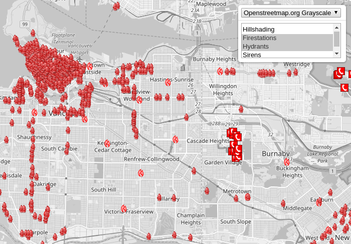
- Walter aka wambacher presents the completely revised version of the Emergency Map.
- Mapzen now offers a map style for cycling. European readers have to answer the question themselves if this map design can compete with the long-standing experience and work of all those cycling mappers/developers in Europe. 😉
switch2OSM
- When you do a geo search on the meta search engine Startpage, you will directly see an OpenStreetMap map in the results.
Open Data
- Mapbox published new satellite imagery for Vancouver and Toronto.
- The summary of an interview with Antonio F. Rodríguez Pascual provides 10 good reasons why the public administration (in Spain) should release data under an open license. (automatic translation)
 10 good reasons why the public administration (in Spain) should release data under an open license. (automatic
 Software
- Andrés summarizes all important sources for learning about and using the Overpass API.
- The motorcycle route planner “Kurviger”, which prefers beautiful winding routes with elevation changes, is now available worldwide.
- Harry Wood created a tool to convert OpenStreetMap notes into KML and to use them in MAPS.ME.
- On talk-fr, Florian Lainez announces the launch of Bus Contributor, a new Android app to ease public transport related contributions in OSM. Provided by Jawg Maps, the app is based on OSM Contributor.
Programming
- A “monster relation” of an undiscussed import in Brazil with more than 32,767 members was too big for osm2pgsql, which probably caused problems on many servers.
- In the second part of his blog series, Roland explained how to deal with numbers in the Overpass API.
Releases
| Software | Version | Release date | Comment |
|---|---|---|---|
| OSRM Backend | 5.6.3 | 2017-03-03 | Some bugfixes. |
| Osmium Tool | 1.6.0 | 2017-03-06 | Many changes, please read release info. |
| libosmium | 2.12.0 | 2017-03-07 | Many changes and bugfixes. Please read change log. |
| MapContrib | 1.4.6 | 2017-03-08 | Bug fixed. |
| Mapillary Android * | 3.32 | 2017-03-08 | Fix background crash in camera and upload. |
| Locus Map Free * | 3.22.1 | 2017-03-09 | Bugfix release. |
| VROOM | V1.1.0 | 2017-03-09 | Three extensions and three changes. |
| Mapbox GL JS | v0.33.1 | 2017-03-10 | Many changes and bugfixes. Please read change log. |
| Routino | 3.2 | 2017-03-12 | Various bug fixes, more translated phrases and some web page improvements. |
Provided by the OSM Software Watchlist.
(*) unfree software. See: freesoftware.
Did you know …
- … Multimapas by Javier Jiménez Shaw to compare a variety of different map layers? Javier’s service also supports WMS layers and allows you to add your own layers.
Other “geo” things
- Mongabay Wildtech reported on a new mapping platform for environmental protection.
- The French magazine ‘Sciences et Avenir’ reports on PaleobioDB, a database inventorying fossils found by hundreds of paleontologists. The corresponding interactive map is based on OSM.
Upcoming Events
| Where | What | When | Country |
|---|---|---|---|
| Mazzano Romano | Presentazione di OSM al MAVNA | 17/03/2017 |  |
| Tokyo | 東京!街歩き!マッピングパーティ:第6回 愛宕神社 | 18/03/2017 |  |
| Bonn | Bonner Stammtisch | 21/03/2017 |  |
| Scotland | Edinburgh | 21/03/2017 |  |
| Lüneburg | Mappertreffen Lüneburg | 21/03/2017 | |
| Nottingham | Nottingham Pub Meetup | 21/03/2017 | |
| Passau | FOSSGIS 2017 | 22/03/2017-25/03/2017 | |
| Lübeck | Lübecker Mappertreffen | 23/03/2017 | |
| Urspring | Stammtisch Ulmer Alb | 23/03/2017 | |
| Zaragoza | Mapeado Colaborativo | 23/03/2017 |  |
| Zaragoza | Mapping Party #Zaccesibilidad (Mapeado Colaborativo) | 24/03/2017 | |
| Louvain-la-Neuve | Bar meeting | 24/03/2017 |  |
| Vancouver | Vancouver mappy hour | 24/03/2017 |  |
| Mazzano Romano | Workshop 1 | 24/03/2017 | |
| Ayacucho | Workshop of Mapbox Studio | 25/03/2017 |  |
| Bremen | Bremer Mappertreffen | 27/03/2017 | |
| Mazzano Romano | Workshop 2 | 31/03/2017 | |
| Kyoto | 【西国街道#02】山崎蒸溜所と桜マッピングパーティ | 01/04/2017 | |
| Avignon | State of the Map France 2017 | 02/06/2017-04/06/2017 |  |
| Kampala | State of the Map Africa 2017 | 08/07/2017-10/07/2017 |  |
| Curitiba | FOSS4G+SOTM Brasil 2017 | 27/07/2017-29/07/2017 |  |
| Aizu-wakamatsu Shi | State of the Map 2017 | 18/08/2017-20/08/2017 | |
| Boulder | State Of The Map U.S. 2017 | 19/10/2017-22/10/2017 |  |
| Buenos Aires | FOSS4G+SOTM Argentina 2017 | 23/10/2017-28/10/2017 |  |
| Lima | State of the Map – LatAm 2017 | 29/11/2017-02/12/2017 | |
Note: If you like to see your event here, please put it into the calendar. Only data which is there, will appear in weeklyOSM. Please check your event in our public calendar preview and correct it, where appropriate.
This weeklyOSM was produced by Nakaner, Peda, Polyglot, Rogehm, SeleneYang, Spec80, SrrReal, TheFive, YoViajo, derFred, freeExec, jcoupey, jinalfoflia, keithonearth, taranarmo, wambacher.