20/06/2017-26/06/2017
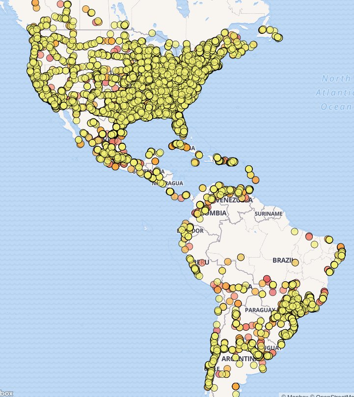
Validator map for sharp turns onto ramps 1 | © Mapbox © OpenStreetMap contributors ODbL
Erratum
- In weeklyOSM #361 we said that the proposal “Language information for name” was approved. That was wrong. As chris66 pointed out in the German forum: “A rule of thumb for ‘enough support’ is 8 unanimous approval votes or at least 10 votes with more than 74 % approval, but other factors may also be considered (such as whether a feature is already in use).”
Mapping
- Google got good publicity from Radio-Canada
 / CBC for mapping boundaries of the First Nations and Inuits (native Americans) territories. Pierre Béland suggests on Talk-ca that there is an equal opportunity for publicity for OSM by highlighting the quality of OSM in the same places.
 - Telenav invites the Ecuador community to discuss adding street names and turn restrictions. They estimate that only 35% of streets or roads which have been mapped are named in this country.
- Marcos Oliveira informed the Portuguese mailing list that Bing published new aerial images in Portugal. Several people acknowledged this update. Happy mapping.
- On the “talk” mailing list, a contributor asked how they could follow other mappers’ edits to things of interest to them. Other than whodidit (which can also provide RSS feeds), other monitoring tools such as “Hall Monitor” and osm-qa-feeds were mentioned.
- Daniel writes about the validator for sharp turns onto ramps and explains about why highway ramps should never be sharp (i.e. < ~90 degrees) and the possibility of finding turn restrictions in this location.
- User Paul the Archivist has mapped the town centre of Alton, Hampshire in great detail including simple3D tags. This F4map demo 3D Map shows buildings, trees, lamps, cranes, etc… This is just one of many town centres in South-East England which Paul has mapped in recent years.
- Simon Poole tweets about his work on a usable opening hours editor. It will be featured in the next version of Vespucci.
 /
/  for mapping boundaries of the First Nations and Inuits (native Americans) territories. Pierre Béland suggests on
 Community
- Alexander Zipf announced the new Labs.OpenRouteService.org where you can test and comment on new upcoming features of OpenRouteService. It is also demonstrating some more experimental research results. The list starts with Open Space routing through squares for pedestrians and the new POI location API Places. The labs demonstrator is only using OSM data for Germany at the outset.
- The OSM Belgium community’s “Mapper of the Month” is Julien Minet aka juminet. More about him on his site.
- Italian mappers discuss relations, tags and trail maintenance for the Sentiero Italia, a long-distance path initiated in the 1980s. As guideposts and official sources don’t always coincide, OSM mapping could be the incentive to revive this picturesque route.
 relations, tags and trail maintenance for the
 OpenStreetMap Foundation
- On June 20th a public OSMF Board meeting took place on the HOT Mumble server. Topics included: the applications by France and the United Kingdom associations to be recognised as regional chapters; a policy for organized arrangements; and the relationship between the OSMF and HOT.
Events
- Applications for travel grants to FOSS4G 2017 in Boston (August 14 – 19) are open until July 7th.
- The 2017 edition of FOSS4G-Europe will take place in Paris – Marne-la-Vallée, from the 18th to the 22nd of July.
- The videos from SotMFR 2017 are online.
- FOSS4G-Africa is taking place in Johannesburg, South Africa, with a strong focus on geography education. The event is organised by OSGeo Africa and the South African QGIS User Group, together with SAGTA (Southern African Geography Teachers’ Association) and GeoforAll.
- Registration for the HOT Summit on September 14-15, in Ottawa, Canada, is now open.
- The 2017 Elbe-Labe meeting in Saxony, SE Germany is a gathering for mappers. It takes place from September 1st to 3rd. The location is a little bit outside Dresden. Participants are expected from the local area and the Czech Republic. If you want to participate, please register by entering the details into the table in the OSM wiki.
- The program of SotM 2017, Japan, in Aizuwakamatsu City Culture Center is online.

Humanitarian OSM
- On the talk mailing list, Micha? Brzozowski complained about some low quality changesets by new users in Nepal. The thread touches many topics: best practices for new mappers, communication improvements, local knowledge, partner organisations to exchange with the local community, languages and respect.
- Russel Deffner opens three mapping projects (1, 2 and 3), the first HOT tasks concerning the elimination of malaria in Cambodia.
Maps
- Henry Lau downloaded a list of bakeries from OpenStreetMap using Overpass Turbo, and used d3-hexbin plugin together with leaflet to map the density of bakeries in two capital cities – London and Paris. This is part of his larger project about baking or cooking 80 different recipes involving dough or wheat from the top 80 wheat consuming countries.
- Rosenblatt has created a meticulous work, an interactive map of prehistoric sites where human DNA was secured. Each individual site on the map contains classification information and links to the relevant publications. The Spanish newspaper “La voz de Galicia” reported in a popular scientific way on it.
- moovellab, the home of “Roads to Rome”, launched a new project: “What the Street!?” (desktop browser only), a dataviz project to interactively explore mobility space in cities around the world. What the Street!? illustrates how daily transportation choices shape cityscapes in a playful way. The project analyzed OpenStreetMap data from 23 cities around the world, including London, Barcelona and Tokyo to create unique, comparative data visualizations of parking and movement spaces in each city.
- Maki recently updated Bugianen, a map of Piedmont for hikers and mountain biking that merges OSM to the official regional cartography. The improvements are visible on zoom levels 11 to 15, now much more detailed, and in the inclusion of neighbouring areas’ open datasets.
switch2OSM
Open Data
- The reuse of Open Data in Italy, PA-Webinar Events: June 27, 12:00. Slides are available here.
- Connected Signals, a traffic analytics firm, offers its database of traffic signals, stop lines and other features to OpenStreetMap. The data, presumably for the Continental USA, are acquired through machine-learning from sensor data, including video.
Software
- Nils Nolde developed a new QGIS plugin for OSM routing and accessibility analysis using OpenRouteService.
- Walkalytics from EPB (an engineering company, based in Switzerland) calculates which amenities can be reached within 2, 5, 10 minutes from a given point or a set of points (i.e. Isochrone maps). They use both OSM data and other sources.
Programming
- Vladimir Agafonkin is working on Mapbox GL’s heatmaps, a convenient way of exploring massive datasets.
Releases
Version 3.0.0 of Nominatim is now out. The result is a much smaller database and improved query response times. The most important feature is undoubtedly the on-the-fly address interpolation, as it makes sense to address blocks of houses that are particularly popular in North and South America. Sarah Hoffmann, aka lonvia told us, that Nominatim has now officially moved to openstreetmap.org on GitHub and nominatim.org is currently being expanded into the official homepage.
| Software | Version | Release date | Comment |
|---|---|---|---|
| Mapillary Android * | 3.61 | 2017-06-14 | Next fix of stray images upload problems. |
| Mapzen Lost | 3.0.1 | 2017-06-19 | Bugfix release. |
| Locus Map Free * | 3.24.2 | 2017-06-20 | No Infos. |
| Maps.me Android * | var | 2017-06-21 | No Infos. |
| Maps.me iOS * | 7.3.6 | 2017-06-21 | Bugfix release. |
| OSRM Backend | 5.8.0 | 2017-06-21 | Many changes, please read release info. |
| Mapillary iOS * | 4.7.4 | 2017-06-22 | Two bugs fixed. |
| Kurviger Free * | 1.1.1 | 2017-06-23 | Mapzen map: several improvements, Mapstyle: Kurviger style is the default style. |
| QGIS | 2.18.10 | 2017-06-23 | No infos. |
| Overpass-Turbo | 2017-06-25 | 2017-06-25 | Many changes during the last days, please read release infos. |
| guide4you | 2.0.5 | 2017-06-26 | No Infos. |
| Nominatim | 3.0.0 | 2017-06-26 | New database format. Please read release info. |
Provided by the OSM Software Watchlist. Timestamp: 2017-06-26 18:14:22+02 UTC
(*) unfree software. See: freesoftware.
Did you know …
- … Fhacktions? It is a free location-based MOBA (Multiplayer Online Battle Arena) where you are a member of a faction of hackers in a dystopian world. It was produced in Paraguay and uses an OSM based map.
- … MapProxy is an open source proxy for geospatial data. It caches, accelerates and transforms data from existing map services (any WMS or tile server) and serves any desktop or web GIS client.
- … OSM Blitzermap, a map of speed cameras from OSM?
- … OpenStreetMap Ireland?
- … that the Export Tool is pushing customised OpenStreetMap data through to the Humanitarian Data Exchange (HDX) platform?
- … the nice video to advertise SotMFR 2016 one year ago in Clermont-Ferrand?
OSM in the media
- The “Journal de Montréal” followed a group of enthusiasts of OSM along their thorough mapping wanderings.
- Fabrizio “Sbiribizio” Tambussa presents OSM at TEDxNovara Salon, in his talk “A free map of the world”.
Other “geo” things
- KDE Google Summer of Code student Davide Riva announces the first stable release of Brooklyn, a protocol-independent chat-bridge. Telegram and IRC are fully supported and attachments are managed. Map locations are provided through OSM.
- The International Cartographic Association (ICA) invited children from all countries into a competition, mapping how they see their places in the world. The results are stunning.
- Blitzortung.org (German for “lightning localization”) visualises worldwide lightning strikes in real time.
- Andy Kriebel publishes an intuitive map of U.S. air quality levels, with plots displayed geographically.
- AMSTS made a map colouring countries depending on the main subject of their national anthems’ lyrics.
- National Geographic published an article with the title “Atlas for the End of the World” and the subtitle “Dozens of colorful new maps and graphics show where urbanization is most likely to conflict with biodiversity”.
- Thanks to new algorithms, researchers from the Technical University of Munich succeeded in making four-dimensional, high-resolution point clouds of Berlin, Las Vegas, Paris and Washington, D.C. from images stacks of the TerraSAR-X radar satellite.
- A World Bridge has been chosen as GeoForAll’s “Lab of the Month”. It’s an international award-winning program for learning 21st century skills, using advanced teaching methods that incorporate real-world projects involving industry and government partners.
- Maps could look great when they actually say nothing, like this one from xkcd 🙂
- weeklyOSM correspondent in Paraguay, Selene Yang discovered a nice and unconventional vehicle to contribute to Mapillary. 😉
Upcoming Events


Note: If you like to see your event here, please put it into the calendar. Only data which is there, will appear in weeklyOSM. Please check your event in our public calendar preview and correct it, where appropriate.
This weeklyOSM was produced by Anne Ghisla, Nakaner, PierZen, SK53, SeleneYang, SomeoneElse, Spec80, derFred, jinalfoflia, keithonearth, kreuzschnabel, wambacher.