05/09/2023-11/09/2023
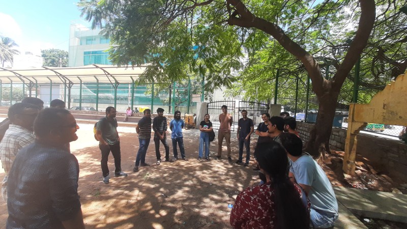
Group mapping activity organised by OSM Bengaluru [1] © Photo by Aman Bagrecha
Mapping
- Black Diamond shared his experience of using USGS 3D Elevation data, which is available as a background layer in iD and JOSM for most US territories, to more easily map geographic features.
Community
- Deus Figendi called on friends and acquaintances to motivate them to map their houses in OpenStreetMap in detail. He described
 ► for beginners how to do this and hopes to attract new mappers.
 ►
►
OpenStreetMap Foundation
- Courtney Williamson has released an update on the OpenStreetMap fundraising programme. As of 8 September 2023, €50,450.85 had been raised from 1425 donors. These funds will go towards data centre infrastructure maintenance and site reliability engineering.
- Courtney wrote about the new guidelines for companies who use OpenStreetMap data in their products and services. All corporate members will now have a seat on the OSMF advisory committee and the fee for an annual membership has increased by 50% for the top tiers.
Events
- [1] Aman Bagrecha shared his experience of participating in a community mapping activity organised by OSM Bengaluru, India, on 9 September 2023.
- The schedule for the State Of The Map 2023 Brazil (2 to 4 October in Curitiba) has been published.
Humanitarian OSM
- OSM Morocco and HOT’s Open Mapping Hub – West and Northern Africa have collaboratively launched the Morocco Earthquake activation of HOT in response to the disaster. They are asking for help from mappers (and validators) to fill out OpenStreetMap data in the affected areas and support the response. Mapping tasks are available at tasks.hotosm.org
switch2OSM
- StralsundTourismus.app ►, the new tourist website for Stralsund, Germany, is using OpenStreetMap for its map displays.
Open Data
- Miroff has published ► software for converting the State Catalogue of Geographical Names of Russia into a GeoJSON format that is supported by JOSM. The latest version of the dataset contains 730,738 names of rivers, lakes, mountains, hamlets, and other place names.In response to this, freeExec has made an updated list of the top 20 longest currently unnamed rivers and river basins that can be named from the catalogue, while rtnf has made a simple guide on how to use this tool.
- Junior Flores, from DevSeed, has created ► an interactive 3D visualisation tool using OSM data showing the mobile signal coverage at educational institutions in Ayacucho, Peru, and the location of the antennas of different telecommunication companies. It shows that of the 1,960 educational institutions in Ayacucho, 670 have no mobile coverage at all, and only 122 enjoy high signal quality.
- Daniel O’Donohue, from the Mapscaping Podcast team, interviewed Jennings Anderson, a researcher at Meta, about Meta’s Daylight Map Distribution and the Overture Maps Foundation.
- Raquel Dezidério Souto, from OSMBrasil, reported ► that Fidelis Assis has, among other things ►, captured the data of the 2022 Brazilian Census.
 ►
► ►
► ►
►
Software
- HeiGIT reported that their openrouteservice (ORS) for Disaster Management is expanding its coverage to include Africa, Central and South America, and South-East Asia. Using OSM data, ORS for Disaster Management updates frequently to ensure first responders are able to circumnavigate critical infrastructure that is blocked or damaged.
Programming
- osm2pgsql announced the concept of Themepark. It can be used to create a configuration file by reusing existing building blocks.
- Alexandre Donciu-Julin described how he used OpenStreetMap and Python to create a map showing his runs.
Releases
- HeiGIT reported that the ohsome dashboard has now been integrated with taginfo.
- HeiGIT reported that version 1.0 of their ohsome quality API and ohsome dashboard is now online. The new version includes an overhauled currentness indicator and the integration of the ohsome quality API into the ohsome dashboard. The tool allows easy access to aggregated statistics on the evolution of OSM elements since 2020.
Did you know …
- … GeoVisio, also known as Panoramax, is a Street View gallery server software that is libre and open source and that you can host on your own server?
- … that machine learning is being used to create 3D digital models of past neighbourhoods? These provide valuable tools for studying economic losses incurred from demolishing historic areas.
- … MapTiler labs offers a variety of proofs-of-concept showcasing OpenStreetMap data, including an elevation profile calculator, a digital elevation model, a bathymetric map, a map of the Roman Empire, a wind simulator, and sea routes?
- … Pieter Fiers has released an app named OSMfocus Reborn? It is an Android app, based on OSMFocus, to help view the details of object tags on OpenStreetMap.
Other “geo” things
- Justin O’Beirne reviewed Google Maps’ new map style.
- The Royal Navy is testing a quantum navigation system. It wants to use it to determine the exact position of a ship worldwide without relying on GPS.
- literan collects funny images from various street-views in their Telegram channel .
- Alexey Radchenko has analysed public and open data from users of Yandex’s geo-services about road accidents in Moscow and found that only 2% of road accidents reported by users were officially registered.
Upcoming Events
| Where | What | Online | When | Country |
|---|---|---|---|---|
| London Borough of Camden | Mobile mapping training session and workshop | 2023-09-19 |  | |
| Lyon | Réunion du groupe local de Lyon | 2023-09-19 |  | |
| 167. Treffen des OSM-Stammtisches Bonn | 2023-09-19 | |||
| City of Edinburgh | OSM Edinburgh Social | 2023-09-19 | | |
| Lüneburg | Lüneburger Mappertreffen (online) | 2023-09-19 |  | |
| OSMF Engineering Working Group meeting | 2023-09-20 | |||
| IJmuiden | OSM Nederland bijeenkomst (online) | 2023-09-20 |  | |
| The Municipal District of Kilkenny City | Kilkenny History Mappers MeetUp | 2023-09-21 |  | |
| Saint-Barthélemy-de-Séchilienne | Mapping Party in Saint-Barthélemy-de-Séchilienne 38220 France | 2023-09-23 | | |
| Град Кикинда | OpenStreetMap x Pionir #2 | 2023-09-23 – 2023-09-24 |  | |
| Localidad Teusaquillo | Bici Ruta Geek en Bogotá | 2023-09-24 |  | |
| Maricá | Mapathon – Maricá City | 2023-09-24 – 2023-09-30 |  | |
| Chambéry | Mapathon débutant saison 23/24 CartONG | 2023-09-25 | | |
| San Jose | South Bay Map Night | ✓ | 2023-09-27 |  |
| Berlin | Missing Maps Mapathon Berlin | 2023-09-27 | | |
| City of Westminster | London pub meet-up | 2023-09-27 | | |
| Aachen | 4. Treffen Aachener Stammtisch 2.0 | 2023-09-28 | | |
| Lübeck | 135. OSM-Stammtisch für Lübeck und Umgebung | 2023-09-28 | | |
| Düsseldorf | Düsseldorfer OpenStreetMap-Treffen | 2023-09-29 | | |
| Curitiba | Pré-Conferência – State of the Map Brasil 2023 | 2023-09-30 | | |
| Karlsruhe | Karlsruhe Hack Weekend September 2023 | 2023-09-30 – 2023-10-01 | |
Note:
If you like to see your event here, please put it into the OSM calendar. Only data which is there, will appear in weeklyOSM.
This weeklyOSM was produced by MatthiasMatthias, PierZen, Strubbl, TheSwavu, YoViajo, barefootstache, derFred, rtnf.
We welcome link suggestions for the next issue via this form and look forward to your contributions.