30/05/2024-05/06/2024
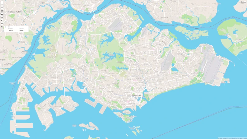
Jérôme Limozin a réussi à parcourir en vélo 99% des rues de Singapour [1] | © wandrer.earth | Données cartographiques © Contributeurs et contributrices OpenStreetMap
Cartographie
- [1] Jérôme Limozin, un cartographe OpenStreetMap basé à Singapour, a réussi à parcourir à vélo 99 % de toutes les routes de Singapour en utilisant le jeu d’exploration Wandrer.
- Ilya Zverev, Zverik sur OpenStreetMap, a annoncé qu’à partir du 1er juin 2024, l’éditeur de texte Level0 et d’autres services, tels que le navigateur d’imagerie OSM et le serveur frontal de la base de données Offset, seront temporairement non fonctionnels. Ilya explique qu’en raison du développement de Every Door, il n’a pas été en mesure de migrer les services vers un nouveau serveur à temps pour la transition vers OAuth 2. L’interruption devrait durer un mois, sauf en cas d’engagements urgents.
Campagnes de cartographie
- IrdiIs a décidé de promouvoir la cartographie rurale de l’Albanie et a choisi au hasard 100 villages pour les cartographier dans les 100 jours à venir !
- OpenStreetMap Inde a rapporté que la cartopartie Sahakarnagar organisée le 1er juin 2024 par la communauté OpenStreetMap Bengaluru, a permis de cartographier plus de 250 objets, principalement des bancs, des kiosques et des lampadaires autour du parc Sahakarnagar.
Fondation OpenStreetMap
- Vous pouvez aider le groupe de travail OSM CWG à collecter des images pour la fête des 20 ans d’OSM en envoyant vos photos ou images préférées d’OpenStreetMap des 20 dernières années.
Nouvelles des sections locales
- FOSSGIS eV a publié
 ► une déclaration officielle concernant le projet de loi sur les données de mobilité envoyé par le ministère fédéral allemand du numérique et des transports. Le projet de loi pourrait avoir un impact négatif sur le projet OpenStreetMap au sein de l’Union européenne. FOSSGIS eV propose plusieurs révisions, y compris des exemptions pour le projet OSM de l’exigence de mise à jour immédiate des données et l’obligation de traiter les erreurs de données signalées par les utilisateurs.
 ►
►
Événements
- Gislars a annoncé que le OpenStreetMap Berlin Hack Weekend se tiendra les 2 et 3 novembre 2024 lors du Wikimedia Deutschland à Berlin.
- L’association suisse OpenStreetMap organise ► un webinaire gratuit « OpenStreetMap für den Tourismus » pour les professionnels du tourisme et les développeurs. Les participants apprendront comment utiliser efficacement les points d’intérêt (POI) pour améliorer les services touristiques. Le webinaire aura lieu les 19 et 25 juin 2024, avec accès sans inscription via BigBlueButton.
Éducation
- Raquel Dezidério Souto (IVIDES), a publié ► un tutoriel sur la cartographie des cours d’eau dans JOSM, à l’aide du plugin FastDraw. Cet effort fait partie du projet de cartographie du bassin hydrographique de Taquari-Antas, l’une des principales zones touchées par l’événement désastreux, en cours dans l’État de Rio Grande do Sul (Brésil). La page wiki ► de la campagne inclut ce projet et d’autres, qui peuvent bénéficier de la collaboration de la communauté mondiale des cartographes OpenStreetMap.
 ►
► ►
►OSM – Recherches universitaires
- Benjamin Herfort et al. ont publié une recherche intitulée « Data Quality of OpenStreetMap for Industrial Sites in the Arctic » (Qualité des données d’OpenStreetMap pour les sites industriels dans l’Arctique).
- HeiGIT signale que son service Openrouteservice est désormais utilisé dans le cadre du projet européen Grid Cell Database, qui vise à créer des analyses d’accessibilité pour les établissements de santé, d’enseignement et autres de toute l’Allemagne.
Cartes
- Candid Dauth décide d’investir dans un serveur plus grand pour relancer la carte de transport OpenPublic et la rendre disponible en tant que style de carte supplémentaire de FacilMap. Parallèlement, il recherche un soutien financier pour son service.
OSM à l’œuvre
- Rihard Olups a partagé une carte interactive montrant l’emplacement des bureaux de vote pour les élections européennes en Lettonie.
- User_5359 a développé une carte interactive basée sur OpenStreetMap pour montrer l’emplacement des objets historiques gérés par la Fondation de l’Institut culturel de Silésie (Stiftung Kulturwerk Schlesien). Cette collection comprend des cartes postales, des autographes, des timbres, des cartes historiques, des titres historiques, des œuvres d’artistes, des plans de bataille, des védutes et divers autres objets.
Applications
- Michael Mann a développé OSM_LeaderBoard, un tableau de bord permettant d’afficher un classement des contributeurs OpenStreetMap en fonction du nombre de nœuds auxquels ils ont contribué pour une zone de délimitation et une période données.
Développement
- Volker Krause a présenté quelques mises à jour récentes de l’application KDE Itinerary, un assistant de voyage numérique.
- Kamil Monicz a publié son neuvième Blog sur le développement de OpenStreetMap NextGen, son alternative personnelle à la base de code OpenStreetMap, rapportant plusieurs mises à jour telles que le support de l’environnement de développement MacOS, une mise à jour de l’interface de l’historique des changements, et une nouvelle fonctionnalité d’animation des traces GPS.
- PeachyOne partage une requête Overpass pour corriger les fautes d’accentuation dans les régions de langue grecque.
- Andy Townsend explique comment mettre en place un serveur de dalles avec Shortbread, Tilemaker et VersaTiles.
Nouvelles versions
- Tobias Zwick a publié la version 58.0 de StreetComplete, qui comprend plusieurs nouvelles quêtes et de nombreuses améliorations.
Connaissez-vous ? …
- … le guide pour les contributeurs et contributrices OpenStreetMap débutants que prépare bxl-forever ?
- … la plateforme Inforoute France qui vous permet de suivre l’état actuel des routes en France ?
- … l’ouvrage en ligne de Michael Gaigg intitulé Design Patterns For
Effective Maps UX (Modèles de conception pour des interfaces utilisateurs cartographiques efficaces) ? Il contient un aperçu détaillé et une description des éléments et des modèles d’interface utilisateur utilisés dans les programmes et les sites web contenant des cartes. L’auteur du site web donne des conseils et montre des exemples de la manière dont l’utilisation correcte de ces éléments peut améliorer la convivialité et l’expérience des utilisateurs de cartes numériques et éviter les erreurs courantes. - … l’application Shade Map qui permet de simuler le mouvement des ombres derrière les bâtiments, les montagnes et les arbres ?
OSM dans les médias
- ZDNET illustre le dynamisme du Libre et de l’Open Source avec la dixième rencontre de la communauté
OpenStreetMap à Lyon lors des 3 journées du SotM-FR fin juin et la croissance de Panoramax, le projet conjoint IGN-OSM France. - Ouest France a analysé les noms de routes en France qui commémorent le débarquement en Normandie en utilisant la base de données OpenStreetMap. Ils ont identifié 90 routes directement associées au jour J, la majorité étant concentrée en Normandie.
- Sanyo News rapporte ► que Ray Frontier a analysé les habitudes de voyage des utilisateurs de l’application SilentLog. Ces données de voyage anonymes ont été directement comparées aux données POI d’OpenStreetMap afin d’examiner les types d’endroits visités par les utilisateurs.
 ►
►Autres sujets géographiques
- Mierune, une société japonaise spécialisée dans les SIG, organisera ► régulièrement des formations QGIS pour les niveaux débutant, intermédiaire et avancé entre juin et août 2024. Chaque unité de formation coûte 27 500 ¥.
- Freethink et la Fondation Skoll ont publié un documentaire vidéo expliquant comment OpenStreetMap et HOT, à travers ses logiciels et ses centres régionaux, peuvent aider les communautés du monde entier à relever des défis tels que les catastrophes humanitaires, le changement climatique, les problèmes urbains, etc.
Événements à venir
| Où | Quoi | Online | Quand | Pays |
|---|---|---|---|---|
| København | OSMmapperCPH | 2024-06-09 |  | |
| London Borough of Hackney | London Ruby User Group talk on OSM | 2024-06-10 |  | |
| Grenoble | Atelier du groupe local OpenStreetMap | 2024-06-10 |  | |
| Zug | 164. OSM-Stammtisch ausnahmsweise in Zug | 2024-06-11 |  | |
| San Jose | South Bay Map Night | ✓ | 2024-06-12 |  |
| Salt Lake City | OSM Utah Monthly Map Night | 2024-06-13 | | |
| Lorain County | OpenStreetMap Midwest Meetup | ✓ | 2024-06-13 | |
| Bruxelles – Brussel | OSM Belgium meetup in Brussels | 2024-06-13 |  | |
| Bochum | Bochumer OSM Treffen | 2024-06-13 |  | |
| München | Münchner OSM-Treffen | 2024-06-13 | | |
| Berlin | 192. Berlin-Brandenburg OpenStreetMap Stammtisch | 2024-06-14 | | |
| Defence Colony Tehsil | 9th OSM Delhi (Indoor) Mapping Party – Session 1 | 2024-06-15 |  | |
| Kalkaji Tehsil | 9th OSM Delhi (Indoor) Mapping Party – Session 2 | 2024-06-16 | | |
| Hannover | OSM-Stammtisch Hannover | 2024-06-16 | | |
| England | OSM UK Online Chat | 2024-06-17 | | |
| Lyon | Réunion du groupe local de Lyon | 2024-06-18 | | |
| Bonn | 176. OSM-Stammtisch Bonn (Juni 2024: 20 Jahre OSM – 15 Jahre Stammtisch Bonn) | 2024-06-18 | | |
| City of Edinburgh | OSM Edinburgh pub meetup | 2024-06-18 | | |
| Utrecht | OSGeo.nl Open Zomerpodium – OSGeo.nl Open Summer Stage | 2024-06-19 |  | |
| Karlsruhe | Stammtisch Karlsruhe | 2024-06-19 | | |
| Stainach-Pürgg | 13. Österreichischer OSM-Stammtisch (online) | 2024-06-19 |  | |
| OSM-Deutschland Vernetzungstreffen | 2024-06-20 | |||
| OSMF Engineering Working Group meeting | 2024-06-21 |
Note: Pour que votre événement apparaisse dans l’hebdoOSM, ajoutez-le au calendrier OSM.
Cet hebdoOSM a été préparé par MatthiasMatthias, Patchanka, PierZen, Raquel Dezidério Souto, SeverinGeo, Strubbl, derFred, euroPathfinder, jcr83, mcliquid, miurahr, renecha, rtnf.