19/12/2023-25/12/2023
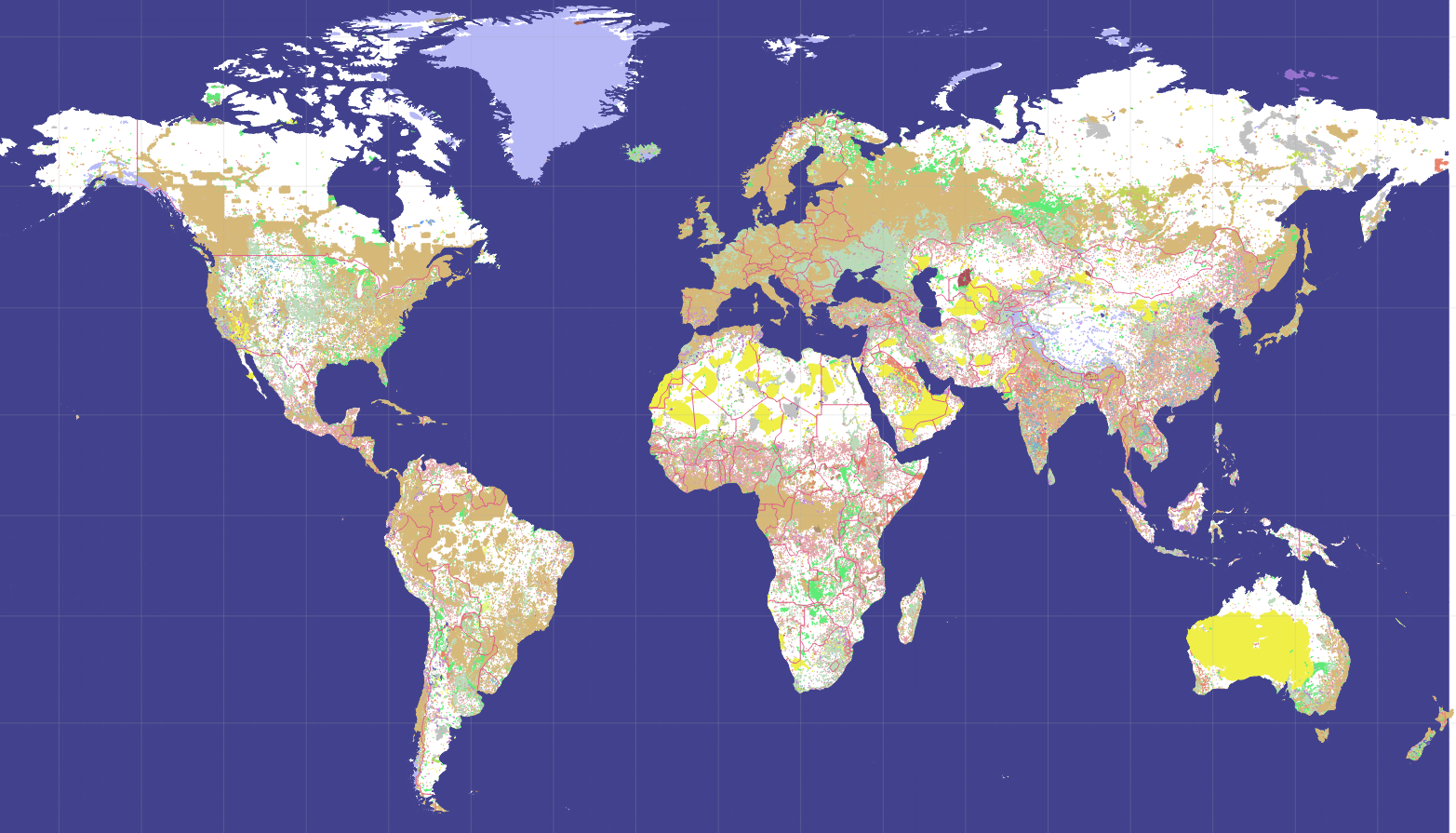
Land cover map of the world using OpenStreetMap data [1] | © Zkir | map data © OpenStreetMap contributors
Community
- A number of OpenStreetMap enthusiasts in Asia have participated in the first public Map-py Wednesday activity intended to build ties among OSM contributors, foster opportunities for sharing local happenings, and promote learning from each other. ‘Map-py Wednesday’ is a nickname coined by a group of mappers who have been meeting online for a couple of months already and are keen to get the rest of the community involved.
- In his new OpenStreetMap diary entry, Jiri Vlasak (known for the ‘Divide and map. Now.’ project) critiqued the backend codebase of the HOT Tasking Manager, describing it as impossible to maintain. The author describes what he perceives as complexities and inefficiencies encountered when trying to understand and modify the code, particularly when dealing with the task splitting functionality.
- Michael Brückner has been recognised as the Volunteer of the Month by the Trufi Association. Michael has been a foundational member since 2018 and he built the organisation’s first website and contributes to their IT Operations team. Michael now serves as the treasurer and handles legal aspects, bringing stability to the Association.
Events
- The FOSSGIS 2024 conference programme has been published. It features exciting presentations on OpenStreetMap, open data, routing, and more. FOSSGIS 2024 will be held at Hamburg University of Technology from 20 to 23 March 2024.
- The State of the Map Europe 2023 team have published the recordings of this year’s conference.
- The State of the Map (SotM) 2024 conference in Nairobi, Kenya is offering a travel grant programme to promote accessibility and diversity. The grants, which can be applied for until 31 January 2024, include full conference tickets and varying lump sums based on the applicant’s location, with grants ranging from EUR 100 to 1200.
OSM research
- A new study has developed a detailed dataset of material stocks in China for the years 2000 and 2020, focusing on geographic distribution and geometric configurations in the built environment, covering twelve materials across five sectors in a 1×1 km grid. This gridded mapping, validated against previous studies, provides insights into urban-rural disparities and opportunities for urban mining, resilience to climate and natural disasters, and fills the gap in high-resolution, accurate material stock information. The authors used OpenStreetMap for all the infrastructure data.
- A new study from Rowan University, led by Dr. Qian He, showed how climate change is expected to increase the isolation of vulnerable groups in the United States. The study, published in Nature Communications, used OpenStreetMap data and other sources to assess the risk of isolation due to sea level rise. It found that black and Hispanic populations, renters and older adults are at higher risk of isolation in coastal areas, with an estimated 20 million residents at risk of flooding by 2030.
- A study to improve urban metro station planning through spatial data analysis and the random forest algorithm highlights the importance of metro station layout in urban development, congestion relief, and traffic efficiency. To achieve this, various data sources were used, including the OpenStreetMap road network.
- Physicists at the University of the Philippines (UP) have applied the nearly 300-year-old discipline of network science, originally formulated by Leonhard Euler, to improve disaster response strategies in the Philippines, particularly for typhoon relief. The researchers tested their model on the Visayas region using geographic data from Google Maps, OpenStreetMap and other publicly available sources.
Maps
- [1] Kirill Bondarenko discussed
 ► the progress and results of a global generalisation project for OSM data. The project successfully reduced data complexity from 62 million polygons in 2423 different classes to 139 thousand polygons in 242 classes, significantly compressing the map data. Kirill’s analysis highlighted discrepancies in mapping detail, with Europe being more thoroughly mapped than other regions. Future plans include the development of an online map, using either a tile server or using Tilemill to host static tiles.
 - The website hscholland.de ► offers the OSM-based RadReiseKarte (BikeTravelMap) for Garmin GPS devices. These maps contain information about accommodation, shopping opportunities, medical facilities, and restaurants. They differentiate paths based on their characteristics and are specifically designed for cyclists. The maps are available as gmapsupp.img files, allowing for direct integration into Garmin devices or for download to use in BaseCamp or MapSource.
 ►
►
 ►
►OSM in action
- The B.Z. has published ► an article on fireworks ban zones in Berlin, which are shown on an OpenStreetMap.
Software
- The Revolution9 Geocode Map Viewer is a tool that allows users to enter latitude and longitude coordinates, which are then converted to Quadkey, Geohash, or Grid Square Code. These formats are visualised on a map for easy understanding.
- Tobias Zwick is planning to develop an iOS version of StreetComplete. The approach for creating the iOS version using Kotlin Multiplatform and Compose Multiplatform is outlined on GitHub. Information on the current state of the project and how readers can contribute to its development is also provided.
- The Roadmap to Nominatim 5 has been published and the plan is for the next version to be leaner and easier to use. Version 5 will see the transition to a pure Python package, removal of PHP, and the unbundling of osm2pgsql. The roadmap includes gradual changes leading to the first major version of Nominatim 5 in the fourth quarter of 2024. It will become possible to install Nominatim via pip.
Programming
- Andy Allan explained how you can help contribute to maintaining the codebase of the OpenStreetMap website.
- bolo published, on DEV Community, step-by-step instructions on how to create a map and display it on a web page using Leaflet. The article also introduces the Basemaps with Vector Tiles plugin, which enables users to display vector tiles in Leaflet.
- Mapbox listed, in its 2023 Year in Review, their new product launches, enhancements to developer tools, and collaborations across industries. Key developments listed include the Search Box API for an enhanced search experience, Mapbox’s integration with Snowflake’s cloud platform, and the introduction of 3D mapping as a standard feature. They also listed advancements in automotive software, particularly with AI integration and solutions for electric vehicles.
Releases
- Organic Maps reached a significant milestone in 2023, gaining its first million users. The app’s success was bolstered by community support, including nearly 9,000 edits and contributions to OpenStreetMap. New features such as GPX import, a Ruler tool, and an Outdoors map style were introduced, along with 15 app updates and numerous improvements in search, routing, and overall usability. Looking ahead to 2024, Organic Maps aims to continue scaling its infrastructure, enhance user engagement in contributing to OpenStreetMap, and offer a viable alternative to mainstream mapping services like Google and Apple Maps.
- Organic Maps presented its ‘Community Christmas and New Year Gift’, including support for Android Auto, outdoor map styles for walking and cycling, the ability to search for village addresses without streets in selected European countries, support for Samsung DeX, and features for finding skiing options.
- OsmAnd’s latest update (Android and iOS) introduces customisable top/bottom panels, new widgets for glide ratio, external temperature sensors, sun position, and a redesigned Local tab in the Maps and Resources menu. Users can now create and manage ‘Smart Folders’ in the Tracks tab, utilise advanced track search filters, and manage deleted files via a new ‘Trash’ feature in OsmAnd Cloud.
Did you know …
- … CartoCams? It’s a map of webcams around the world, based on OpenStreetMap data. You can add more webcam data to OpenStreetMap by using the contact:webcam tag.
- … the OsmDestinationToSVG tool? This tool renders the various
destinationtags as SVG graphics, making it particularly useful for displaying guideposts and traffic signs in a graphically appealing form. Existing OSM data can be displayed using the OsmDestinationSigns tool. - … that you can report sites that are using OpenStreetMap’s map tiles without proper attribution?
- … OSM-GPT uses GPT-3 technology and the Overpass API to provide an intuitive user experience for exploring features on OpenStreetMap? It enables natural language queries, seamless integration with the Overpass API, and provides a user-friendly interface.
- … that you can call the overpass turbo Query Wizard from your browser’s address bar? In Firefox, you need to add the address
https://overpass-turbo.eu/?w=%sbookmark and give it a short name. In Chromium-based browsers, you need to add this address as a search engine. If you use DuckDuckGo, you can call the Query Wizard by writing!otw <your query>in the search bar. - … Mapbox has a ‘Road Features Mapping Guide’? It provides a comprehensive resource for mapping road features in OpenStreetMap, emphasising navigation. It covers routing features, including the categorisation of roads by importance and use of the
highwaytag, which helps routing engines select optimal routes. - … the show-me-the-way tool that shows you OSM edits happening on a map in real time? It could be used as a moving screensaver at trade shows to show how OSM is being used.
OSM in the media
- The German Hiking Association’s ‘WaldWegweiser‘ ► project aims ► to resolve conflicts between forestry, nature conservation, and those seeking recreation in the forest. The project will develop and test universal solutions in selected model regions to improve visitor guidance in the forest using digital data, specifically OpenStreetMap.
Other “geo” things
- The Patrick J. McGovern Foundation has awarded USD 66.4 million to 148 organisations for leveraging artificial intelligence and data science. The American National Red Cross received $1,000,000 to advance technological innovations in humanitarian services and the Humanitarian OpenStreetMap Team received $400,000 to support their fAIr initiative.
Upcoming Events
| Where | What | Online | When | Country |
|---|---|---|---|---|
| Düsseldorf | Düsseldorfer OpenStreetMap-Treffen (online) | 2023-12-29 |  | |
| Missing Maps London Mapathon | 2024-01-02 | |||
| Richmond | MapRVA Happy Hour | 2024-01-04 |  | |
| 臺北市 | OpenStreetMap x Wikidata Taipei #60 | 2024-01-08 |  | |
| San Jose | South Bay Map Night | ✓ | 2024-01-10 | |
| München | Münchner OSM-Treffen | 2024-01-09 | | |
| OSMF Engineering Working Group meeting | 2024-01-10 | |||
| Brest | Brest: rencontre du groupe local | 2024-01-10 |  | |
| Hannover | OSM-Stammtisch Hannover | 2024-01-13 | |
Note:
If you like to see your event here, please put it into the OSM calendar. Only data which is there, will appear in weeklyOSM.
This weeklyOSM was produced by MatthiasMatthias, PierZen, Strubbl, TheSwavu, barefootstache, derFred, mcliquid, rtnf.
We welcome link suggestions for the next issue via this form and look forward to your contributions.
Es wäre nicht schlecht wenn Links, die nicht zu Textseiten sondern Youtube führen, mit gekennzeichnetet wären.