10/25/2016-10/31/2016
 Earthquake in Italy – please map in Italy 1 | OSM Tasking Manager – Wikimedia Italia
About us
- The OpenStreetMap Foundation is seeking donations to finance the Foundation’s expenditures in 2017. The fundraising drive though, has only raised 42,000 euros of the target 70,000 euros after a few weeks.
Mapping
- User Bharata from Mapbox writes about the usage of the offset database while aligning roads in Taiwan.
- The slave databases of the OpenStreetmap API experienced replication delays on Tuesday and Wednesday. This caused difficulties to editors who when editing write to the master database but then read from a slave which might be up to 10 hours out of date, causing spurious editing conflicts.
- On MapRoulette, there are seven new tasks of the project Zebrastreifen-Safari (automatic translation). This project is validating automatically detected pedestrian crossings in Switzerland.
- Thomas Skowron argues that the syntax of
opening_hours=*is overly complex. - Sven Geggus, the maintainer of the German OSM-style, has started a discussion about the rendering of country names. He proposed a correction of all country names into official languages of the respective countries instead of English names.
- Richard Welty suggests the creation of a new tag for car manufacturers’ test tracks instead of
highway=racing.
Community
- Christian blogs
 (automatic translation) about his commitment to the collection of architectural monuments for the Wiki Loves Monuments and Wikidata projects. Also mentioned is the helpful tool Geolocator.
 - Pascal Neis tweeted the answer to the question, in which country and on which day most mappers were active and most of the change rates were uploaded?
- A new mapper from South Australia, asked for advice about what to map on the talk-au mailing list and got a number of very helpful responses.
- Zoar announced (automatic translation) an OSM Advent calendar (日本語) for 2016. Is an English version a good idea? Here is the already opened one from last year. (automatic translation)
- FOSS4G Argentina tweeted about the first meeting for the organization of the FOSS4G + SotM Argentina 2017.
- Raymo853 wonders out loud on Reddit about privacy concerns as an OSM Editor in mapping sensitive/disputed areas.
- The discussions about automating OSM translations into Indic languages continue on the talk-in mailing list. (We reported earlier)
 (automatic
  (automatic
 OpenStreetMap Foundation
- The Operations Working Group would like to reduce the load on the tile servers of the OSMF (tile.openstreetmap.org) considerably and asks for comments on the Tile Usage Policy. The discussion also highlighted some interesting statistics about the usage of the tile server by embedding in websites and applications of third parties.
- The official OpenStreetMap blog announced the new offer of memberships for companies and organizations. It will take effect on Jan 1, 2017.
- The Operations Working Group wants to document the rules for whitelisting of IP addresses on the tile and API servers and asks for comments.
- Simon Poole suggests to the OSMF Operations Working Group that “the use policies should contain pointers to the new privacy policy and at least the tile usage policy should recommend a suitable link to fix the map“.
- On the agenda of OpenStreetMap US are the elections in the second half of November.
Events
- DB Cargo, the Deutsche Bahn subsidiary for freight traffic, invites (automatic translation) mappers to a mapping party on the marshalling yard in Mainz-Bischofsheim (near Frankfurt). Participants have to register via email.
- The GISday 2016 will be on the 16th of November worldwide.
- The National Geographic Society celebrates the Geography Awareness Week from November 13th until 19th. Read more about the program’s mission and history.
- On October 19th, the city of Buenos Aires, Argentina held the UNIGIS Latin America Forum. This academic event provided a place to exchange ideas and discuss different topics on geomatics for the region.
Humanitarian OSM
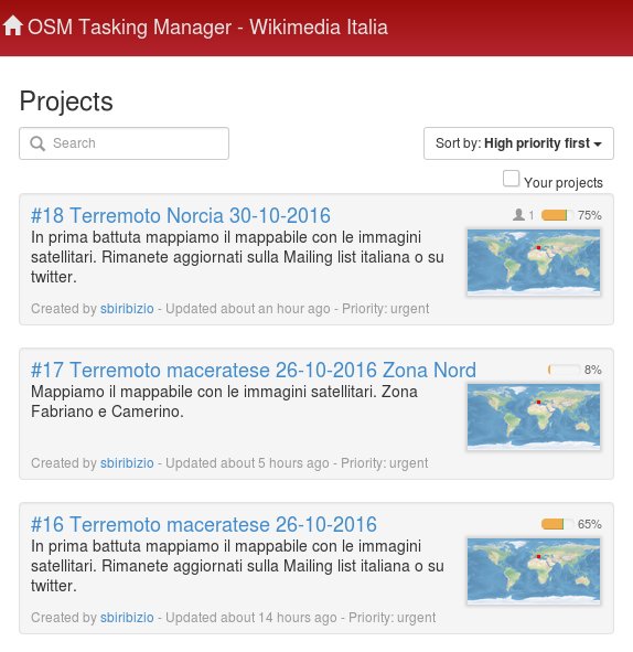
- [1] Once again, a devastating earthquake hit 6.6 in Central Italy. BBC reported that thousands of people were left homeless and many buildings destroyed. The Italian community has its own tasking manager. Please help map Italy!
- Amelie Baron of AFP describes the drone mapping in Haiti after the hurricane Matthew. News on the devastation were tweeted by Potentiel3_0 with references to the images of Pierzen.
- On hotosm.org there is now a showcase to collect and show examples of the impact of humanitarian mapping projects. There was a discussion whether only projects from Hot Inc. should be shown, because it would be used for fundraising.
- The Atlantic’s Citylab explains the concept of the app MapSwipe, its goals and where it’s headed.
- The presentations at the HOT Summit 2016 in Brussels are online.
- Severin Menard writes to the HOT mailing list about his experience during the Hurricane Matthew mapping tasks. He also shares his perspective about using drones, remote mapping, involving local mappers and HOT US Inc.
Maps
switch2OSM
- The city of Frankfurt am Main shows on an OSM basic map traffic details exactly as the current traffic situation.
Open Data
- The Open Data Institute (ODI) has announced the winner of the OpenDataAwards on November 1st in London. The Humanitarian Data Exchange (HDX), operated by UNOCHA (Office for the Coordination of Humanitarian Affairs), was honored by the Open Data Innovation Award.
- Punctually to the 4th birthday (Oct. 29th) of Wikidata, user Addshore presented his blog with the new version of the Wikidata map. A lot has happened in the last six months.
- Ash_Crow congratulates Wikidata on its fourth anniversary and talks about his experiences in the project.
Licences
- Mapbox clarifies who has which rights on a map style for Mapbox GL JS when created with Mapbox Studio. It does not make any demands on styles self-written by its users.
Programming
- The MapsForge developers forked the Java Vectron Library VTM for Android, iOS and desktop systems of the OpenScienceMap and released version 0.6.0.
- With GEOS 3.6, the C++ API was changed by GEOS. Jochen Topf as a developer of the library libosmium presented on the dev mailing list, three possible ways how to proceed with the functions to generate GEOS geometries in libosmium.
Releases
| Software | Version | Release date | Comment |
|---|---|---|---|
| Graphhopper | 0.8 | 2016-10-18 | Many changes, please read release info. |
| Mapillary Android * | 3.0.1 | 2016-10-26 | Bugfix release. |
| Route Converter | 2.19 | 2016-10-26 | Many changes, please read release info. |
| Cruiser for Android * | 1.4.12 | 2016-10-27 | Alternative routes, round trips, various improvements |
| Cruiser for Desktop * | 1.2.12 | 2016-10-27 | No info. |
| PostgreSQL | 9.6.1 | 2016-10-27 | This release contains a variety of fixes from 9.6.0. |
| Komoot Android * | var | 2016-10-28 | “Tips and comments” accepting videos. |
| OpenLayers | 3.19.1 | 2016-10-28 | Patch release that addresses four regressions in the v3.19.0 release. |
| Gnome Maps | 3.23.1 | 2016-10-29 | Fixed a typo and a formatting issue, handle a plain 00:00-24:00 opening hour specification as being “always open” for POIs |
| Mapillary iOS * | 4.5.0 | 2016-10-29 | New camera mode: Auto, Compatibility fix for latest Ricoh Theta S firmware. |
| GeoServer | 2.10.0 | 2016-10-31 | New Style Editor, CSS Styling Improvements and many more. |
| Locus Map Free * | 3.20.0 | 2016-10-31 | New maps, this time of Europe and Middle East. |
Provided by the OSM Software Watchlist.
(*) unfree software. See freesoftware.
Did you know …
- … the GeoHipster map?
- … the blog post “Become a power mapper” from our correspondent Jinal Foflia from Bangalore? Jinal shows JOSM shortcuts by examples such as splitting and connecting ways, creating circles (for roundabouts), changing these shortcuts and last but not least using filters.
- … the numbers regarding usage of different editors in OSM?
- … the online tool yohours for determining the opening hours for OSM?
- … the long article by Alexander Zipf (automatic translation) of the University of Hedelberg about the value of social media and mapping in disaster relief operations.
Other “geo” things
- On Kickstarter there are posters and t-shirts with OSM design again.
- Telenav joins the select group of companies granted California Autonomous Vehicle Testing Permits
- What does New York do with all its trash? This question has been investigated by The Guardian. An interesting Leaflet animation supports the report.
Upcoming Events


Note: If you like to see your event here, please put it into the calendar. Only data which is there, will appear in weeklyOSM. Please check your event in our public calendar preview and correct it, where appropiate..
This weeklyOSM was produced by Hakuch, Nakaner, Peda, Rogehm, Softgrow, Spec80, YoViajo, derFred, jinalfoflia, muramototomoya, sabas88, sbiribizio.